Pierre Part is a census-designated place (CDP) in Assumption Parish, Louisiana, United States. The population was 3,169 at the 2010 census, making it the most populous community in Assumption Parish. With 39.3 percent of the population speaking French at home, Pierre Part is the most French town in the United States outside of Maine. Pierre Part is known locally for its prominent French influence and ancestry, which have become significant aspects of its contemporary local culture. Situated near Lake Verret, Pierre Part is a popular local destination for water sports and fishing during the summer.

Barataria is a census-designated place (CDP) in Jefferson Parish, Louisiana, United States. The population was 1,057 in 2020. It is part of the New Orleans–Metairie–Kenner metropolitan statistical area.
Lafitte is an unincorporated community and census-designated place (CDP) in Jefferson Parish, Louisiana, United States. The population was 972 at the 2010 census, and 816 in 2019. In 2020, its population increased to 1,014 people. It is part of the New Orleans–Metairie–Kenner metropolitan statistical area. Lafitte is located at the southern end of Louisiana Highway 45 along Bayou Barataria, and fishing is a major part of the local economy and culture.
Chackbay is a census-designated place (CDP) in northern Lafourche Parish, Louisiana, United States. The population was 5,370 in 2020. It is part of the Houma–Bayou Cane–Thibodaux metropolitan statistical area.
Galliano is an unincorporated community and census-designated place (CDP) on the Bayou Lafourche in Lafourche Parish, Louisiana, United States. As of 2020, its population was 7,100. It is part of the Houma–Bayou Cane–Thibodaux metropolitan statistical area.

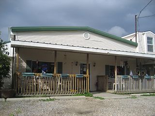
Golden Meadow French: Canal Yankee is a town along Bayou Lafourche in Lafourche Parish, Louisiana, United States. The population was 1,761 in 2020. It is part of the Houma–Bayou Cane–Thibodaux metropolitan statistical area. Its main source of revenue is the oil and gas industry. The fishing and seafood industries also have strong economic impacts, with charter fishing, restaurants, and lodging actively serving patrons. The town was once known as a speed trap, but it has since been bypassed by Hwy 3235 and city traffic has been reduced to mostly locals; however, the speed limit is reduced to 50 mph on Hwy 3235 and said highway is still patrolled heavily. As in other places in Louisiana, there is a noticeable presence of Cajun culture, music, and cuisine.

Larose is an unincorporated community and census-designated place (CDP) in Lafourche Parish, Louisiana, United States. The population was 6,763 in 2020. It is part of the Houma–Bayou Cane–Thibodaux metropolitan statistical area.
Mathews is a census-designated place (CDP) on Bayou Lafourche in Lafourche Parish, Louisiana, United States. The population was 2,273 in 2020. It is part of the Houma–Bayou Cane–Thibodaux metropolitan statistical area.
Bayou Cane is a census-designated place (CDP) in Terrebonne Parish, Louisiana, United States. It is located just north of Houma and had a population of 19,770 in 2020.

Chauvin is a census-designated place (CDP) in Terrebonne Parish, Louisiana, United States. The population was 2,575 in 2020.. It is part of the Houma–Bayou Cane–Thibodaux metropolitan statistical area.
Gray is a census-designated place (CDP) in Terrebonne Parish, Louisiana. The population was 5,518 in 2020. It is part of the Houma–Bayou Cane–Thibodaux metropolitan statistical area.
Montegut is a census-designated place (CDP) in Terrebonne Parish, Louisiana, United States. The population was 1,540 at the 2010 census. It is part of the Houma–Bayou Cane–Thibodaux metropolitan statistical area. It was the primary filming location for the 2012 film Beasts of the Southern Wild.

Des Allemands is an unincorporated community and census-designated place (CDP) in Lafourche and St. Charles parishes in the southeastern part of the U.S. state of Louisiana. The population was 2,179 at the 2020 census. The town, known as the "Catfish Capital of the Universe", is along the Bayou des Allemands, which is the boundary of Lafourche and St. Charles parishes. Lac des Allemands is located northwest of the town. The ZIP code for Des Allemands is 70030.

Bayou Goula is an unincorporated community and census-designated place (CDP) in Iberville Parish, Louisiana, United States. Its population was 514 in 2020.
Bayou L'Ourse is a census-designated place (CDP) in Assumption Parish, Louisiana, United States. The population was 1,978 at the 2010 census.
Lakeshore is an unincorporated community and census-designated place in Ouachita Parish, Louisiana, United States. Its population was 1,930 as of the 2010 census. The community is located on the south bank of Bayou Desiard, east of Monroe.
Bayou Blue is an unincorporated community and census-designated place in Lafourche and Terrebonne parishes, Louisiana, United States. Its population was 12,352 as of the 2010 census.
Choctaw is an unincorporated community and census-designated place in Lafourche Parish, Louisiana, United States. Its population was 879 as of the 2010 census.
Lafourche Crossing is an unincorporated community and census-designated place in Lafourche Parish, Louisiana, United States. Its population was 2,002 as of the 2010 census. Louisiana Highway 1 passes through the community.
Crescent is an unincorporated community and census-designated place in Iberville Parish, Louisiana, United States. It was first listed as a CDP in the 2010 Census with a population of 959. In 2020, its population was 811.


