
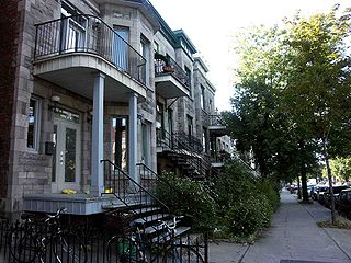
Outremont is an affluent residential borough (arrondissement) of the city of Montreal, Quebec, Canada. It consists entirely of the former city on the Island of Montreal in southwestern Quebec. The neighbourhood is inhabited largely by Francophones, and is also home to a Hasidic Jewish community. Since the 1950s, Outremont has been mostly residential.
Rosemont–La Petite-Patrie is a borough (arrondissement) in the city of Montreal, Quebec, Canada. It is located centre-east of the island.

Chinatown in Montreal is located in the area of De la Gauchetière Street in Montreal. The neighbourhood contains many Asian restaurants, food markets, and convenience stores as well being home to many of Montreal's East Asian community centres, such as the Montreal Chinese Hospital and the Montreal Chinese Community and Cultural Centre.

René Lévesque Boulevard, previously named Dorchester Boulevard is one of the main streets in Montreal, Quebec, Canada.

Le Plateau-Mont-Royal is a borough (arrondissement) of the city of Montreal, Quebec, Canada.
Breakglass Studios is a Canadian analogue and digital recording studio established in 2005. Co-founded by producer Dave Smith and Jace Lasek, the 5,000-square-foot (460 m2) studio space is located in the Le Plateau-Mont-Royal area of Montreal, Quebec. Since its inception, the studio has had a third partner in James Benjamin.

Park Avenue is one of central Montreal's major north-south streets. It derives its name from Mount Royal Park, by which it runs. Between Mount Royal Avenue and Pine Avenue, the street separates the eastern side of the mountain park and the smaller Jeanne Mance Park.

McGill College Avenue is a street in downtown Montreal, Quebec, Canada. Named for McGill University, the street was widened in the 1980s and transformed into a scenic avenue with McGill's Roddick Gates on Sherbrooke Street at its north end and the Place Ville Marie plaza at its south end.

Atwater Avenue is a major north–south street located in Montreal, Quebec, Canada. It links Doctor Penfield Avenue in the Ville-Marie borough to the north, and Henri Duhamel Street in the Verdun borough to the south. It is named for Edwin Atwater. The street runs through the Atwater Tunnel near the Atwater Market in Saint-Henri, before climbing and straddling the border of the city of Westmount.

Rue de la Montagne, also known as Mountain Street, is a north–south street located in downtown Montreal, Quebec, Canada. It starts at Wellington Street in the south and continues to above Doctor Penfield Avenue in the north, where it stops in a dead end just short of Pine Avenue. Notable businesses located along the street include Ogilvy's, an upscale department store.

Saint Antoine Street, formerly known as Craig Street, is a street located in Montreal, Quebec, Canada. It runs to the south of Downtown Montreal and north of Old Montreal and Griffintown and Saint-Henri. It crosses the Quartier international de Montréal. Between Atwater Avenue and Greene Avenue, the north side of the street is in Westmount.
Jean Talon Street is one of the longest streets on the Island of Montreal. It runs from Décarie Boulevard in the west through Anjou in the east to Galeries d'Anjou. Jean Talon was the first Intendant of New France. In the Town of Mount Royal, it is called Dresden Avenue. In the Montreal Borough of Saint-Léonard, it is colloquially known as Via Italia.
Papineau Avenue is the longest north–south street in Montreal, Quebec, Canada. The part of the street between Henri Bourassa Boulevard and Quebec Autoroute 40 is the Montreal portion of Quebec Autoroute 19, commonly referred to as Autoroute Papineau. North of Henri Bourassa Boulevard, it becomes a true autoroute before crossing the Rivière des Prairies on the Papineau-Leblanc Bridge. In the south, the avenue ends at Notre-Dame Street.

Doctor Penfield Avenue is a one-way eastbound street located in the Golden Square Mile neighbourhood of the borough of Ville-Marie in Montreal, Quebec, Canada. Spanning 1.7 kilometres, it begins at Pine Avenue in the east and terminates at McDougall Avenue, to the west. Doctor Penfield Avenue is named after Wilder Penfield (1891–1976), the founder of the Montreal Neurological Institute.

Saint-Édouard Church is a Roman Catholic church in Montreal, Quebec, Canada. It is dedicated to Edward the Confessor, the King of England from 1047 until 1066. Its construction started in 1901 and was completed in 1909.

Collège de Rosement is a French public college in Montreal, Quebec, Canada. The school was founded in September 1954 by Father Gerard Cornellier. It is located at 6400 16th avenue, corner Beaubien Street in the borough of Rosemont–La Petite-Patrie.

La Petite-Patrie is a neighbourhood of Montreal, Quebec, Canada. It is located in the borough of Rosemont–La Petite-Patrie.

Laurier Avenue is a commercial and residential street in Montreal, Quebec, Canada. It crosses the boroughs of Outremont, Le Plateau-Mont-Royal and Rosemont–La Petite-Patrie. It is known for its cafés, restaurants and specialty stores, especially near Park Avenue and east of Sir Wilfrid Laurier Park.
Jeanne Mance Street is a north–south street in Montreal, Quebec, Canada, located east of Park Avenue. It was named in 1914 in honour of Jeanne Mance, the founder of the Hôtel-Dieu de Montréal, which is also located along this street.

Côte-Sainte-Catherine Road is a street in Montreal, Quebec, Canada. It begins at the Décarie Expressway in Snowdon, part of the borough of Côte-des-Neiges–Notre-Dame-de-Grâce, and runs east and southeast along the periphery of Mount Royal to Park Avenue in the Plateau, terminating near Mount Royal Avenue. In between, it crosses Outremont completely and is one of the oldest streets in the borough, having been present at the time Outremont was incorporated in 1875. Outremont's borough hall is located on this street, as is Beaubien Park. Further west in Côte-des-Neiges, it houses the Jewish General Hospital, the CHU Sainte-Justine hospital, Collège Jean-de-Brébeuf, the Montreal Holocaust Museum, and the Segal Centre for Performing Arts.