Beaver Creek, Montana

Last updated

Beaver Creek, Montana
Hill County Montana Incorporated and Unincorporated areas Beaver Creek Highlighted.svg
Location of Beaver Creek, Montana
Coordinates: 48°33′18″N109°47′16″W / 48.55500°N 109.78778°W / 48.55500; -109.78778
Country United States
State Montana
County Hill
Area
[1]
  Total4.59 sq mi (11.88 km2)
  Land4.59 sq mi (11.88 km2)
  Water0.00 sq mi (0.00 km2)
Elevation
2,579 ft (786 m)
Population
 (2020)
  Total311
  Density67.79/sq mi (26.17/km2)
Time zone UTC-7 (Mountain (MST))
  Summer (DST) UTC-6 (MDT)
Area code 406
FIPS code 30-04575
GNIS feature ID1853173

Beaver Creek is a census-designated place (CDP) in Hill County, Montana, United States. The population was 271 at the 2010 census. [2]

Contents

Geography

Beaver Creek is located in eastern Hill County at 48°33′18″N109°47′16″W / 48.55500°N 109.78778°W / 48.55500; -109.78778 (48.554949, -109.787812). [3] It is bordered to the east by Herron. U.S. Route 2 runs through the northern part of the CDP, leading east 5 miles (8 km) to Havre, the county seat, and west 97 miles (156 km) to Shelby.

According to the United States Census Bureau, the Beaver Creek CDP has a total area of 4.6 square miles (11.9 km2), all land. [2]

Demographics

Historical population
CensusPop.Note
2020 311
U.S. Decennial Census [4]

As of the census [5] of 2000, there were 291 people, 109 households, and 89 families residing in the CDP. The population density was 63.6 inhabitants per square mile (24.6/km2). There were 113 housing units at an average density of 24.7 per square mile (9.5/km2). The racial makeup of the CDP was 98.28% White, 0.34% Native American, and 1.37% from two or more races. Hispanic or Latino of any race were 0.34% of the population.

There were 109 households, out of which 37.6% had children under the age of 18 living with them, 73.4% were married couples living together, 4.6% had a female householder with no husband present, and 18.3% were non-families. 16.5% of all households were made up of individuals, and 5.5% had someone living alone who was 65 years of age or older. The average household size was 2.67 and the average family size was 3.01.

In the CDP, the population was spread out, with 25.4% under the age of 18, 6.2% from 18 to 24, 30.6% from 25 to 44, 27.1% from 45 to 64, and 10.7% who were 65 years of age or older. The median age was 40 years. For every 100 females, there were 103.5 males. For every 100 females age 18 and over, there were 100.9 males.

The median income for a household in the CDP was $43,571, and the median income for a family was $44,205. Males had a median income of $34,261 versus $25,000 for females. The per capita income for the CDP was $19,566. None of the population or families were below the poverty line.

Related Research Articles

<span class="mw-page-title-main">Canyon Day, Arizona</span> CDP in Gila County, Arizona

Canyon Day is a census-designated place (CDP) in Gila County, Arizona, United States, on the Fort Apache Indian Reservation. The population was 1,209 at the 2010 census.

<span class="mw-page-title-main">Prairie Creek, Arkansas</span> CDP in Arkansas, United States

Prairie Creek is a census-designated place (CDP) in Benton County, Arkansas, United States. Per the 2020 census, the population was 2,217. It is a lakefront community adjacent to Beaver Lake and Rogers within the Northwest Arkansas region.

<span class="mw-page-title-main">Villas, Florida</span> Census-designated place in Florida, United States

Villas, Florida is an unincorporated community and census-designated place (CDP) in Lee County, Florida, United States. It is part of the Cape Coral-Fort Myers, Florida Metropolitan Statistical Area.

<span class="mw-page-title-main">Boneau, Montana</span> Census-designated place in Montana, United States

Boneau is a census-designated place (CDP) in Chouteau County, Montana, United States. The population was 380 at the 2010 census, up from 190 in 2000.

<span class="mw-page-title-main">Lewistown Heights, Montana</span> Census-designated place in Montana, United States

Lewistown Heights is an unincorporated area and census-designated place (CDP) in Fergus County, Montana, United States. The population was 407 at the 2010 census, up from 365 in 2000.

<span class="mw-page-title-main">Willow Creek, Montana</span> Census-designated place in Gallatin County, Montana, United States.

Willow Creek is a census-designated place (CDP) in Gallatin County, Montana, United States. The population was 210 at the 2010 census. It is part of the Bozeman, MT Micropolitan Statistical Area.

<span class="mw-page-title-main">Rocky Boy's Agency, Montana</span> CDP in Montana, United States

Rocky Boy's Agency is a census-designated place (CDP) in Hill County, Montana, United States. The population was 355 at the 2010 census. The settlement developed around the US Indian agency for the Rocky Boy's Indian Reservation.

<span class="mw-page-title-main">Havre North, Montana</span> Census-designated place in Montana, United States

Havre North is a census-designated place (CDP) in Hill County, Montana, United States. The population was 716 at the 2010 census, down from 973 in 2000.

<span class="mw-page-title-main">Herron, Montana</span> Census-designated place in Montana, United States

Herron is a census-designated place (CDP) in Hill County, Montana, United States. The population was 43 at the 2010 census.

<span class="mw-page-title-main">Saddle Butte, Montana</span> Census-designated place in Montana, United States

Saddle Butte is a census-designated place (CDP) in Hill County, Montana, United States. The population was 128 at the 2010 census.

<span class="mw-page-title-main">St. Pierre, Montana</span> Census-designated place in Montana, United States

St. Pierre is a census-designated place (CDP) in Hill County, Montana, United States, within the Rocky Boy Indian Reservation. The population of St. Pierre was 350 at the 2010 census, up from 289 in 2000.

<span class="mw-page-title-main">Fortine, Montana</span> Census-designated place in Montana, United States

Fortine is a census-designated place (CDP) in Lincoln County, Montana, United States. The population was 206 at the 2021 census.

<span class="mw-page-title-main">Azure, Montana</span> Census-designated place in Montana, United States

Azure is a census-designated place (CDP) in Hill County, Montana, United States. The population was 286 at the 2010 census.

<span class="mw-page-title-main">Calcutta, Ohio</span> Census-designated place in Ohio, United States

Calcutta is an unincorporated community and census-designated place in southeastern Columbiana County, Ohio, United States. The population was 3,941 at the 2020 census. Historically a rural town, Calcutta grew as businesses from neighboring East Liverpool moved into larger shopping centers clustered around Ohio State Route 170.

Brush Creek is an unincorporated community and census-designated place (CDP) in Delaware County, Oklahoma, United States. The population was 35 at the 2010 census.

<span class="mw-page-title-main">Halchita, Utah</span> CDP in Utah, United States

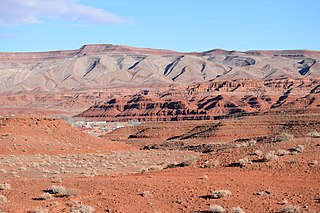
Halchita is a census-designated place (CDP) in San Juan County, Utah, United States. The population was 270 at the 2000 census.

<span class="mw-page-title-main">Meadow Glade, Washington</span> Census-designated place in Washington, United States

Meadow Glade is a census-designated place (CDP) in Clark County, Washington, United States. The population was 2,541 at the 2010 census.

<span class="mw-page-title-main">Ocean City, Washington</span> Census-designated place in Washington, United States

Ocean City is a census-designated place (CDP) in Grays Harbor County, Washington, United States. The population was 200 at the 2010 census.

<span class="mw-page-title-main">Canyon Creek, Washington</span> CDP in Washington, United States

Canyon Creek is a census-designated place (CDP) in Snohomish County, Washington, United States. The population was 3,200 at the 2010 census. Prior to the 2010 census, the CDP was known as Jordan Road-Canyon Creek.

<span class="mw-page-title-main">Beaver, West Virginia</span> Census-designated place in West Virginia, United States

Beaver is a census-designated place (C.D.P.) in Raleigh County, West Virginia, United States. The population was 1,308 at the 2010 census.

References

  1. "ArcGIS REST Services Directory". United States Census Bureau. Retrieved September 5, 2022.
  2. 1 2 "Geographic Identifiers: 2010 Census Summary File 1 (G001): Beaver Creek CDP, Montana". American Factfinder. U.S. Census Bureau. Archived from the original on February 13, 2020. Retrieved August 22, 2017.
  3. "US Gazetteer files: 2010, 2000, and 1990". United States Census Bureau. February 12, 2011. Retrieved April 23, 2011.
  4. "Census of Population and Housing". Census.gov. Retrieved June 4, 2016.
  5. "U.S. Census website". United States Census Bureau . Retrieved January 31, 2008.