Berrysburg, Pennsylvania

Last updated

Berrysburg, Pennsylvania
ROMBERGER-STOVER HOUSE, BERRYSBURG, DAUPHIN COUNTY, PA.jpg
Dauphin County Pennsylvania incorporated and unincorporated areas Berrysburg highlighted.svg
Location in Dauphin County and the U.S. state of Pennsylvania.
USA Pennsylvania location map.svg
Red pog.svg
Berrysburg
Location in Pennsylvania and the United States
Usa edcp location map.svg
Red pog.svg
Berrysburg
Berrysburg (the United States)
Coordinates: 40°36′09″N76°48′41″W / 40.60250°N 76.81139°W / 40.60250; -76.81139
Country United States
State Pennsylvania
County Dauphin
Settled1819
Incorporated1871
Government
  TypeBorough Council
Area
[1]
  Total0.61 sq mi (1.57 km2)
  Land0.61 sq mi (1.57 km2)
  Water0.00 sq mi (0.00 km2)
Elevation
722 ft (220 m)
Population
 (2020) [2]
  Total326
  Density537.95/sq mi (207.64/km2)
Time zone UTC-5 (Eastern (EST))
  Summer (DST) UTC-4 (EDT)
ZIP Code
17005
Area code 717
FIPS code 42-05856
Website berrysburg.org

Berrysburg is a borough in Dauphin County, Pennsylvania, United States. The population was 324 at the 2020 census. [3] It is part of the Harrisburg metropolitan area.

Contents

History

Berrysburg was originally called Hellerstown. The present name is for the Berry family of settlers. [4]

The Romberger-Stover House was added to the National Register of Historic Places in 1980. [5]

Geography

Berrysburg is located in the eastern part of Mifflin Township, in northern Dauphin County at 40°36′9″N76°48′41″W / 40.60250°N 76.81139°W / 40.60250; -76.81139 (40.602475, -76.811309). [6] Berrysburg as a borough is a separate municipality from the township. The Mahantango Mountain lies 2 miles (3 km) to the north. Pennsylvania Routes 25 and 225 intersect in the borough; PA 25 leads east 5 miles (8 km) to Gratz and west 9 miles (14 km) to Millersburg on the Susquehanna River, while PA 225 leads north 3 miles (5 km) to Pillow and south 4 miles (6 km) to Elizabethville. Harrisburg, the state capital and Dauphin County seat, is 30 miles (48 km) to the south.

According to the U.S. Census Bureau, the borough has a total area of 0.62 square miles (1.6 km2), all land. [7]

Demographics

Historical population
CensusPop.Note
1870 451
1880 4765.5%
1890 426−10.5%
1900 398−6.6%
1910 377−5.3%
1920 329−12.7%
1930 39520.1%
1940 4267.8%
1950 386−9.4%
1960 43412.4%
1970 4432.1%
1980 4470.9%
1990 376−15.9%
2000 354−5.9%
2010 3684.0%
2020 324−12.0%
2021 (est.)324 [3] 0.0%
Sources: [8] [9] [10] [11] [2]

As of the census [9] of 2000, there were 354 people, 144 households, and 102 families residing in the borough. The population density was 519.5 inhabitants per square mile (200.6/km2). There were 152 housing units at an average density of 223.0 per square mile (86.1/km2). The racial makeup of the borough was 99.15% White, 0.56% African American and 0.28% Native American. Hispanic or Latino of any race were 0.28% of the population.

There were 144 households, out of which 27.8% had children under the age of 18 living with them, 61.8% were married couples living together, 7.6% had a female householder with no husband present, and 28.5% were non-families. 22.2% of all households were made up of individuals, and 11.1% had someone living alone who was 65 years of age or older. The average household size was 2.41 and the average family size was 2.83.

In the borough the population was spread out, with 19.5% under the age of 18, 5.6% from 18 to 24, 30.8% from 25 to 44, 25.1% from 45 to 64, and 18.9% who were 65 years of age or older. The median age was 41 years. For every 100 females, there were 93.4 males. For every 100 females age 18 and over, there were 95.2 males.

The median income for a household in the borough was $33,281, and the median income for a family was $42,250. Males had a median income of $29,911 versus $25,000 for females. The per capita income for the borough was $17,269. About 5.1% of families and 8.6% of the population were below the poverty line, including none of those under age 18 and 21.4% of those age 65 or over.

Related Research Articles

<span class="mw-page-title-main">Wormleysburg, Pennsylvania</span> Borough in Pennsylvania, United States

Wormleysburg is a borough in Cumberland County, Pennsylvania, United States. The population was 3,070 at the 2010 census. It is part of the Harrisburg–Carlisle Metropolitan Statistical Area.

<span class="mw-page-title-main">Colonial Park, Pennsylvania</span> Census-designated place in Pennsylvania, United States

Colonial Park is an unincorporated community and census-designated place (CDP) in Lower Paxton Township, Pennsylvania, United States. The population was 13,229 at the 2010 census. It is part of the Harrisburg–Carlisle Metropolitan Statistical Area. It uses the Harrisburg ZIP code of 17109 and hosts a great deal of the area's retail activity, including the Colonial Park Mall.

<span class="mw-page-title-main">Dauphin, Pennsylvania</span> Borough in Pennsylvania, United States

Dauphin is a borough in Dauphin County, Pennsylvania, United States. The population was 796 at the 2020 census. Dauphin's ZIP code is 17018. It is part of the Harrisburg–Carlisle Metropolitan Statistical Area.

<span class="mw-page-title-main">Elizabethville, Pennsylvania</span> Borough in Pennsylvania, United States

Elizabethville is a borough in Dauphin County, Pennsylvania, United States. As of the 2020 census, the borough's population was 1,352. It is part of the Harrisburg metropolitan area.

<span class="mw-page-title-main">Gratz, Pennsylvania</span> Borough in Pennsylvania, United States

Gratz is a borough in Dauphin County, Pennsylvania, United States. The population was 743 at the time of the 2020 census, a decline from the figure of 765 in 2010.

<span class="mw-page-title-main">Halifax, Pennsylvania</span> Borough in Pennsylvania, United States

Halifax is a borough in Dauphin County, Pennsylvania, United States. Halifax was incorporated as a borough on May 29, 1785. It is situated at the confluence of Armstrong Creek and the Susquehanna River. The population was 795 at the 2020 census. It is part of the Harrisburg–Carlisle Metropolitan Statistical Area.

<span class="mw-page-title-main">Halifax Township, Pennsylvania</span> Township in Pennsylvania, United States

Halifax Township is a township in Dauphin County, Pennsylvania, United States. The population was 3,336 at the 2020 census.

<span class="mw-page-title-main">Highspire, Pennsylvania</span> Borough in Pennsylvania, United States

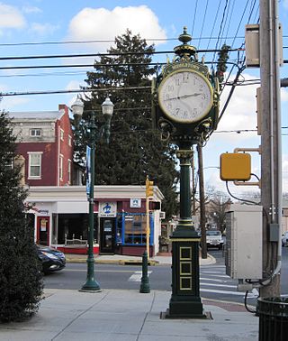
Highspire is a borough in Dauphin County, Pennsylvania, United States. The population was 2,741 at the 2020 census, an increase over the figure of 2,399 tabulated in 2010. It is part of the Harrisburg–Carlisle Metropolitan Statistical Area.

<span class="mw-page-title-main">Lawnton, Pennsylvania</span> Census-designated place in Pennsylvania, United States

Lawnton is an unincorporated area and census-designated place (CDP) in Swatara Township, Dauphin County, Pennsylvania, United States. The population was 3,813 at the 2010 census. It is part of the Harrisburg–Carlisle Metropolitan Statistical Area.

<span class="mw-page-title-main">Lower Swatara Township, Pennsylvania</span> Township in Pennsylvania, United States

Lower Swatara Township is a township in Dauphin County, Pennsylvania, United States. The population was 9,557 at the 2020 census. Harrisburg International Airport and Penn State Harrisburg are located within the township. It shares a ZIP Code with the nearby borough of Middletown, and all locations in the township have Middletown addresses.

<span class="mw-page-title-main">Lykens, Pennsylvania</span> Borough in Pennsylvania, United States

Lykens is a borough in Dauphin County, Pennsylvania, United States. Anthracite coal mining sustained a population of 2,762 in 1900 and 2,943 in 1910. The population was 1,865 at the 2020 census.

<span class="mw-page-title-main">Middletown, Dauphin County, Pennsylvania</span> Borough in Pennsylvania, United States

Middletown is a borough in Dauphin County, Pennsylvania, on the Susquehanna River, 10 miles (16 km) southeast of Harrisburg. As of the 2020 census, it had a population of 9,550. It is part of the Harrisburg–Carlisle Metropolitan Statistical Area.

<span class="mw-page-title-main">Mifflin Township, Dauphin County, Pennsylvania</span> Township in Pennsylvania, United States

Mifflin Township is a township that is located in Dauphin County, Pennsylvania, United States. The population was 816 at the time of the 2020 census, an increase over the figure of 662 tabulated in 2000.

<span class="mw-page-title-main">Pillow, Pennsylvania</span> Borough in Pennsylvania, United States

Pillow is a borough in Dauphin County, Pennsylvania, United States. The population was 291 at the 2020 census. It is part of the Harrisburg–Carlisle Metropolitan Statistical Area.

<span class="mw-page-title-main">Royalton, Pennsylvania</span> Borough in Pennsylvania, United States

Royalton is a borough in Dauphin County, Pennsylvania, United States. As of the 2020 census the borough population was 1,134.

<span class="mw-page-title-main">Rush Township, Dauphin County, Pennsylvania</span> Township in Pennsylvania, United States

Rush Township is a township in Dauphin County, Pennsylvania, United States. As of the 2020 census, the township population was 226, a decline from the figure of 231 tabulated in 2000.

<span class="mw-page-title-main">Rutherford, Pennsylvania</span> Census-designated place in Pennsylvania, United States

Rutherford is a census-designated place (CDP) in Swatara Township, Dauphin County, Pennsylvania, United States. The area is also known as Rutherford Heights. The population was 4,303 at the 2010 census, an increase over the figure of 3,859 tabulated in 2000. It is part of the Harrisburg–Carlisle Metropolitan Statistical Area.

<span class="mw-page-title-main">Skyline View, Pennsylvania</span> Census-designated place in Pennsylvania, United States

Skyline View is an unincorporated community and census-designated place (CDP) in West Hanover Township, Dauphin County, Pennsylvania, United States. The population was 4,003 at the 2010 census, up from 2,307 at the 2000 census. It is part of the Harrisburg–Carlisle Metropolitan Statistical Area.

<span class="mw-page-title-main">Wiconisco Township, Pennsylvania</span> Township in Pennsylvania, United States

Wiconisco Township is a township in Dauphin County, Pennsylvania, United States. The population was 1,162 in the 2020 census. Wiconisco Township took its name from Wiconisco Creek, a west-flowing tributary of the Susquehanna River.

<span class="mw-page-title-main">Williamstown, Pennsylvania</span> Borough in Pennsylvania, United States

Williamstown is a borough in Dauphin County, Pennsylvania, United States. The borough is 38 miles (61 km) northeast of Harrisburg. Formerly, anthracite coal mines and hosiery mills were located in the borough. The population was 1,303 at the 2020 census.

References

  1. "ArcGIS REST Services Directory". United States Census Bureau. Retrieved October 12, 2022.
  2. 1 2 "Census Population API". United States Census Bureau. Retrieved October 12, 2022.
  3. 1 2 Bureau, US Census. "City and Town Population Totals: 2020-2021". Census.gov. US Census Bureau. Retrieved July 13, 2022.
  4. Notes and Queries, Historical, Biographical and Genealogical, Relating Chiefly to Interior Pennsylvania. Harrisburg Publishing Company. 1895. p. 21.
  5. "National Register Information System". National Register of Historic Places . National Park Service. July 9, 2010.
  6. "US Gazetteer files: 2010, 2000, and 1990". United States Census Bureau. February 12, 2011. Retrieved April 23, 2011.
  7. "Geographic Identifiers: 2010 Demographic Profile Data (G001): Berrysburg borough, Pennsylvania". U.S. Census Bureau, American Factfinder. Archived from the original on February 13, 2020. Retrieved December 14, 2015.
  8. "Census of Population and Housing". U.S. Census Bureau. Retrieved December 11, 2013.
  9. 1 2 "U.S. Census website". United States Census Bureau . Retrieved January 31, 2008.
  10. "Incorporated Places and Minor Civil Divisions Datasets: Subcounty Resident Population Estimates: April 1, 2010 to July 1, 2012". Population Estimates. U.S. Census Bureau. Archived from the original on June 11, 2013. Retrieved December 11, 2013.
  11. "Census of Population and Housing". Census.gov. Retrieved June 4, 2016.