Penbrook, Pennsylvania

Last updated
Penbrook, Pennsylvania
Penbrook Park Winter, Penbrook Pa.jpg
Penbrook Park in winter 2012
Penbrook borough-logo.png
Dauphin County Pennsylvania incorporated and unincorporated areas Penbrook highlighted.svg
Location of Pennbrook in Dauphin County (right) and of Dauphin County in Pennsylvania (left)
USA Pennsylvania location map.svg
Red pog.svg
Penbrook
Location of Pennbrook in Pennsylvania and the United States
Usa edcp location map.svg
Red pog.svg
Penbrook
Penbrook (the United States)
Coordinates: 40°16′42″N76°50′51″W / 40.27833°N 76.84750°W / 40.27833; -76.84750
Country United States
State Pennsylvania
County Dauphin
Settled1861
Incorporated1894
Government
  TypeBorough Council
  MayorJohn McDonald (2019-Present)
  Former MayorPeggyanne Miller (2017-2019)
  Former MayorKenneth J. Cramer (2010-2017)
  Former MayorRichard Stottlemeyer (1992-2010)
Area
[1]
  Total0.45 sq mi (1.16 km2)
  Land0.45 sq mi (1.16 km2)
  Water0.00 sq mi (0.00 km2)
Elevation
490 ft (150 m)
Population
 (2020) [2]
  Total3,274
  Density7,324.38/sq mi (2,830.36/km2)
Time zone UTC-5 (Eastern (EST))
  Summer (DST) UTC-4 (EDT)
ZIP Code
17103
Area code 717
FIPS code 42-58712
Website www.penbrook.org

Penbrook is a borough in Dauphin County, Pennsylvania, United States, founded in 1861 and incorporated July 10, 1894. Penbrook was once named East Harrisburg and still maintains a Harrisburg postal ZIP code. The population was 3,268 at the 2020 census. [3]

Contents

Penbrook is part of the Harrisburg Carlisle Metropolitan Statistical Area.

Geography

Penbrook is located in southern Dauphin County at 40°16′42″N76°50′51″W / 40.27833°N 76.84750°W / 40.27833; -76.84750 (40.278445, -76.847463). [4] It is bordered to the south by the city of Harrisburg.

According to the U.S. Census Bureau, the borough has a total area of 0.45 square miles (1.16 km2), all of which is land. [5]

Parks

Little Valley Park in Pennbrook Penbrook Little Valley Park.jpg
Little Valley Park in Pennbrook

Penbrook Park is an 8.5-acre (3.4 ha) recreational area in the southeast corner of the borough and contains ball fields, a large wooden play structure, basketball courts, concession stand, and a picnic pavilion. It was also the home of the former Penbrook Swim Club. The park is connected to the Capital Area Greenbelt, a 20-mile (32 km) link to Riverfront Park and other regional parks.

Little Valley Park with 1.5 acres (0.61 ha) was given to the community in 1960 by S. Merl Mosby, who reclaimed a Depression-era landfill with more than 2,000 loads of dirt from nearby Edgemont. It contains a ball field, a play structure with a large purple dinosaur, baseball field and basketball courts and is located near East Harrisburg Cemetery and the St. Margaret Mary school.

Reservoir Park, with 85 acres (34 ha), is adjacent to the southwest border of the borough, with Levitt Performing Arts Pavilion and the National Civil War Museum.

Since 1952, the Penbrook Athletic Association has led the community's recreational programs. [6] [7]

Government and politics

There are four voting precincts, one for each ward, though all four polling stations are located in the same room in the Community Building. [8]

The mayor is John McDonald. [9]

Borough council

Two council members are elected from each of the borough's four wards.

1st Ward2nd Ward3rd Ward4th Ward
Robin DryDavid Deardorff1Nathaniel ShawJames Armbruster
Frank HeffelfingerBen StokesVictoria ShawKevin M. Ramper2

1 Council President, 2 Council Vice President

Council meetings are held on the first Monday of every month at 6:30 pm at the Borough Building.

Caucus meetings are held on the third Monday of every month at 6:30 pm at the Borough Building.

Legislators

Demographics

Historical population
CensusPop.Note
1900 864
1910 1,46269.2%
1920 2,07241.7%
1930 3,56772.2%
1940 3,6271.7%
1950 3,6911.8%
1960 3,671−0.5%
1970 3,379−8.0%
1980 3,006−11.0%
1990 2,791−7.2%
2000 3,0449.1%
2010 3,008−1.2%
2020 3,2688.6%
2021 (est.)3,260 [3] −0.2%
Sources: [10] [11] [12] [2]

As of the census [11] of 2000, there were 3,044 people, 1,307 households, and 764 families residing in the borough. The population density was 6,636.1 inhabitants per square mile (2,562.2/km2). There were 1,398 housing units at an average density of 3,047.7 units per square mile (1,176.7 units/km2). The racial makeup of the borough was 77.33% White, 15.24% African American, 0.23% Native American, 1.61% Asian, 1.87% from other races, and 3.71% from two or more races. Hispanic or Latino of any race were 4.60% of the population.

There were 1,307 households, out of which 30.0% had children under the age of 18 living with them, 39.6% were married couples living together, 15.6% had a female householder with no husband present, and 41.5% were non-families. 36.3% of all households were made up of individuals, and 10.0% had someone living alone who was 65 years of age or older. The average household size was 2.32 and the average family size was 3.04.

In the borough the population was spread out, with 26.3% under the age of 18, 8.1% from 18 to 24, 33.8% from 25 to 44, 20.1% from 45 to 64, and 11.7% who were 65 years of age or older. The median age was 35 years. For every 100 females, there were 93.9 males. For every 100 females age 18 and over, there were 92.2 males.

The median income for a household in the borough was $35,341, and the median income for a family was $44,375. Males had a median income of $32,128 versus $26,061 for females. The per capita income for the borough was $18,274. About 4.4% of families and 6.2% of the population were below the poverty line, including 8.7% of those under age 18 and 3.2% of those age 65 or over.

Education

Opening in 1901, and with additions in the 1930s and 1950s, the Penbrook School initially educated the students through 12 years, but later only educated children through 10th grade. Older students transferred to John Harris HS or Susquehanna Township High School.

In 1955, the school became part of the new Central Dauphin School District. The building served as an elementary school until 1982 and now serves as the home to Infinity Charter School. A reunion is held for former students in even-numbered years. [7] [13]

St. Margaret Mary Parish School of the Roman Catholic Diocese of Harrisburg was established in March 1948, with the School Sisters of Notre Dame teaching. Additions were made to the building in 1958, 1985, 2000 and 2011. In 2009 both 3-year-old and Pre-K programs were added. After the completion of a new church off campus, the original church was turned into a gym and multi-purpose area for the school and parish community. [14] [15]

See also

Related Research Articles

<span class="mw-page-title-main">Berrysburg, Pennsylvania</span> Borough in Pennsylvania, United States

Berrysburg is a borough in Dauphin County, Pennsylvania, United States. The population was 324 at the 2020 census. It is part of the Harrisburg metropolitan area.

<span class="mw-page-title-main">Dauphin, Pennsylvania</span> Borough in Pennsylvania, United States

Dauphin is a borough in Dauphin County, Pennsylvania, United States. The population was 796 at the 2020 census. Dauphin's ZIP code is 17018. It is part of the Harrisburg–Carlisle Metropolitan Statistical Area.

<span class="mw-page-title-main">Elizabethville, Pennsylvania</span> Borough in Pennsylvania, United States

Elizabethville is a borough in Dauphin County, Pennsylvania, United States. As of the 2020 census, the borough's population was 1,352. It is part of the Harrisburg metropolitan area.

<span class="mw-page-title-main">Halifax, Pennsylvania</span> Borough in Pennsylvania, United States

Halifax is a borough in Dauphin County, Pennsylvania, United States. Halifax was incorporated as a borough on May 29, 1785. It is situated at the confluence of Armstrong Creek and the Susquehanna River. The population was 795 at the 2020 census. It is part of the Harrisburg–Carlisle Metropolitan Statistical Area.

<span class="mw-page-title-main">Halifax Township, Pennsylvania</span> Township in Pennsylvania, United States

Halifax Township is a township in Dauphin County, Pennsylvania, United States. The population was 3,336 at the 2020 census.

<span class="mw-page-title-main">Highspire, Pennsylvania</span> Borough in Pennsylvania, United States

Highspire is a borough in Dauphin County, Pennsylvania, United States. The population was 2,741 at the 2020 census, an increase over the figure of 2,399 tabulated in 2010. It is part of the Harrisburg–Carlisle Metropolitan Statistical Area.

<span class="mw-page-title-main">Hummelstown, Pennsylvania</span> Borough in Pennsylvania, United States

Hummelstown is a borough in Dauphin County, Pennsylvania, United States. The population was 4,535 as of the 2020 census. It is part of the Harrisburg–Carlisle Metropolitan Statistical Area.

<span class="mw-page-title-main">Lower Paxton Township, Pennsylvania</span> Township in Pennsylvania, United States

Lower Paxton is a township in Dauphin County, Pennsylvania, United States. The population was 53,501 at the 2020 census. It is the most populous municipality in Dauphin County and the 17th-most populated municipality in the state.

<span class="mw-page-title-main">Lower Swatara Township, Pennsylvania</span> Township in Pennsylvania, United States

Lower Swatara Township is a township in Dauphin County, Pennsylvania, United States. The population was 9,557 at the 2020 census. Harrisburg International Airport and Penn State Harrisburg are located within the township. It shares a ZIP Code with the nearby borough of Middletown, and all locations in the township have Middletown addresses.

<span class="mw-page-title-main">Lykens, Pennsylvania</span> Borough in Pennsylvania, United States

Lykens is a borough in Dauphin County, Pennsylvania, United States. Anthracite coal mining sustained a population of 2,762 in 1900 and 2,943 in 1910. The population was 1,865 at the 2020 census.

<span class="mw-page-title-main">Middletown, Dauphin County, Pennsylvania</span> Borough in Pennsylvania, United States

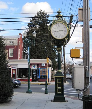
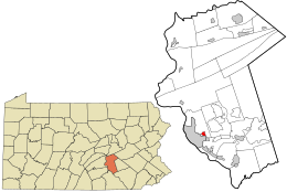
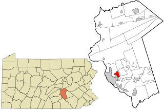
Middletown is a borough in Dauphin County, Pennsylvania, on the Susquehanna River, 10 miles (16 km) southeast of Harrisburg. As of the 2020 census, it had a population of 9,550. It is part of the Harrisburg–Carlisle Metropolitan Statistical Area.

<span class="mw-page-title-main">Mifflin Township, Dauphin County, Pennsylvania</span> Township in Pennsylvania, United States

Mifflin Township is a township that is located in Dauphin County, Pennsylvania, United States. The population was 816 at the time of the 2020 census, an increase over the figure of 662 tabulated in 2000.

<span class="mw-page-title-main">Paxtang, Pennsylvania</span> Borough in Pennsylvania, United States

Paxtang is a borough in Dauphin County, Pennsylvania, United States. As of the 2020 census it had a population of 1,640. The borough is a suburb of Harrisburg and is one of the earliest colonial settlements in South Central Pennsylvania.

<span class="mw-page-title-main">Pillow, Pennsylvania</span> Borough in Pennsylvania, United States

Pillow is a borough in Dauphin County, Pennsylvania, United States. The population was 291 at the 2020 census. It is part of the Harrisburg–Carlisle Metropolitan Statistical Area.

<span class="mw-page-title-main">Progress, Pennsylvania</span> Census-designated place in Pennsylvania, United States

Progress is an unincorporated community and census-designated place (CDP) mainly in Susquehanna Township but also in Lower Paxton Township, Dauphin County, Pennsylvania, United States. The population was 11,168 at the 2020 census. It is part of the Harrisburg–Carlisle Metropolitan Statistical Area.

<span class="mw-page-title-main">Royalton, Pennsylvania</span> Borough in Pennsylvania, United States

Royalton is a borough in Dauphin County, Pennsylvania, United States. As of the 2020 census the borough population was 1,134.

<span class="mw-page-title-main">Steelton, Pennsylvania</span> Borough in Pennsylvania, United States

Steelton is a borough in Dauphin County, Pennsylvania, United States, 4 miles (6 km) southeast of Harrisburg. The population was 6,263 at the 2020 census. The borough is part of the Harrisburg–Carlisle Metropolitan Statistical Area.

<span class="mw-page-title-main">Williamstown, Pennsylvania</span> Borough in Pennsylvania, United States

Williamstown is a borough in Dauphin County, Pennsylvania, United States. The borough is 38 miles (61 km) northeast of Harrisburg. Formerly, anthracite coal mines and hosiery mills were located in the borough. The population was 1,303 at the 2020 census.

Campbelltown is an unincorporated community and census-designated place (CDP) in Lebanon County, Pennsylvania, United States. The population was 3,616 at the 2010 census. It is located east of Hershey at the intersection of U.S. Route 322 and Pennsylvania Route 117 and is located in the Harrisburg metropolitan area.

<span class="mw-page-title-main">Central Dauphin School District</span> School district in Pennsylvania

The Central Dauphin School District is a large, suburban, public school district located in suburban Harrisburg, Pennsylvania serving students in central and eastern Dauphin County. It is the largest school district in the county, the largest in the greater Harrisburg metropolitan area and is the 9th largest school district in Pennsylvania. The district serves the Boroughs of: Dauphin, Paxtang and Penbrook as well as Lower Paxton Township, Middle Paxton Township, Swatara Township and West Hanover Township. It was created in 1954, combining four smaller districts. The Central Dauphin School District encompasses approximately 118 square miles (310 km2). According to 2000 federal census data, it served a resident population of 83,750. By 2010, the district's population increased to 90,442 people. The educational attainment levels for the Central Dauphin School District population were 91.8% high school graduates and 30.4% college graduates.

References

  1. "ArcGIS REST Services Directory". United States Census Bureau. Retrieved October 12, 2022.
  2. 1 2 "Census Population API". United States Census Bureau. Retrieved Oct 12, 2022.
  3. 1 2 Bureau, US Census. "City and Town Population Totals: 2020-2021". Census.gov. US Census Bureau. Retrieved 13 July 2022.
  4. "US Gazetteer files: 2010, 2000, and 1990". United States Census Bureau. 2011-02-12. Retrieved 2011-04-23.
  5. "Geographic Identifiers: 2010 Demographic Profile Data (G001): Penbrook borough, Pennsylvania". U.S. Census Bureau, American Factfinder. Archived from the original on February 13, 2020. Retrieved December 16, 2015.
  6. "Penbrook Borough Athletic Association". Archived from the original on 24 August 2011. Retrieved 1 May 2011.
  7. 1 2 Penbrook Centennial Committee (1994). Penbrook Centennial Celebration 1894-1994.
  8. "Dauphin County polling locations". Dauphin County. Archived from the original on 21 March 2007. Retrieved 12 February 2012.
  9. "Penbrook Mayor".
  10. "Census of Population and Housing". U.S. Census Bureau. Retrieved 11 December 2013.
  11. 1 2 "U.S. Census website". United States Census Bureau . Retrieved 2008-01-31.
  12. "Incorporated Places and Minor Civil Divisions Datasets: Subcounty Resident Population Estimates: April 1, 2010 to July 1, 2012". Population Estimates. U.S. Census Bureau. Retrieved 11 December 2013.
  13. "Infinity Charter School" . Retrieved 12 February 2012.
  14. "About St Margret Marys" . Retrieved 11 February 2012.
  15. Echoes of 1922 Published by The Senior Class of Penbrook High School