Big Island, Virginia

Last updated
Big Island, Virginia
Big Island UMC from north.jpg
Big Island United Methodist Church (former)
USA Virginia location map.svg
Red pog.svg
Big Island, Virginia
Location within the Commonwealth of Virginia
Coordinates: 37°32′3″N79°21′43″W / 37.53417°N 79.36194°W / 37.53417; -79.36194
Country United States
State Virginia
County Bedford
Area
  Total0.830 sq mi (2.15 km2)
  Land0.823 sq mi (2.13 km2)
  Water0.007 sq mi (0.02 km2)
Elevation
839.6 ft (255.9 m)
Population
 (2020)
  Total300
  Density360/sq mi (140/km2)
Time zone UTC−5 (Eastern (EST))
  Summer (DST) UTC−4 (EDT)
ZIP Code
24526
Area code Area code 434
FIPS code 51-07400
GNIS feature ID2629017

Big Island is a census-designated place (CDP) in northern Bedford County, Virginia, United States. The population as of the 2020 United States census was 300. The CDP is located along the James River and U.S. Route 501, between Glasgow and Coleman Falls. It is part of the Lynchburg Metropolitan Statistical Area.

Contents

History

The area is named for a large, uninhabited island in the river upstream from the community. [1]

Geography

According to the United States Census Bureau, the CDP has a total area of 0.830 square miles (2.15 km²).

Demographics

Historical population
CensusPop.Note
2010 303
2020 300−1.0%
Source: U.S. Census Bureau [2]

2020 census

As of the census of 2020, there were 300 people residing in the CDP. There were 153 housing units. The racial makeup of the CDP was 268 White people, 19 African American or Black, and 12 from two or more races. Only one resident was Hispanic or Latino of any race.

2010 census

As of the census of 2010, there were 303 people residing in the CDP. There were 153 housing units. The racial makeup of the CDP was 95.4% White, 4.0% African American or Black, 0.3% American Indian, 0.0% Asian, 0.0% Pacific Islander, 0.0% from other races, and 0.3% from two or more races. Hispanic or Latino of any race were 0.3% of the population.

Economy

The community is centered around a Georgia-Pacific paper mill that has been in operation for more than 125 years and is considered one of the longest continuously producing paper mills in the United States. [3]

Government

The United States Postal Service operates the Big Island Post Office within the CDP.

Education

The CDP is served by Bedford County Public Schools. Public school students residing in Big Island are zoned to attend Big Island Elementary School, Liberty Middle School, and Liberty High School.

The closest higher education institutions are located in Bedford and Lynchburg.

Infrastructure

The Bedford Hydropower Project and larger Cushaw Hydroelectric Project dams are located near Big Island and provide electricity to a portion of Bedford County, including the Town of Bedford.

Public safety

Fire protection is provided by the Big Island Volunteer Fire Company, which operates a fire station within the CDP. Emergency medical services are provided by the Big Island Emergency Crew. Law enforcement is provided by the Bedford County Sheriffs Office and Virginia State Police.

Transportation

Airports

The Lynchburg Regional Airport is the closest airport with commercial service to the CDP.

Roads

Rail

The CSX operated James River Subdivision runs through the CDP. The closest passenger rail service is located in Lynchburg.

Related Research Articles

<span class="mw-page-title-main">Bedford, Virginia</span> Incorporated town in Virginia, United States

Bedford is an incorporated town and former independent city located within Bedford County in the U.S. state of Virginia. It serves as the county seat of Bedford County. As of the 2020 census, the population was 6,657. It is part of the Lynchburg Metropolitan Statistical Area.

<span class="mw-page-title-main">Hobe Sound, Florida</span> Census-designated place in Florida, United States

Hobe Sound is an unincorporated area and census-designated place (CDP) in Martin County, Florida, United States, located along Florida's Treasure Coast. The population was 13,163 at the 2020 census, up from 11,521 in 2010.

<span class="mw-page-title-main">Forest, Virginia</span> Census-designated place in Virginia, US

Forest is a census-designated place (CDP) in eastern Bedford County, Virginia, United States. The population was 11,709 at the 2020 census. It is part of the Lynchburg Metropolitan Statistical Area.
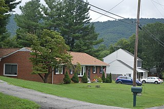
<span class="mw-page-title-main">Blue Ridge, Virginia</span> Census-designated place in Virginia, United States

Blue Ridge is a census-designated place (CDP) in southern Botetourt County, Virginia, United States. The population was 3,185 at the 2020 census. The CDP is located along U.S. Route 460. It is part of the Roanoke Metropolitan Statistical Area.

Cloverdale is a census-designated place (CDP) in southern Botetourt County, Virginia, United States. The population was 3,410 at the 2020 census. The community is located along State Route 654. It is part of the Roanoke Metropolitan Statistical Area.

Daleville is a census-designated place (CDP) in southern Botetourt County, Virginia, United States. The population was 3,070 at the 2020 census. The CDP is located along U.S. Route 220. It is part of the Roanoke Metropolitan Statistical Area.

Laymantown is a census-designated place (CDP) in southern Botetourt County, Virginia, United States. The population was 1,867 at the 2020 census. The community is located along State Route 658. It is part of the Roanoke Metropolitan Statistical Area.

<span class="mw-page-title-main">Troutville, Virginia</span> Town in Virginia, United States

Troutville is a town in Botetourt County, Virginia, United States. The population was 458 at the 2020 census. The town is located along the U.S. Route 11 between Cloverdale and Buchanan. It is part of the Roanoke Metropolitan Statistical Area.
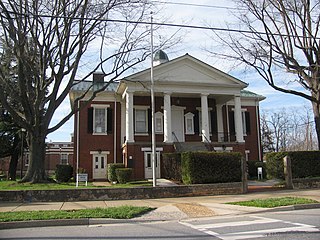
<span class="mw-page-title-main">Rustburg, Virginia</span> Census-designated place in Virginia, United States

Rustburg is a census-designated place (CDP) in and the county seat of Campbell County, Virginia, United States. The population was 1,585 at the 2020 census. It is part of the Lynchburg Metropolitan Statistical Area.

North Shore is a census-designated place (CDP) in Franklin County, Virginia, United States. The community lies along State Route 616. It is part of the Roanoke Metropolitan Statistical Area.

<span class="mw-page-title-main">Vinton, Virginia</span> Town in Virginia, United States

Vinton is a town in eastern Roanoke County, Virginia, United States. The population was 8,059 at the 2020 census. Vinton is part of the Roanoke Metropolitan Statistical Area and the Roanoke Region of Virginia.

Thaxton is an unincorporated community in western Bedford County, Virginia, United States. The community is located along U.S. Route 460 between Bedford and Montvale. It is part of the Lynchburg Metropolitan Statistical Area.

<span class="mw-page-title-main">Goode, Virginia</span> Unincorporated community in Virginia, United States

Goode is an unincorporated community in eastern Bedford County, Virginia, United States. The community lies along U.S. Route 221 between Bedford and Forest. It is part of the Lynchburg Metropolitan Statistical Area.

<span class="mw-page-title-main">Moneta, Virginia</span> Unincorporated community in Virginia, United States

Moneta is a census-designated place (CDP) in southern Bedford County, Virginia, United States. The community is located along Route 122 between the towns of Bedford and Rocky Mount. It is part of the Lynchburg Metropolitan Statistical Area.

Glen Wilton is a census-designated place (CDP) in northern Botetourt County, Virginia, United States. The population was 129 at the 2020 census. The CDP is located along the James River, between Eagle Rock and Iron Gate. It is part of the Roanoke Metropolitan Statistical Area.

<span class="mw-page-title-main">Montvale, Virginia</span> Census-designated place in Virginia, United States

Montvale is a census-designated place (CDP) in western Bedford County, Virginia, United States. The population as of the 2020 census was 635. The community is located between Roanoke and Bedford. It is part of the Lynchburg Metropolitan Statistical Area.

Villamont is an unincorporated community in western Bedford County, Virginia, United States. Villamont is located along U.S. Route 460 between Blue Ridge and Montvale. It is part of the Lynchburg Metropolitan Statistical Area.
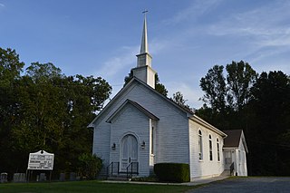
<span class="mw-page-title-main">Coleman Falls, Virginia</span> Unincorporated community in Virginia, United States

Coleman Falls is an unincorporated community in northern Bedford County, Virginia, United States. The community is located along the James River and U.S. Route 501, between Big Island and Boonsboro. It is part of the Lynchburg Metropolitan Statistical Area.

Lowry is an unincorporated community in eastern Bedford County, Virginia, United States. The community is located along State Route 715 and is 5.2 miles (8.4 km) east-northeast of Bedford. It is part of the Lynchburg Metropolitan Statistical Area.

Stewartsville is a census-designated place (CDP) in southwestern Bedford County, Virginia, United States. The population as of the 2020 census was 533. The CDP is located along State Route 24, between Vinton and Chamblissburg. It is part of the Lynchburg Metropolitan Statistical Area.

References

  1. Carmel, Margaret (30 May 2016). "Big Island Mill celebrates 125 years". The News & Advance. The News & Advance. Retrieved 20 May 2019.
  2. Virginia Trend Report 2: State and Complete Places (Sub-state 2010 Census Data). Archived 2012-07-11 at archive.today Missouri Census Data Center. Accessed 2011-06-08.
  3. Carmel, Margaret (30 May 2016). "Big Island Mill celebrates 125 years". The News & Advance. The News & Advance. Retrieved 20 May 2019.