
Forest is a census-designated place (CDP) in eastern Bedford County, Virginia, United States. The population was 11,709 at the 2020 census. It is part of the Lynchburg Metropolitan Statistical Area.
Blue Ridge is a census-designated place (CDP) in southern Botetourt County, Virginia, United States. The population was 3,185 at the 2020 census. The CDP is located along U.S. Route 460. It is part of the Roanoke Metropolitan Statistical Area.
Laymantown is a census-designated place (CDP) in southern Botetourt County, Virginia, United States. The population was 1,867 at the 2020 census. The community is located along State Route 658. It is part of the Roanoke Metropolitan Statistical Area.

Vinton is a town in eastern Roanoke County, Virginia, United States. The population was 8,059 at the 2020 census. Vinton is part of the Roanoke Metropolitan Statistical Area and the Roanoke Region of Virginia.
Buford's Gap is a wind gap in the Blue Ridge Mountains in Bedford County, Virginia. Buford's Gap was the original crossing of the Blue Ridge Mountains for the Virginia and Tennessee Railroad, later the Norfolk and Western Railway, a precursor of today's Norfolk Southern Railway system. It was the site of a battle in 1864 during the American Civil War. U.S. Route 460 also passes through the gap.

U.S. Route 460 (US 460) in Virginia runs west-east through the southern part of the Commonwealth. The road has two separate pieces in Virginia, joined by a relatively short section in West Virginia. Most of US 460 is a four-lane divided highway and is a major artery in the southern third of the state. From Petersburg to Suffolk, US 460 is a four-lane non-divided highway. It is a popular alternative to Interstate 64 (I-64) when going from Richmond and other points in central Virginia to the Currituck Sound and Outer Banks of North Carolina, avoiding the congestion and tunnels of the more northerly I-64 corridor. The road passes through several small towns that built up at stops along the railroad line.

U.S. Route 221 (US 221) is a part of the U.S. Highway System that runs from Perry, Florida to Lynchburg, Virginia. In Virginia, the U.S. Highway runs 149.61 miles (240.77 km) from the North Carolina state line near Independence north to its northern terminus at US 29 Business, US 460 Business, and US 501 Business in Lynchburg. US 221 connects Independence, Galax, and Hillsville in Southwest Virginia while running concurrently with US 58. The U.S. Highway connects those communities with Roanoke via Floyd County, within which US 221 is the main east–west highway. Entering Bedford County, US 221 exits the Blue Ridge Mountains; it then passes through the Piedmont town of Bedford on its way to Lynchburg and shares a brief overlap with US 460 Business through the town. The U.S. Highway also runs concurrently with US 460 from Roanoke to Bedford and parallels that U.S. Highway from Bedford to Lynchburg.

State Route 122 is a primary state highway in the U.S. state of Virginia. The state highway runs 54.58 miles (87.84 km) from SR 40 in Rocky Mount north to U.S. Route 501 in Big Island. SR 122 passes through the Blue Ridge foothills of Franklin and Bedford counties, connecting Rocky Mount with the town of Bedford. The state highway provides access to Booker T. Washington National Monument and Smith Mountain Lake, and the National D-Day Memorial via its Bedford business route.

Hardy is an unincorporated community in southwestern Bedford County and northeastern Franklin County, Virginia, United States. The community lies along State Route 634 and is approximately nine miles southeast of Roanoke.
Thaxton is an unincorporated community in western Bedford County, Virginia, United States. The community is located along U.S. Route 460 between Bedford and Montvale. It is part of the Lynchburg Metropolitan Statistical Area.

Goode is an unincorporated community in eastern Bedford County, Virginia, United States. The community lies along U.S. Route 221 between Bedford and Forest. It is part of the Lynchburg Metropolitan Statistical Area.

Moneta is a census-designated place (CDP) in southern Bedford County, Virginia, United States. The community is located along Route 122 between the towns of Bedford and Rocky Mount. It is part of the Lynchburg Metropolitan Statistical Area.
Glen Wilton is a census-designated place (CDP) in northern Botetourt County, Virginia, United States. The population was 129 at the 2020 census. The CDP is located along the James River, between Eagle Rock and Iron Gate. It is part of the Roanoke Metropolitan Statistical Area.
Big Island is a census-designated place (CDP) in northern Bedford County, Virginia, United States. The population as of the 2020 United States census was 300. The CDP is located along the James River and U.S. Route 501, between Glasgow and Coleman Falls. It is part of the Lynchburg Metropolitan Statistical Area.

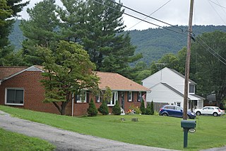
Montvale is a census-designated place (CDP) in western Bedford County, Virginia, United States. The population as of the 2020 census was 635. The community is located between Roanoke and Bedford. It is part of the Lynchburg Metropolitan Statistical Area.

Chamblissburg is an unincorporated community in southwestern Bedford County, Virginia, United States. It lies along State Route 24, east of Stewartsville. It is part of the Lynchburg Metropolitan Statistical Area.

Huddleston is an unincorporated community in southeastern Bedford County, Virginia, United States. The community lies along State Route 626 and is located 12.5 miles (20.1 km) south-southeast of Bedford. It is part of the Lynchburg Metropolitan Statistical Area.
Coleman Falls is an unincorporated community in northern Bedford County, Virginia, United States. The community is located along the James River and U.S. Route 501, between Big Island and Boonsboro. It is part of the Lynchburg Metropolitan Statistical Area.
Lowry is an unincorporated community in eastern Bedford County, Virginia, United States. The community is located along State Route 715 and is 5.2 miles (8.4 km) east-northeast of Bedford. It is part of the Lynchburg Metropolitan Statistical Area.
Stewartsville is a census-designated place (CDP) in southwestern Bedford County, Virginia, United States. The population as of the 2020 census was 533. The CDP is located along State Route 24, between Vinton and Chamblissburg. It is part of the Lynchburg Metropolitan Statistical Area.


