Blue Berry Hill, Texas

Last updated

Blue Berry Hill, Texas
Bee BlueBerryHill.svg
Coordinates: 28°23′21″N97°46′54″W / 28.38917°N 97.78167°W / 28.38917; -97.78167
Country United States
State Texas
County Bee
Area
  Total2.9 sq mi (7.6 km2)
  Land2.9 sq mi (7.6 km2)
  Water0.0 sq mi (0.0 km2)
Elevation
272 ft (83 m)
Population
 (2020)
  Total844
  Density290/sq mi (110/km2)
Time zone UTC-6 (Central (CST))
  Summer (DST) UTC-5 (CDT)
Zip Code
78102
FIPS code 48-08830 [1]
GNIS feature ID1852687 [2]

Blueberry Hill is a census-designated place (CDP) in Bee County, Texas, United States. The population was 844 at the 2020 census. It is located just outside Beeville and has no services of its own. Drinking water and garbage services are provided by the city of Beeville. [3] Mailing addresses for Blueberry Hill are labeled "Beeville".

Contents

Geography

Blueberry Hill is located southwest of Beeville at 28°23′21″N97°46′54″W / 28.38917°N 97.78167°W / 28.38917; -97.78167 (28.389303, -97.781611). [4] U.S. Route 59 forms the southern edge of the CDP; the highway leads west 21 miles (34 km) to George West and northeast through Beeville 32 miles (51 km) to Goliad. The northeastern edge of the CDP is formed by the 351 Bypass around Beeville. Beeville is a small town, approximately one hour 45 minutes southeast of San Antonio.

According to the United States Census Bureau, the CDP has a total area of 2.9 square miles (7.6 km2), all land. [5]

Demographics

Historical population
CensusPop.Note
2000 982
2010 866−11.8%
2020 844−2.5%
US Decennial Census [4]
2020 Census [6]

As of the census [1] of 2000, there were 982 people, 316 households, and 238 families residing in the CDP. The population density was 335.6 inhabitants per square mile (129.6/km2). There were 370 housing units at an average density of 126.4 per square mile (48.8/km2). The racial makeup of the CDP was 66.60% White, 0.20% African American, 1.02% Native American, 0.20% Asian, 30.24% from other races, and 1.73% from two or more races. Hispanic or Latino of any race were 80.45% of the population.

There were 316 households, out of which 40.2% had children under the age of 18 living with them, 52.5% were married couples living together, 17.4% had a female householder with no husband present, and 24.4% were non-families. 16.1% of all households were made up of individuals, and 5.7% had someone living alone who was 65 years of age or older. The average household size was 3.11 and the average family size was 3.54.

In the CDP, the population was spread out, with 34.0% under the age of 18, 11.4% from 18 to 24, 27.0% from 25 to 44, 19.9% from 45 to 64, and 7.7% who were 65 years of age or older. The median age was 29 years. For every 100 females, there were 101.6 males. For every 100 females age 18 and over, there were 97.0 males.

The median income for a household in the CDP was $26,500, and the median income for a family was $26,250. Males had a median income of $27,273 versus $16,912 for females. The per capita income for the CDP was $9,255. About 39.5% of families and 45.3% of the population were below the poverty line, including 67.7% of those under age 18 and 21.7% of those age 65 or over.

Education

Blueberry Hill is served by the Beeville Independent School District. [7]

Related Research Articles

<span class="mw-page-title-main">Funny River, Alaska</span> Census-designated place in Alaska, United States

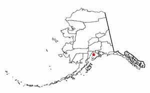
Funny River is a census-designated place (CDP) in Kenai Peninsula Borough, Alaska, United States. At the 2010 census the population was 877, up from 636 in 2000.

<span class="mw-page-title-main">Mohawk Vista, California</span> Census-designated place in California, United States

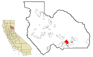
Mohawk Vista is a census-designated place in Plumas County, California, United States. The population was 159 at the 2010 census, up from 121 at the 2000 census.

<span class="mw-page-title-main">Normanna, Texas</span> Census-designated place in Texas, United States

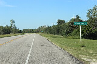
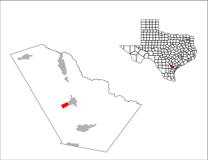
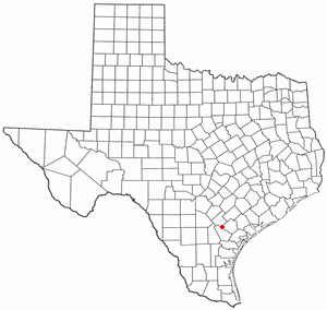
Normanna is a census-designated place in Bee County, Texas, United States. The population was 98 at the 2020 census.

<span class="mw-page-title-main">Pettus, Texas</span> Census-designated place in Texas, United States

Pettus is a census-designated place (CDP) in Bee County, Texas, United States. The population was 449 at the 2020 census.

<span class="mw-page-title-main">Skidmore, Texas</span> Census-designated place in Texas, United States

Skidmore is a census-designated place (CDP) in Bee County, Texas, United States. The population was 863 at the 2020 census.

<span class="mw-page-title-main">Tuleta, Texas</span> Census-designated place in Texas, United States

Tuleta is a census-designated place (CDP) in Bee County, Texas, United States. The population was 231 at the 2020 census.

<span class="mw-page-title-main">Tulsita, Texas</span> Census-designated place in Texas, United States

Tulsita is a census-designated place (CDP) in Bee County, Texas, United States. The population was 31 at the 2020 census.

<span class="mw-page-title-main">Encantada-Ranchito-El Calaboz, Texas</span> Census-designated place in Texas, United States

Encantada-Ranchito-El Calaboz, also known as El Calaboz Rancheria in the San Pedro de Carricitos Land Grant, is a census-designated place (CDP) in Cameron County, Texas, United States. The population was 1,981 at the 2020 census. It is part of the Brownsville–Harlingen Metropolitan Statistical Area.

<span class="mw-page-title-main">Lozano, Texas</span> Census-designated place in Texas, United States

Lozano is a census-designated place (CDP) in Cameron County, Texas, United States. The population was 404 at the 2010 census, up from 324 at the 2000 census. By the 2020 census, the population went drastically down to 174. It is part of the Brownsville–Harlingen Metropolitan Statistical Area.

<span class="mw-page-title-main">Olmito, Texas</span> Census-designated place in Texas, United States

Olmito is a census-designated place (CDP) in Cameron County, Texas, United States. Olmito is Spanish for "little elm". The population was 1,021 at the 2020 census. It is part of the Brownsville–Harlingen Metropolitan Statistical Area. Olmito is the self-described "mesquite capital of the world."

<span class="mw-page-title-main">Reid Hope King, Texas</span> Census-designated place in Texas, United States

Reid Hope King is a census-designated place (CDP) in Cameron County, Texas, United States. The population was 667 at the 2020 census. It is part of the Brownsville–Harlingen Metropolitan Statistical Area.

<span class="mw-page-title-main">Yznaga, Texas</span> Census-designated place in Texas, United States

Yznaga is a census-designated place (CDP) in Cameron County, Texas, United States. The population was 108 at the 2020 census. It is part of the Brownsville–Harlingen Metropolitan Statistical Area.

<span class="mw-page-title-main">Indian Hills, Texas</span> Census-designated place in Texas

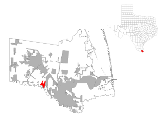
Indian Hills is a census-designated place (CDP) in Hidalgo County, Texas, United States. At the 2020 United States Census, the population was 2,694. It is part of the McAllen–Edinburg–Mission Metropolitan Statistical Area.

<span class="mw-page-title-main">Rancho Banquete, Texas</span> CDP in Texas, United States

Rancho Banquete is a census-designated place (CDP) in Nueces County, Texas, United States. The population was 459 at the 2020 census, down from 424 at the 2010 census.

<span class="mw-page-title-main">St. Paul, San Patricio County, Texas</span> Place in Texas, United States

St. Paul is a census-designated place (CDP) in San Patricio County, Texas, United States. The population was 608 at the 2020 census.

<span class="mw-page-title-main">Tradewinds, Texas</span> CDP in Texas, United States

Tradewinds is a census-designated place (CDP) in San Patricio County, Texas, United States. The population was 160 at the 2020 census.

<span class="mw-page-title-main">Sebastian, Texas</span> CDP in Texas, United States

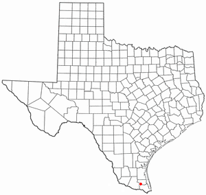
Sebastian is a census-designated place (CDP) in Willacy County, Texas, United States. The population was 1,684 at the 2020 census.

<span class="mw-page-title-main">Serenada, Texas</span> CDP in Texas, United States

Serenada is a census-designated place (CDP) in Williamson County, Texas, United States. The population was 2,098 at the 2020 census. Those living in Serenada have Georgetown addresses.

<span class="mw-page-title-main">East Hill-Meridian, Washington</span> Former CDP in Washington, United States

East Hill-Meridian is a former census-designated place (CDP) in King County, Washington. The population was 29,878 at the time of the 2010 census. The majority of the census area is now within the limits of Kent and Renton.

Pittsfield is a census-designated place (CDP) in the town of Pittsfield in Somerset County, Maine, United States. The population was 3,217 at the 2000 census.

References

  1. 1 2 "U.S. Census website". United States Census Bureau . Retrieved January 31, 2008.
  2. "US Board on Geographic Names". United States Geological Survey. October 25, 2007. Retrieved January 31, 2008.
  3. "MySouTex.com - Council tentatively approves Blueberry Hills water contract". mysoutex.com. Archived from the original on November 26, 2010. Retrieved May 22, 2022.
  4. 1 2 "US Gazetteer files: 2010, 2000, and 1990". United States Census Bureau. February 12, 2011. Retrieved April 23, 2011.
  5. "Geographic Identifiers: 2010 Demographic Profile Data (G001): Blue Berry Hill CDP, Texas". U.S. Census Bureau, American Factfinder. Archived from the original on February 12, 2020. Retrieved April 10, 2014.
  6. "Census Bureau profile: Blue Berry Hill, Texas". United States Census Bureau. May 2023. Retrieved May 27, 2024.
  7. "2020 CENSUS - SCHOOL DISTRICT REFERENCE MAP: Bee County, TX" (PDF). U.S. Census Bureau . Retrieved February 15, 2024.