
Mattapoisett Center is a census-designated place (CDP) in the town of Mattapoisett in Plymouth County, Massachusetts. The population was 2,915 at the 2010 census.

Shorewood–Tower Hills–Harbert is a census-designated place (CDP) composed of several small unincorporated communities in Chikaming Township of Berrien County in the U.S. state of Michigan. The population was 1,249 at the 2020 census. The CDP is limited to Chikaming Township, although some of the communities extend into southern Lake Township. All of the communities are located either upon or just east of the dunes on the shore of Lake Michigan. Most of the communities lie west of Interstate 94, although the CDP includes a small area east of the freeway up to Sawyer, Michigan. The township is a popular resort destination.
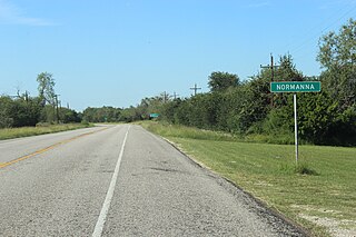
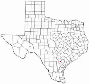
Normanna is a census-designated place in Bee County, Texas, United States. The population was 98 at the 2020 census.

Tuleta is a census-designated place (CDP) in Bee County, Texas, United States. The population was 231 at the 2020 census.
Tulsita is a census-designated place (CDP) in Bee County, Texas, United States. The population was 31 at the 2020 census.

Bixby is a census-designated place (CDP) in Cameron County, Texas, United States. The population was 352 at the 2020 census. It is part of the Brownsville–Harlingen Metropolitan Statistical Area.

El Camino Angosto is a census-designated place (CDP) in Cameron County, Texas, United States. The population was 186 at the 2020 census. It is part of the Brownsville–Harlingen Metropolitan Statistical Area.

Green Valley Farms is a census-designated place (CDP) in Cameron County, Texas, United States. The population was 655 at the 2020 census, down from 1,272 at the 2010 census. It is part of the Brownsville–Harlingen Metropolitan Statistical Area.

Lasana is a census-designated place (CDP) in Cameron County, Texas, United States. The population was 84 at the 2010 census, down from 135 at the 2000 census. It is part of the Brownsville–Harlingen Metropolitan Statistical Area.

Laureles is a census-designated place (CDP) in Cameron County, Texas, United States. The population was 4,111 at the 2020 census. It is part of the Brownsville–Harlingen Metropolitan Statistical Area. Laureles is an area between Los Fresnos and San Benito.

Lozano is a census-designated place (CDP) in Cameron County, Texas, United States. The population was 404 at the 2010 census, up from 324 at the 2000 census. By the 2020 census, the population went drastically down to 174. It is part of the Brownsville–Harlingen Metropolitan Statistical Area.
Ratamosa is a census-designated place (CDP) in Cameron County, Texas, United States. The population was 197 at the 2020 census. It is part of the Brownsville–Harlingen Metropolitan Statistical Area.

Reid Hope King is a census-designated place (CDP) in Cameron County, Texas, United States. The population was 667 at the 2020 census. It is part of the Brownsville–Harlingen Metropolitan Statistical Area.

Yznaga is a census-designated place (CDP) in Cameron County, Texas, United States. The population was 108 at the 2020 census. It is part of the Brownsville–Harlingen Metropolitan Statistical Area.

Indian Hills is a census-designated place (CDP) in Hidalgo County, Texas, United States. At the 2020 United States Census, the population was 2,694. It is part of the McAllen–Edinburg–Mission Metropolitan Statistical Area.

St. Paul is a census-designated place (CDP) in San Patricio County, Texas, United States. The population was 608 at the 2020 census.

Tradewinds is a census-designated place (CDP) in San Patricio County, Texas, United States. The population was 160 at the 2020 census.
Eagle Mountain is a former census-designated place (CDP) in Tarrant County, Texas, United States. The population was 6,599 at the 2000 census. It is now a part of the city of Saginaw.

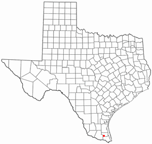
Los Angeles is a census-designated place (CDP) in Willacy County, Texas, United States. The population was 108 at the 2020 census. Prior to the 2010 census, the CDP was known as Los Angeles Subdivision.
Sebastian is a census-designated place (CDP) in Willacy County, Texas, United States. The population was 1,684 at the 2020 census.


