Bow Mar, Colorado

Last updated

Bow Mar, Colorado
Bow Mar, Colorado.JPG
Bow Mar in 2014.
Arapahoe County and Jefferson County Colorado Incorporated and Unincorporated areas Bow Mar Highlighted 0808070.svg
Location of the Town of Bow Mar in Arapahoe and Jefferson counties, Colorado.
Usa edcp location map.svg
Red pog.svg
Bow Mar
Location of the Town of Bow Mar in the United States.
Coordinates: 39°37′36″N105°03′03″W / 39.626594°N 105.050914°W / 39.626594; -105.050914 [2]
Country Flag of the United States.svg  United States
State Flag of Colorado.svg  Colorado
Counties Arapahoe County [1]
Jefferson County
Incorporated (town) August 1958 [3]
Government
  Type Statutory Town [1]
Area
[4]
  Total0.812 sq mi (2.104 km2)
  Land0.662 sq mi (1.714 km2)
  Water0.151 sq mi (0.390 km2)
Elevation
[5]
5,518 ft (1,682 m)
Population
 (2020) [4]
  Total853
  Density1,289/sq mi (498/km2)
   Metro
2,963,821 (19th)
   CSA
3,623,560 (17th)
   Front Range
5,055,344
Time zone UTC−07:00 (MST)
  Summer (DST) UTC−06:00 (MDT)
ZIP code
80123 [6]
Area code(s) Both 303 and 720
FIPS code 08-08070
GNIS feature ID 0202874
Highways none
Website www.townofbowmar.org

Bow Mar is a Statutory Town located in Arapahoe and Jefferson counties, Colorado, United States. [1] The town population was 853 at the 2020 United States Census with 587 residing in Arapahoe County and 266 residing in Jefferson County. [4] Bow Mar is part of the Front Range Urban Corridor. The current mayor of Bow Mar is Bryan Sperry.

Contents

History

As the Denver-area grew in the late 19th century, the area that is now known as Bow Mar was developed as an agricultural area. It was home to several large farms that provided for both Denver and nearby Littleton. The name Bow Mar is derived from combining the names of two nearby lakes, Bowles Lake and Marston Lake. The lakes were named for two pioneering farmers in the area, Joseph Bowles and John Marston. [7] The Bowles family farmhouse and barn can today be found south of the town of Bow Mar.

As Denver grew in the post-World War II era, Bow Mar farmland was purchased to develop the area into single-family housing. Homes were first constructed in what is now Bow Mar in the late 1940s and early 1950s. In 1947, the first home was built in Bow Mar by land developed by Lloyd and Eleanor King. [8] The neighborhood was largely built up by the end of the 1950s. Bow Mar was incorporated as a town in 1958 [8] as a town that straddled both Arapahoe and Jefferson counties. When built, many homes in Bow Mar reflected Frank Lloyd Wright's prairie-style architecture. Homes were constructed upon acre lots and were placed on wide streets, and were limited to being no more than one story tall. Today, many houses in the area are being updated or replaced with new construction.

Bow Mar maintains a public beach for residents that is utilized year-round for concerts, gatherings, or other neighborhood events. The Bow Mar Yacht Club hosts regattas during summer months on Bow Mar Lake.

Geography

Bow Mar is located at 39°37′37″N105°03′03″W / 39.626937°N 105.050767°W / 39.626937; -105.050767 . [9]

At the 2020 United States Census, the town had a total area of 520 acres (2.104 km2) including 96 acres (0.390 km2) of water.

Demographics

Historical population
CensusPop.Note
1960 748
1970 94526.3%
1980 930−1.6%
1990 854−8.2%
2000 847−0.8%
2010 8662.2%
2020 853−1.5%
U.S. Decennial Census
General plan for the village of Bow-Mar 1956 General plan for the village of Bow-Mar, Colorado - DPLA - d23bf83b3cf9e9936b48bb23abcc971b.jpg
General plan for the village of Bow-Mar 1956

Bow Mar is located within the Denver-Aurora-Lakewood, CO Metropolitan Statistical Area.

As of the census [10] of 2000, there were 847 people, 295 households, and 264 families residing in the town. The population density was 1,181.4 inhabitants per square mile (456.1/km2). There were 302 housing units at an average density of 421.2 per square mile (162.6/km2). The racial makeup of the town was 97.76% White, 0.71% Asian, 0.24% from other races, and 1.30% from two or more races. Hispanic or Latino of any race were 3.78% of the population.

There were 295 households, out of which 40.3% had children under the age of 18 living with them, 82.4% were married couples living together, 5.1% had a female householder with no husband present, and 10.5% were non-families. 8.1% of all households were made up of individuals, and 4.4% had someone living alone who was 65 years of age or older. The average household size was 2.87 and the average family size was 3.04.

In the town, the population was spread out, with 27.3% under the age of 18, 3.3% from 18 to 24, 20.7% from 25 to 44, 32.0% from 45 to 64, and 16.8% who were 65 years of age or older. The median age was 44 years. For every 100 females, there were 99.3 males. For every 100 females age 18 and over, there were 96.8 males.

The median income for a household in the town was $112,300, and the median income for a family was $119,377. Males had a median income of $88,442 versus $61,667 for females. The per capita income for the town was $53,558. About 2.4% of families and 3.4% of the population were below the poverty line, including 1.6% of those under age 18 and 2.2% of those age 65 or over.

Education

The Bow Mar homes situated in Arapahoe County attend part of the Littleton School District. There are fourteen elementary schools, four middle schools, three high schools, and two charter schools in the district.

Brian Ewert is the Superintendent of Schools. [11]

Homes that are within the Jefferson County borders attend Jefferson County Public Schools.

See also

Related Research Articles

<span class="mw-page-title-main">Douglas County, Colorado</span> County in Colorado, United States

Douglas County is a county located in the U.S. state of Colorado. As of the 2020 Census, the population was 357,978. The county is named in honor of U.S. Senator Stephen A. Douglas. The county seat is Castle Rock.

<span class="mw-page-title-main">Adams County, Colorado</span> County in Colorado, United States

Adams County is a county located in the U.S. state of Colorado. As of the 2020 census, the population was 519,572. The county seat is Brighton, and the largest city is Thornton. The county is named for Alva Adams, an early Governor of the State of Colorado in 1887–1889. Adams County is part of the Denver–Aurora–Lakewood, CO Metropolitan Statistical Area.

<span class="mw-page-title-main">Park County, Colorado</span> County in Colorado, United States

Park County is a county located in the U.S. state of Colorado. As of the 2020 census, the population was 17,390. The county seat is Fairplay. The county was named after the large geographic region known as South Park, which was named by early fur traders and trappers in the area.

<span class="mw-page-title-main">Jefferson County, Colorado</span> County in Colorado, United States

Jefferson County is a county located in the U.S. state of Colorado. As of the 2020 census, the population was 582,910, making it the fourth-most populous county in Colorado. The county seat is Golden, and the most populous city's Lakewood.

<span class="mw-page-title-main">Gilpin County, Colorado</span> County in Colorado, United States

Gilpin County is a county located in the U.S. state of Colorado, smallest in land area behind only the City and County of Broomfield. As of the 2020 census, the population was 5,808. The county seat is Central City. The county was formed in 1861, while Colorado was still a territory, and was named after Colonel William Gilpin, the first territorial governor.

<span class="mw-page-title-main">Elbert County, Colorado</span> County in the United States

Elbert County is a county located in the U.S. state of Colorado. As of the 2020 census, the population was 26,062. The county seat is Kiowa and the largest town is Elizabeth.

<span class="mw-page-title-main">Arapahoe County, Colorado</span> County in Colorado, United States

Arapahoe County is a county located in the U.S. state of Colorado. As of the 2020 census, its population was 655,070, making it the third-most populous county in Colorado. The county seat is Littleton, and the most populous city is Aurora. The county was named for the Arapaho Native American tribe, who once lived in the region.

<span class="mw-page-title-main">Bennett, Colorado</span> Town in Colorado, United States

Bennett is a Statutory Town located in Adams and Arapahoe counties, Colorado, United States. The town population was 2,862 at the 2020 United States Census with 2,443 residing in Adams County and 419 residing in Arapahoe County.

<span class="mw-page-title-main">Broomfield, Colorado</span> Consolidated city and county in Colorado, United States

Broomfield is a consolidated city and county located in the U.S. state of Colorado. It has a consolidated government which operates under Article XX, Sections 10–13 of the Constitution of the State of Colorado. Broomfield's population was 74,112 at the 2020 United States Census, making it the 15th most populous municipality and the 12th most populous county in Colorado. Broomfield is a part of the Denver–Aurora–Lakewood, CO Metropolitan Statistical Area and the Front Range urban corridor.

<span class="mw-page-title-main">Federal Heights, Colorado</span> City in Colorado, United States

The City of Federal Heights is a home rule municipality located in western Adams County, Colorado, United States. The city population was 14,382 at the 2020 United States Census, a +25.42% increase since the 2010 United States Census. Federal Heights is a part of the Denver–Aurora–Lakewood, CO Metropolitan Statistical Area and the Front Range Urban Corridor. The current Mayor is Linda S. Montoya, who was elected to a four-year term in 2019.

<span class="mw-page-title-main">Sherrelwood, Colorado</span> Place in Colorado, United States

Sherrelwood is an unincorporated community and a census-designated place (CDP) located in and governed by Adams County, Colorado, United States. The CDP is a part of the Denver–Aurora–Lakewood, CO Metropolitan Statistical Area. The population was 19,228 at the 2020 census.

<span class="mw-page-title-main">Cherry Hills Village, Colorado</span> City in Colorado, United States

The City of Cherry Hills Village is a home rule municipality located in Arapahoe County, Colorado, United States. The city population was 6,442 at the 2020 United States Census. Cherry Hills Village is a part of the Denver–Aurora–Lakewood, CO Metropolitan Statistical Area and the Front Range Urban Corridor.

<span class="mw-page-title-main">Columbine, Colorado</span> Census-designated place in Jefferson and Arapahoe counties in Colorado, United States

Columbine is a census-designated place (CDP) in and governed by Jefferson and Arapahoe counties in Colorado, United States. The CDP is a part of the Denver metropolitan area. Located primarily in Jefferson County, Columbine lies immediately south of Denver. The population of the Columbine CDP was 25,229 at the 2020 census. The community lies in ZIP code 80123.

<span class="mw-page-title-main">Columbine Valley, Colorado</span> Town in Colorado, United States

The Town of Columbine Valley is a Statutory Town located in western Arapahoe County, Colorado, United States. The town population was 1,502 at the 2020 United States Census, a +19.59% increase since the 2010 United States Census. Columbine Valley is a part of the Denver-Aurora-Lakewood, CO Metropolitan Statistical Area and the Front Range Urban Corridor.

<span class="mw-page-title-main">Deer Trail, Colorado</span> Town in Colorado, United States

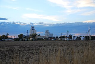
The Town of Deer Trail is a Statutory Town located in eastern Arapahoe County, Colorado, United States. The town population was 1,068 at the 2020 United States Census, a +95.60% increase since the 2010 United States Census. Deer Trail is a part of the Denver–Aurora–Lakewood, CO Metropolitan Statistical Area and the Front Range Urban Corridor. The town is situated along Interstate 70, approximately 55 miles (89 km) east of Denver.

<span class="mw-page-title-main">Englewood, Colorado</span> City in Colorado, United States

The City of Englewood is a home rule municipality located in Arapahoe County, Colorado, United States. The town population was 33,659 at the 2020 United States Census. Englewood is a part of the Denver–Aurora–Lakewood, CO Metropolitan Statistical Area and the Front Range Urban Corridor. Englewood is located immediately south of Denver in the South Platte River Valley.

<span class="mw-page-title-main">Foxfield, Colorado</span> Town in Colorado, United States

The Town of Foxfield is a statutory town located in Arapahoe County, Colorado, United States. The town population was 754 at the 2020 United States Census. Foxfield is a part of the Denver–Aurora–Lakewood, CO Metropolitan Statistical Area and the Front Range Urban Corridor. The town is bordered by the cities of Aurora and Centennial.

<span class="mw-page-title-main">Greenwood Village, Colorado</span> City in Colorado, United States

The City of Greenwood Village is a home rule municipality located in Arapahoe County, Colorado, United States. The city population was 15,691 at the 2020 United States Census. Greenwood Village is a part of the Denver–Aurora–Lakewood, CO Metropolitan Statistical Area and the Front Range Urban Corridor.

<span class="mw-page-title-main">Edgewater, Colorado</span> City in Colorado, United States

The City of Edgewater is a home rule municipality located in Jefferson County, Colorado, United States. The city population was 5,005 at the 2020 United States Census. Edgewater is surrounded by Denver to the east, Lakewood to the south and west, and Wheat Ridge to the north. The city is a part of the Denver–Aurora–Lakewood, CO Metropolitan Statistical Area and the Front Range Urban Corridor.

<span class="mw-page-title-main">Littleton, Colorado</span> City in Colorado, United States

Littleton is a home rule municipality city located in Arapahoe, Douglas, and Jefferson counties, Colorado, United States. Littleton is the county seat of Arapahoe County and is a part of the Denver–Aurora–Lakewood, CO Metropolitan Statistical Area. The city population was 45,652 at the 2020 United States Census, ranking as the 20th most populous municipality in the State of Colorado.

References

  1. 1 2 3 4 "Active Colorado Municipalities". Colorado Department of Local Affairs . Retrieved October 15, 2021.
  2. "2014 U.S. Gazetteer Files: Places". United States Census Bureau. July 1, 2014. Retrieved January 5, 2015.
  3. "Colorado Municipal Incorporations". State of Colorado, Department of Personnel & Administration, Colorado State Archives. December 1, 2004. Retrieved September 2, 2007.
  4. 1 2 3 "Decennial Census P.L. 94-171 Redistricting Data". United States Census Bureau, United States Department of Commerce. August 12, 2021. Retrieved September 7, 2021.
  5. "US Board on Geographic Names". United States Geological Survey. October 25, 2007. Retrieved January 31, 2008.
  6. "ZIP Code Lookup". United States Postal Service. Archived from the original (JavaScript/HTML) on September 3, 2007. Retrieved September 4, 2007.
  7. "Profile for Bow Mar, Colorado, CO". ePodunk. Retrieved May 7, 2012.
  8. 1 2 "Town of Bow Mar". Town of Bow Mar. Archived from the original on October 21, 2012. Retrieved May 7, 2012.
  9. "US Gazetteer files: 2010, 2000, and 1990". United States Census Bureau. February 12, 2011. Retrieved April 23, 2011.
  10. "U.S. Census website". United States Census Bureau . Retrieved January 31, 2008.
  11. "Littleton Public Schools". Littleton Public Schools. Retrieved July 15, 2021.