Bradfordsville, Kentucky

Last updated

Bradfordsville, Kentucky
Bradfordsville-Christian-Church-ky.jpg
Bradfordsville Performing Arts Center, formerly Bradfordsville Christian Church
Marion County Kentucky Incorporated and Unincorporated areas Bradfordsville Highlighted 2109100.svg
Location in Marion County, Kentucky
Coordinates: 37°29′43″N85°8′54″W / 37.49528°N 85.14833°W / 37.49528; -85.14833 Coordinates: 37°29′43″N85°8′54″W / 37.49528°N 85.14833°W / 37.49528; -85.14833
Country United States
State Kentucky
County Marion
Established1777 [1]
IncorporatedJanuary 30, 1836 [1]
Named for A local miller
Area
[2]
  Total0.27 sq mi (0.70 km2)
  Land0.27 sq mi (0.70 km2)
  Water0.00 sq mi (0.01 km2)
Elevation
699 ft (213 m)
Population
 (2020) [3]
  Total270
  Density1,000.00/sq mi (386.30/km2)
Time zone UTC-5 (Eastern (EST))
  Summer (DST) UTC-4 (EDT)
ZIP code
40009
Area code(s) 270 & 364
FIPS code 21-09100
GNIS feature ID0487792

Bradfordsville is a home rule-class city in Marion County, Kentucky, in the United States. The population was 270 at the time of the 2020 census. [3]

Contents

History

The community at the site was first known as Centerville from its supposed location at the center of the state. (Having since gained the Jackson Purchase, the present geographic center of the state remains nearby at Cowherd Road and McCarty Lane on Ky. 429 northwest of Lebanon. [4] ) The settlement was renamed Bradford's Mill after Peter Bradford's combined saw- and gristmill at the site; this became "Bradfordsville" after the establishment of a post office in 1834. [5]

Geography

Bradfordsville is located in southeastern Marion County at 37°29′43″N85°8′54″W / 37.49528°N 85.14833°W / 37.49528; -85.14833 (37.495328, -85.148452). [6] According to the U.S. Census Bureau, the city has a total area of 0.27 square miles (0.70 km2), all land. [2] Bradfordsville lies in the Rolling Fork Valley, just east of the point where the North Rolling Fork and the Big South Fork converge to form the Rolling Fork proper. The Rolling Fork is a northwest-flowing tributary of the Salt River, which joins the Ohio River a few miles downstream. Bradfordsville is mostly surrounded by rugged hills, with the Muldraugh Hill escarpment rising to the south.

Bradfordsville is concentrated around the intersection of Kentucky Route 337 (Main Street) and Kentucky Route 49 (Liberty Road). The former leads northeast 9 miles (14 km) to Gravel Switch and the Perryville area and southwest 12 miles (19 km) to Mannsville, while the latter leads southeast 20 miles (32 km) to Liberty and northwest 9 miles (14 km) to Lebanon, the Marion county seat.

Climate

Climate data for Bradfordsville, Kentucky (1991–2020)
MonthJanFebMarAprMayJunJulAugSepOctNovDecYear
Average high °F (°C)43.7
(6.5)
48.5
(9.2)
57.8
(14.3)
68.8
(20.4)
77.1
(25.1)
84.7
(29.3)
87.8
(31.0)
87.2
(30.7)
81.9
(27.7)
71.0
(21.7)
58.2
(14.6)
47.9
(8.8)
67.9
(19.9)
Daily mean °F (°C)33.9
(1.1)
37.0
(2.8)
44.9
(7.2)
54.9
(12.7)
64.6
(18.1)
72.4
(22.4)
76.2
(24.6)
74.8
(23.8)
68.4
(20.2)
56.9
(13.8)
45.6
(7.6)
37.9
(3.3)
55.6
(13.1)
Average low °F (°C)24.1
(−4.4)
25.6
(−3.6)
31.9
(−0.1)
41.0
(5.0)
52.1
(11.2)
60.2
(15.7)
64.7
(18.2)
62.3
(16.8)
55.0
(12.8)
42.7
(5.9)
32.9
(0.5)
27.8
(−2.3)
43.4
(6.3)
Average precipitation inches (mm)4.09
(104)
4.25
(108)
4.86
(123)
4.85
(123)
5.02
(128)
4.99
(127)
5.31
(135)
3.85
(98)
4.22
(107)
2.96
(75)
3.27
(83)
4.73
(120)
52.4
(1,331)
Average snowfall inches (cm)5.0
(13)
5.0
(13)
1.6
(4.1)
0.0
(0.0)
0.0
(0.0)
0.0
(0.0)
0.0
(0.0)
0.0
(0.0)
0.0
(0.0)
0.0
(0.0)
0.1
(0.25)
2.8
(7.1)
14.5
(37.45)
Source: NOAA [7]

Demographics

Historical population
CensusPop.Note
1860 186
1870 155−16.7%
1880 150−3.2%
1890 17919.3%
1900 30168.2%
1910 3309.6%
1920 298−9.7%
1960 387
1970 338−12.7%
1980 331−2.1%
1990 199−39.9%
2000 30452.8%
2010 294−3.3%
2020 270−8.2%
U.S. Decennial Census [8]

As of the census [9] of 2000, there were 304 people, 133 households, and 75 families residing in the city. The population density was 1,068.3 inhabitants per square mile (412.5/km2). There were 150 housing units at an average density of 527.1 per square mile (203.5/km2). The racial makeup of the city was 97.04% White, 1.32% from other races, and 1.64% from two or more races. Hispanic or Latino of any race were 1.32% of the population.

There were 133 households, out of which 29.3% had children under the age of 18 living with them, 39.1% were married couples living together, 12.0% had a female householder with no husband present, and 42.9% were non-families. 37.6% of all households were made up of individuals, and 14.3% had someone living alone who was 65 years of age or older. The average household size was 2.29 and the average family size was 2.97.

In the city, the population was spread out, with 25.7% under the age of 18, 10.9% from 18 to 24, 30.3% from 25 to 44, 18.8% from 45 to 64, and 14.5% who were 65 years of age or older. The median age was 35 years. For every 100 females, there were 83.1 males. For every 100 females age 18 and over, there were 88.3 males.

The median income for a household in the city was $16,125, and the median income for a family was $21,250. Males had a median income of $22,917 versus $17,500 for females. The per capita income for the city was $17,222. About 22.1% of families and 26.5% of the population were below the poverty line, including 27.3% of those under the age of eighteen and 17.9% of those 65 or over.

Notable people

Related Research Articles

<span class="mw-page-title-main">Marion County, Kentucky</span> County in Kentucky, United States

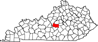
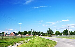
Marion County is a county in the U.S. state of Kentucky. As of the 2020 census, the total population was 19,581. Its county seat is Lebanon. The county was founded in 1834 and named for Francis Marion, the American Revolutionary War hero known as the "Swamp Fox".

<span class="mw-page-title-main">LaRue County, Kentucky</span> County in Kentucky, United States

LaRue County is a county in the central region of the U.S. state of Kentucky, outside the Bluegrass Region and larger population centers. As of the 2020 census, the population was 14,867. Its county seat is Hodgenville, which is best known as the birthplace of United States President Abraham Lincoln. The county was established on March 4, 1843, from the southeast portion of Hardin County. It was named for John P. LaRue, an early settler. LaRue County is included in the Elizabethtown-Fort Knox, KY Metropolitan Statistical Area, which is also included in the Louisville/Jefferson County-Elizabethtown-Bardstown, KY-IN Combined Statistical Area. It is a dry county.

<span class="mw-page-title-main">Lebanon Junction, Kentucky</span> City in Kentucky, United States

Lebanon Junction is a home rule-class city in Bullitt County, Kentucky, in the United States. The population was 1,813 as of the 2010 census.

<span class="mw-page-title-main">Marion, Kentucky</span> City in Kentucky, United States

Marion is a home rule-class city in Crittenden County, Kentucky, in the United States. It is the seat of its county. As of the 2010 census, the city population was 3,039.

<span class="mw-page-title-main">Vine Grove, Kentucky</span> City in Kentucky, United States

Vine Grove is a home rule-class city in Hardin County, Kentucky, United States. The population was 4,520 at the 2010 census, up from 4,169 at the 2000 census. It is part of the Elizabethtown–Fort Knox Metropolitan Statistical Area.

<span class="mw-page-title-main">Evarts, Kentucky</span> City in Kentucky, United States

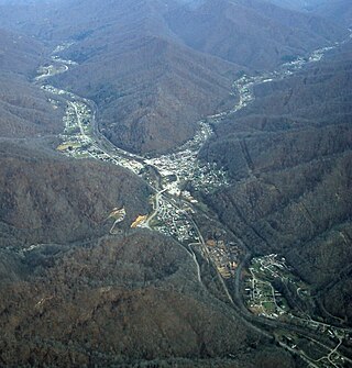
Evarts is a home rule-class city in Harlan County, Kentucky, in the United States. The post office was opened on February 9, 1855, and named for one of the area's pioneer families. The city was formally incorporated by the state assembly in 1921. The population was 962 at the 2010 census.

<span class="mw-page-title-main">Bancroft, Kentucky</span> City in Kentucky, United States

Bancroft is a home rule-class city in Jefferson County, Kentucky, United States. It was formally incorporated by the state assembly in 1970. The population was 494 at the 2010 census.

<span class="mw-page-title-main">Beechwood Village, Kentucky</span> City in Kentucky, United States

Beechwood Village is a home rule-class city in Jefferson County, Kentucky, United States. The city was formally incorporated by the state assembly in 1950. The population was 1,324 at the 2010 census, up from 1,173 at the 2000 census.

<span class="mw-page-title-main">Brownsboro Farm, Kentucky</span> City in Kentucky, United States

Brownsboro Farm is a home rule-class city in Jefferson County, Kentucky, United States. The population was 648 at the 2010 census.

<span class="mw-page-title-main">Glenview Manor, Kentucky</span> City in Kentucky, United States

Glenview Manor is a home rule-class city in Jefferson County, Kentucky, United States. The population was 191 at the 2010 census.

<span class="mw-page-title-main">Green Spring, Kentucky</span> City in Kentucky, United States

Green Spring is a home rule-class city in Jefferson County, Kentucky, United States. The population was 715 at the 2010 census.

<span class="mw-page-title-main">Hills and Dales, Kentucky</span> City in Kentucky, United States

Hills and Dales is a home rule-class city in Jefferson County, Kentucky, United States. The population was 142 at the 2010 census.

<span class="mw-page-title-main">Rolling Fields, Kentucky</span> City in Kentucky, United States

Rolling Fields is a home rule-class city in Jefferson County, Kentucky, United States. The population was 646 at the 2010 census. It incorporated as a city in 1958.

<span class="mw-page-title-main">Rolling Hills, Kentucky</span> City in Kentucky, United States

Rolling Hills is a home rule-class city in Jefferson County, Kentucky. The population was 959 at the time of the 2010 census.

<span class="mw-page-title-main">Windy Hills, Kentucky</span> City in Jefferson County, Kentucky, United States

Windy Hills is a home rule-class city, incorporated in 1952, in eastern Jefferson County, Kentucky, United States. The population was 2,385 at the 2010 census.

<span class="mw-page-title-main">Lebanon, Kentucky</span> City in Kentucky, United States

Lebanon is a home rule-class city and the county seat of Marion County, Kentucky, in the United States. The population was 6,274 at the 2020 census, up from 5,539 in 2010. Lebanon is located in central Kentucky, 63 miles (101 km) southeast of Louisville. A national cemetery is nearby.

<span class="mw-page-title-main">Loretto, Kentucky</span> City in Kentucky, United States

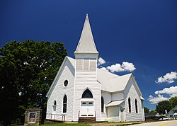
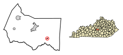
Loretto is a home rule-class city in Marion County, Kentucky, United States. The population was 723 at the 2020 census.

<span class="mw-page-title-main">Raywick, Kentucky</span> City in Kentucky, United States

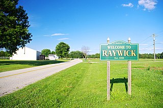
Raywick is a home rule-class city in Marion County, Kentucky, United States. The population was 155 at the 2020 census.

<span class="mw-page-title-main">Bloomfield, Kentucky</span> City in Kentucky, United States

Bloomfield is a home rule–class city in Nelson County, Kentucky, in the United States. The population was 838 during the 2010 U.S. census. Former names of the city included Middlesburg and Gandertown.

<span class="mw-page-title-main">New Haven, Kentucky</span> City in Kentucky, United States

New Haven is a home rule-class city in Nelson County, Kentucky, United States. The population was 855 at the 2010 census.

References

  1. 1 2 Commonwealth of Kentucky. Office of the Secretary of State. Land Office. "Bradfordsville, Kentucky". Accessed 26 August 2013.
  2. 1 2 "2022 U.S. Gazetteer Files: Kentucky". United States Census Bureau. Retrieved May 3, 2023.
  3. 1 2 "P1. Race – Bradfordsville city, Kentucky: 2020 DEC Redistricting Data (PL 94-171)". U.S. Census Bureau. Retrieved May 3, 2023.
  4. University of Kentucky. Kentucky Atlas and Gazetteer. "Geographic Center of Kentucky". Accessed 5 October 2013.
  5. Rennick, Robert. Kentucky Place Names, p. 34. University Press of Kentucky (Lexington), 1987. Accessed 1 August 2013.
  6. "US Gazetteer files: 2010, 2000, and 1990". United States Census Bureau. February 12, 2011. Retrieved April 23, 2011.
  7. "NOAA NCEI U.S. Climate Normals Quick Access". NOAA. Retrieved October 10, 2022.
  8. "Census of Population and Housing". Census.gov. Retrieved June 4, 2015.
  9. "U.S. Census website". United States Census Bureau . Retrieved January 31, 2008.