Brighton Heights (Pittsburgh)

Last updated
Brighton Heights
Pgh locator brighton heights.svg
Coordinates: 40°29′02″N80°02′13″W / 40.484°N 80.037°W / 40.484; -80.037
Country United States
State Pennsylvania
County Allegheny County
City Pittsburgh
Area
  Total1.117 sq mi (2.89 km2)
Population
 (2010) [1]
  Total7,247
  Density6,500/sq mi (2,500/km2)
ZIP Code
15212

Brighton Heights is a neighborhood in Pittsburgh, Pennsylvania's northside area. It has a zip code of 15212, and has representation on Pittsburgh City Council by the council member for District 1 (North Neighborhoods). The Western gateway to the neighborhood, Brighton Heights Boulevard, is opposite the McKees Rocks Bridge and accessible via Route 65/Ohio River Boulevard. The Pittsburgh Bureau of Fire houses 35 Engine and 33 Truck (formerly 34 Truck) in Brighton Heights.

Contents

Once a predominantly German area, Brighton Heights now has a varied ethnic mix. The community is notable for its solid stately architecture, with many fine early 20th Century homes and churches built of stone and brick, featuring stained glass windows and ornamental woodwork and fireplaces. Because of the high quality and variety of the architecture of the neighborhood, Brighton Heights is one of the regularly featured neighborhoods of Pittsburgh's annual house tours. [2]

Brighton Heights was featured in the July 2006 issue of Pittsburgh magazine article entitled "No Place Like Home: 10 Neighborhoods you need to know about." Many of Brighton Heights' streets are lined with large maple trees, maintained by the City of Pittsburgh. Recreational opportunities include the adjacent Riverview Park, the Jack Stack pool, and Marmaduke Playground.

Historical population
YearPop.±%
1940 11,515    
1950 11,847+2.9%
1960 11,483−3.1%
1970 10,604−7.7%
1980 9,122−14.0%
1990 8,580−5.9%
2000 8,050−6.2%
2010 7,247−10.0%
Source: University of Pittsburgh [3]

Surrounding neighborhoods

Brighton Heights has four borders, including Ross Township to the north, Bellevue to the northwest, and the Pittsburgh neighborhoods of Perry North, to the east, and Marshall-Shadeland from the south to the west.

Places of interest

Brighton Heights Citizens Federation (BHCF) is a volunteer-led community organization formed in 1967 to improve the neighborhood and quality of life for its residents. The BHCF committees host annual events like The Memorial Day Tribute, Bright the Night, The Halloween Parade, and The House Tour. BHCF also maintains about a dozen community flower gardens, and hosts 2 community clean up events per year. Regular public meetings are held to encourage event and committee participation and public safety initiatives.

Transportation

Brighton Heights is within the city of Pittsburgh, and is in "zone 1" of the public transit system. Bus lines serving Brighton Heights include the 13, 14, 16, and 17.

City Steps

The Brighton Heights neighborhood has 11 distinct flights of city steps - all of which are open and in a safe condition. In Brighton Heights, the Steps of Pittsburgh quickly connect pedestrians to public transportation and provide an easy way to travel through the neighborhood. [4]

The Termon Avenue city steps in Brighton Heights, Pittsburgh. Photo by Laura Zurowski. Termon Avenue city steps in Brighton Heights Pittsburgh.jpg
The Termon Avenue city steps in Brighton Heights, Pittsburgh. Photo by Laura Zurowski.

Bridges

The Davis Avenue Bridge, which opened in 1899, spanned over Woods Run Ave. and directly connected Brighton Heights with Riverview Park in the Perry North neighborhood. After decades of deterioration and a lack of funding for a complete overhaul, the bridge closed to vehicular traffic in August 2001. By April 2009, it was determined that the bridge could collapse at any time, thus several residents whose houses were situated under the bridge on Woods Run Ave. were forced to evacuate. With a call made for its immediate destruction, the Davis Avenue Bridge was brought down with explosives on May 6, 2009. Since then, many long time residents of Brighton Heights have been distressed that this now unique transition to public green space no longer exists and are determined to bring the funding for a new bridge. WPXI Report

Wilksboro Bridge is a foot bridge that has been closed to pedestrians (see waymarking.com Orphaned Bridges) with plans to rebuild a new one. KDKA Report

Related Research Articles

<span class="mw-page-title-main">North Side (Pittsburgh)</span> Region of Pittsburgh, Pennsylvania

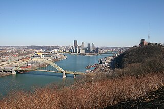
North Side refers to the region of Pittsburgh, Pennsylvania, located to the north of the Allegheny River and the Ohio River. The term "North Side" does not refer to a specific neighborhood, but rather to a disparate collection of contiguous neighborhoods.

<span class="mw-page-title-main">Greenfield (Pittsburgh)</span> Neighborhood of Pittsburgh in Allegheny County, Pennsylvania, United States

Greenfield is a neighborhood in Pittsburgh, Pennsylvania, United States. It is represented on Pittsburgh City Council by Barb Warwick.

<span class="mw-page-title-main">Sheraden</span> Neighborhood of Pittsburgh in Allegheny County, Pennsylvania, United States

Sheraden is a neighborhood that is located in the West End of Pittsburgh, Pennsylvania in the United States. Nearby neighborhoods include Windgap, Chartiers City, Crafton Heights, Esplen, and Elliott.

<span class="mw-page-title-main">Highland Park (Pittsburgh neighborhood)</span> Neighborhood of Pittsburgh in Allegheny County, Pennsylvania, United States

Highland Park is a neighborhood in the northeastern part of Pittsburgh, Pennsylvania. Highland Park, the neighborhood, fully encompasses the park with the same name.

<span class="mw-page-title-main">Lincoln–Lemington–Belmar</span> Neighborhood of Pittsburgh in Allegheny County, Pennsylvania, United States

Lincoln–Lemington–Belmar is a neighborhood in Pittsburgh, Pennsylvania. It is located in the northeastern section of the city and spans the Allegheny River. Lincoln–Lemington–Belmar houses PBF 15 Engine, and is covered by PBP Zone 5 and the Bureau of EMS Medic 1.

<span class="mw-page-title-main">Elliott (Pittsburgh)</span> Neighborhood in Allegheny County, Pennsylvania, United States

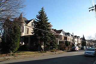
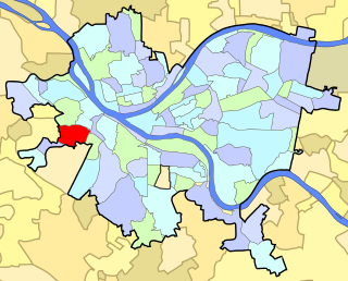
Elliott is a small, hilly neighborhood in Pittsburgh, Pennsylvania, United States' West End Region. Elliott is represented on the Pittsburgh City Council by the council member for District 2, and uses the ZIP code 15220.

<span class="mw-page-title-main">Garfield (Pittsburgh)</span> Place in Pennsylvania, United States

Garfield is a neighborhood in the East End of the City of Pittsburgh, Pennsylvania, United States. Garfield is bordered on the South by Bloomfield and Friendship, on the West by the Allegheny Cemetery, on the North by Stanton Heights, and on the East by East Liberty. Like many parts of Pittsburgh, Garfield is a fairly steep neighborhood, with north-south residential streets running at about a 20% incline from Penn Avenue at the bottom to Mossfield Street at the top. Garfield is divided into “the valley” and “the hilltop.”

<span class="mw-page-title-main">Uptown Pittsburgh</span> Neighborhood of Pittsburgh in Allegheny County, Pennsylvania, United States

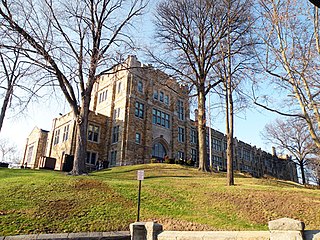
Uptown or The Bluff is a neighborhood in the city of Pittsburgh, Pennsylvania to the southeast of the city's Central Business District. It is bordered in the north by the Hill District and located across the Monongahela River from South Side. The predominant area zip code is 15219.

<span class="mw-page-title-main">California-Kirkbride</span> Neighborhood of Pittsburgh in Allegheny County, Pennsylvania, United States

California-Kirkbride is a neighborhood on Pittsburgh, Pennsylvania's North Side.

<span class="mw-page-title-main">Banksville (Pittsburgh)</span> Neighborhood of Pittsburgh in Allegheny County, Pennsylvania, United States

Banksville is a neighborhood in Pittsburgh, Pennsylvania. The neighborhood of Banksville is located in the West End of the city and borders the South Hills region. Real estate agencies frequently refer to the Banksville area as Greentree City due to Banksville's shared border with the borough of Green Tree. It has two zip codes of both 15220 and 15216, and has representation in Pittsburgh City Council by the council member for District 2. Theresa Kail-Smith is the current Councilperson for district two. Banksville's primary corridor, Banksville Road, is frequently used as a gateway between the South Hills of Pittsburgh and downtown Pittsburgh via the Fort Pitt Tunnels. Banksville, formerly Union Township, joined the City of Pittsburgh around 1928.

<span class="mw-page-title-main">Central Lawrenceville</span> Neighborhood of Pittsburgh in Allegheny County, Pennsylvania, United States

Central Lawrenceville is a neighborhood in the northeast of Pittsburgh, Pennsylvania in the United States. It has a zip code of 15201, and has representation on Pittsburgh City Council by the council member for District 7. It is home to Allegheny Cemetery. Central Lawrenceville is the home of the Pittsburgh Bureau of Fire's 6 Engine and 6 Truck.

<span class="mw-page-title-main">Duquesne Heights</span> Neighborhood of Pittsburgh in Allegheny County, Pennsylvania, United States

Duquesne Heights is a neighborhood in Pittsburgh, Pennsylvania's south city area. It has a zip code of 15211, and has representation on Pittsburgh City Council by the council member for District 2.

<span class="mw-page-title-main">Marshall-Shadeland</span> Neighborhood of Pittsburgh in Allegheny County, Pennsylvania, United States

Marshall-Shadeland is a neighborhood on Pittsburgh, Pennsylvania's North Side. It has a zip codes of both 15212 and 15214, and has representation on Pittsburgh City Council by the council member for District 1.

<span class="mw-page-title-main">Morningside (Pittsburgh)</span> Neighborhood of Pittsburgh in Allegheny County, Pennsylvania, United States

Morningside is a neighborhood in Pittsburgh, Pennsylvania's East End. It has two Zip Codes, 15201 and 15206.

<span class="mw-page-title-main">Stanton Heights</span> Neighborhood of Pittsburgh in Allegheny County, Pennsylvania, United States

Stanton Heights is a neighborhood in Pittsburgh, Pennsylvania's East End. It has zip codes of both 15201 and 15206, and has representation on Pittsburgh City Council by the council member for District 7. Stanton Heights is the home of PBF 7 Engine and the city's Arson Investigation Units, and is covered by PBP Zone 5 and the Bureau of EMS Medic 6.

<span class="mw-page-title-main">Troy Hill (Pittsburgh)</span> Neighborhood of Pittsburgh in Allegheny County, Pennsylvania, United States

Troy Hill is a neighborhood on Pittsburgh, Pennsylvania's North Side. It has a zip code of 15212, and has representation on Pittsburgh City Council by the council member for District 1.

<span class="mw-page-title-main">Westwood (Pittsburgh)</span> Neighborhood of Pittsburgh in Allegheny County, Pennsylvania, United States

Westwood is an American neighborhood that is located in the West End Region of Pittsburgh, Pennsylvania.

<span class="mw-page-title-main">Perry North</span> Neighborhood of Pittsburgh in Allegheny County, Pennsylvania, United States

Perry North is a neighborhood in Pittsburgh, Pennsylvania, USA's north city area. It lies within zip codes 15212 and 15214, and has representation on Pittsburgh City Council by the council member for District 1. The highest elevation in Pittsburgh is 1,370 feet at the Brashear Reservoir at the top of Observatory Hill. The Pittsburgh Bureau of fire houses 34 Engine in Perry North.

<span class="mw-page-title-main">Riverview Park (Pittsburgh)</span> Municipal park in Pittsburgh, Pennsylvania

Riverview Park is the fourth largest municipal park in Pittsburgh, Pennsylvania. The park is located four miles (6 km) north of Downtown in the neighborhood of Perry North and consists of 251 acres (1.02 km2).

References

  1. 1 2 "PGHSNAP 2010 Raw Census Data by Neighborhood". PGHSNAP Utility. Pittsburgh Department of City Planning. 2012. Retrieved 21 June 2013.
  2. McKay, Gretchen (2005-05-05). "Brighton Heights House Tour: Residents will show off scenic, historic neighborhood". Pittsburgh Post-Gazette . Archived from the original on 2007-10-11. Retrieved 2007-08-12.
  3. "Pittsburgh Census Tracts". pitt.libguides.com. Retrieved January 2, 2018.
  4. Regan, Bob (2015). Pittsburgh Steps, The Story of the City's Public Stairways. Globe Pequot. ISBN   978-1-4930-1384-5.

Further reading

See also