Brooklyn, Iowa

Last updated

Brooklyn, Iowa
Brooklyn Iowa 20090802 Welcome Sign.JPG
Nickname: 
Brooklyn: Community of Flags
Poweshiek County Iowa Incorporated and Unincorporated areas Brooklyn Highlighted.svg
Location of Brooklyn, Iowa
Coordinates: 41°43′56″N92°26′37″W / 41.73222°N 92.44361°W / 41.73222; -92.44361
Country Flag of the United States.svg  United States
State Flag of Iowa.svg  Iowa
County Poweshiek
Area
[1]
  Total1.31 sq mi (3.40 km2)
  Land1.31 sq mi (3.40 km2)
  Water0.00 sq mi (0.00 km2)
Elevation
912 ft (278 m)
Population
 (2020)
  Total1,502
  Density1,142.21/sq mi (441.12/km2)
Time zone UTC-6 (Central (CST))
  Summer (DST) UTC-5 (CDT)
ZIP code
52211
Area code 641
FIPS code 19-08695
GNIS feature ID0454842
Website brooklyniowa.com

Brooklyn is a city in Poweshiek County, Iowa, United States. The population was 1,502 at the 2020 census. [2] It is located just off U.S. Route 6 and a few miles north of Interstate 80. Near the center of town, Brooklyn boasts a large display of flags from each of the fifty states, branches of the military, and a smattering of other sources. The city bills itself as "Brooklyn: Community of Flags."

Contents

Geography

Brooklyn is located at 41°43′56″N92°26′37″W / 41.73222°N 92.44361°W / 41.73222; -92.44361 (41.732093, −92.443531). [3]

According to the United States Census Bureau, the city has a total area of 1.24 square miles (3.21 km2), all land. [4]

Demographics

The state flag display in Brooklyn, Iowa. Brooklyn Iowa 20090802 Flags.JPG
The state flag display in Brooklyn, Iowa.
Historical populations
YearPop.±%
1860 184    
1870 971+427.7%
1880 1,234+27.1%
1890 1,202−2.6%
1900 1,188−1.2%
1910 1,233+3.8%
1920 1,533+24.3%
1930 1,345−12.3%
1940 1,408+4.7%
1950 1,323−6.0%
1960 1,415+7.0%
1970 1,410−0.4%
1980 1,509+7.0%
1990 1,439−4.6%
2000 1,367−5.0%
2010 1,468+7.4%
2020 1,502+2.3%
Source: "U.S. Census website". United States Census Bureau . Retrieved March 29, 2020. and Iowa Data Center
Source:
U.S. Decennial Census [5] [2]
The population of Brooklyn, Iowa from US census data BrooklynIowaPopPlot.png
The population of Brooklyn, Iowa from US census data

2010 census

As of the census [6] of 2010, there were 1,468 people, 615 households, and 370 families residing in the city. The population density was 1,183.9 inhabitants per square mile (457.1/km2). There were 665 housing units at an average density of 536.3 per square mile (207.1/km2). The racial makeup of the city was 95.1% White, 0.7% African American, 0.3% Asian, 2.9% from other races, and 1.0% from two or more races. Hispanic or Latino of any race were 4.0% of the population.

There were 615 households, of which 32.0% had children under the age of 18 living with them, 44.6% were married couples living together, 11.5% had a female householder with no husband present, 4.1% had a male householder with no wife present, and 39.8% were non-families. 33.5% of all households were made up of individuals, and 14.6% had someone living alone who was 65 years of age or older. The average household size was 2.31 and the average family size was 2.99.

The median age in the city was 36.2 years. 26.3% of residents were under the age of 18; 8.4% were between the ages of 18 and 24; 23.9% were from 25 to 44; 24.7% were from 45 to 64; and 16.6% were 65 years of age or older. The gender makeup of the city was 46.3% male and 53.7% female.

2000 census

As of the census [7] of 2000, there were 1,367 people, 582 households, and 349 families residing in the city. The population density was 1,142.8 inhabitants per square mile (441.2/km2). There were 639 housing units at an average density of 534.2 per square mile (206.3/km2). The racial makeup of the city was 99.20% White, 0.07% Asian, 0.22% from other races, and 0.51% from two or more races. Hispanic or Latino of any race were 0.51% of the population.

There were 582 households, out of which 29.6% had children under the age of 18 living with them, 48.1% were married couples living together, 8.9% had a female householder with no husband present, and 39.9% were non-families. 36.8% of all households were made up of individuals, and 20.3% had someone living alone who was 65 years of age or older. The average household size was 2.25 and the average family size was 2.95.

24.5% were under the age of 18, 7.5% from 18 to 24, 26.5% from 25 to 44, 20.3% from 45 to 64, and 21.2% were 65 years of age or older. The median age was 40 years. For every 100 females, there were 83.5 males. For every 100 females age 18 and over, there were 79.8 males.

The median income for a household in the city was $34,583, and the median income for a family was $44,531. Males had a median income of $29,018 versus $20,481 for females. The per capita income for the city was $18,315. About 2.9% of families and 6.2% of the population were below the poverty line, including 6.6% of those under age 18 and 7.5% of those age 65 or over.

Education

Brooklyn is part of the BGM Community School District, a primarily rural school district that also includes the communities of Guernsey and Malcom and surrounding areas. The main campus houses a single building that serves students from pre-kindergarten through 12th grade.

Healthcare

Brooklyn area residents have access to Brooklyn Medical Clinic, located at 128 Jackson St. When hospitalization is required the closest and most convenient hospital for residents is Grinnell Regional Medical Center, located at 210 4th Avenue in Grinnell, Iowa.

Media

Brooklyn is home to one radio station. KSKB Radio broadcasts on 99.1 FM as a Class C2 station and broadcasts and contemporary Christian music and teaching format. The station is locally programmed but owned by Florida Public Radio, Inc. which owns other stations in Iowa, Kansas, & Florida as well. KSKB is marketed towards the Cedar Rapids - Iowa City - Marshalltown - Pella region and is rebroadcast on K259AV 99.7 in Waterloo and KLOX 90.9 in Creston.

2008 Iowa caucus

During the Presidential caucus of 2008, Gersh Kuntzman, the editor of The Brooklyn Paper , a small New York City broadsheet journal, spent a week in Brooklyn, Iowa, posting daily reports on the city, its residents and the political process. [8]

Notable people

Related Research Articles

<span class="mw-page-title-main">Ringgold County, Iowa</span> County in Iowa, United States

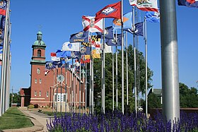
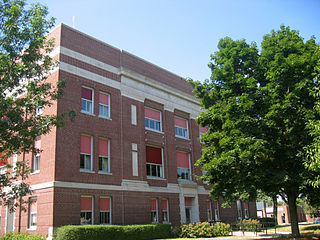
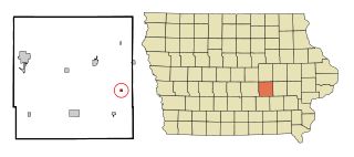
Ringgold County is a county located in the U.S. state of Iowa. As of the 2020 census, the population was 4,663, making it the Iowa county with the second-smallest population. The county seat is Mount Ayr. The county is named after Maj. Samuel Ringgold, a hero of the Battle of Palo Alto fought in May 1846, during the Mexican–American War. It is one of the 26 Iowa counties with a name that is unique across the nation.

<span class="mw-page-title-main">Ogden, Iowa</span> City in Iowa, United States

Ogden is a city in Yell Township, Boone County, Iowa, United States. The population was 2,007 at the time of the 2020 census, down 1.8% from 2,044 in 2010. It is part of the Boone, Iowa Micropolitan Statistical Area, which is a part of the larger Ames-Boone, Iowa Combined Statistical Area.

<span class="mw-page-title-main">Dunlap, Iowa</span> City in Iowa, United States

Dunlap is a city in Harrison and Crawford counties, Iowa, United States, along the Boyer River. The population was 1,038 at the time of the 2020 census.

<span class="mw-page-title-main">Little Sioux, Iowa</span> City in Iowa, United States

Little Sioux is a city in Harrison County, Iowa, United States. The population was 166 at the time of the 2020 census. The city is most known for Little Sioux Scout Ranch of the Boy Scouts of America.

<span class="mw-page-title-main">Logan, Iowa</span> City in Iowa, United States

Logan is a city and county seat of Harrison County, Iowa, United States, along the Boyer River. The population was 1,397 at the time of the 2020 census.

<span class="mw-page-title-main">Mondamin, Iowa</span> City in Iowa, United States

Mondamin is a city in Harrison County, Iowa, United States. The population was 339 at the time of the 2020 census.

<span class="mw-page-title-main">Wapello, Iowa</span> City in Iowa, United States

Wapello is a city in and the county seat of Louisa County, Iowa, United States. The population was 2,084 at the time of the 2020 census.

<span class="mw-page-title-main">Emerson, Iowa</span> City in Iowa, United States

Emerson is a city in Mills County, Iowa, United States. The population was 403 at the time of the 2020 census.

<span class="mw-page-title-main">Hancock, Iowa</span> City in Iowa, United States

Hancock is a city in Pottawattamie County, Iowa, United States, along the West Nishnabotna River. The population was 200 at the time of the 2020 census.

<span class="mw-page-title-main">Guernsey, Iowa</span> City in Iowa, United States

Guernsey is a town in Poweshiek County, Iowa, United States. The population was 63 at the time of the 2020 census.

<span class="mw-page-title-main">Dixon, Iowa</span> City in Iowa, United States

Dixon is a city in Scott County, Iowa, United States. The population was 202 at the time of the 2020 census.

<span class="mw-page-title-main">Sebewaing, Michigan</span> Village in Michigan, United States

Sebewaing is a village in Huron County in the U.S. state of Michigan. The population was 1,721 at the 2020 census. The village is within Sebewaing Township. This community is known as the Sugar Beet Capital, due to the Michigan Sugar slicing mill located within the village and the yearly Michigan Sugar Festival. The Sebewaing area, the Thumb, and the state of Michigan overall are major beet sugar producers, mostly for domestic consumption. Sebewaing is also the first gigabit village in the state of Michigan. In 2014–15, Sebewaing completed its fiber to the home network, offering up to gigabit/second speeds over their fiber optic network.

<span class="mw-page-title-main">Whalan, Minnesota</span> City in Minnesota, United States

Whalan is a city in Fillmore County, Minnesota, United States. The population was 63 at the 2010 census.

<span class="mw-page-title-main">Emigsville, Pennsylvania</span> CDP in Pennsylvania, United States

Emigsville is a census-designated place (CDP) in York County, Pennsylvania, United States. The population was 2,672 at the 2010 census.

<span class="mw-page-title-main">Ward, South Carolina</span> Town in South Carolina, United States

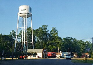
Ward is a town in Saluda County, South Carolina, United States. The population was 91 at the 2010 census.

<span class="mw-page-title-main">Stinnett, Texas</span> City in Texas, United States

Stinnett is a city in and the county seat of Hutchinson County, Texas, United States. The population was 1,881 at the 2010 census, a decrease from 1,936 at the 2000 census.

<span class="mw-page-title-main">Pilsen, Wisconsin</span> Town in Wisconsin, United States

Pilsen is a town in Bayfield County, Wisconsin, United States. The population was 210 at the 2010 census. The unincorporated community of Moquah is located in the town.

<span class="mw-page-title-main">Ogema, Wisconsin</span> Town in Wisconsin, United States

Ogema is a town in Price County, Wisconsin, United States. The population was 882 at the 2000 census. The unincorporated community of Ogema is located in the town.

Whitewater is a town in Walworth County, Wisconsin, United States. The population was 1,433 at the 2020 census.

<span class="mw-page-title-main">Garner, Iowa</span> City in Iowa, United States

Garner is a city in and the county seat of Hancock County, Iowa, United States. The population was 3,065 in the 2020 census, an increase from 2,922 in 2000.

References

  1. "2020 U.S. Gazetteer Files". United States Census Bureau. Retrieved March 16, 2022.
  2. 1 2 "2020 Census State Redistricting Data". census.gov. United states Census Bureau. Retrieved August 12, 2021.
  3. "US Gazetteer files: 2010, 2000, and 1990". United States Census Bureau. February 12, 2011. Retrieved April 23, 2011.
  4. "US Gazetteer files 2010". United States Census Bureau. Archived from the original on July 2, 2012. Retrieved May 11, 2012.
  5. "Census of Population and Housing". Census.gov. Retrieved June 4, 2015.
  6. "U.S. Census website". United States Census Bureau . Retrieved May 11, 2012.
  7. "U.S. Census website". United States Census Bureau . Retrieved January 31, 2008.
  8. "Brooklyn goes Brooklyn". The Brooklyn Paper. December 31, 2007. Retrieved September 3, 2009.
  9. About Bruce Braley Archived September 22, 2012, at the Wayback Machine
  10. 'Rollin Edelen-obituary,' The Estherville Daily News (Iowa), November 29, 1993, pg. 2
  11. 'Walter Edelen-obituary,' The Garner Leader (Iowa), November 20, 1991, pg. 6
  12. Daniel P. Finney (October 22, 2019). "Meet the Iowan who helped raise the flag at Iwo Jima in World War II". desmoinesregister.com.
  13. "Fr. Bernard F. Meyer, MM". Maryknoll Mission Archives. Archived from the original on February 22, 2014. Retrieved February 20, 2014.