Bruceville, Indiana

Last updated

Bruceville, Indiana
Bruceville, Indiana.jpg
Knox County Indiana Incorporated and Unincorporated areas Bruceville Highlighted 1808578.svg
Location of Bruceville in Knox County, Indiana.
Coordinates: 38°45′25″N87°24′54″W / 38.75694°N 87.41500°W / 38.75694; -87.41500
Country United States
State Indiana
County Knox
Township Washington
Area
[1]
  Total0.34 sq mi (0.89 km2)
  Land0.34 sq mi (0.89 km2)
  Water0.00 sq mi (0.00 km2)
Elevation
554 ft (169 m)
Population
 (2020)
  Total450
  Density1,311.95/sq mi (506.74/km2)
Time zone UTC-5 (EST)
  Summer (DST) UTC-4 (EDT)
ZIP code
47516
Area code(s) 812, 930
FIPS code 18-08578 [2]
GNIS feature ID0431657 [3]

Bruceville is a town in Washington Township, Knox County, Indiana, United States. The population was 478 at the 2010 census.

Contents

Geography

Bruceville is located at 38°45′25″N87°24′54″W / 38.75694°N 87.41500°W / 38.75694; -87.41500 (38.756984, -87.415001). [4]

According to the 2010 census, Bruceville has a total area of 0.34 square miles (0.88 km2), all land. [5]

Climate

The climate in this area is characterized by hot, humid summers and generally mild to cool winters. According to the Köppen Climate Classification system, Bruceville has a humid subtropical climate, abbreviated "Cfa" on climate maps. [6]

History

Bruceville was named for the Bruce family. William Bruce (1776–1853) settled here in 1805. Bruce led the local militia during Tecumseh's War in 1811. The streets of the town were laid out in 1829. [7]

Abraham Lincoln visited Bruceville in October 1844 and gave a speech in support of Henry Clay.

Demographics

Historical population
CensusPop.Note
1880 258
1960 623
1970 6270.6%
1980 6463.0%
1990 471−27.1%
2000 469−0.4%
2010 4781.9%
2020 450−5.9%
U.S. Decennial Census [8]

2010 census

As of the census [9] of 2010, there were 478 people, 193 households, and 125 families living in the town. The population density was 1,405.9 inhabitants per square mile (542.8/km2). There were 218 housing units at an average density of 641.2 per square mile (247.6/km2). The racial makeup of the town was 95.6% White, 0.2% African American, 0.4% Native American, 1.0% Asian, 1.5% from other races, and 1.3% from two or more races. Hispanic or Latino of any race were 2.1% of the population.

There were 193 households, of which 32.1% had children under the age of 18 living with them, 48.7% were married couples living together, 13.0% had a female householder with no husband present, 3.1% had a male householder with no wife present, and 35.2% were non-families. 32.1% of all households were made up of individuals, and 10.4% had someone living alone who was 65 years of age or older. The average household size was 2.48 and the average family size was 3.16.

The median age in the town was 35.4 years. 26.8% of residents were under the age of 18; 10% were between the ages of 18 and 24; 25% were from 25 to 44; 27.8% were from 45 to 64; and 10.5% were 65 years of age or older. The gender makeup of the town was 47.9% male and 52.1% female.

2000 census

As of the census [2] of 2000, there were 469 people, 199 households, and 141 families living in the town. The population density was 1,597.2 inhabitants per square mile (616.7/km2). There were 221 housing units at an average density of 752.6 per square mile (290.6/km2). The racial makeup of the town was 98.51% White, 0.21% African American, 0.21% Native American, 0.21% from other races, and 0.85% from two or more races. Hispanic or Latino of any race were 0.43% of the population.

There were 199 households, out of which 33.2% had children under the age of 18 living with them, 56.8% were married couples living together, 11.6% had a female householder with no husband present, and 29.1% were non-families. 26.6% of all households were made up of individuals, and 13.1% had someone living alone who was 65 years of age or older. The average household size was 2.36 and the average family size was 2.87.

In the town, the population was spread out, with 25.8% under the age of 18, 8.3% from 18 to 24, 28.6% from 25 to 44, 22.2% from 45 to 64, and 15.1% who were 65 years of age or older. The median age was 37 years. For every 100 females, there were 94.6 males. For every 100 females age 18 and over, there were 91.2 males.

The median income for a household in the town was $24,028, and the median income for a family was $33,036. Males had a median income of $27,292 versus $17,857 for females. The per capita income for the town was $13,829. About 12.6% of families and 14.0% of the population were below the poverty line, including 16.3% of those under age 18 and 11.0% of those age 65 or over.

Related Research Articles

<span class="mw-page-title-main">Frisco City, Alabama</span> Town in Alabama, United States

Frisco City is a town in Monroe County, Alabama, United States. The population was 1,170 at the 2020 census.

<span class="mw-page-title-main">Center Point, Indiana</span> Town in Indiana, United States

Center Point is a town in Sugar Ridge Township, Clay County, Indiana, United States. The population was 242 at the 2010 census. It is part of the Terre Haute Metropolitan Statistical Area.

<span class="mw-page-title-main">Switz City, Indiana</span> Town in Indiana, United States

Switz City is a town in Fairplay and Grant townships, Greene County, Indiana, United States. The population was 293 at the 2010 census. It is part of the Bloomington, Indiana, Metropolitan Statistical Area.

<span class="mw-page-title-main">Edwardsport, Indiana</span> Town in Indiana, United States

Edwardsport is a town in Vigo Township, Knox County, Indiana, United States. The population was 303 at the 2010 census. It was founded in 1832 and named after Edward Wilkins, a founding father.

<span class="mw-page-title-main">Darmstadt, Indiana</span> Town in Indiana, United States

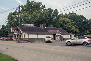
Darmstadt is a small, German-heritage town primarily located in Scott Township, Vanderburgh County, Indiana, United States. It also extends slightly into Armstrong, Center and German townships. The population was 1,407 at the 2010 census. Darmstadt, located just north of Evansville, is the only other incorporated municipality in Vanderburgh County besides Evansville.

<span class="mw-page-title-main">Seelyville, Indiana</span> Town in Indiana, United States

Seelyville is a town in Lost Creek Township, Vigo County, in the U.S. state of Indiana. The population was 1,029 at the 2010 census. It is part of the Terre Haute Metropolitan Statistical Area.

<span class="mw-page-title-main">Lansing, Kansas</span> City in Kansas, United States

Lansing is a city in Leavenworth County, Kansas, United States. It is situated along the west side of the Missouri River and Kansas-Missouri state border. As of the 2020 census, the population of the city was 11,239. It is the second most populous city of Leavenworth County and is a part of the Kansas City metropolitan area. The Lansing Correctional Facility, which includes the state's main maximum-security prison, is located in Lansing.

<span class="mw-page-title-main">Bridgewater, Maine</span> Town in the state of Maine, United States

Bridgewater is a town in Aroostook County, Maine, United States. The population was 532 at the 2020 census.

<span class="mw-page-title-main">Hartford, Maine</span> Town in the state of Maine, United States

Hartford is a town in Oxford County, Maine, United States. Hartford is included in the Lewiston-Auburn, Maine metropolitan New England City and Town Area. The population was 1,203 at the 2020 census.

Kenduskeag is a town in Penobscot County, Maine, United States. The population was 1,346 at the 2020 census.

Wesley is a town in Washington County, Maine, United States. The town was named after John Wesley, founder of the English Methodist movement. The population was 122 at the 2020 census.

<span class="mw-page-title-main">Mardela Springs, Maryland</span> Town in Maryland, United States

Mardela Springs is a town in Wicomico County, Maryland, United States. The population was 357 at the 2010 census. It is included in the Salisbury, Maryland-Delaware Metropolitan Statistical Area.

<span class="mw-page-title-main">Rexford, Montana</span> Town in Montana, United States

Rexford is a town in Lincoln County, Montana, United States. The population was 78 at the 2020 census.

<span class="mw-page-title-main">Surrey, North Dakota</span> City in North Dakota, United States

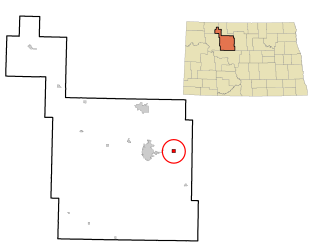
Surrey is a town in Ward County, North Dakota, United States. The population was 1,357 at the 2020 census. Official incorporation of Surrey occurred in 1951. The city is part of the Minot Micropolitan Statistical Area.

<span class="mw-page-title-main">Harvey, North Dakota</span> City in North Dakota, United States

Harvey is a city in Wells County, North Dakota, United States. The population was 1,650 at the 2020 census. Harvey was founded in 1893 as a division point by the Soo Line Railway. Harvey is believed to have been named for a director of the Soo Line Railway, Col. Scott William Harvey of Minneapolis, Minnesota.

<span class="mw-page-title-main">Webster, South Dakota</span> City in South Dakota, United States

Webster is a city in and the county seat of Day County, South Dakota, United States. The population was 1,728 at the 2020 census.

<span class="mw-page-title-main">Hartline, Washington</span> Town in Washington, United States

Hartline is a town in Grant County, Washington, United States. The population was 180 at the 2020 census. The high school for the Almira-Coulee/Hartline school district was located here, but moved to Coulee City, Washington in 2008. The name "Hartline" is an Americanized spelling of the German last name "Hartlein" and is an uncommon last name.

<span class="mw-page-title-main">Belle, West Virginia</span> Town in West Virginia, United States

Belle is a town in Kanawha County, West Virginia, United States, situated along the Kanawha River. The population was 1,171 at the 2020 census. Belle was incorporated on December 13, 1958, by the Kanawha County Circuit Court. It is the home of the Belle Bulldogs Elementary School.

<span class="mw-page-title-main">Jane Lew, West Virginia</span> Town in West Virginia, United States

Jane Lew is a town in Lewis County, West Virginia, United States. The population was 409 at the time of the 2020 census.

<span class="mw-page-title-main">Matoaka, West Virginia</span> Census-designated place in West Virginia, United States

Matoaka is a census-designated place in Mercer County, West Virginia, United States. The population was 173 at the 2020 census. It is part of the Bluefield, WV-VA micropolitan area which has a population of 100,093. This town is named for Chief Powhatan's daughter Matoaka who was better known by her nickname "Pocahontas". Matoaka became an unincorporated town when it voted to dissolve its charter in May 2018.

References

  1. "2020 U.S. Gazetteer Files". United States Census Bureau. Retrieved March 16, 2022.
  2. 1 2 "U.S. Census website". United States Census Bureau . Retrieved January 31, 2008.
  3. "US Board on Geographic Names". United States Geological Survey. October 25, 2007. Retrieved January 31, 2008.
  4. "US Gazetteer files: 2010, 2000, and 1990". United States Census Bureau. February 12, 2011. Retrieved April 23, 2011.
  5. "G001 - Geographic Identifiers - 2010 Census Summary File 1". United States Census Bureau. Archived from the original on February 13, 2020. Retrieved July 13, 2015.
  6. Climate Summary for Bruceville, Indiana
  7. History of Knox and Daviess County, Indiana: From the Earliest Time to the Present. Goodspeed. 1886. pp.  267.
  8. "Census of Population and Housing". Census.gov. Retrieved June 4, 2015.
  9. "U.S. Census website". United States Census Bureau . Retrieved December 11, 2012.