Related Research Articles

Geauga County is a county in the U.S. state of Ohio. As of the 2020 census, the population was 95,397. The county seat and largest city is Chardon. The county is named for an Onondaga or Seneca language word meaning 'raccoon', originally the name of the Grand River. Geauga County is part of the Cleveland-Elyria, OH Metropolitan Statistical Area. In 2008, Forbes Magazine ranked Geauga County as the fourth best place in the United States to raise a family. About 20% of the county's population is Amish, as of 2017.
Bainbridge is a census-designated place (CDP) in Bainbridge Township, Geauga County, Ohio, United States. As of the 2020 census, the CDP had a population of 9,242.
Thompson is an unincorporated community in Thompson Township, Geauga County, in the U.S. state of Ohio at an elevation of 1270 ft (287 m). The Thompson Ledges, an important geologic and topographic feature of northeast Ohio, are located nearby.

Parkman is a census-designated place in southern Parkman Township, Geauga County, Ohio, United States. It has a post office with the ZIP code 44080. It lies along U.S. Route 422 at its intersection with State Routes 88, 168, and 528.
Montville is an unincorporated community in central Montville Township, Geauga County, Ohio, United States. It has a post office with the ZIP code 44064. It lies at the intersection of U.S. Route 6 with State Route 528.

East Claridon is an unincorporated community in eastern Claridon Township, Geauga County, Ohio, United States. It has a post office with the ZIP code 44033. It lies at the intersection of U.S. Route 322 with State Route 608. The unincorporated community of Claridon lies to the west along Route 322.
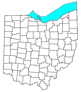
Claridon is an unincorporated community in Claridon Township, Geauga County, Ohio, United States. It is located on U.S. Route 322 southeast of Chardon and to the west of East Claridon.

Reinersville is an unincorporated community in Morgan County, in the U.S. state of Ohio.
Bostwick is an unincorporated community in Geauga County, in the U.S. state of Ohio.
Fowlers Mill is an unincorporated community in Geauga County, in the U.S. state of Ohio.
Fullertown is an unincorporated community in Geauga County, in the U.S. state of Ohio.
Hambden is an unincorporated community in Geauga County, in the U.S. state of Ohio.
Huntsburg is an unincorporated community in Huntsburg Township, Geauga County, in the U.S. state of Ohio.
Newbury State is an unincorporated community in Geauga County, in the U.S. state of Ohio. It is a rural suburb of Cleveland.
Russell Center is an unincorporated community in Geauga County, in the U.S. state of Ohio. Russell Center is a synonym for Russell Township. Russell Center is not a Census designated place, nor does it have its own postal code. The postal codes for Russell Township include 44072 and 44022.
South Newbury is an unincorporated community in Geauga County, in the U.S. state of Ohio.
South Thompson is an unincorporated community in Geauga County, in the U.S. state of Ohio.
Popes Corners is an unincorporated community in Geauga County, in the U.S. state of Ohio.
Plum Bottom Creek is a stream located entirely within Geauga County, Ohio.
Hopsons Creek is a stream located entirely within Geauga County, Ohio.
References
- ↑ U.S. Geological Survey Geographic Names Information System: Bundysburg, Ohio
- ↑ History of Geauga and Lake Counties, Ohio: With Illustrations and Biographical Sketches of Its Pioneers and Most Prominent Men. Williams Brothers. 1878. p. 155.
- ↑ Pioneer and General History of Geauga County: With Sketches of Some of the Pioneers and Prominent Men. Historical Society of Geauga County. 1880. p. 686.
- ↑ "Geauga County". Jim Forte Postal History. Archived from the original on September 12, 2005. Retrieved January 26, 2016.
Municipalities and communities of Geauga County, Ohio, United States | ||
|---|---|---|
| City |  | |
| Villages | ||
| Townships | ||
| CDPs | ||
| Unincorporated communities | ||
| Footnotes | ‡This populated place also has portions in an adjacent county or counties | |
41°25′12″N81°00′29″W / 41.42000°N 81.00806°W
| | This Geauga County, Ohio state location article is a stub. You can help Wikipedia by expanding it. |