A ZIP Code is a system of postal codes used by the United States Postal Service (USPS). The term ZIP was chosen to suggest that the mail travels more efficiently and quickly when senders use the code in the postal address.

Geauga County is a county in the U.S. state of Ohio. As of the 2020 census, the population was 95,397. The county seat and largest city is Chardon.

The region Northeast Ohio, in the US state of Ohio, in its most expansive usage contains six metropolitan statistical areas: Cleveland–Elyria, Akron, Canton–Massillon, Youngstown–Warren, Mansfield, and Weirton–Steubenville along with eight micropolitan statistical areas. Most of the region is considered either part of the Cleveland–Akron–Canton, OH Combined Statistical Area and media market or the Youngstown–Warren, OH–PA Combined Statistical Area and media market. In all, the region is home to: 4,502,460 residents. It is also a part of the Great Lakes megalopolis, containing over 54 million people. Northeast Ohio also includes most of the area known historically as the Connecticut Western Reserve.

Montville Township is one of the sixteen townships of Geauga County, Ohio, United States. As of the 2020 census the population was 1,938.

Thompson Township is one of the sixteen townships of Geauga County, Ohio, United States. As of the 2020 census the population was 2,144.

Russell Township is one of the sixteen townships of Geauga County, Ohio, United States. As of the 2020 census the population was 5,404.

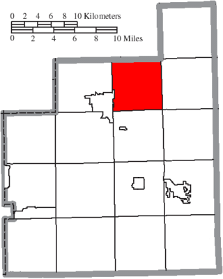
Claridon Township is one of the sixteen townships of Geauga County, Ohio, United States. As of the 2020 census the population was 3,103, of whom 2,865 lived in the unincorporated portions of the township.
Hambden Township is one of the sixteen townships of Geauga County, Ohio, United States. As of the 2020 census the population was 4,676, up from 4,024 at the 2000 census.

Lemoyne is an unincorporated community in northern Troy Township, Wood County, Ohio, United States. It has a post office with the ZIP code 43441. It lies along the concurrent U.S. Routes 20 and 23.

Parkman is a census-designated place in southern Parkman Township, Geauga County, Ohio, United States. It lies along U.S. Route 422 at its intersection with State Routes 88, 168, and 528.

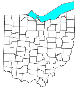
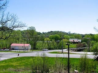
East Claridon is an unincorporated community in eastern Claridon Township, Geauga County, Ohio, United States. It has a post office with the ZIP code 44033. It lies at the intersection of U.S. Route 322 with State Route 608. The unincorporated community of Claridon lies to the west along Route 322.

Marathon is an unincorporated community and Census-designated place in northeastern Jackson Township, Clermont County, Ohio, United States. Although it is unincorporated, it had a post office, with the ZIP code 45145. The current ZIP code is 45118. It lies along U.S. Route 50.

North Benton is an unincorporated community in northern Smith Township, Mahoning County, Ohio, United States. It has a post office with the ZIP code 44449. It lies along State Route 14 between Salem and Ravenna.
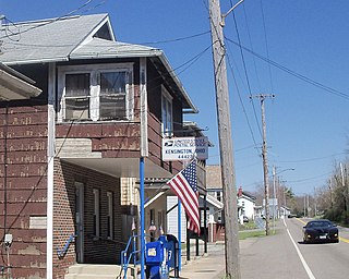
Kensington is an unincorporated community in southwestern Hanover Township, Columbiana County, Ohio, United States. Lying along U.S. Route 30 at its intersection with Ohio State Routes 9 and 644, it has a post office with the ZIP code 44427. Kensington is a part of the Salem micropolitan area, 23 miles (37 km) miles east of Canton and 30 miles (48 km) southwest of Youngstown.

Scioto Furnace is an unincorporated community in western Bloom Township, Scioto County, Ohio, United States. It has a post office with the ZIP code 45677. It lies along State Route 140.

Nashport is an unincorporated community and Census-designated place in western Licking Township, Muskingum County, Ohio, United States. It has a post office with the ZIP code 43830. It lies along State Route 146.

Chandlersville is an unincorporated community in western Salt Creek Township, Muskingum County, Ohio, United States. It has a post office with the ZIP code 43727. It lies along State Route 146 at its intersection with State Routes 284 and 313.
Beechgrove, also known as Beech Grove, is an unincorporated community in Coffee County, Tennessee, United States. Beechgrove is located in northwestern Coffee County at the junction of Interstate 24, U.S. Route 41, and State Route 64. Beechgrove has a post office with ZIP code 37018.
Claridon is an unincorporated community in Claridon Township, Geauga County, Ohio, United States. It is located on U.S. Route 322 southeast of Chardon and to the west of East Claridon.
Russell Center is an unincorporated community in Geauga County, in the U.S. state of Ohio. Russell Center is a synonym for Russell Township. Russell Center is not a Census designated place, nor does it have its own postal code. The postal codes for Russell Township include 44072 and 44022.