
Bowers is a town in Kent County, Delaware, United States. It is part of the Dover, Delaware Metropolitan Statistical Area. According to the 2020 census, its population was 278.

Bethel is a town in Sussex County, Delaware, United States. According to 2010 Census Bureau figures, the population of the town is 171. It is part of the Salisbury, Maryland-Delaware Metropolitan Statistical Area.
Centerville is an unincorporated community in New Castle County, Delaware, United States. Centerville is now known primarily for being the location of Du Pont family estates, as well as several other wealthy business families from nearby Wilmington, and the home of Governor Jack Markell.
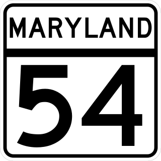
Maryland Route 54 (MD 54) and Delaware Route 54 (DE 54) are adjoining state highways in the U.S. states of Maryland and Delaware. Route 54 runs 41.84 mi (67.33 km) from MD 313 in Mardela Springs, Maryland, east to DE 1 in Fenwick Island, Delaware. In addition to two segments in which the highway is completely in Delaware and two segments in which the highway is completely in Maryland, Route 54 follows the Delaware/Maryland state line between the twin towns of Delmar, Maryland, and Delmar, Delaware, and the highway's intersection with MD 353 and DE 26. One section of the state line portion of Route 54 is maintained by the Delaware Department of Transportation (DelDOT) while three sections of the highway that follow the state line are maintained by the Maryland State Highway Administration (MDSHA).

Christiana is an unincorporated community in New Castle County, Delaware, United States, located on the Christina River, 12 miles southwest of Wilmington. It is home to the Christiana Hospital and the Christiana Mall and is the location of the northern terminus of Delaware Route 1 at an interchange with Interstate 95. Despite sharing a name with Christiana Hundred, the community of Christiana is located in White Clay Creek Hundred.
Carpenter is an unincorporated community in New Castle County, Delaware, United States. Carpenter is located where Delaware Route 92 crosses the former Baltimore & Ohio Railroad, 6.5 miles northeast of Wilmington.
Carrcroft is an unincorporated community in New Castle County, Delaware, United States. Carrcroft is located along Delaware Route 3, north of the interchange with Interstate 95 to the northeast of Wilmington. Stoney Creek runs along its eastern edge and creates its border with Green Acres.
Concord is an unincorporated community in Sussex County, Delaware, United States. Concord is located along Delaware Route 20, east of Seaford.
Redden is an unincorporated community in Sussex County, Delaware, United States. The community became an important railroad center on the Junction and Breakwater Railroad in the 1800s. The site of a historic 19th-century church and a World War II mess hall, Redden lost its post office and school in the 1930s.
Ashland is an unincorporated community in New Castle County, Delaware, United States. Ashland is located at the intersection of Delaware Route 82 and Barley Mill Road along the Red Clay Creek.
Bellevue is an unincorporated community in New Castle County, Delaware, United States. Bellevue is located along U.S. Route 13, on the west bank of the Delaware River between Edgemoor and Claymont.
Cool Spring is an unincorporated community in Sussex County, in the U.S. state of Delaware. It is located on U.S. Route 9 and is about five miles from both Nassau and Jimtown.
Canterbury is an unincorporated community in Kent County, Delaware, United States. Canterbury is located at the intersection of U.S. Route 13 and Delaware Route 15 south of Woodside, north of Felton, and east of Viola.
Hares Corner is an unincorporated community in New Castle County, Delaware, United States. Hares Corner is located at the intersection of U.S. Route 13/U.S. Route 40 and Delaware Route 273, west of New Castle and immediately south of Wilmington Airport.

Cowgills Corner is an unincorporated community in Kent County, Delaware, United States. Cowgills Corner is located on Delaware Route 9, 3.5 miles (5.6 km) northeast of Dover. The Octagonal Schoolhouse, which is listed on the National Register of Historic Places, is located in Cowgills Corner.
Adamsville is an unincorporated community in Kent and Sussex counties of Delaware, United States. Adamsville is located at the intersection of Delaware Route 16 and Adamsville Road, northwest of Greenwood.
Downs Chapel is an unincorporated community in Kent County, Delaware, United States. Downs Chapel is located at the intersection of Delaware Route 300 and Downs Chapel Road, west of Kenton.
Fieldsboro is an unincorporated community in New Castle County, Delaware, United States. Fieldsboro is located at the intersection of U.S. Route 13 and Fieldsboro Road, south of Odessa.
Brownsville is an unincorporated community in Kent County, Delaware, United States. Brownsville is located at the intersection of Brownsville Road and Drapers Corners Road, west of Harrington.
Oneida is an unincorporated community in Oneida Township, Delaware County, Iowa, United States. The community is on county highway D13, 3 miles (4.8 km) south of Greeley.


