
Delaware is a state in the Mid-Atlantic region of the United States, bordering Maryland to its south and west; Pennsylvania to its north; and New Jersey and the Atlantic Ocean to its east. The state takes its name from the nearby Delaware River named after Thomas West, 3rd Baron De La Warr, an English nobleman and Virginia's first colonial governor.

The Delmarva Peninsula, or simply Delmarva, is a large peninsula on the East Coast of the United States, occupied by the vast majority of the state of Delaware and parts of the Eastern Shore regions of Maryland and Virginia. The peninsula is 170 miles (274 km) long. In width, it ranges from 70 miles (113 km) near its center, to 12 miles (19 km) at the isthmus on its northern edge, to less near its southern tip of Cape Charles. It is bordered by the Chesapeake Bay on the west, and the Delaware River, Delaware Bay, and the Atlantic Ocean on the east.

Bear is a census-designated place (CDP) in New Castle County, Delaware, United States. The population was 19,371 at the 2010 census.
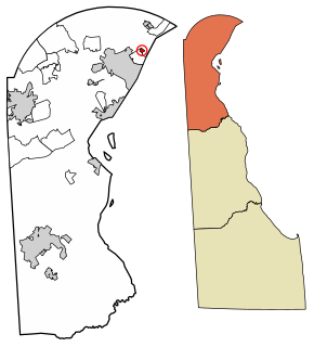
Bellefonte is a town in New Castle County, Delaware, United States. According to the 2010 Census, the population of the town is 1,193.

Newark is a city in New Castle County, Delaware, United States. It is located 12 miles (19 km) west-southwest of Wilmington. According to the 2010 Census, the population of the city is 31,454. Newark is home to the University of Delaware.

Bethel is a town in Sussex County, Delaware, United States. According to 2010 Census Bureau figures, the population of the town is 171. It is part of the Salisbury, Maryland-Delaware Metropolitan Statistical Area.

Blades is a town in Sussex County, Delaware, United States. As of the 2010 census, the town population was 1,241, a 29.8% increase over the previous decade. It is part of the Salisbury, Maryland-Delaware Metropolitan Statistical Area.

Bridgeville is a town in Sussex County, Delaware, United States. According to the 2010 census, the population is 2,048, an increase of 42.6% from the previous decade. It is part of the Salisbury, Maryland-Delaware Metropolitan Statistical Area.

Seaford is a city located along the Nanticoke River in Sussex County, Delaware, United States. According to the 2010 Census Bureau figures, the population of the city is 6,928, an increase of 3.4% from the 2000 census. It is part of the Salisbury, Maryland-Delaware Metropolitan Statistical Area.

Delmar is a town in Wicomico County, Maryland, United States. The population was 3,003 at the 2010 census. It is included in the Salisbury, Maryland-Delaware Metropolitan Statistical Area. When the population is added to "twin city" Delmar, Delaware, the town's total population is 4,600.

Delaware Technical Community College is a public community college in the U.S. state of Delaware. Delaware Tech is an open admission institution accredited by the Middle States Commission on Higher Education. The college offers more than 100 associate degrees, diplomas, and certificate programs. Of these programs, 48 are accredited degree programs with articulation agreements with 61 other higher learning institutions. It is the only community college in the state. The four-component campuses that make up the college are the Jack F. Owens Campus in Georgetown, Delaware, the Stanton Campus in Stanton, Delaware, the Charles L. Terry Campus in Dover, and the Orlando J. George, Jr. Campus in Wilmington, Delaware.
Maryland Route 54 (MD 54) and Delaware Route 54 (DE 54) are adjoining state highways in the U.S. states of Maryland and Delaware. Route 54 runs 41.84 mi (67.33 km) from MD 313 in Mardela Springs, Maryland east to DE 1 in Fenwick Island, Delaware. In addition to two segments in which the highway is completely in Delaware and two segments in which the highway is completely in Maryland, Route 54 follows the Delaware/Maryland state line between the twin towns of Delmar, Maryland and Delmar, Delaware and the highway's intersection with MD 353 and DE 26. One section of the state line portion of Route 54 is maintained by the Delaware Department of Transportation (DelDOT) while three sections of the highway that follow the state line are maintained by the Maryland State Highway Administration (MDSHA).

U.S. Route 13 (US 13) is a U.S. highway running from Fayetteville, North Carolina north to Morrisville, Pennsylvania. In the U.S. state of Delaware, the route runs for 103.33 mi (166.29 km). It traverses the entire north-south length of the state from the Maryland state line in Delmar, Sussex County north to the Pennsylvania state line in Claymont, New Castle County. US 13 connects many important cities and towns in Delaware, including Seaford, Dover, and Wilmington. The entire length of US 13 in Delaware is a multilane divided highway with the exceptions of the segment through Wilmington and parts of Philadelphia Pike in Claymont. Between the Maryland border and Dover, US 13 serves as one of the main north–south routes across the Delmarva Peninsula. From Dover north to Tybouts Corner, the route is followed by the controlled-access Delaware Route 1 (DE 1) toll road, which crosses the route several times and has multiple interchanges with it. US 13 bypasses downtown Wilmington to the east before it heads northeast of the city parallel to Interstate 495 (I-495) and the Delaware River to Claymont. US 13 is the longest numbered highway in the state of Delaware.

Angola is an unincorporated community adjacent to the Angola Neck peninsula in Sussex County, Delaware, United States. Angola is located on an inlet of Rehoboth Bay and is near Delaware Route 24. It is a population center for the Indian River Hundred.
Jimtown is an unincorporated community in Sussex County, Delaware, United States.
Whitesville is an unincorporated community in Sussex County, Delaware, United States. Whitesville is located just north of the stateline with Maryland. between Delmar and Selbyville. Local folklore ascribes the name to Ezekiel Williams, who built the first house in the village. It is the site of the Line United Methodist Church.
Redden is an unincorporated community in Sussex County, Delaware, United States.
Pinetown is an unincorporated community in Sussex County, Delaware, United States. Pinetown is located on Sweet Briar Road near Red Mill Pond southwest of Lewes.
Adamsville is an unincorporated community in Kent and Sussex counties of Delaware, United States. Adamsville is located at the intersection of Delaware Route 16 and Adamsville Road northwest of Greenwood.
Overbrook is an unincorporated community and former village in Sussex County, Delaware, United States.


