Burns, Wyoming

Last updated

Burns, Wyoming
Laramie County Wyoming Incorporated and Unincorporated areas Burns Highlighted 5611265.svg
Location of Burns in Laramie County, Wyoming.
Usa edcp location map.svg
Red pog.svg
Burns, Wyoming
Location in the United States
Coordinates: 41°11′31″N104°21′29″W / 41.19194°N 104.35806°W / 41.19194; -104.35806
Country United States
State Wyoming
County Laramie
Government
  TypeMayor and Council
  MayorJames "Okie" Clark
Area
[1]
  Total3.05 sq mi (7.91 km2)
  Land3.05 sq mi (7.91 km2)
  Water0.00 sq mi (0.00 km2)
Elevation
5,518 ft (1,682 m)
Population
 (2020) [2]
  Total356
  Density118.27/sq mi (45.01/km2)
Time zone UTC-7 (Mountain (MST))
  Summer (DST) UTC-6 (MDT)
ZIP code
82053
Area code 307
FIPS code 56-11265 [3]
GNIS feature ID1609075 [4]
Website www.burnswy.com

Burns is a town in Laramie County, Wyoming, United States. It is part of the Cheyenne, Wyoming Metropolitan Statistical Area. The population was 301 at the 2010 census. [5]

Contents

Geography

Burns is located at 41°11′31″N104°21′29″W / 41.19194°N 104.35806°W / 41.19194; -104.35806 (41.191962, -104.358163), [6] approximately 25 miles (40 km) east of Cheyenne.

According to the United States Census Bureau, the town has a total area of 3.05 square miles (7.90 km2), all land. [7]

Demographics

Historical population
CensusPop.Note
1920 300
1930 216−28.0%
1940 25317.1%
1950 216−14.6%
1960 2254.2%
1970 185−17.8%
1980 26844.9%
1990 254−5.2%
2000 28512.2%
2010 3015.6%
2020 35618.3%
2019 (est.)312 [8] 3.7%
U.S. Decennial Census [9]

2020 census

As of the census [2] of 2020, there were 356 [10] people, 118 households, and 83 families residing in the town. The population density was 98.7 inhabitants per square mile (38.1/km2). There were 138 housing units at an average density of 45.2 per square mile (17.5/km2). The racial makeup of the town was 87.1% White, 0.1% African American, 1.1% Native American, 2.2% from other races, and 8.1% from two or more races. Hispanic or Latino of any race were 6.7% of the population.

2010 census

As of the census [2] of 2010, there were 301 people, 118 households, and 83 families residing in the town. The population density was 98.7 inhabitants per square mile (38.1/km2). There were 138 housing units at an average density of 45.2 per square mile (17.5/km2). The racial makeup of the town was 94.7% White, 1.0% African American, 1.3% Native American, 1.0% from other races, and 2.0% from two or more races. Hispanic or Latino of any race were 3.7% of the population.

There were 118 households, of which 30.5% had children under the age of 18 living with them, 58.5% were married couples living together, 6.8% had a female householder with no husband present, 5.1% had a male householder with no wife present, and 29.7% were non-families. 23.7% of all households were made up of individuals, and 12.7% had someone living alone who was 65 years of age or older. The average household size was 2.55 and the average family size was 3.04.

The median age in the town was 41.6 years. 26.9% of residents were under the age of 18; 6.9% were between the ages of 18 and 24; 19.9% were from 25 to 44; 27.5% were from 45 to 64; and 18.6% were 65 years of age or older. The gender makeup of the town was 47.5% male and 52.5% female.

2000 census

As of the census [3] of 2000, there were 285 people, 112 households, and 76 families residing in the town. The population density was 93.2 people per square mile (36.0/km2). There were 117 housing units at an average density of 38.3 per square mile (14.8/km2). The racial makeup of the town was 96.14% White, 0.70% Native American, 1.75% from other races, and 1.40% from two or more races. Hispanic or Latino of any race were 2.11% of the population.

There were 112 households, out of which 35.7% had children under the age of 18 living with them, 58.0% were married couples living together, 6.3% had a female householder with no husband present, and 32.1% were non-families. 25.0% of all households were made up of individuals, and 12.5% had someone living alone who was 65 years of age or older. The average household size was 2.54 and the average family size was 3.13.

In the town, the population was spread out, with 30.5% under the age of 18, 4.9% from 18 to 24, 25.6% from 25 to 44, 24.6% from 45 to 64, and 14.4% who were 65 years of age or older. The median age was 37 years. For every 100 females, there were 88.7 males. For every 100 females age 18 and over, there were 90.4 males.

The median income for a household in the town was $31,875, and the median income for a family was $33,333. Males had a median income of $23,929 versus $19,286 for females. The per capita income for the town was $15,460. About 7.3% of families and 14.7% of the population were below the poverty line, including 26.0% of those under the age of eighteen and 12.8% of those 65 or over.

Education

Public education in the town of Burns is provided by Laramie County School District #2. Schools serving the town include Burns Elementary School (grades K-6) and Burns Junior/Senior High School (grades 7-12).

Burns has a public library, a branch of the Laramie County Library System. [11]

History

Originally, Burns was a siding with a water tank on the Union Pacific Railroad. [12] The community of Burns was conceived and marketed as a German-Lutheran settlement named New Berlin [13] and initially platted as the Town of Luther in 1907. [14] The original name was given by settlers of German Ancestry in honor of Martin Luther. Burns was the center of the Golden Prairie District promoted by the James R. Carpenter's Federal Land & Securities Co. formed in 1905. [15]

See also

Related Research Articles

<span class="mw-page-title-main">Washakie County, Wyoming</span> County in Wyoming, United States

Washakie County is a county in the U.S. state of Wyoming. As of the 2020 United States Census, the population was 7,685. Its county seat is Worland.

<span class="mw-page-title-main">Platte County, Wyoming</span> County in Wyoming, United States

Platte County is a county located in the U.S. state of Wyoming. As of the 2020 United States Census, the population was 8,605. Its county seat is Wheatland.

<span class="mw-page-title-main">Park County, Wyoming</span> County in Wyoming, United States

Park County is a county in the U.S. state of Wyoming. As of the 2020 United States Census, the population was 29,624. The county seat is Cody.

<span class="mw-page-title-main">Laramie County, Wyoming</span> County in Wyoming, United States

Laramie County is a county located at the southeast corner of the state of Wyoming. As of the 2020 United States Census, the population was 100,512 or 17.4% of the state's total 2020 population, making it the most populous county in Wyoming, but the least populous county in the United States to be the most populous in its state.

<span class="mw-page-title-main">Goshen County, Wyoming</span> County in Wyoming, United States

Goshen County is a county in the U.S. state of Wyoming. As of the 2020 United States Census, the population was 12,498. Its county seat is Torrington. The eastern boundary of the County borders the Nebraska state line.

<span class="mw-page-title-main">Converse County, Wyoming</span> County in Wyoming, United States

Converse County is a county located in the U.S. state of Wyoming. As of the 2020 United States Census, the population was 13,751. Its county seat is Douglas.

<span class="mw-page-title-main">Carbon County, Wyoming</span> County in Wyoming, United States

Carbon County is a county in the U.S. state of Wyoming. As of the 2020 United States Census, the population was 14,537. Its county seat is Rawlins. Its south border abuts the north line of Colorado.

<span class="mw-page-title-main">Albany County, Wyoming</span> County in Wyoming, United States

Albany County is a county in the U.S. state of Wyoming. As of the 2020 United States Census, the population was 37,066. Its county seat is Laramie, the site of the University of Wyoming. Its south border lies on the northern Colorado state line.

<span class="mw-page-title-main">West Hamlin, West Virginia</span> Town in West Virginia, United States

West Hamlin is a town in Lincoln County, West Virginia, United States, along the Guyandotte River. The population was 519 at the 2020 census, and is now down to 509, according to the 2021 census. West Hamlin is a part of the Huntington-Ashland, WV-KY-OH, Metropolitan Statistical Area (MSA). West Hamlin is west of the county seat at Hamlin, hence the name.

<span class="mw-page-title-main">Burlington, Wyoming</span> Town in Wyoming, United States

Burlington is a town in Big Horn County, Wyoming, United States. The population was 288 at the 2010 census.

<span class="mw-page-title-main">Byron, Wyoming</span> Town in Big Horn County, Wyoming, United States

Byron is a town in Big Horn County, Wyoming, United States. The population was 562 according to the 2020 census.

<span class="mw-page-title-main">Manderson, Wyoming</span> Town in Wyoming, United States

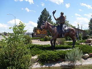
Manderson is a town in Big Horn County, Wyoming, United States. The population was 88 at the 2020 census. The town was originally called Alamo, but it was renamed in 1889 in honor of Charles F. Manderson, chief counsel for Burlington Railroad. The town is widely regarded as a speed trap for tourists heading to Yellowstone National Park.

<span class="mw-page-title-main">Encampment, Wyoming</span> Town in Wyoming, United States

Encampment is a town in southern Carbon County, Wyoming, United States. The population was 450 at the 2010 census.

<span class="mw-page-title-main">Fort Laramie, Wyoming</span> Town in Wyoming, United States

Fort Laramie is a town in Goshen County, Wyoming, United States. The population was 206 at the 2020 census. The town is named after historic Fort Laramie, an important stop on the Oregon, California and Mormon trails, as well as a staging point for various military excursions and treaty signings. The old fort was located south of town across the North Platte River, at the mouth of the Laramie River.

<span class="mw-page-title-main">Torrington, Wyoming</span> City in Wyoming, United States

Torrington is a city in, and the county seat of, Goshen County, Wyoming, United States. The population was 6,501 at the 2010 census.

<span class="mw-page-title-main">Albin, Wyoming</span> Town in Laramie County, Wyoming, United States

Albin is a town in Laramie County, Wyoming, United States. It is part of the Cheyenne Metropolitan Statistical Area. The population was 169 at the 2020 census.

<span class="mw-page-title-main">Fox Farm-College, Wyoming</span> Census-designated place in Wyoming, United States

Fox Farm-College is a census-designated place (CDP) in Laramie County, Wyoming, United States. It is part of the Cheyenne, Wyoming Metropolitan Statistical Area. The population was 3,876 people at the 2020 census.

<span class="mw-page-title-main">Pine Bluffs, Wyoming</span> Town in Wyoming, United States

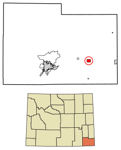
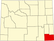
Pine Bluffs is a town in eastern Laramie County, Wyoming, United States. It is located on the county's border with Nebraska. Pine Bluffs is part of the Cheyenne, Wyoming, Metropolitan Statistical Area. The population was 1,129 at the 2010 census. It was first known as Rock Ranch, but the name was changed by railroad officials for the pines on the nearby bluffs.

<span class="mw-page-title-main">South Greeley, Wyoming</span> Census-designated place in Wyoming, United States

South Greeley is a census-designated place (CDP) in Laramie County, Wyoming, United States. It is part of the Cheyenne, Wyoming Metropolitan Statistical Area. The population was 4,733 at the 2020 census. The population was 4,217 at the 2010 census.

<span class="mw-page-title-main">Ranchester, Wyoming</span> Town in Wyoming, United States

Ranchester is a town in Sheridan County, Wyoming, United States. The population was 1,064 at the 2020 census.

References

  1. "2019 U.S. Gazetteer Files". United States Census Bureau. Retrieved August 7, 2020.
  2. 1 2 3 "U.S. Census website". United States Census Bureau . Retrieved December 14, 2012.
  3. 1 2 "U.S. Census website". United States Census Bureau . Retrieved January 31, 2008.
  4. "US Board on Geographic Names". United States Geological Survey. October 25, 2007. Retrieved January 31, 2008.
  5. "Profile of General Population and Housing Characteristics: 2010 Demographic Profile Data (DP-1): Burns town, Wyoming". United States Census Bureau . Retrieved April 2, 2012.
  6. "US Gazetteer files: 2010, 2000, and 1990". United States Census Bureau. February 12, 2011. Retrieved April 23, 2011.
  7. "US Gazetteer files 2010". United States Census Bureau. Archived from the original on January 25, 2012. Retrieved December 14, 2012.
  8. "Population and Housing Unit Estimates". United States Census Bureau. May 24, 2020. Retrieved May 27, 2020.
  9. "Census of Population and Housing". Census.gov. Retrieved June 4, 2015.
  10. "Explore Census Data". data.census.gov. Retrieved February 19, 2022.
  11. "Wyoming Public Libraries". PublicLibraries.com. Retrieved June 13, 2019.
  12. Bowman, J. R. (1882). Shearer, Frederick E. (ed.). The Pacific tourist. J.R. Bowman's illustrated transcontinental guide of travel from the Atlantic to the Pacific Ocean. New York: J.R. Bowman. p. 61. OCLC   752667534 . Retrieved May 16, 2018.
  13. "Wyoming Places / Burns (Laramie)". Wyomingplaces.pbworks.com. Archived from the original on September 23, 2016. Retrieved September 22, 2016.
  14. "Plat of Luther, Laramie County, Wyoming" (PDF). Laramie County Interactive Map Portal. Laramie County, Wyoming. November 19, 1907. Archived from the original (PDF) on June 30, 2016. Retrieved May 16, 2018.
  15. "Lincon Highway-Wyoming". Wyomingtalesandtrails.com. Retrieved January 9, 2018.