Calatagan

Last updated

Calatagan
Bayan ng Calatagan
Kalatagan
Municipality of Calatagan
Calatagan, Batangas.jpg
Cape Santiago Lighthouse tower.jpg
CalataganHall,Plaza,Batangasjf0546 25.JPG
Calatagan,Batangasjf678.JPG
Cape Santiago Lighthouse facing east.jpg
Calatagan,Batangasjf0701 05.JPG
Clockwise from top: Beach, Cape Santiago Lighthouse, Sto. Domingo de Silos Parish, Port of Calatagan, View of Southern Calatagan, Calatagan Municipal Hall
Calatagan Batangas.png
Ph locator batangas calatagan.svg
Map of Batangas with Calatagan highlighted
OpenStreetMap
Calatagan
Philippines location map (square).svg
Red pog.svg
Calatagan
Location within the Philippines
Coordinates: 13°49′56″N120°37′56″E / 13.83224°N 120.63219°E / 13.83224; 120.63219
Country Philippines
Region Calabarzon
Province Batangas
District 1st district
Founded January 1, 1912
Barangays 25 (see Barangays)
Government
[1]
  Type Sangguniang Bayan
   Mayor Peter Oliver M. Palacio
   Vice Mayor Rogelio H. Zarraga
   Representative Joseph Eric R. Buhain
   Municipal Council
Members
   Electorate 35,488 voters (2022)
Area
[2]
  Total112.00 km2 (43.24 sq mi)
Elevation
6.0 m (19.7 ft)
Highest elevation
347 m (1,138 ft)
Lowest elevation
0 m (0 ft)
Population
 (2020 census) [3]
  Total58,719
  Density520/km2 (1,400/sq mi)
   Households
14,267
Economy
   Income class 2nd municipal income class
   Poverty incidence
11.71
% (2018) [4]
   Revenue 216.2 million (2020)
   Assets 627.3 million (2020)
   Expenditure 193.7 million (2020)
   Liabilities 151.8 million (2020)
Service provider
  ElectricityBatangas 1 Electric Cooperative (BATELEC 1)
Time zone UTC+8 (PST)
ZIP code
4215
PSGC
IDD : area code +63(0)43
Native languages Tagalog
Website www.calatagan.gov.ph

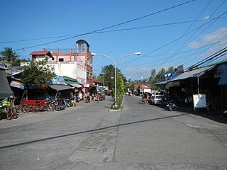
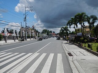
Calatagan, officially the Municipality of Calatagan (Tagalog : Bayan ng Calatagan), is a 2nd class municipality in the province of Batangas, Philippines. According to the 2020 census, it has a population of 58,719 people. [3]

Contents

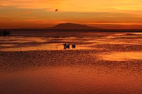
Calatagan comprises the Calatagan Peninsula between the South China Sea and Balayan Bay. The peninsula's near white sand beaches are well-known vacation and leisure sites. There are several beach resorts including the Banak House Calatagan on Calatagan beach, the Ronco Beach Resort in barangay Bagong Silang, Playa Calatagan in barangay Santa Ana, the Golden Sunset Resort in barangay Uno, Lago de Oro Resort in barangay Balibago, Villa Agustina in barangay Bagong Silang, and Nacua Sea Park in barangay Quilitisan. Calatagan was formerly titled as the Forbes Park of the South, because of the rich families who own estates here.[ citation needed ]

An extremely rare example of pre-Spanish Philippine script was found in Calatagan. The script is called Baybayin in Tagalog, and was derived from Javanese writing, which in turn is derived from Brahmi. This writing survived on an earthenware burial jar dated to the 13th or 14th century.[ citation needed ] A Spanish lighthouse can also be found at Cape Santiago at the peninsula's southern tip dating back to the 1890s and is also one of the municipality's main tourist attractions.

Etymology

The word Calatagan is taken from the Tagalog word latag and is closely associated with kapatagan, which means a vast portion of flat land lying between the hills and mountains. Thus, Calatagan means a large expanse of wide flat land. [5]

History

The town is the site of the historically and archaeologically famous Calatagan Excavation whose antique pottery and utensils contributed important facts about the culture and activities of the Filipinos before the coming of the Spaniards. Chinese pottery, unearthed from six large cemeteries by archaeologists Olov T.R Jones and Robert B. Fox led to a conclusion made by H. Otley Beyer which points out the existence of a sizable pre-Spanish population in the town. The same studies suggested that there were direct Chinese trade by water in Calatagan and centered at a place called Balong-Bato, wherein an entrance through the reef, which surrounds Calatagan, is still presently used by vessels coming from Mindoro and Manila.

The land occupied by the municipality of Calatagan was acquired by Domingo Roxas from the Spanish Crown in 1829 and was called Hacienda de Calatagan. The successors Pedro P. Roxas and Antonio R. Roxas continued to develop it.

In 1912, through Executive Order No. 78 by then Governor-General William Cameron Forbes, Calatagan became a municipality independent from its mother municipality, Balayan. [6]

In 1931, Carmen Roxas, the last heir of the Roxas Clan transferred ownership of the Hacienda to the Zobel brothers, Jacobo and Alfonso. During the time of the Zobels, the hacienda came to be known as Central Azucarera de Calatagan or simply "Central Carmen" when referring to the sugar milling complex.

In 1934, the barangays of Baha and Talibayog, which were parts of Balayan at the time, were annexed to Calatagan since surveys showed that they are part of the land titled to the original owner of Hacienda Calatagan. This added a big area to the municipality.

On October 28, 1957, a decade after the Philippines gained independence from the Americans, the Land Tenure Administration, upon petition of the people of Calatagan bought the Hacienda Lands from the Zobels. These were apportioned to the inhabitants and sold to them at 5.00(equivalent to ₱639.8 in 2021) per hectare payable in installment within a period of 25 years. [5]

Geography

Calatagan is located at 13°49′56″N120°37′56″E / 13.83224°N 120.63219°E / 13.83224; 120.63219 .

According to the Philippine Statistics Authority, the municipality has a land area of 112.00 square kilometers (43.24 sq mi) [7] constituting

Calatagan is 71 kilometers (44 mi) from Batangas City and 129 kilometers (80 mi) from Manila.

Barangays

Calatagan is politically subdivided into 25 barangays. [8] Each barangay consists of puroks and some have sitios.

PSGC Barangay Population ±% p.a.
2020 [3] 2010 [9]
041008001 Bagong Silang 3.9% 2,270 2,074 0.91%
041008002 Baha 0.0% 0 1,494 −100.00%
041008003 Balibago 5.8% 3,377 3,161 0.66%
041008004 Balitoc 5.1% 3,023 2,814 0.72%
041008005 Biga 4.9% 2,849 2,795 0.19%
041008006 Bucal 1.6% 965 892 0.79%
041008007 Carlosa 2.4% 1,414 1,253 1.22%
041008008 Carretunan 2.6% 1,504 1,449 0.37%
041008009 Encarnacion 2.3% 1,327 1,049 2.38%
041008010 Gulod 5.3% 3,127 2,798 1.12%
041008011 Hukay 3.6% 2,120 2,124 −0.02%
041008013 Lucsuhin 7.7% 4,528 4,299 0.52%
041008014 Luya 1.1% 664 616 0.75%
041008015 Paraiso 2.3% 1,346 1,133 1.74%
041008016 Barangay 1 ( Poblacion ) 5.8% 3,433 3,150 0.86%
041008017 Barangay 2 (Poblacion) 2.4% 1,408 1,296 0.83%
041008018 Barangay 3 (Poblacion) 1.6% 953 760 2.29%
041008019 Barangay 4 (Poblacion) 4.9% 2,863 2,770 0.33%
041008020 Quilitisan 3.7% 2,176 2,022 0.74%
041008021 Real 2.7% 1,588 1,380 1.41%
041008022 Sambungan 3.4% 1,975 1,820 0.82%
041008023 Santa Ana 5.5% 3,209 2,747 1.57%
041008026 Talibayog 0.3% 200 1,783 −19.65%
041008027 Talisay 4.5% 2,617 2,524 0.36%
041008028 Tanagan 7.2% 4,224 3,794 1.08%
Total58,71951,9971.22%

Climate

Climate data for Calatagan, Batangas
MonthJanFebMarAprMayJunJulAugSepOctNovDecYear
Average high °C (°F)29
(84)
30
(86)
31
(88)
33
(91)
32
(90)
30
(86)
29
(84)
29
(84)
29
(84)
29
(84)
29
(84)
29
(84)
30
(86)
Average low °C (°F)20
(68)
20
(68)
21
(70)
22
(72)
24
(75)
24
(75)
24
(75)
24
(75)
24
(75)
23
(73)
22
(72)
21
(70)
22
(72)
Average precipitation mm (inches)11
(0.4)
13
(0.5)
14
(0.6)
32
(1.3)
101
(4.0)
142
(5.6)
208
(8.2)
187
(7.4)
175
(6.9)
131
(5.2)
68
(2.7)
39
(1.5)
1,121
(44.3)
Average rainy days5.25.07.411.519.823.527.025.925.223.215.58.3197.5
Source: Meteoblue (Use with caution: this is modeled/calculated data, not measured locally.) [10]

Demographics

Population census of Calatagan
YearPop.±% p.a.
1903 2,654    
1918 4,636+3.79%
1939 7,710+2.45%
1948 9,620+2.49%
1960 14,457+3.45%
1970 20,889+3.74%
1975 23,648+2.52%
1980 27,578+3.12%
1990 35,543+2.57%
1995 40,707+2.57%
2000 45,068+2.21%
2007 51,544+1.87%
2010 51,997+0.32%
2015 56,449+1.58%
2020 58,719+0.78%
Source: Philippine Statistics Authority [11] [9] [12] [13]

In the 2020 census, Calatagan had a population of 58,719. [3] The population density was 520 inhabitants per square kilometer (1,300/sq mi).

Economy

Related Research Articles

<span class="mw-page-title-main">Mabini, Batangas</span> Municipality in Batangas, Philippines

Mabini, officially the Municipality of Mabini, is a 1st class municipality in the province of Batangas, Philippines. According to the 2020 census, it has a population of 50,858 people.

<span class="mw-page-title-main">Victoria, Laguna</span> Municipality in Laguna, Philippines

Victoria, officially the Municipality of Victoria, is a 4th class municipality in the province of Laguna, Philippines. According to the 2020 census, it has a population of 43,408 people.

<span class="mw-page-title-main">Calauan</span> Municipality in Laguna, Philippines

Calauan, officially the Municipality of Calauan, is a 2nd class municipality in the province of Laguna, Philippines. The municipality has a land area of 25.25 square miles which constitutes 3.41% of Laguna's total area. According to the 2020 census, it has a population of 87,693 people.

<span class="mw-page-title-main">Agoncillo, Batangas</span> Municipality in Batangas, Philippines

Agoncillo, officially the Municipality of Agoncillo, is a 4th class municipality in the province of Batangas, Philippines. According to the 2020 census, it has a population of 39,101 people.

<span class="mw-page-title-main">Balayan</span> Municipality in Batangas, Philippines

Balayan, officially the Municipality of Balayan, is a 1st class municipality in the province of Batangas, Philippines. According to the 2020 census, it has a population of 95,913 people.

<span class="mw-page-title-main">Alitagtag</span> Municipality in Batangas, Philippines

Alitagtag, officially the Municipality of Alitagtag, is a 4th class municipality in the province of Batangas, Philippines. According to the 2020 census, it has a population of 26,819 people.

<span class="mw-page-title-main">Balete, Batangas</span> Municipality in Batangas, Philippines

Balete, officially the Municipality of Balete, is a 5th class municipality in the province of Batangas, Philippines. According to the 2020 census, it has a population of 24,055 people. The people from Balete is called Baleteños.

<span class="mw-page-title-main">Bauan</span> Municipality in Batangas, Philippines

Bauan, officially the Municipality of Bauan, is a 1st class municipality in the province of Batangas, Philippines. According to the 2020 census, it has a population of 90,819 people.

<span class="mw-page-title-main">Ibaan</span> Municipality in Batangas, Philippines

Ibaan, officially the Municipality of Ibaan, is a 2nd class municipality in the province of Batangas, Philippines. According to the 2020 census, it has a population of 58,507 people.

<span class="mw-page-title-main">Lemery, Batangas</span> Municipality in Batangas, Philippines

Lemery, officially the Municipality of Lemery, is a 1st class municipality in the province of Batangas, Philippines. According to the 2020 census, it has a population of 93,186 people.

<span class="mw-page-title-main">Lian, Batangas</span> Municipality in Batangas, Philippines

Lian, officially the Municipality of Lian, is a 3rd class municipality in the province of Batangas, Philippines. According to the 2020 census, it has a population of 56,280 people.

<span class="mw-page-title-main">Lobo, Batangas</span> Municipality in Batangas, Philippines

Lobo, officially the Municipality of Lobo, is a 3rd class municipality in the province of Batangas, Philippines. According to the 2020 census, it has a population of 40,736 people.

<span class="mw-page-title-main">Nasugbu</span> Municipality in Batangas, Philippines

Nasugbu, officially the Municipality of Nasugbu, is a 1st class municipality in the province of Batangas, Philippines. According to the 2020 census, it has a population of 136,524 people.

<span class="mw-page-title-main">Padre Garcia</span> Municipality in Batangas, Philippines

Padre Garcia, officially the Municipality of Padre Garcia, is a 2nd class municipality in the province of Batangas, Philippines. According to the 2020 census, it has a population of 51,853 people.

<span class="mw-page-title-main">San Luis, Batangas</span> Municipality in Batangas, Philippines

San Luis, officially the Municipality of San Luis, is a 4th class municipality in the province of Batangas, Philippines. According to the 2020 census, it has a population of 36,172 people.

<span class="mw-page-title-main">San Nicolas, Batangas</span> Municipality in Batangas, Philippines

San Nicolas, officially the Municipality of San Nicolas, is a 5th class municipality in the province of Batangas, Philippines. According to the 2020 census, it has a population of 23,908 people. It is equivalent to 0.15% of the population in the Calabarzon area or 0.82% of the total population of Batangas province. These numbers are used to calculate the population density, which is 1,057 inhabitants per square kilometer or 2,740 inhabitants per square mile. The municipality makes up 0.73% of Batangas's total area, with a land area of 22.61 square kilometers or 8.73 square miles.

<span class="mw-page-title-main">Santa Teresita, Batangas</span> Municipality in Batangas, Philippines

Santa Teresita, officially the Municipality of Santa Teresita, is a 5th class municipality in the province of Batangas, Philippines. According to the 2020 census, it has a population of 21,559 people.

<span class="mw-page-title-main">Taal, Batangas</span> Municipality in Batangas, Philippines

Taal, officially the Municipality of Taal, is a 3rd class municipality in the province of Batangas, Philippines. According to the 2020 census, it has a population of 61,460 people.

<span class="mw-page-title-main">Taysan</span> Municipality in Batangas, Philippines

Taysan, officially the Municipality of Taysan, is a 2nd class municipality in the province of Batangas, Philippines. According to the 2020 census, it has a population of 40,146 people.

<span class="mw-page-title-main">Tuy, Batangas</span> Municipality in Batangas, Philippines

Tuy, officially the Municipality of Tuy, is a 3rd class municipality in the province of Batangas, Philippines. According to the 2020 census, it has a population of 46,519 people.

References

  1. Municipality of Calatagan | (DILG)
  2. "2015 Census of Population, Report No. 3 – Population, Land Area, and Population Density" (PDF). Philippine Statistics Authority. Quezon City, Philippines. August 2016. ISSN   0117-1453. Archived (PDF) from the original on May 25, 2021. Retrieved July 16, 2021.
  3. 1 2 3 4 Census of Population (2020). "Region IV-A (Calabarzon)". Total Population by Province, City, Municipality and Barangay. Philippine Statistics Authority . Retrieved July 8, 2021.
  4. "PSA Releases the 2018 Municipal and City Level Poverty Estimates". Philippine Statistics Authority. December 15, 2021. Retrieved January 22, 2022.
  5. 1 2 "Brief Description of LGU". Calatagan LGU Website. Archived from the original on July 2, 2014. Retrieved June 14, 2014.
  6. Executive Order No. 78 (February 3, 2018). Separating Calatagan from the Municipality of Balayan . Retrieved February 1, 2022.{{cite book}}: |website= ignored (help)
  7. "Province: Batangas". PSGC Interactive. Quezon City, Philippines: Philippine Statistics Authority . Retrieved November 12, 2016.
  8. "Municipal: Calatagan". PSGC Interactive. Quezon City, Philippines: Philippine Statistics Authority . Retrieved January 8, 2016.
  9. 1 2 Census of Population and Housing (2010). "Region IV-A (Calabarzon)". Total Population by Province, City, Municipality and Barangay. National Statistics Office . Retrieved June 29, 2016.
  10. "Calatagan: Average Temperatures and Rainfall". Meteoblue. Retrieved May 5, 2020.
  11. Census of Population (2015). "Region IV-A (Calabarzon)". Total Population by Province, City, Municipality and Barangay. Philippine Statistics Authority . Retrieved June 20, 2016.
  12. Censuses of Population (1903–2007). "Region IV-A (Calabarzon)". Table 1. Population Enumerated in Various Censuses by Province/Highly Urbanized City: 1903 to 2007. National Statistics Office.
  13. "Province of Batangas". Municipality Population Data. Local Water Utilities Administration Research Division. Retrieved December 17, 2016.
  14. "Poverty incidence (PI):". Philippine Statistics Authority. Retrieved December 28, 2020.
  15. "Estimation of Local Poverty in the Philippines" (PDF). Philippine Statistics Authority. November 29, 2005.
  16. "2003 City and Municipal Level Poverty Estimates" (PDF). Philippine Statistics Authority. March 23, 2009.
  17. "City and Municipal Level Poverty Estimates; 2006 and 2009" (PDF). Philippine Statistics Authority. August 3, 2012.
  18. "2012 Municipal and City Level Poverty Estimates" (PDF). Philippine Statistics Authority. May 31, 2016.
  19. "Municipal and City Level Small Area Poverty Estimates; 2009, 2012 and 2015". Philippine Statistics Authority. July 10, 2019.
  20. "PSA Releases the 2018 Municipal and City Level Poverty Estimates". Philippine Statistics Authority. December 15, 2021. Retrieved January 22, 2022.