Tingloy

Last updated
Tingloy
Municipality of Tingloy
Tingloy Village.jpg
A fishing village in Tingloy
Seal of Tingloy Batangas.png
Ph locator batangas tingloy.svg
Map of Batangas with Tingloy highlighted
OpenStreetMap
Tingloy
Philippines location map (square).svg
Red pog.svg
Tingloy
Location within the Philippines
Coordinates: 13°39′N120°52′E / 13.65°N 120.87°E / 13.65; 120.87
Country Philippines
Region Calabarzon
Province Batangas
District 2nd district
Founded June 17, 1955 [1]
Barangays 15 (see Barangays)
Government
[2]
  Type Sangguniang Bayan
   Mayor Lauro F. Alvarez
   Vice Mayor Dawn Erika E. Alvarez
   Representative Gerville Luistro
   Municipal Council
Members
   Electorate 11,622 voters (2022)
Area
[3]
  Total33.07 km2 (12.77 sq mi)
Elevation
16 m (52 ft)
Highest elevation
487 m (1,598 ft)
Lowest elevation
0 m (0 ft)
Population
 (2020 census) [4]
  Total19,215
  Density580/km2 (1,500/sq mi)
   Households
5,103
Economy
   Income class 5th municipal income class
   Poverty incidence
19.08
% (2018) [5]
   Revenue 77.57 million (2020)
   Assets 142 million (2020)
   Expenditure 64.8 million (2020)
   Liabilities 32.96 million (2020)
Service provider
  ElectricityBatangas 2 Electric Cooperative (BATELEC 2)
Time zone UTC+8 (PST)
ZIP code
4203
PSGC
IDD : area code +63(0)43
Native languages Tagalog

Tingloy, officially the Municipality of Tingloy (Tagalog : Bayan ng Tingloy), is a 5th class municipality in the province of Batangas, Philippines. According to the 2020 census, it has a population of 19,215 people, making it the least populated municipality in the province. [4]

Contents

The municipality comprises Maricaban Island, Caban Island, and other minor islets, all just south of the Calumpang Peninsula. Visitors to its beaches and diving facilities are a source of income.

History

The name "Tingloy" was, according to legend, derived from a plant of almost the same name, "tinghoy", which is largely found in abundance on the island up to now.[ citation needed ]

The first people to inhabit the island almost a century ago[ when? ] came from Taal and Bauan, presumably to escape the brutalities perpetrated by the Spanish "conquistadors". They came in family groups and finding the place a haven, settled down in definite areas later forming the various barrios now comprising the created political subdivision. It is said that the former barrio of Tingloy was founded by Jose Martinez, a Taaleño. [6] [ verification needed ]

At several times the island was placed under the jurisdiction of different towns. The island was originally part of the town of San Luis. In 1917, it was placed under the jurisdiction of Bauan, only to be separated from it a year later when the municipality of Mabini was formed. In 1921, it was again placed under the jurisdiction of Bauan.

During the Spanish regime, people were educated at home learning to read the "Cartillas" and the "Caton" "Christiana". During American occupation schools were established. Ireneo Martinez together with Flaviano Gamben, initiated a movement for a model schoolhouse for the former barrio of Tingloy. This movement became a success when a model schoolhouse was constructed in the present poblacion of the Municipality of Tingloy sometime in 1921. [6]

During the second regular session of the 3rd Congress of the Philippines, the barrios of Tingloy, Maricaban, Papaya, Pisa, Gamao, and Talahib were separated from Bauan and constituted into the newly created municipality of Tingloy. [7] President Ramon Magsaysay, on June 17, 1955, appointed the first municipal officials headed by Ramon De Claro as mayor.

Geography

According to the Philippine Statistics Authority, the municipality has a land area of 33.07 square kilometres (12.77 sq mi) [8] constituting

Just off the southwest coast of the Batangas mainland, about two nautical miles (3.7 kilometres) south, lies the radish-shaped island of Maricaban. It has a land area of about 14 square miles (36 square kilometres) of rugged hills and sloping mountains with occasional lowland plains and valleys.

Barangays

Tingloy is politically subdivided into 15 barangays. [9] Each barangay consists of puroks and some have sitios.

PSGC Barangay Population ±% p.a.
2020 [4] 2010 [10]
041033001 Corona 4.5% 861 870 −0.10%
041033003 Gamao 5.5% 1,062 1,039 0.22%
041033004 Makawayan 5.1% 977 982 −0.05%
041033005 Marikaban 6.4% 1,221 1,112 0.94%
041033006 Papaya 9.1% 1,747 1,732 0.09%
041033007 Pisa 6.1% 1,181 965 2.04%
041033008 Barangay 13 ( Poblacion 1) 4.6% 876 794 0.99%
041033009 Barangay 14 (Poblacion 2) 4.6% 886 812 0.88%
041033010 Barangay 15 (Poblacion 3) 4.5% 867 722 1.85%
041033011 San Isidro 8.8% 1,686 1,459 1.46%
041033012 San Jose 7.4% 1,428 1,197 1.78%
041033013 San Juan 10.0% 1,916 1,821 0.51%
041033014 San Pedro 2.5% 477 527 −0.99%
041033015 Santo Tomas 8.7% 1,673 1,677 −0.02%
041033016 Talahib 5.5% 1,061 1,161 −0.90%
Total19,21516,8701.31%

Climate

Climate data for Tingloy, Batangas
MonthJanFebMarAprMayJunJulAugSepOctNovDecYear
Mean daily maximum °C (°F)28
(82)
29
(84)
30
(86)
31
(88)
31
(88)
30
(86)
29
(84)
29
(84)
29
(84)
29
(84)
29
(84)
28
(82)
29
(85)
Mean daily minimum °C (°F)22
(72)
21
(70)
22
(72)
23
(73)
25
(77)
25
(77)
25
(77)
25
(77)
25
(77)
24
(75)
23
(73)
22
(72)
24
(74)
Average precipitation mm (inches)48
(1.9)
32
(1.3)
41
(1.6)
54
(2.1)
257
(10.1)
410
(16.1)
466
(18.3)
422
(16.6)
429
(16.9)
300
(11.8)
137
(5.4)
92
(3.6)
2,688
(105.7)
Average rainy days10.88.09.811.723.127.529.228.728.725.518.212.8234
Source: Meteoblue [11]

Demographics

Population census of Tingloy
YearPop.±% p.a.
1960 7,656    
1970 10,636+3.34%
1975 11,963+2.39%
1980 13,381+2.26%
1990 15,430+1.44%
1995 14,897−0.66%
2000 17,028+2.91%
2007 18,548+1.19%
2010 16,870−3.39%
2015 17,919+1.16%
2020 19,215+1.38%
Source: Philippine Statistics Authority [12] [10] [13] [14]

In the 2020 census, Tingloy had a population of 19,215. [4] The population density was 580 inhabitants per square kilometre (1,500/sq mi).

Economy

Attractions

Masasa Beach Masasa Beach, Tingloy Batangas.jpg
Masasa Beach
A view from Sabang on the island of Mindoro in the Philippines towards Maricaban Island. Batangas coast.jpg
A view from Sabang on the island of Mindoro in the Philippines towards Maricaban Island.

Related Research Articles

<span class="mw-page-title-main">Calatagan</span> Municipality in Batangas, Philippines

Calatagan, officially the Municipality of Calatagan, is a 2nd class municipality in the province of Batangas, Philippines. According to the 2020 census, it has a population of 58,719 people.

<span class="mw-page-title-main">Batangas City</span> Capital of Batangas, Philippines

Batangas City, officially the City of Batangas, is a 1st class component city and capital of the province of Batangas, Philippines. According to the 2020 census, it has a population of 351,437 people.

<span class="mw-page-title-main">Padre Burgos, Quezon</span> Municipality in Quezon, Philippines

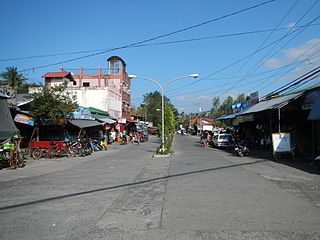
Padre Burgos, officially the Municipality of Padre Burgos, is a 4th class municipality in the province of Quezon, Philippines. According to the 2020 census, it has a population of 23,488 people.

<span class="mw-page-title-main">Mabini, Batangas</span> Municipality in Batangas, Philippines

Mabini, officially the Municipality of Mabini, is a 1st class municipality in the province of Batangas, Philippines. According to the 2020 census, it has a population of 50,858 people.

<span class="mw-page-title-main">Talisay, Batangas</span> Municipality in Batangas, Philippines

Talisay, officially the Municipality of Talisay, is a 3rd class municipality in the province of Batangas, Philippines. According to the 2020 census, it has a population of 46,238 people.

<span class="mw-page-title-main">San Jose, Batangas</span> Municipality in Batangas, Philippines

San Jose, officially the Municipality of San Jose, is a 1st class municipality in the province of Batangas, Philippines. According to the 2020 census, it has a population of 79,868 people.

<span class="mw-page-title-main">San Pascual, Batangas</span> Municipality in Batangas, Philippines

San Pascual, officially the Municipality of San Pascual, is a 1st class municipality in the province of Batangas, Philippines. According to the 2020 census, it has a population of 69,009 making it as the 9th most populous municipality in the province.

<span class="mw-page-title-main">Agoncillo, Batangas</span> Municipality in Batangas, Philippines

Agoncillo, officially the Municipality of Agoncillo, is a 4th class municipality in the province of Batangas, Philippines. According to the 2020 census, it has a population of 39,101 people.

<span class="mw-page-title-main">Alitagtag</span> Municipality in Batangas, Philippines

Alitagtag, officially the Municipality of Alitagtag, is a 4th class municipality in the province of Batangas, Philippines. According to the 2020 census, it has a population of 26,819 people.

<span class="mw-page-title-main">Balete, Batangas</span> Municipality in Batangas, Philippines

Balete, officially the Municipality of Balete, is a 5th class municipality in the province of Batangas, Philippines. According to the 2020 census, it has a population of 24,055 people. The people from Balete is called Baleteños.

<span class="mw-page-title-main">Bauan</span> Municipality in Batangas, Philippines

Bauan, officially the Municipality of Bauan, is a 1st class municipality in the province of Batangas, Philippines. According to the 2020 census, it has a population of 90,819 people.

<span class="mw-page-title-main">Calaca, Batangas</span> Component city in Batangas, Philippines

Calaca, officially the City of Calaca, is a component city in the province of Batangas, Philippines. According to the 2020 census, it has a population of 87,361 people.

<span class="mw-page-title-main">Cuenca, Batangas</span> Municipality in Batangas, Philippines

Cuenca, officially the Municipality of Cuenca, is a 4th class municipality in the province of Batangas, Philippines. According to the 2020 census, it has a population of 36,235 people.

<span class="mw-page-title-main">Laurel, Batangas</span> Municipality in Batangas, Philippines

Laurel, officially the Municipality of Laurel, is a 3rd class municipality in the province of Batangas, Philippines. According to the 2020 census, it has a population of 43,210 people.

<span class="mw-page-title-main">Lobo, Batangas</span> Municipality in Batangas, Philippines

Lobo, officially the Municipality of Lobo, is a 3rd class municipality in the province of Batangas, Philippines. According to the 2020 census, it has a population of 40,736 people.

<span class="mw-page-title-main">San Luis, Batangas</span> Municipality in Batangas, Philippines

San Luis, officially the Municipality of San Luis, is a 4th class municipality in the province of Batangas, Philippines. According to the 2020 census, it has a population of 36,172 people.

<span class="mw-page-title-main">San Nicolas, Batangas</span> Municipality in Batangas, Philippines

San Nicolas, officially the Municipality of San Nicolas, is a 5th class municipality in the province of Batangas, Philippines. According to the 2020 census, it has a population of 23,908 people. It is equivalent to 0.15% of the population in the Calabarzon area or 0.82% of the total population of Batangas province. These numbers are used to calculate the population density, which is 1,057 inhabitants per square kilometer or 2,740 inhabitants per square mile. The municipality makes up 0.73% of Batangas's total area, with a land area of 22.61 square kilometers or 8.73 square miles.

<span class="mw-page-title-main">Santa Teresita, Batangas</span> Municipality in Batangas, Philippines

Santa Teresita, officially the Municipality of Santa Teresita, is a 5th class municipality in the province of Batangas, Philippines. According to the 2020 census, it has a population of 21,559 people.

<span class="mw-page-title-main">Panukulan</span> Municipality in Quezon, Philippines

Panukulan, officially the Municipality of Panukulan, is a 4th class municipality in the province of Quezon, Philippines. According to the 2020 census, it has a population of 16,376 people. It is located in the northwestern part of the island of Polillo in the Polillo Islands.

<span class="mw-page-title-main">San Andres, Quezon</span> Municipality in Quezon, Philippines

San Andres, officially the Municipality of San Andres, is a 4th class municipality in the province of Quezon, Philippines. According to the 2020 census, it has a population of 37,454 people.

References

  1. "Republic Act No. 1344 : REPUBLIC ACTS - PHILIPPINE LAWS STATUTES and CODES - CHANROBLES VIRTUAL LAW LIBRARY".
  2. Municipality of Tingloy | (DILG)
  3. "2015 Census of Population, Report No. 3 – Population, Land Area, and Population Density" (PDF). Philippine Statistics Authority. Quezon City, Philippines. August 2016. ISSN   0117-1453. Archived (PDF) from the original on May 25, 2021. Retrieved July 16, 2021.
  4. 1 2 3 4 Census of Population (2020). "Region IV-A (Calabarzon)". Total Population by Province, City, Municipality and Barangay. Philippine Statistics Authority . Retrieved 8 July 2021.
  5. "PSA Releases the 2018 Municipal and City Level Poverty Estimates". Philippine Statistics Authority. 15 December 2021. Retrieved 22 January 2022.
  6. 1 2 "TINGLOY TOWN", TINGLOY TOWN FIESTA SOUVENIR PROGRAM, 1979-10-18
  7. "Republic Act No. 1344 - An Act to Create the Municipality of Tingloy in the Province of Batangas". Chan Robles Virtual Law Library. 17 June 1955. Retrieved 11 December 2016.
  8. "Province: Batangas". PSGC Interactive. Quezon City, Philippines: Philippine Statistics Authority . Retrieved 12 November 2016.
  9. "Municipal: Tingloy". PSGC Interactive. Quezon City, Philippines: Philippine Statistics Authority . Retrieved 8 January 2016.
  10. 1 2 Census of Population and Housing (2010). "Region IV-A (Calabarzon)" (PDF). Total Population by Province, City, Municipality and Barangay. National Statistics Office . Retrieved 29 June 2016.
  11. "Tingloy: Average Temperatures and Rainfall". Meteoblue. Retrieved 5 May 2020.
  12. Census of Population (2015). "Region IV-A (Calabarzon)". Total Population by Province, City, Municipality and Barangay. Philippine Statistics Authority . Retrieved 20 June 2016.
  13. Censuses of Population (1903–2007). "Region IV-A (Calabarzon)". Table 1. Population Enumerated in Various Censuses by Province/Highly Urbanized City: 1903 to 2007. National Statistics Office.{{cite encyclopedia}}: CS1 maint: numeric names: authors list (link)
  14. "Province of Batangas". Municipality Population Data. Local Water Utilities Administration Research Division. Retrieved 17 December 2016.
  15. "Poverty incidence (PI):". Philippine Statistics Authority. Retrieved December 28, 2020.
  16. "Estimation of Local Poverty in the Philippines" (PDF). Philippine Statistics Authority. 29 November 2005.
  17. "2003 City and Municipal Level Poverty Estimates" (PDF). Philippine Statistics Authority. 23 March 2009.
  18. "City and Municipal Level Poverty Estimates; 2006 and 2009" (PDF). Philippine Statistics Authority. 3 August 2012.
  19. "2012 Municipal and City Level Poverty Estimates" (PDF). Philippine Statistics Authority. 31 May 2016.
  20. "Municipal and City Level Small Area Poverty Estimates; 2009, 2012 and 2015". Philippine Statistics Authority. 10 July 2019.
  21. "PSA Releases the 2018 Municipal and City Level Poverty Estimates". Philippine Statistics Authority. 15 December 2021. Retrieved 22 January 2022.