San Juan, Batangas

Last updated
San Juan
Municipality of San Juan
Batangasjf9369 14.JPG
Gen. Luna Street, the town proper's main thoroughfare
Ph Flag San Juan Batangas.png
San juan batangas seal.png
Motto: 
Sama-sama Tayo sa Napapanahong Pagbabago
Anthem: Bagong Araw (New Day)
Ph locator batangas san juan.svg
Map of Batangas with San Juan highlighted
OpenStreetMap
San Juan, Batangas
Philippines location map (square).svg
Red pog.svg
San Juan
Location within the Philippines
Coordinates: 13°49′34″N121°23′46″E / 13.826°N 121.396°E / 13.826; 121.396
Country Philippines
Region Calabarzon
Province Batangas
District 4th district
Founded December 12, 1848
Named for St. John of Nepomuk
Barangays 42 (see Barangays)
Government
[1]
  Type Sangguniang Bayan
   Mayor Ildebrando D. Salud
   Vice Mayor Octavio Antonio L. Marasigan
   Representative Lianda B. Bolilia
   Municipal Council
Members
   Electorate 72,482 voters (2022)
Area
[2]
  Total273.40 km2 (105.56 sq mi)
Elevation
23 m (75 ft)
Highest elevation
184 m (604 ft)
Lowest elevation
0 m (0 ft)
Population
 (2020 census) [3]
  Total114,068
  Density420/km2 (1,100/sq mi)
   Households
27,553
Economy
   Income class 1st municipal income class
   Poverty incidence
13.04
% (2018) [4]
   Revenue 388.1 million (2020)
   Assets 888 million (2020)
   Expenditure 433.8 million (2020)
   Liabilities 116.9 million (2020)
Service provider
  ElectricityBatangas 2 Electric Cooperative (BATELEC 2)
  WaterSan Juan Water District (SJWD)
  Cable TVMaharlika Cable Systems
Time zone UTC+8 (PST)
ZIP code
4226
PSGC
IDD : area code +63(0)43
Native languages Tagalog
Website www.sanjuanbatangas.gov.ph

San Juan, officially the Municipality of San Juan (Tagalog : Bayan ng San Juan), is a 1st class municipality in the province of Batangas, Philippines. According to the 2020 census, it has a population of 114,068 people. [3]

Contents

The town is known for its baroque church, ancestral houses, and the Pinagbayanan excavation, the most important archaeological site in the municipality.

History

San Juan used to be called Bolbok during the Spanish colonial period up to the 1920s. In the years 1698 until 1836, it was just a barrio of the large town of Rosario located in the eastern part of Batangas. From 1837, the barrio was governed by tinientes or deputies with a term of one to two years. However, when the barrio was recognized as a separate town in 1843, the position of tinientes was replaced by cabezas de barangay serving one for each new barrio. It was only in 1848 when the Spanish government officially recognized the independence of San Juan from its mother town of Rosario and was given the name San Juan de Bocboc. [5]

San Juan was headed by a Gobernadorcillo in 1864. The first Goberdanorcillo was Don Camilo Perez, a prominent citizen who initiated the separation of San Juan from Rosario. He is considered as the founder of the town, and was honored for his contribution in public works and peace and order in the newly created town.

On October 28, 1883, San Juan experienced a major disaster due to continuous winds and intense storm rain. Huge flood from the Bancoro and Bangbang Rivers hit the town resulting to the destruction of houses, drowning of livestocks and planted crops, and the devastation of the church and its convent. In 1886, the flooding become worse in the town. The parish priest had to erect a temporary church and convent in a site seven kilometers away from the town. [6]

On January 18, 1886, the officials of the town initiated the transfer of the new town to Calitcalit. The transfer of the Lumang Bayan to its present location was approved by Governor General Valeriano Weyler on December 12, 1890, during the administration of Gobernadorcillo Benedicto De Villa. San Juan de Bocboc was renamed to Bolbok by virtue of Act No. 2390 dated February 28, 1914. [7] In the early years of 1920, Bolbok was then renamed as San Juan, in honor of San Juan Nepomuceno, the town's patron saint. [8]

On April 4, 1945, the town was liberated from Japanese occupation by the F Company, 188th Infantry of the United States Army as part of their clearing operations to liberate the Bicol peninsula from the hands of the Japanese. [9]

Geography

San Juan is located at 13°49′34″N121°23′46″E / 13.826°N 121.396°E / 13.826; 121.396 , at the easternmost part of Batangas province. North of San Juan is the neighboring town of Candelaria, with Malaking Ilog River defining its geographical boundary. Tayabas Bay lies east and the hills on the eastern portion separate it from the towns of Lobo and Rosario.

According to the Philippine Statistics Authority, the municipality has a land area of 273.40 square kilometres (105.56 sq mi) [10] constituting

Barangays

Political map of San Juan, showing the 42 barangays under its jurisdiction. Ph map of san juan batangas.png
Political map of San Juan, showing the 42 barangays under its jurisdiction.

San Juan is politically subdivided into 42 barangays. [11] Each barangay consists of puroks and some have sitios.

PSGC Barangay Population ±% p.a.
2020 [3] 2010 [12]
041023001 Abung 1.9% 2,119 1,947 0.85%
041023002 Balagbag 2.2% 2,539 2,147 1.69%
041023003 Barualte 1.5% 1,676 1,389 1.90%
041023004 Bataan 1.7% 1,911 1,786 0.68%
041023005 Buhay na Sapa 4.5% 5,123 3,751 3.17%
041023006 Bulsa 1.9% 2,160 1,543 3.42%
041023007 Calicanto 1.7% 1,957 1,908 0.25%
041023008 Calitcalit 4.0% 4,556 4,128 0.99%
041023009 Calubcub I 1.9% 2,206 1,794 2.09%
041023010 Calubcub II 3.1% 3,529 3,360 0.49%
041023011 Catmon 1.2% 1,418 1,282 1.01%
041023012 Coloconto 0.7% 758 702 0.77%
041023013 Escribano 2.9% 3,255 2,844 1.36%
041023014 Hugom 1.4% 1,578 1,301 1.95%
041023015 Imelda (Tubog) 0.8% 959 909 0.54%
041023016 Janaojanao 1.3% 1,511 1,466 0.30%
041023017 LaiyaIbabao 3.9% 4,504 3,580 2.32%
041023018 LaiyaAplaya 5.3% 6,005 5,572 0.75%
041023019 Libato 3.6% 4,107 3,997 0.27%
041023020 Lipahan 3.8% 4,380 3,814 1.39%
041023021 Mabalanoy 3.4% 3,834 3,155 1.97%
041023022 Nagsaulay 2.3% 2,604 2,404 0.80%
041023023 Maraykit 3.1% 3,574 3,060 1.56%
041023024 Muzon 1.3% 1,539 1,497 0.28%
041023025 Palahanan I 0.7% 841 713 1.66%
041023026 Palahanan II 2.8% 3,234 2,954 0.91%
041023027 Palingowak 1.4% 1,632 1,469 1.06%
041023028 Pinagbayanan 1.3% 1,508 1,173 2.54%
041023029 Poblacion 2.9% 3,281 3,111 0.53%
041023030 Poctol 2.7% 3,028 2,216 3.17%
041023031 Pulangbato 2.4% 2,767 2,391 1.47%
041023032 Putingbuhangin 2.2% 2,491 1,872 2.90%
041023033 Quipot 2.9% 3,328 2,517 2.83%
041023034 Sampiro 2.8% 3,151 2,690 1.59%
041023035 Sapangan 2.6% 2,940 2,435 1.90%
041023036 Sico I 1.7% 1,977 1,700 1.52%
041023037 Sico II 1.0% 1,100 934 1.65%
041023038 Subukin 1.4% 1,635 1,444 1.25%
041023039 Talahiban I 2.0% 2,244 2,055 0.88%
041023040 Talahiban II 1.1% 1,301 1,261 0.31%
041023041 Ticalan 1.6% 1,830 1,486 2.10%
041023042 Tipaz 2.6% 2,975 2,534 1.62%
Total114,06894,2911.92%

Climate

Climate data for San Juan, Batangas
MonthJanFebMarAprMayJunJulAugSepOctNovDecYear
Mean daily maximum °C (°F)27
(81)
28
(82)
30
(86)
32
(90)
31
(88)
30
(86)
29
(84)
29
(84)
29
(84)
29
(84)
28
(82)
27
(81)
29
(84)
Mean daily minimum °C (°F)21
(70)
20
(68)
21
(70)
22
(72)
24
(75)
24
(75)
24
(75)
24
(75)
24
(75)
23
(73)
22
(72)
22
(72)
23
(73)
Average precipitation mm (inches)52
(2.0)
35
(1.4)
27
(1.1)
27
(1.1)
82
(3.2)
124
(4.9)
163
(6.4)
144
(5.7)
145
(5.7)
141
(5.6)
100
(3.9)
102
(4.0)
1,142
(45)
Average rainy days12.08.18.89.717.922.626.224.524.622.016.714.9208
Source: Meteoblue (modeled/calculated data, not measured locally) [13]

Demographics

Population census of San Juan
YearPop.±% p.a.
1903 11,853    
1918 13,553+0.90%
1939 24,837+2.93%
1948 28,642+1.60%
1960 36,220+1.98%
YearPop.±% p.a.
1970 47,101+2.66%
1975 52,936+2.37%
1980 59,345+2.31%
1990 67,741+1.33%
1995 71,913+1.13%
YearPop.±% p.a.
2000 78,169+1.80%
2007 87,276+1.53%
2010 94,291+2.85%
2015 108,585+2.72%
2020 114,068+0.97%
Source: Philippine Statistics Authority [14] [12] [15] [16]

In the 2020 census, San Juan had a population of 114,068. [3] The population density was 420 inhabitants per square kilometre (1,100/sq mi).

Economy

View of Tayabas Bay and the Lobo Mountain Range Barrio Laiya.jpg
View of Tayabas Bay and the Lobo Mountain Range

San Juan is a first class municipality in the province of Batangas. It is initially identified as one of the Special Economic Zones ( ECOZONES). According to RA 7916 or the Special Economic Zone Act of 1995, ecozones are selected areas with highly developed or which have the potential to be developed into agro-industrial, industrial, tourist/recreational, commercial, banking, investment and financial centers. [24]

San Juan is a tourist destination known for its white-sand beaches. The tourism and aquaculture industries provide jobs to the town's people and income to the town economy.

Because of its fertile land, the municipality is one of the top suppliers of agricultural products in the province.

The town has also a coconut wine and pottery industry.

Income

Here's the list of the total annual income, assets, expenses and equity of San Juan since 2015, according to the Annual Audit Reports of the Commission on Audit:

YearTotal Annual IncomeAssetsExpensesEquity
2020 [25] ₱527,484,244.43 Increase2.svg₱888,024,559.64 Increase2.svg₱431,318,667.12 Increase2.svg₱771,087,559.47 Increase2.svg
2019 [26] ₱359,577,041.16 Increase2.svg₱777,617,737.52 Increase2.svg₱314,756,691.59 Increase2.svg₱679,909,608.45 Increase2.svg
2018 [27] ₱326,581,854.00 Increase2.svg₱714,378,369.54 Increase2.svg₱290,098,959.77 Increase2.svg₱616,441,566.44 Increase2.svg
2017 [28] ₱307,359,289.40 Increase2.svg₱631,222,065.04 Decrease2.svg₱250,243,204.16 Increase2.svg₱522,162,348.18 Decrease2.svg
2016 [29] ₱258,671,588.66 Increase2.svg₱634,400,575.24 Increase2.svg₱208,687,514.58 Increase2.svg₱532,424,224.13Increase2.svg
2015 [30] ₱237,642,431.61₱310,971,370.24₱180,286,101.48₱232,961,446.48

Government

Government officials

Old Municipal hall SanJuan,BatangasTownhallcomplexjf9276 23.JPG
Old Municipal hall

The 2022 local elections in San Juan was held on May 9, 2022. Five municipal councilors, elected on May 13, 2019, were re-elected while the three others will serve their first term. The following are the elected government officials of San Juan. Their term will expire on June 30, 2025.

Municipal Government of San Juan
(2022-2025)
Mayor
Ildebrando D. Salud
Vice Mayor
Octavio Antonio L. Marasigan
Sangguniang Bayan Members
Wenilo G. AdaGerardo R. Tantay Jr.
Florencio M. De ChavezMeynardo V. Robles
Angelo Luis T. MarasiganRodello A. De Chavez
Rowena M. MagadiaGrenalyn L. Virtusio, Ll. B.
ABC President
Liwelyndo A. Vergara
SK Federation President
Jerick Dwight Rafhael R. Bait

List of former Municipal Mayors

OrderNameYears in OfficeAchievement
1Don Esteban de Villa1900-1905Built the town's public market
2Don Gregorio de Villa1905-1906Constructed the town's elementary school (Gabaldon)
3Don Benedicto de Villa1906-1907Pioneered the town's sugar industry that brought prosperity to the town
4Don Raymundo Balinos1907-1910Encouraged the education of the town's people
5Don Florencio Perez1910-1913Built a public cemetery for the poor and the non-Catholics
6Don Gregorio de Villa1913-1916
7Don Esteban de Villa1916-1919
8Don Juan R. Quizon1919-1922Constructed the municipal building and acquired the site for the town plaza
9Don Nicolas Virrey1922-1925
10Don Juan R. Quizon1925-1928
11Don Filemon Malabanan1928-1934Built the water reservoir and worked for the electrification of the town
12Don Miguel Lopez1934-1942Instrumental in the building of San Juan East Central School
13Guillermo de Villa1942-1945Maintained peaceful relationship with the Japanese government while working secretly with the guerillas
14Vicente Castillo1945; 1946-1955Built the Lawaye River Dike, and organized the town's police force
15Jose Garcia1956-1963Built the Sampiro-Quipot feeder road
16Estelito Castillo1964-1967Repaired municipal building, implemented the minimum wage law, and managed to acquire fire trucks from the national government
17Vicente Lecaroz1968-1986Built feeder roads and bridges; responsible for the construction of additional school buildings; he also eradicated cattle-rustling
18Abelardo de Villa1986-1998Electrification of barrios; built new feeder roads, new bridges and cemented road to Laiya.
19Rodolfo Hernandez Manalo1998-2007a) Carried out the Computerization of Real Property Tax Administration and Business Permit and Licensing System. b) Built Farm to Market Roads and Bridges.
20Danilo Salapare Mindanao2007-2010Asphalting of roads; he envisioned the cityhood of San Juan
21Rodolfo Hernandez Manalo20102019Establishment of 13 national high schools, opening of barangay roads and massive concreting of Farm To Market Roads, construction of hanging and foot bridge in various barangays, scholarships to indigent constituents from elementary to college, massive mangrove rehabilitation, tree planting, no to mining, no to plastics, regulated cutting of trees.
22Ildebrando Danias Salud2019present

Official seal

San juan batangas seal.png

Tourism

San Juan Nepomuceno Parish Church SanJuan,Batangasjf8280 06.JPG
San Juan Nepomuceno Parish Church
Laiya Beach Laiyabydexdroid.jpg
Laiya Beach

On June 29, 2010, then President Gloria Macapagal Arroyo signed the Executive Order No. 904, series of 2010 designating the Municipality of San Juan, Batangas as a priority area for Tourism Development. [31]

Attractions include:

Education

Private schools in town include Joseph Marello Institute, Batangas Eastern Colleges, CCFI Christian Academy, South Ridge Asian Integrated Montessori School, and San Juan Institute of Technology founded in 1947, 1940, 1991, 2011, and 2018 respectively. San Juan has also a campus of Batangas State University located at Barangay Talahiban II.

Almost all barangays have their own elementary and high schools, where tuition fees are relatively low.

Despite improvements of the town's education system, parents of some students from well-off families send their children to Metro Manila for college.

Notable personalities

Related Research Articles

<span class="mw-page-title-main">Rodriguez, Rizal</span> Municipality in Rizal, Philippines

Rodriguez, officially the Municipality of Rodriguez, is a 1st class urban municipality in the province of Rizal, Philippines. According to the 2020 census, it has a population of 443,954 people making it the most populous municipality in the country. Pending an affirmation through plebiscite, Republic Act No. 11812 repealed Batas Pambansa Blg. 275 and intend to revert to its original municipal name Montalban.

<span class="mw-page-title-main">Mabini, Batangas</span> Municipality in Batangas, Philippines

Mabini, officially the Municipality of Mabini, is a 1st class municipality in the province of Batangas, Philippines. According to the 2020 census, it has a population of 50,858 people.

<span class="mw-page-title-main">Talisay, Batangas</span> Municipality in Batangas, Philippines

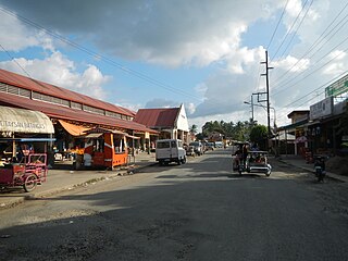
Talisay, officially the Municipality of Talisay, is a 3rd class municipality in the province of Batangas, Philippines. According to the 2020 census, it has a population of 46,238 people.

<span class="mw-page-title-main">Sariaya</span> Municipality in Quezon, Philippines

Sariaya, officially the Municipality of Sariaya, is a 1st class municipality in the province of Quezon, Philippines. According to the 2020 census, it has a population of 161,868 people.

<span class="mw-page-title-main">San Pascual, Batangas</span> Municipality in Batangas, Philippines

San Pascual, officially the Municipality of San Pascual, is a 1st class municipality in the province of Batangas, Philippines. According to the 2020 census, it has a population of 69,009 making it as the 9th most populous municipality in the province.

<span class="mw-page-title-main">Alitagtag</span> Municipality in Batangas, Philippines

Alitagtag, officially the Municipality of Alitagtag, is a 4th class municipality in the province of Batangas, Philippines. According to the 2020 census, it has a population of 26,819 people.

<span class="mw-page-title-main">Balete, Batangas</span> Municipality in Batangas, Philippines

Balete, officially the Municipality of Balete, is a 5th class municipality in the province of Batangas, Philippines. According to the 2020 census, it has a population of 24,055 people. The people from Balete is called Baleteños.

<span class="mw-page-title-main">Cuenca, Batangas</span> Municipality in Batangas, Philippines

Cuenca, officially the Municipality of Cuenca, is a 4th class municipality in the province of Batangas, Philippines. According to the 2020 census, it has a population of 36,235 people.

<span class="mw-page-title-main">Ibaan</span> Municipality in Batangas, Philippines

Ibaan, officially the Municipality of Ibaan, is a 2nd class municipality in the province of Batangas, Philippines. According to the 2020 census, it has a population of 58,507 people.

<span class="mw-page-title-main">Laurel, Batangas</span> Municipality in Batangas, Philippines

Laurel, officially the Municipality of Laurel, is a 3rd class municipality in the province of Batangas, Philippines. According to the 2020 census, it has a population of 43,210 people.

<span class="mw-page-title-main">Lemery, Batangas</span> Municipality in Batangas, Philippines

Lemery, officially the Municipality of Lemery, is a 1st class municipality in the province of Batangas, Philippines. According to the 2020 census, it has a population of 93,186 people.

<span class="mw-page-title-main">Padre Garcia</span> Municipality in Batangas, Philippines

Padre Garcia, officially the Municipality of Padre Garcia, is a 2nd class municipality in the province of Batangas, Philippines. According to the 2020 census, it has a population of 51,853 people.

<span class="mw-page-title-main">Rosario, Batangas</span> Municipality in Batangas, Philippines

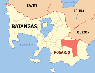
Rosario, officially the Municipality of Rosario, is a 1st class municipality in the province of Batangas, Philippines. According to the 2020 census, it has a population of 128,352 people.

<span class="mw-page-title-main">San Luis, Batangas</span> Municipality in Batangas, Philippines

San Luis, officially the Municipality of San Luis, is a 4th class municipality in the province of Batangas, Philippines. According to the 2020 census, it has a population of 36,172 people.

<span class="mw-page-title-main">San Nicolas, Batangas</span> Municipality in Batangas, Philippines

San Nicolas, officially the Municipality of San Nicolas, is a 5th class municipality in the province of Batangas, Philippines. According to the 2020 census, it has a population of 23,908 people. It is equivalent to 0.15% of the population in the Calabarzon area or 0.82% of the total population of Batangas province. These numbers are used to calculate the population density, which is 1,057 inhabitants per square kilometer or 2,740 inhabitants per square mile. The municipality makes up 0.73% of Batangas's total area, with a land area of 22.61 square kilometers or 8.73 square miles.

<span class="mw-page-title-main">Taal, Batangas</span> Municipality in Batangas, Philippines

Taal, officially the Municipality of Taal, is a 3rd class municipality in the province of Batangas, Philippines. According to the 2020 census, it has a population of 61,460 people.

<span class="mw-page-title-main">Taysan</span> Municipality in Batangas, Philippines

Taysan, officially the Municipality of Taysan, is a 2nd class municipality in the province of Batangas, Philippines. According to the 2020 census, it has a population of 40,146 people.

<span class="mw-page-title-main">Tingloy</span> Municipality in Batangas, Philippines

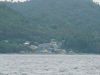
Tingloy, officially the Municipality of Tingloy, is a 5th class municipality in the province of Batangas, Philippines. According to the 2020 census, it has a population of 19,215 people.

<span class="mw-page-title-main">San Antonio, Quezon</span> Municipality in Quezon, Philippines

San Antonio, officially the Municipality of San Antonio, is a 4th class municipality in the province of Quezon, Philippines. According to the 2020 census, it has a population of 35,891 people.

<span class="mw-page-title-main">Tiaong</span> Municipality in Quezon, Philippines

Tiaong, officially the Municipality of Tiaong, is a 1st class municipality in the province of Quezon, Philippines. According to the 2020 census, it has a population of 106,265 people.

References

  1. Municipality of San Juan | (DILG)
  2. "2015 Census of Population, Report No. 3 – Population, Land Area, and Population Density" (PDF). Philippine Statistics Authority. Quezon City, Philippines. August 2016. ISSN   0117-1453. Archived (PDF) from the original on May 25, 2021. Retrieved July 16, 2021.
  3. 1 2 3 4 Census of Population (2020). "Region IV-A (Calabarzon)". Total Population by Province, City, Municipality and Barangay. Philippine Statistics Authority . Retrieved 8 July 2021.{{cite encyclopedia}}: CS1 maint: numeric names: authors list (link)
  4. "PSA Releases the 2018 Municipal and City Level Poverty Estimates". Philippine Statistics Authority. 15 December 2021. Retrieved 22 January 2022.
  5. "A Glimpse of History". sanjuanbatangas.gov.ph.
  6. "The San Juan Batangas Legacy" (PDF). Arch. Leon M. Mayo.
  7. Act No. 2390 (28 February 1914). An Act Changing the names of the municipalities of Santo Niño and Mawanan, Province of Cagayan; San Isidro Labrador and San Isidro de Potot, Province of Pangasinan; San Francisco de Malabon and Santa Cruz de Malabon, Province of Cavite; Nagpartian and San Miguel, Province of Ilocos Norte; Langaran, Province of Misamis; San Pedro Tunasan, Province of Laguna; Cabagan Nuevo, Province of Isabela; Nueva Caceres, Province of Ambos Camarines; San Pedro Macati, Province of Rizal; San Juan de Bocboc, Province of Batangas; San Juan, Province of Nueva Ecija; township of Barrit - Luluno, Province of Ilocos Sur, and of the Barrios of Tublijon and Gibigaan, Municipality of Sorsogon, Province of Sorsogon . Retrieved July 18, 2022.{{cite book}}: CS1 maint: numeric names: authors list (link)
  8. "A Glimpse of History". sanjuanbatangas.gov.ph.
  9. Buhay Batangas (March 3, 2018). "DATES WHEN EACH TOWN OF BATANGAS WAS LIBERATED FROM THE JAPANESE IN WWII". Batangas History. Retrieved August 5, 2021.
  10. "Province: Batangas". PSGC Interactive. Quezon City, Philippines: Philippine Statistics Authority . Retrieved 12 November 2016.
  11. "Municipal: San Juan, Batangas". PSGC Interactive. Quezon City, Philippines: Philippine Statistics Authority . Retrieved 8 January 2016.
  12. 1 2 Census of Population and Housing (2010). "Region IV-A (Calabarzon)" (PDF). Total Population by Province, City, Municipality and Barangay. National Statistics Office . Retrieved 29 June 2016.{{cite encyclopedia}}: CS1 maint: numeric names: authors list (link)
  13. "San Juan: Average Temperatures and Rainfall". Meteoblue. Retrieved 5 May 2020.
  14. Census of Population (2015). "Region IV-A (Calabarzon)". Total Population by Province, City, Municipality and Barangay. Philippine Statistics Authority . Retrieved 20 June 2016.{{cite encyclopedia}}: CS1 maint: numeric names: authors list (link)
  15. Censuses of Population (1903–2007). "Region IV-A (Calabarzon)". Table 1. Population Enumerated in Various Censuses by Province/Highly Urbanized City: 1903 to 2007. National Statistics Office.{{cite encyclopedia}}: CS1 maint: numeric names: authors list (link)
  16. "Province of Batangas". Municipality Population Data. Local Water Utilities Administration Research Division. Retrieved 17 December 2016.
  17. "Poverty incidence (PI):". Philippine Statistics Authority. Retrieved December 28, 2020.
  18. "Estimation of Local Poverty in the Philippines" (PDF). Philippine Statistics Authority. 29 November 2005.
  19. "2003 City and Municipal Level Poverty Estimates" (PDF). Philippine Statistics Authority. 23 March 2009.
  20. "City and Municipal Level Poverty Estimates; 2006 and 2009" (PDF). Philippine Statistics Authority. 3 August 2012.
  21. "2012 Municipal and City Level Poverty Estimates" (PDF). Philippine Statistics Authority. 31 May 2016.
  22. "Municipal and City Level Small Area Poverty Estimates; 2009, 2012 and 2015". Philippine Statistics Authority. 10 July 2019.
  23. "PSA Releases the 2018 Municipal and City Level Poverty Estimates". Philippine Statistics Authority. 15 December 2021. Retrieved 22 January 2022.
  24. "Republic Act No. 7916". Official Gazette of the Republic of the Philippines. 24 February 1995.
  25. "2020 COA Annual Audit Report for San Juan, Batangas". Commission on Audit.
  26. "2019 COA Annual Audit Report for San Juan, Batangas". Commission on Audit.
  27. "2018 COA Annual Audit Report for San Juan, Batangas". Commission on Audit.
  28. "2017 COA Annual Financial Report for Local Government Unit". Commission on Audit.
  29. "2016 COA Annual Financial Report for Local Government Unit". Commission on Audit.
  30. "2015 COA Annual Financial Report for Local Government Unit". Commission on Audit.
  31. "Executive Order No. 904 s. 2010". Official Gazette of the Republic of the Philippines. 29 June 2010.
  32. "San Juan Batangas". sanjuanbatangas.gov.ph. Retrieved 11 December 2016.