Indang Indan | |
|---|---|
| Municipality of Indang | |
 Indang Municipal Hall | |
 Flag  Seal | |
Nicknames:
| |
| Motto: Indang Atin 'to! [1] | |
 Map of Cavite with Indang highlighted | |
OpenStreetMap  | |
 Indang Location within the Philippines | |
| Coordinates: 14°12′N120°53′E / 14.2°N 120.88°E | |
| Country | Philippines |
| Region | Calabarzon |
| Province | Cavite |
| District | 7th district |
| Founded | 1655 |
| Barangays | 36 (see Barangays) |
| Government | |
| • Type | Sangguniang Bayan |
| • Mayor | Perfecto V. Fidel |
| • Vice Mayor | Ismael D. Rodil |
| • Representative | Crispin Diego D. Remulla |
| • Municipal Council | Members |
| • Electorate | 45,647 voters (2022) |
| Area | |
| • Total | 74.90 km2 (28.92 sq mi) |
| Elevation | 325 m (1,066 ft) |
| Highest elevation | 700 m (2,300 ft) |
| Lowest elevation | 49 m (161 ft) |
| Population (2020 census) [4] | |
| • Total | 68,699 |
| • Density | 920/km2 (2,400/sq mi) |
| • Households | 17,012 |
| Demonym(s) | Indangeño, Taga-Indang |
| Economy | |
| • Income class | 1st municipal income class |
| • Poverty incidence | 4.04 |
| • Revenue | ₱ 237.5 million (2020) |
| • Assets | ₱ 478.6 million (2020) |
| • Expenditure | ₱ 219.4 million (2020) |
| • Liabilities | ₱ 170.2 million (2020) |
| Service provider | |
| • Electricity | Manila Electric Company (Meralco) |
| Time zone | UTC+8 (PST) |
| ZIP code | 4122 |
| PSGC | |
| IDD : area code | +63 (0)46 |
| Native languages | Tagalog |
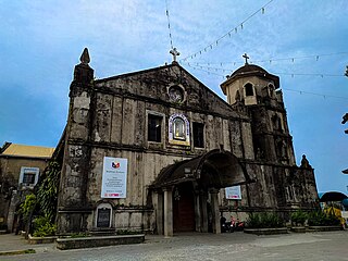
| Major religions | |
| Feast date | September 3 |
| Catholic diocese | Diocese of Imus |
| Patron saint | Saint Gregory the Great |
| Website | www |
Indang, officially the Municipality of Indang (Tagalog : Bayan ng Indang), is a 1st class municipality in the province of Cavite, Philippines. According to the 2020 census, it has a population of 68,699 people. [4]
Contents
- Etymology
- History
- Before 1655: Separation and Independence
- 1896-1897: The Philippine Revolution
- 1906-1998: Cavite State University
- 2008-2015: Tagaytay Water Crisis
- Geography
- Topography
- Elevation
- Climate
- Barangays
- Demographics
- Population
- Languages
- Religion
- Economy
- Agriculture
- Infrastructure
- Transportation
- Utilities
- Government
- Elected officials
- Education
- Cavite State University
- Private schools
- Public elementary schools
- Public secondary schools
- Notable people
- Sister city
- See also
- References
- External links
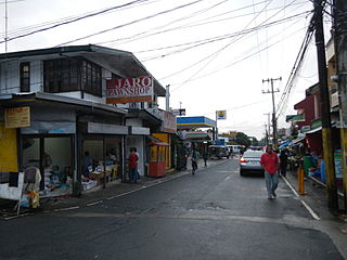
The municipality is situated in the central part of Cavite Province approximately 12 kilometers (7.5 mi) from Tagaytay Ridge. The Municipality consists of the Poblacion and surrounding barangays with a total land area of 8,920 hectares (22,000 acres).