Famy

Last updated
Famy
Municipality of Famy
Famy,Lagunajf9828 19.JPG
Downtown area
Flag of Famy, Laguna.png
Famy Laguna.png
Nickname: 
Home of Bamboo Weavers
Motto: 
Bang Gara Aba!
Anthem: Himno ng Famy & Martsa ng Bayan ng Famy
Ph locator laguna famy.svg
Map of Laguna with Famy highlighted
OpenStreetMap
Famy
Philippines location map (square).svg
Red pog.svg
Famy
Location within the Philippines
Coordinates: 14°26′N121°27′E / 14.43°N 121.45°E / 14.43; 121.45
Country Philippines
Region Calabarzon
Province Laguna
District 4th district
Founded August 15, 1910 [1]
Named for Trinidad Aguinaldo y Famy
Barangays 20 (see Barangays)
Government
[2]
  Type Sangguniang Bayan
   Mayor Lorenzo B. Rellosa
   Vice Mayor Wilfredo M. Valois
   Representative Maria Jamina Katherine B. Agarao
   Municipal Council
Members
   Electorate 14,156 voters (2022)
Area
[3]
  Total53.06 km2 (20.49 sq mi)
Elevation
265 m (869 ft)
Highest elevation
835 m (2,740 ft)
Lowest elevation
1 m (3 ft)
Population
 (2020 census) [4]
  Total16,791
  Density320/km2 (820/sq mi)
   Households
4,189
Economy
   Income class 5th municipal income class
   Poverty incidence
2.78
% (2018) [5]
   Revenue 85.35 million (2020)
   Assets 154.1 million (2020)
   Expenditure 83.92 million (2020)
   Liabilities 62.94 million (2020)
Service provider
  ElectricityFirst Laguna Electric Cooperative (FLECO)
Time zone UTC+8 (PST)
ZIP code
4021
PSGC
IDD : area code +63(0)49
Native languages Tagalog
Website www.famylaguna.gov.ph

Famy, officially the Municipality of Famy (Tagalog : Bayan ng Famy), is a 5th class municipality in the province of Laguna, Philippines. According to the 2020 census, it has a population of 16,791 people, [4] making it the least populated municipality in the province.

Contents

Famy lies in the north-eastern part of the province of Laguna via Manila East Road. It has a total land area of 3.297 square miles (8.54 km2) which is bounded by the town of Real, Quezon, in the east, in the north by Santa Maria, in the west by Mabitac and Santa Maria, and in the south by Siniloan and Mabitac. It is 27 kilometres (17 mi) from the provincial capital, Santa Cruz and 114 kilometres (71 mi) from Manila via South Luzon Expressway crossing the capital town.

History

The history of the town as a barrio of Siniloan dates back to the year 1612 when its natural resources were first exploited by the busy hands of home seekers from Daraitan in Tanay. These home seekers named the place Calumpang, after a big shady Calumpang tree that grows in the heart of the place. [6]

Year after year, the inhabitants of the place increased. People from nearby towns were attracted to the barrio because of the vast area of uncultivated lands. After years of struggle for development, they succeeded in making the lands suitable for food crops. They especially made use of the lowlands where more of the inhabitants settled. Home industries gained interest among women. Spiny bamboos were planted as raw materials for the basket industry that remained an important industry in the present time. [6]

In the year 1835, when the people realized the changes of the place, from the bedlam of wilderness to a barrio worthy of becoming a town, they for the first time, sought to become a municipality with its own government. The plan was rejected because of the meager population of the barrio. The people did not lose hope. Again the prominent men of the barrio tried to secure the separation. Stimulated by the feeling of patriotism, men from the barrio voluntarily presented themselves as revolutionist claiming that they will fight on the side of General Emilio Aguinaldo, if the General will help making the barrio a town. So after the revolution, the President of the Republic of the Philippines ordered that Calumpang be separated from the Municipality of Siniloan. Barrio Calumpang was then renamed Famy. This was in memory of Aguinaldo's mother, Mrs. Trinidad Aguinaldo y Famy. [6]

When the Americans took possession of the Philippines, the form of government automatically changed. With an Executive Order, small towns became barrios of nearby towns. Famy was affected by this order, and again became a barrio of Siniloan in 1903. [7] In spite of these changes the people continued the development of the barrio. They tried their best to increase the area of cultivated lands. The inhabitants of this municipality were not satisfied of being a barrio again of Siniloan, so they filed a request to the Governor General that Famy be a town again, citing that no salary for services rendered will be asked and that the municipal hall and school buildings shall be constructed, all on the help of the town's people. By virtue of this request, the Governor General issued Executive Order No. 60 series of 1910, separating Famy from the Municipality of Siniloan, Laguna. This order took effect on August 15, 1910. [6]

Geography

Barangays

Famy town hall Famyjf0031 06.JPG
Famy town hall

Famy is politically subdivided into 20 barangays. [8] Each barangay consists of puroks and some have sitios.

Climate

Climate data for Famy, Laguna
MonthJanFebMarAprMayJunJulAugSepOctNovDecYear
Average high °C (°F)26
(79)
27
(81)
29
(84)
31
(88)
31
(88)
30
(86)
29
(84)
29
(84)
29
(84)
29
(84)
28
(82)
26
(79)
29
(84)
Average low °C (°F)22
(72)
22
(72)
22
(72)
23
(73)
24
(75)
25
(77)
24
(75)
24
(75)
24
(75)
24
(75)
24
(75)
23
(73)
23
(74)
Average precipitation mm (inches)58
(2.3)
41
(1.6)
32
(1.3)
29
(1.1)
91
(3.6)
143
(5.6)
181
(7.1)
162
(6.4)
172
(6.8)
164
(6.5)
113
(4.4)
121
(4.8)
1,307
(51.5)
Average rainy days13.49.39.19.819.122.926.624.925.021.416.516.5214.5
Source: Meteoblue [9]

Demographics

Population census of Famy
YearPop.±% p.a.
1903 1,262    
1918 1,095−0.94%
1939 1,547+1.66%
1948 1,569+0.16%
1960 4,163+8.47%
1970 4,651+1.11%
1975 5,222+2.35%
1980 5,241+0.07%
1990 7,928+4.23%
1995 9,661+3.77%
2000 10,419+1.63%
2007 13,577+3.72%
2010 15,021+3.75%
2015 16,587+1.91%
2020 16,791+0.24%
Source: Philippine Statistics Authority [10] [11] [12] [13]

In the 2020 census, the population of Famy, Laguna, was 16,791 people, [4] with a density of 320 inhabitants per square kilometre or 830 inhabitants per square mile.

Economy

Bus Route

Related Research Articles

<span class="mw-page-title-main">Mabitac</span> Municipality in Laguna, Philippines

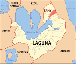
Mabitac, officially the Municipality of Mabitac, is a 5th class municipality in the province of Laguna, Philippines. According to the 2020 census, it has a population of 21,275 people.

<span class="mw-page-title-main">Pagsanjan</span> Municipality in Laguna, Philippines

Pagsanjan, officially the Municipality of Pagsanjan, is a 3rd class municipality in the province of Laguna, Philippines. According to the 2020 census, it has a population of 44,327 people.

<span class="mw-page-title-main">Victoria, Laguna</span> Municipality in Laguna, Philippines

Victoria, officially the Municipality of Victoria, is a 4th class municipality in the province of Laguna, Philippines. According to the 2020 census, it has a population of 43,408 people.

<span class="mw-page-title-main">Rizal, Laguna</span> Municipality in Laguna, Philippines

Rizal, officially the Municipality of Rizal, is a 5th class municipality in the province of Laguna, Philippines. According to the 2020 census, it has a population of 18,332 people.

<span class="mw-page-title-main">Calauan</span> Municipality in Laguna, Philippines

Calauan, officially the Municipality of Calauan, is a 2nd class municipality in the province of Laguna, Philippines. The municipality has a land area of 25.25 square miles which constitutes 3.41% of Laguna's total area. According to the 2020 census, it has a population of 87,693 people.

<span class="mw-page-title-main">Luisiana</span> Municipality in Laguna, Philippines

Luisiana, officially the Municipality of Luisiana, is a 4th class municipality in the province of Laguna, Philippines. According to the 2020 census, it has a population of 20,859 people.

<span class="mw-page-title-main">Magdalena, Laguna</span> Municipality in Laguna, Philippines

Magdalena, officially the Municipality of Magdalena, is a 4th class municipality in the province of Laguna, Philippines. According to the 2020 census, it has a population of 27,816 people.

<span class="mw-page-title-main">Pakil</span> Municipality in Laguna, Philippines

Pakil, officially the Municipality of Pakil, is a 5th class municipality in the province of Laguna, Philippines. According to the 2020 census, it has a population of 23,495 people.

<span class="mw-page-title-main">Santa Cruz, Laguna</span> Capital of Laguna, Philippines

Santa Cruz, officially the Municipality of Santa Cruz, is a 1st class municipality and capital of the province of Laguna, Philippines. According to the 2020 census, it has a population of 123,574 people.

<span class="mw-page-title-main">Siniloan</span> Municipality in Laguna, Philippines

Siniloan, officially the Municipality of Siniloan, is a 2nd class municipality in the province of Laguna, Philippines. According to the 2020 census, it has a population of 39,460 people.

<span class="mw-page-title-main">Kawit</span> Municipality in Cavite, Philippines

Kawit, officially the Municipality of Kawit, is a 1st class municipality in the province of Cavite, Philippines. According to the 2020 census, it has a population of 107,535. It is one of the notable places that had a major role in the country's history during the 1800s and 1900s.

<span class="mw-page-title-main">Jalajala</span> Municipality in Rizal, Philippines

Jalajala, officially the Municipality of Jalajala, is a 4th class municipality in the province of Rizal, Philippines. According to the 2020 census, it has a population of 34,017 people.

<span class="mw-page-title-main">Pililla</span> Municipality in Rizal, Philippines

Pililla, officially the Municipality of Pililla, is a 1st class municipality in the province of Rizal, Philippines. According to the 2020 census, it has a population of 71,535 people. It is surrounded by farms, small mountains, plains, and trees. Pililla is known as the Green Field Municipality of Rizal.

<span class="mw-page-title-main">General Emilio Aguinaldo, Cavite</span> Municipality in Cavite, Philippines

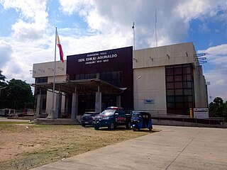
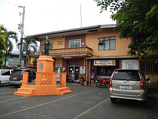
General Emilio Aguinaldo, officially the Municipality of General Emilio Aguinaldo, is a 5th class municipality in the province of Cavite, Philippines. According to the 2020 census, it has a population of 23,973 people.

<span class="mw-page-title-main">Taysan</span> Municipality in Batangas, Philippines

Taysan, officially the Municipality of Taysan, is a 2nd class municipality in the province of Batangas, Philippines. According to the 2020 census, it has a population of 40,146 people.

<span class="mw-page-title-main">General Luna, Quezon</span> Municipality in Quezon, Philippines

General Luna, officially the Municipality of General Luna, is a 4th class municipality in the province of Quezon, Philippines. According to the 2020 census, it has a population of 24,804 people.

<span class="mw-page-title-main">Perez, Quezon</span> Municipality in Quezon, Philippines

Perez, officially the Municipality of Perez, is a 5th class municipality in the province of Quezon, Philippines. According to the 2020 census, it has a population of 12,767 people.

<span class="mw-page-title-main">Plaridel, Quezon</span> Municipality in Quezon, Philippines

Plaridel, officially the Municipality of Plaridel, is a 5th class municipality in the province of Quezon, Philippines. According to the 2020 census, it has a population of 10,129 people.

<span class="mw-page-title-main">Santa Maria, Laguna</span> Municipality in Laguna, Philippines

Santa Maria, officially the Municipality of Santa Maria, is a 2nd class municipality in the province of Laguna, Philippines. According to the 2020 census, it has a population of 34,511 people.

<span class="mw-page-title-main">Quezon, Palawan</span> Municipality in Palawan, Philippines

Quezon, named by the late President Manuel L. Quezon and officially named the Municipality of Quezon, is a first-class municipality in the province of Palawan, Philippines. According to the 2020 census, it has a population of 65,283 people.

References

  1. "Amabell Buenzalida". Facebook .
  2. Municipality of Famy | (DILG)
  3. "2015 Census of Population, Report No. 3 – Population, Land Area, and Population Density" (PDF). Philippine Statistics Authority. Quezon City, Philippines. August 2016. ISSN   0117-1453. Archived (PDF) from the original on May 25, 2021. Retrieved July 16, 2021.
  4. 1 2 3 Census of Population (2020). "Region IV-A (Calabarzon)". Total Population by Province, City, Municipality and Barangay. Philippine Statistics Authority . Retrieved 8 July 2021.
  5. "PSA Releases the 2018 Municipal and City Level Poverty Estimates". Philippine Statistics Authority. 15 December 2021. Retrieved 22 January 2022.
  6. 1 2 3 4 "Mabitac". Government of the Philippines Department of the Interior. 8 May 2014. Retrieved 1 November 2020.PD-icon.svg This article incorporates text from this source, which is in the public domain .
  7. Act No. 939 (12 October 1903). An Act reducing the thirty municipalities of the Province of La Laguna to nineteen . Retrieved June 15, 2023.
  8. Philippine Standard Geographic Code listing for Famy – National Statistical Coordination Board
  9. "Famy: Average Temperatures and Rainfall". Meteoblue. Retrieved 11 May 2020.
  10. Census of Population (2015). "Region IV-A (Calabarzon)". Total Population by Province, City, Municipality and Barangay. Philippine Statistics Authority . Retrieved 20 June 2016.
  11. Census of Population and Housing (2010). "Region IV-A (Calabarzon)" (PDF). Total Population by Province, City, Municipality and Barangay. National Statistics Office . Retrieved 29 June 2016.
  12. Censuses of Population (1903–2007). "Region IV-A (Calabarzon)". Table 1. Population Enumerated in Various Censuses by Province/Highly Urbanized City: 1903 to 2007. National Statistics Office.
  13. "Province of Laguna". Municipality Population Data. Local Water Utilities Administration Research Division. Retrieved 17 December 2016.
  14. "Poverty incidence (PI):". Philippine Statistics Authority. Retrieved December 28, 2020.
  15. "Estimation of Local Poverty in the Philippines" (PDF). Philippine Statistics Authority. 29 November 2005.
  16. "2003 City and Municipal Level Poverty Estimates" (PDF). Philippine Statistics Authority. 23 March 2009.
  17. "City and Municipal Level Poverty Estimates; 2006 and 2009" (PDF). Philippine Statistics Authority. 3 August 2012.
  18. "2012 Municipal and City Level Poverty Estimates" (PDF). Philippine Statistics Authority. 31 May 2016.
  19. "Municipal and City Level Small Area Poverty Estimates; 2009, 2012 and 2015". Philippine Statistics Authority. 10 July 2019.
  20. "PSA Releases the 2018 Municipal and City Level Poverty Estimates". Philippine Statistics Authority. 15 December 2021. Retrieved 22 January 2022.