Carthage, Indiana

Last updated
Carthage, Indiana
Town of Carthage
Carthage, Indiana.jpg
Rush County Indiana Incorporated and Unincorporated areas Carthage Highlighted 1810612.svg
Location of Carthage in Rush County, Indiana.
Coordinates: 39°44′13″N85°34′17″W / 39.73694°N 85.57139°W / 39.73694; -85.57139
Country United States
State Indiana
County Rush
Township Ripley
Area
[1]
  Total0.56 sq mi (1.46 km2)
  Land0.56 sq mi (1.46 km2)
  Water0.00 sq mi (0.00 km2)
Elevation
[2]
879 ft (268 m)
Population
 (2020)
  Total918
  Density1,624.78/sq mi (627.10/km2)
Time zone UTC-5 (EST)
  Summer (DST) UTC-5 (EST)
ZIP code
46115
Area code 765
FIPS code 18-10612 [3]
GNIS feature ID2396629 [2]
Website https://carthagein.net/

Carthage is a town in Ripley Township, Rush County, Indiana, United States, located along the Big Blue River. The population was 927 at the 2010 census.

Contents

History

Carthage was platted in 1834. [4] The town was named after Carthage, North Carolina. [5] A post office has been in operation at Carthage since 1835. [6]

The Henry Henley Public Library was listed on the National Register of Historic Places in 2016. [7]

Geography

According to the 2010 census, Carthage has a total area of 0.58 square miles (1.50 km2), all land. [8]

Education

The town is served by the Charles A. Beard Memorial School Corporation school district, based at Knightstown in Henry County to the north. Local elementary students attended Carthage Elementary School until its closure in 2014.

The town has a lending library, the Henry Henley Public Library, one of two public libraries in Rush County. [9]

Demographics

Historical population
CensusPop.Note
1870 481
1880 5004.0%
1890 482−3.6%
1900 1,028113.3%
1910 873−15.1%
1920 9023.3%
1930 9313.2%
1940 9370.6%
1950 1,06513.7%
1960 1,043−2.1%
1970 946−9.3%
1980 886−6.3%
1990 8870.1%
2000 9284.6%
2010 927−0.1%
2020 918−1.0%
U.S. Decennial Census [10]

2010 census

As of the census [11] of 2010, there were 927 people, 351 households, and 251 families living in the town. The population density was 1,598.3 inhabitants per square mile (617.1/km2). There were 411 housing units at an average density of 708.6 per square mile (273.6/km2). The racial makeup of the town was 98.6% White, 0.2% Native American, 0.2% Asian, and 1.0% from two or more races. Hispanic or Latino of any race were 0.3% of the population.

There were 351 households, of which 39.6% had children under the age of 18 living with them, 49.9% were married couples living together, 15.4% had a female householder with no husband present, 6.3% had a male householder with no wife present, and 28.5% were non-families. 25.4% of all households were made up of individuals, and 11.1% had someone living alone who was 65 years of age or older. The average household size was 2.64 and the average family size was 3.10.

The median age in the town was 37.3 years. 28.2% of residents were under the age of 18; 6.9% were between the ages of 18 and 24; 26.5% were from 25 to 44; 26.6% were from 45 to 64; and 11.8% were 65 years of age or older. The gender makeup of the town was 49.9% male and 50.1% female.

2000 census

As of the census [3] of 2000, there were 928 people, 373 households, and 255 families living in the town. The population density was 1,616.3 inhabitants per square mile (624.1/km2). There were 391 housing units at an average density of 681.0 per square mile (262.9/km2). The racial makeup of the town was 97.95% White, 0.22% Native American, 1.08% from other races, and 0.75% from two or more races. Hispanic or Latino of any race were 1.51% of the population.

There were 373 households, out of which 36.2% had children under the age of 18 living with them, 58.2% were married couples living together, 7.2% had a female householder with no husband present, and 31.6% were non-families. 27.9% of all households were made up of individuals, and 16.1% had someone living alone who was 65 years of age or older. The average household size was 2.49 and the average family size was 3.03.

In the town, the population was spread out, with 26.6% under the age of 18, 8.1% from 18 to 24, 31.9% from 25 to 44, 19.6% from 45 to 64, and 13.8% who were 65 years of age or older. The median age was 36 years. For every 100 females there were 95.4 males. For every 100 females age 18 and over, there were 91.8 males.

The median income for a household in the town was $35,417, and the median income for a family was $40,333. Males had a median income of $31,618 versus $21,875 for females. The per capita income for the town was $15,598. About 6.0% of families and 7.2% of the population were below the poverty line, including 5.1% of those under age 18 and 13.3% of those age 65 or over.

Notable people

Related Research Articles

<span class="mw-page-title-main">Odon, Indiana</span> Town in Indiana, United States

Odon is a town in Madison Township, Daviess County, Indiana, United States. The population was 1,354 at the 2010 census.

<span class="mw-page-title-main">Glenwood, Indiana</span> Town in Indiana, United States

Glenwood is a town in Fairview and Orange townships, Fayette County and Union Township, Rush County in the U.S. state of Indiana. The population was 250 at the 2010 census.

<span class="mw-page-title-main">Converse, Indiana</span> Town in Indiana, United States

Converse is a town in Richland Township, Grant County, and Jackson Township, Miami County, in the U.S. state of Indiana. The population was 1,161 at the 2020 census.

<span class="mw-page-title-main">Palmyra, Indiana</span> Town in Indiana, United States

Palmyra is a town in Morgan Township, Harrison County, Indiana, United States. The population was 930 at the 2010 census.

<span class="mw-page-title-main">Coatesville, Indiana</span> Town in Indiana, United States

Coatesville is a town in Clay Township, Hendricks County, Indiana, United States. The population was 523 at the 2010 Census.

<span class="mw-page-title-main">Spiceland, Indiana</span> Town in Indiana, United States

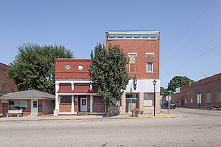
Spiceland is a town in Spiceland Township, Henry County, Indiana, United States. The population was 890 at the 2010 census.

<span class="mw-page-title-main">Andrews, Indiana</span> Town in Indiana, United States

Andrews is a town in Dallas Township, Huntington County, Indiana, United States. The population was 1,048 at the 2020 census.

<span class="mw-page-title-main">Medora, Indiana</span> Town in Indiana, United States

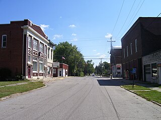
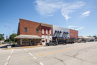
Medora is a town in Carr Township, Jackson County, Indiana, United States. The population was 693 at the 2010 census.

<span class="mw-page-title-main">Mentone, Indiana</span> Town in Indiana, United States

Mentone is a town in Harrison and Franklin townships, Kosciusko County, in the U.S. state of Indiana. Mentone is the self-proclaimed "Egg Basket of the Midwest" because of prolific commercial egg production in the area, and holds an Egg Festival annually in early June to celebrate its heritage. A large concrete egg stands near the town center and is considered locally to be the "Largest Egg in the World". The Lawrence D. Bell Aircraft Museum, is located within the town limits. The Popular Rotorcraft Association has its home at the PRA Mentone Airport C92) and is home to their annual fly-in convention.

<span class="mw-page-title-main">Syracuse, Indiana</span> Town in Indiana, United States

Syracuse is a town in Turkey Creek Township, Kosciusko County, in the U.S. state of Indiana. The population was 3,079 at the 2020 census. Syracuse is the location of Lake Syracuse and the nearby, larger Lake Wawasee, in addition to several other lakes in the region. The National Weather Service operates a Weather Forecast Office in the town. It serves Northern Indiana.

<span class="mw-page-title-main">Topeka, Indiana</span> Town in Indiana, United States

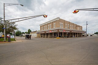
Topeka is a town in Clearspring and Eden townships, LaGrange County, Indiana, United States. The population was 1,153 at the 2010 census. Topeka is located approximately eleven miles south of Shipshewana, Indiana.

<span class="mw-page-title-main">Wanatah, Indiana</span> Town in Indiana, United States

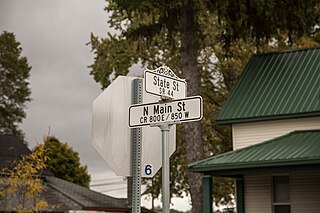
Wanatah is a town in LaPorte County, Indiana, United States. The population was 1,048 at the 2010 census.

<span class="mw-page-title-main">Lynn, Indiana</span> Town in Indiana, United States

Lynn is a town in Washington Township, Randolph County, in the U.S. state of Indiana. The population was 1,097 at the 2010 census.

<span class="mw-page-title-main">Ridgeville, Indiana</span> Town in Indiana, United States

Ridgeville is a town in Franklin Township, Randolph County, Indiana, United States, along the Mississinewa River. The population was 688 at the 2020 census.

<span class="mw-page-title-main">Saratoga, Indiana</span> Town in Indiana, United States

Saratoga is a town in Ward Township, Randolph County, in the U.S. state of Indiana. The population was 254 at the 2010 census.

<span class="mw-page-title-main">Rushville, Indiana</span> City in Indiana, United States

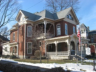
Rushville is a city in Rushville Township, Rush County, in the U.S. state of Indiana. The population was 6,185 at the 2020 census. The city is the county seat of Rush County. It, like the county, was named in honor of Dr. Benjamin Rush, who signed the Declaration of Independence.

<span class="mw-page-title-main">Hamlet, Indiana</span> Town in Starke County, Indiana, United States

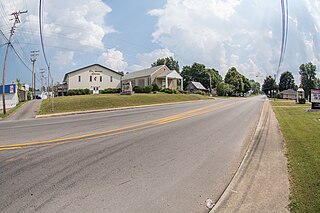
Hamlet is a town in Davis and Oregon Townships, Starke County, in the U.S. state of Indiana. The population was 800 as of the 2010 census.

<span class="mw-page-title-main">Dublin, Indiana</span> Town in Indiana, United States

Dublin is a town in Jackson Township, Wayne County, in the U.S. state of Indiana. The population was 679 at the 2020 census.

<span class="mw-page-title-main">Carthage, Maine</span> Town in the state of Maine, United States

Carthage is a town in Franklin County, Maine, United States. The population was 509 at the 2020 census.

<span class="mw-page-title-main">Orleans, Indiana</span> Town in Indiana, United States

Orleans is a town in Orleans Township, Orange County, in the U.S. state of Indiana. The population was 2,142 at the 2010 census.

References

  1. "2020 U.S. Gazetteer Files". United States Census Bureau. Retrieved March 16, 2022.
  2. 1 2 U.S. Geological Survey Geographic Names Information System: Carthage, Indiana
  3. 1 2 "U.S. Census website". United States Census Bureau . Retrieved 2008-01-31.
  4. History of Rush County, Indiana: From the Earliest Time to the Present, with Biographical Sketches, Notes, Etc. Eastern Indiana Publishing Company. 1888. p. 660.
  5. Baker, Ronald L. (October 1995). From Needmore to Prosperity: Hoosier Place Names in Folklore and History. Indiana University Press. p. 88. ISBN   978-0-253-32866-3. ...named for Carthage, North Carolina, home of Quaker settlers.
  6. "Rush County". Jim Forte Postal History. Retrieved 1 December 2015.
  7. "National Register of Historic Places Program". National Park Service. Retrieved 15 March 2018.
  8. "G001 - Geographic Identifiers - 2010 Census Summary File 1". United States Census Bureau. Archived from the original on 2020-02-13. Retrieved 2015-07-13.
  9. "Indiana public library directory" (PDF). Indiana State Library. Archived from the original (PDF) on 18 February 2017. Retrieved 15 March 2018.
  10. "Census of Population and Housing". Census.gov. Retrieved June 4, 2015.
  11. "U.S. Census website". United States Census Bureau . Retrieved 2012-12-11.