Chalmers, Indiana

Last updated

Chalmers, Indiana
Chalmers Indiana South Downtown.jpg
Downtown Chalmers
White County Indiana Incorporated and Unincorporated areas Chalmers Highlighted 1811944.svg
Location of Chalmers in White County, Indiana.
Coordinates: 40°39′45″N86°52′04″W / 40.66250°N 86.86778°W / 40.66250; -86.86778 [1]
Country United States
State Indiana
County White
Township Big Creek
Platted 1873
Incorporated 1892
Founded byJacob Raub
Government
  Type Town council
  PresidentRenee Collier
  Vice PresidentMarcus King
  Town MarshalJared Baer
Area
[2]
  Total0.30 sq mi (0.78 km2)
  Land0.30 sq mi (0.78 km2)
  Water0.00 sq mi (0.00 km2)
Elevation
[1]
715 ft (218 m)
Population
 (2020)
  Total523
  Density1,731.79/sq mi (668.77/km2)
Time zone UTC-5 (EST)
  Summer (DST) UTC-4 (EDT)
ZIP code
47929
Area code Area code 219
FIPS code 18-11944 [3]
GNIS feature ID2396638 [1]
Website chalmers.in.gov

Chalmers is a town in Big Creek Township, White County in the U.S. state of Indiana. [1] Its population was 508 at the 2010 census.

Contents

History

Chalmers historic railway Chalmers historic railway.jpg
Chalmers historic railway

Chalmers dates back to the early 1850s. Land was donated by Gardner Mudge to the Chicago, Indianapolis and Louisville Railway in 1854 after the company constructed a rail line through Big Creek in 1853. Mudge and his brother-in-law operated a general store. On April 21, 1854, a Post Office was established with Mudge serving as postmaster.

Chalmers was platted on July 24, 1873; it included 103 lots on six streets. Several homes and stores were erected, and a school was constructed in the early 1870s. The first church was organized in 1878, and a tile factory was erected in the same year. The Bank of Chalmers was established by Jacob Raub in the early 1890s with a capital of $10,000. Chalmers became an incorporated town in 1892. "The Ledger" served as the first community newspaper, published initially in 1893. In 1895, a train station which later became a symbol of the town's history was constructed. The village was originally known by many as "Mudge's Station," after Gardner Mudge. The name "Chalmers" was listed on railroad timetables of New Albany and Salem as early as 1856. By 1912, Chalmers had approximately 600 residents. It consisted of two grain elevators, a factory, fifteen stores, two banks, two livery barns, three blacksmith shops, a lumber yard, two hotels, two garages, and dozens of homes.
Although the depot was demolished in 1976, the railroad which passes through Chalmers is still in use and is operated by CSX Transportation. [4] [5]
An archive of the town's history is maintained by the Chalmers Historical Society.

Geography

According to the 2010 census, it has a total area of 0.25 square miles (0.65 km2), all land. [6]

Climate

According to the Köppen Climate Classification system, Chalmers has a hot-summer humid continental climate, abbreviated "Dfa" on climate maps. The hottest temperature recorded in Chalmers was 102 °F (38.9 °C) on June 27, 2005, and July 8, 2012, while the coldest temperature recorded was −22 °F (−30.0 °C) on January 3, 2018. [7]

Climate data for Chalmers, Indiana, 1991–2020 normals, extremes 2000–present
MonthJanFebMarAprMayJunJulAugSepOctNovDecYear
Record high °F (°C)68
(20)
73
(23)
85
(29)
89
(32)
96
(36)
102
(39)
102
(39)
98
(37)
89
(32)
93
(34)
79
(26)
69
(21)
102
(39)
Mean maximum °F (°C)54.3
(12.4)
55.7
(13.2)
69.9
(21.1)
80.6
(27.0)
89.7
(32.1)
93.1
(33.9)
91.8
(33.2)
91.3
(32.9)
91.2
(32.9)
84.0
(28.9)
69.5
(20.8)
59.1
(15.1)
95.5
(35.3)
Mean daily maximum °F (°C)31.2
(−0.4)
35.5
(1.9)
47.4
(8.6)
60.8
(16.0)
72.0
(22.2)
81.0
(27.2)
83.0
(28.3)
81.8
(27.7)
76.9
(24.9)
64.5
(18.1)
49.5
(9.7)
36.8
(2.7)
60.0
(15.6)
Daily mean °F (°C)23.7
(−4.6)
27.2
(−2.7)
37.8
(3.2)
49.4
(9.7)
60.6
(15.9)
70.0
(21.1)
72.3
(22.4)
70.7
(21.5)
64.6
(18.1)
53.0
(11.7)
40.3
(4.6)
29.4
(−1.4)
49.9
(10.0)
Mean daily minimum °F (°C)16.2
(−8.8)
18.9
(−7.3)
28.3
(−2.1)
38.0
(3.3)
49.2
(9.6)
59.1
(15.1)
61.7
(16.5)
59.6
(15.3)
52.2
(11.2)
41.4
(5.2)
31.0
(−0.6)
22.0
(−5.6)
39.8
(4.3)
Mean minimum °F (°C)−5.7
(−20.9)
−5.1
(−20.6)
11.5
(−11.4)
24.3
(−4.3)
34.8
(1.6)
47.9
(8.8)
51.7
(10.9)
49.8
(9.9)
41.4
(5.2)
27.9
(−2.3)
15.6
(−9.1)
4.1
(−15.5)
−11.3
(−24.1)
Record low °F (°C)−22
(−30)
−20
(−29)
−7
(−22)
15
(−9)
27
(−3)
37
(3)
43
(6)
43
(6)
34
(1)
23
(−5)
3
(−16)
−11
(−24)
−22
(−30)
Average precipitation inches (mm)2.54
(65)
2.06
(52)
2.78
(71)
3.93
(100)
4.26
(108)
5.54
(141)
4.50
(114)
4.04
(103)
3.00
(76)
3.07
(78)
2.91
(74)
2.36
(60)
40.99
(1,042)
Average snowfall inches (cm)6.6
(17)
6.2
(16)
2.5
(6.4)
0.4
(1.0)
0.0
(0.0)
0.0
(0.0)
0.0
(0.0)
0.0
(0.0)
0.0
(0.0)
0.0
(0.0)
0.5
(1.3)
4.1
(10)
20.3
(51.7)
Average precipitation days (≥ 0.01 in)10.39.410.912.112.711.710.39.48.69.510.311.0126.2
Average snowy days (≥ 0.1 in)4.94.21.90.30.00.00.00.00.00.00.53.315.1
Source 1: NOAA [8]
Source 2: National Weather Service (mean maxima/minima 20062020) [7]

Demographics

Historical population
CensusPop.Note
1900 462
1910 51311.0%
1920 5282.9%
1930 510−3.4%
1940 475−6.9%
1950 5086.9%
1960 5487.9%
1970 544−0.7%
1980 5541.8%
1990 525−5.2%
2000 513−2.3%
2010 508−1.0%
2020 5233.0%
U.S. Decennial Census [9]

2010 census

As of the census [10] of 2010, there were 508 people, 203 households, and 137 families residing in the town. The population density was 2,032.0 inhabitants per square mile (784.6/km2). There were 226 housing units at an average density of 904.0 per square mile (349.0/km2). The racial makeup of the town was 97.0% White, 0.2% Asian, 1.8% from other races, and 1.0% from two or more races. Hispanic or Latino of any race were 2.2% of the population.

There were 203 households, of which 33.5% had children under the age of 18 living with them, 53.7% were married couples living together, 10.3% had a female householder with no husband present, 3.4% had a male householder with no wife present, and 32.5% were non-families. 28.6% of all households were made up of individuals, and 13.8% had someone living alone who was 65 years of age or older. The average household size was 2.50 and the average family size was 3.07.

The median age in the town was 40.1 years. 25% of residents were under the age of 18; 7.6% were between the ages of 18 and 24; 26.2% were from 25 to 44; 27.9% were from 45 to 64; and 13.2% were 65 years of age or older. The gender makeup of the town was 49.0% male and 51.0% female.

2000 census

As of the census [3] of 2000, there were 513 people, 185 households, and 133 families residing in the town. The population density was 2,055.7 inhabitants per square mile (793.7/km2). There were 190 housing units at an average density of 761.4 per square mile (294.0/km2). The racial makeup of the town was 99.61% White, and 0.39% from two or more races. Hispanic or Latino of any race were 1.17% of the population.

There were 185 households, out of which 40.0% had children under the age of 18 living with them, 60.5% were married couples living together, 8.6% had a female householder with no husband present, and 28.1% were non-families. 23.2% of all households were made up of individuals, and 13.0% had someone living alone who was 65 years of age or older. The average household size was 2.77 and the average family size was 3.32.

In the town, the population was spread out, with 31.6% under the age of 18, 7.2% from 18 to 24, 32.4% from 25 to 44, 18.9% from 45 to 64, and 9.9% who were 65 years of age or older. The median age was 33 years. For every 100 females, there were 91.4 males. For every 100 females age 18 and over, there were 90.8 males.

The median income for a household in the town was $51,591, and the median income for a family was $55,833. Males had a median income of $31,667 versus $21,518 for females. The per capita income for the town was $19,258. About 5.4% of families and 3.6% of the population were below the poverty line, including 4.9% of those under age 18 and 7.7% of those age 65 or over.

Government

Chalmers has a community-operated government and is managed by a small town council.

Town Hall

The Chalmers Town Hall is in a building that is also a firehouse for the Chalmers Volunteer Fire Department. It is on Walnut Street, next to the community basketball court and the Chalmers Community Church. It is used for council and board meetings, and it's the office of the town's clerk-treasurer.

Town Council

Regular council meetings are held at the Chalmers Town Hall. Meetings are held the 2nd and 4th Tuesday of each month at 6:30 pm. Current officials include the following:[ citation needed ]

Public Safety

Public involvement

Chalmers Town Council meetings are open to the public on a monthly basis. They occur on the second and fourth Tuesday of each month at 6:30 PM Eastern Time in the Chalmers Town Hall. Residents are welcome to join and observe these meetings. In addition, each meeting is initiated with a comment session for residents to ask questions or state concerns for the council to address.

Commercial revitalization

As of September 2013, the Chalmers town council is working cooperatively with a committee of residents who have a mission to promote commerce in Chalmers, particularly in its downtown square. The committee is working to better qualify Chalmers for the Indiana Main Street (IMS) program, an economic revitalization assistance organization. The program may assist communities like Chalmers by aiding them with downtown enhancement grants. [11]

Education

Frontier Jr./Sr. High School Frontier Jr. Sr. High School Sign.jpg
Frontier Jr./Sr. High School

Preschool

The Discovering H.A.N.D.S. Preschool is a nonprofit ministry of the local Chalmers Community Church. It operates out of the church facility. H.A.N.D.S. stands for "Hearts and Attitudes are Nurtured while Discovering the Savior." [12]

Primary and secondary

Frontier School Corporation, a public school system, is headquartered in Downtown Chalmers. Most Chalmers students are enrolled in this district. Its single secondary school, Frontier Jr./Sr. High School, was formed to replace the former Chalmers High School as well as the schools in Brookston. Elementary-level children attend the primary school of the same corporation in Brookston, Frontier Elementary School. For the 2012-2013 school year, Frontier was honored as a grade "A" school corporation by the Indiana Department of Education. [13]

Arts and culture

Chalmers is a small community known to have cheerful hospitality. [14]

Chalmers Community Day

For years, an annual festival known as Chalmers Community Day has occurred each summer. It includes a pancake breakfast and a pork dinner, hosted by the volunteer fire department. A car show often takes place at the Downtown square and a motorcycle show at Chalmers Community Park. [14] Many residents conduct garage sales and yard sales at their homes during this event, giving it the nickname "Garage Sale Day." Outsiders, many of which reside in the surrounding towns and cities, visit the town to attend this annual event.

Wind farm

A large fraction of Meadow Lake Wind Farm, one of the largest onshore wind farms in the world, is located just west of Chalmers. The first turbine in the farm was constructed northwest of Chalmers and was visible from the north edge of the town. Today, the turbines can be spotted from within the town. The wind farm attracts tourists and has sparked a trend of turbine appearances in local art and photography. Following the construction of wind turbines near I-65, the traffic of the Chalmers Interstate exit increased substantially. Plans have been made for a tourism center near that Interstate exit. In addition to cultural impact, the wind farm has affected the local economy due to the farmland leasing involved with turbine placement.

Chalmers Historical Museum

A group of locals has expressed interest in the history of Chalmers, much of which seems to be missing. As a result, a committee of residents organized the Chalmers Historical Society which aims to recover and collect historical documents such as photos, yearbooks, newspapers, films, and artifacts. Volunteers also record audio interviews with current and former long-term residents of the town.

This Chalmers Historical Society hopes to soon operate a small museum which would showcase the physical and digital media collected by the committee. As of 2016, a former insurance agency office at 114 E. Main St. in Downtown Chalmers is being renovated for this purpose. Once completed, committee members and other volunteers will supervise the facility and allow public browsing on weekends and during special occasions.

The society and its museum are financed solely by benefactors. Most of the collection is recovered through donation as well.

Parks and recreation

The playground at Chalmers Community Park with a softball fields in the background Chalmers Indiana Park Playground.jpg
The playground at Chalmers Community Park with a softball fields in the background

Chalmers Community Park

A pavilion at Chalmers Community Park Chalmers Community Park Pavilion.jpg
A pavilion at Chalmers Community Park

In the town is an outdoor complex called Chalmers Community Park, [15] which features several recreational points of interest. It is a common location for seasonal sports competitions and everyday outdoor activities. The park is located on an alley with parking space.

Activities

A playground includes various swings, slides, see-saws, a merry-go-round, and other climbing structures. The complex also includes two fenced softball fields, one multi-use (soccer) field, a beach-style volleyball court, and horseshoe tossing pits.

Buildings

The park has a pavilion shelter, which includes a concession stand, trash cans, picnic tables, and a drinking fountain. The pavilion can be rented for special occasions such as birthday parties and reunions. Electrical outlets are provided. A small building west of the playground contains restrooms. Contact Chalmers Town Hall to rent the pavilion.

Walking trails and landscaping at Chalmers Community Park Chalmers Indiana walking trail north.jpg
Walking trails and landscaping at Chalmers Community Park

Trails

In the park is a network of connected walking trails. Overall, the walking park consists of 3,500 feet of trail. Originally chip seal, the trails were recently resurfaced with recycled asphalt from Indiana State Road 43. The park allows pets and encourages dog walking on these trails. Along the trails are several rest areas which include benches, trash cans, and community-planted flowers. From the trails, one can see to the horizon over the surrounding farmland.

Management

The complex is maintained by a community management board. Park board meetings occur each month at the Chalmers Town Hall and are regularly open to the public. [15]

Future plans

The park board plans to make considerable improvements to Chalmers Community Park. The currently separate restrooms will be converted to unisex. The park's signs will be replaced. Lighting will be installed throughout the walking trails, allowing residents to utilize the park after dusk. Hundreds of new trees and shrubs are planned for purchase to be planted throughout the trails. Additionally, residents who adopt garden plots in the trails will be recognized by plaques. At least one new shelter will be constructed on the opposite side of the park as the current pavilion. Additional restroom facilities will be installed in the shelters. New basketball and volleyball courts will be installed.

Basketball court

There is a community basketball court on Walnut Street east of the town hall and fire station. The court is lighted during dark hours.

Downtown park

In September 2013, the Chalmers Civic Club announced its intention to transform a vacant lot in Downtown Chalmers into a small outdoor park area. The lot is located immediately east of the post office. The new park was to provide a reading and lounging area with covered seating. It would also significantly improve the ambience of Downtown. The Civic Club hopes that it will spark other cosmetic improvements in the area as well.

By November, the lot was cleared and the post office wall was primed for a future mural. New sidewalks and other cement work was installed, and decorative stone was laid. The following spring, the project resumed. A custom gazebo was constructed on the cement platform in the center of the lot, providing covered seating. Trash cans and flower boxes were also placed.

In 2013, the Civic Club approached the Art Club at Frontier Jr./Sr. High School about incorporating local student art into the project. They also hoped that this would spark youthful interest in community betterment. The Art Club volunteered to paint a mural on the exterior of the post office. The mural, now complete, is modeled on a black-and-white photograph of the Chalmers depot with an approaching steam locomotive. The date of the photograph is unknown. Atop the mural is the text, "Mudge's Station," a historical name for the town. In 2015, the Art Club began working on a second mural which paints a vision of Chalmers's vibrant past. It is modeled on a color photograph of Downtown Chalmers in its prime with many active storefronts. Beneath the photograph, the mural reads, "Building a better Community," which reflects the mission of the Civic Club.

Future plans for the Downtown park include mounting five plaques on the cement wall in honor of the men and women who have served in the military. A potential location for another mural is the Chalmers Historical Museum directly to the east of the park.

Related Research Articles

<span class="mw-page-title-main">Dunkirk, Indiana</span> City in Indiana, United States

Dunkirk is a city in Blackford and Jay counties in the U.S. state of Indiana. The population was 2,164 at the 2020 census.

<span class="mw-page-title-main">Whitestown, Indiana</span> Town in Indiana, United States

Whitestown is a town in Boone County, Indiana, United States. The population was 10,187 at the 2020 census. The town is located near Interstate 65, approximately 22 miles (35 km) northwest of Downtown Indianapolis, and about 7 miles (11 km) from the northern city limits of Indianapolis, between exits 130 and 133. Since 2010, Whitestown has been the fastest-growing municipality in Indiana; its population increased more than threefold between the 2010 and 2020 Census tabulations.

<span class="mw-page-title-main">Zionsville, Indiana</span> Town in Indiana, United States

Zionsville is a suburban town located in the extreme southeast area of Boone County, Indiana, United States, northwest of Indianapolis. The population was 14,160 at the 2010 census, 30,693 at the 2020 census.

<span class="mw-page-title-main">Clarksville, Indiana</span> Town in Indiana, United States

Clarksville is a town in Clark County, Indiana, United States, along the Ohio River and is a part of the Louisville Metropolitan area. The population was 22,333 at the 2020 census. The town was founded in 1783 by early resident George Rogers Clark at the only seasonal rapids on the entire Ohio River, it is the oldest American town in the former Northwest Territory. The town is home to the Colgate clock, one of the largest clocks in the world and the Falls of the Ohio State Park, home to the world's largest exposed Devonian period fossil bed.

<span class="mw-page-title-main">Sweetser, Indiana</span> Town in Indiana, United States

Sweetser is a town in Franklin, Pleasant and Richland townships, Grant County, Indiana, United States. The population was 1,229 at the 2010 census.

<span class="mw-page-title-main">Westfield, Indiana</span> City in Indiana, United States

Westfield is a city in Hamilton County, Indiana, United States. As of the 2010 census the population was 30,068, and in 2023 the population was 58,410. Westfield is in the Indianapolis metropolitan area.

<span class="mw-page-title-main">Fortville, Indiana</span> Town in Indiana, United States

Fortville is a town in Vernon Township, Hancock County, Indiana, United States. The population was 4,784 at the 2020 census.

<span class="mw-page-title-main">Amo, Indiana</span> Town in Indiana, United States

Amo is a town in Clay Township, Hendricks County, Indiana, United States. The population was 408 at the 2020 census.

<span class="mw-page-title-main">Franklin, Indiana</span> City in Indiana, United States

Franklin is a city in Johnson County, Indiana, United States. The population was 23,712 at the 2010 census. Located about 20 miles (32 km) south of Indianapolis, the city is the county seat of Johnson County. The site of Franklin College, the city attracts numerous regional sports fans for the college teams, as well as audiences for its art events.

<span class="mw-page-title-main">Greenwood, Indiana</span> City in Indiana, United States

Greenwood is a city in Johnson County, Indiana, United States. The population was 63,830 at the 2020 Census. Greenwood is located southeast of central Indianapolis between Indiana State Road 37 and Interstate 65. The city shares a border with Indianapolis and is the most populous suburban municipality in the southern portion of the Indianapolis Metropolitan Area.

<span class="mw-page-title-main">LaGrange, Indiana</span> Town in Indiana, United States

LaGrange is a town in and the county seat of LaGrange County, Indiana, United States. The population was 2,625 at the 2010 census.

<span class="mw-page-title-main">Highland, Lake County, Indiana</span> Town in Indiana, United States

Highland is a town in Lake County, Indiana, United States. The population was 23,984 at the 2020 census. The town was incorporated on April 4, 1910. It is a part of the Chicago metropolitan area and North Township, and is surrounded by Hammond to the north, Munster to the west, Schererville to the south and Griffith to the east.

<span class="mw-page-title-main">Merrillville, Indiana</span> Town in Indiana, United States

Merrillville is a town in Ross Township, Lake County, Indiana, United States. The population was 35,246 at the 2010 census. Merrillville is in east-central Lake County, in the Chicago metropolitan area. On January 1, 2015, Merrillville became the most populated town in Indiana, as Fishers in Hamilton County was converted from a town to a city. The town serves as a major shopping hub for Northwest Indiana.

<span class="mw-page-title-main">Long Beach, Indiana</span> Town in Indiana, United States

Long Beach is a town in Michigan Township, LaPorte County, Indiana, United States. As of the 2010 census, the population of Long Beach was 1,179. It is included in the Michigan City, Indiana-La Porte, Indiana Metropolitan statistical area.

<span class="mw-page-title-main">Fremont, Indiana</span> Town in Indiana, United States

Fremont is a town in Fremont Township, Steuben County, in the U.S. state of Indiana. The population was 2,138 at the 2010 census.

<span class="mw-page-title-main">Newburgh, Indiana</span> Human settlement in USA, founded 1829

Newburgh is a borough in Ohio Township, Warrick County, Indiana, United States, along the Ohio River. The population was 3,325 at the 2010 census, although the town is part of the larger Evansville metropolitan area which recorded a population of 342,815, and Ohio Township, which Newburgh shares with nearby Chandler, has a population of 37,749 in the 2010 census with over 17,000 of those living in the town and areas adjacent to the town. It is the easternmost suburb of Evansville.

<span class="mw-page-title-main">Churubusco, Indiana</span> Town in Whitley County, Indiana

Churubusco ; often shortened to Busco, is a town located near the headwaters of the Eel River in the extreme northeast corner of Whitley County, Indiana, United States, in Smith Township, about 16 miles (26 km) northwest of Fort Wayne. The population was 1,796 at the 2010 census.

<span class="mw-page-title-main">Tipp City, Ohio</span> City in Ohio, United States

Tipp City is a city in southern Miami County, Ohio, United States, just outside Dayton. The population was 10,274 at the 2020 census. Originally known as Tippecanoe, and then Tippecanoe City, it was renamed to Tipp City in 1938 because another town in Ohio was likewise named Tippecanoe. The city lies in the Miami Valley and sits along Interstate 75 near the Interstate 70 interchange. Tipp City is part of the Dayton metropolitan area.

<span class="mw-page-title-main">Vermillion, South Dakota</span> City in South Dakota, United States

Vermillion is a city and the county seat of Clay County. It is in the southeastern corner of South Dakota, United States, and is the state's 12th-most populous city. According to the 2020 Census, the population was 11,695. The city lies atop a bluff near the Missouri River.

<span class="mw-page-title-main">Grand Ledge, Michigan</span> City in Michigan, United States

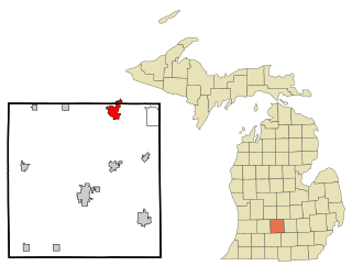
Grand Ledge is a city in the U.S. state of Michigan. The city lies mostly within Eaton County, though a small portion extends into Clinton County to the north. The city sits along the Grand River 12.7 miles west of downtown Lansing. The population was 7,786 at the 2010 census. The city is named for its sandstone rock ledges that rise 40 feet (12 m) above the Grand River and are used by recreational rock climbers.

References

  1. 1 2 3 4 U.S. Geological Survey Geographic Names Information System: Chalmers, Indiana
  2. "2020 U.S. Gazetteer Files". United States Census Bureau. Retrieved March 16, 2022.
  3. 1 2 "U.S. Census website". United States Census Bureau . Retrieved January 31, 2008.
  4. "Chalmers Town History" . Retrieved May 28, 2013.
  5. Thomas Kepshire. "Chalmers Indiana". Archived from the original on June 5, 2013. Retrieved May 28, 2013.
  6. "G001 - Geographic Identifiers - 2010 Census Summary File 1". United States Census Bureau. Archived from the original on February 13, 2020. Retrieved July 13, 2015.
  7. 1 2 "NOAA Online Weather Data – NWS Northern Indiana". National Weather Service. Retrieved November 17, 2023.
  8. "U.S. Climate Normals Quick Access – Station: Chalmers 5 W, IN". National Oceanic and Atmospheric Administration. Retrieved November 17, 2023.
  9. "Census of Population and Housing". Census.gov. Retrieved June 4, 2015.
  10. "U.S. Census website". United States Census Bureau . Retrieved December 11, 2012.
  11. "Downtown Enhancement Grants". OCRA. Retrieved September 1, 2013.
  12. "Discovering H.A.N.D.S. Preschool". Archived from the original on June 10, 2015. Retrieved June 15, 2013.
  13. "IDOE Accountability". IDOE.in.gov. Indiana Department of Education. Archived from the original on September 28, 2013. Retrieved August 9, 2013.
  14. 1 2 White County Tourism Authority. "Enjoy White County" . Retrieved June 12, 2013.
  15. 1 2 Chalmers, Indiana Park Board. "Parks & Trails in Chalmers, Indiana". Archived from the original on June 26, 2013. Retrieved May 27, 2013.

Further reading