Norway was originally called Mt. Walleston, and under the latter name was laid out in 1845.[6] A large share of the early settlers being natives of Norway caused the present name to be selected.[7] A post office was established at Norway in 1898, but was soon discontinued, in 1899.[8]
According to the United States Census Bureau, the CDP has a total area of 0.9 square miles (2.3km2), of which 0.9 square miles (2.3km2) is land and 0.1 square miles (0.26km2) (6.32%) is water.
Norway is on Tippecanoe River just below the Norway Dam. The dam holds Lake Shafer, the home of Indiana Beach, an amusement park and campground. Norway's Southern boundary is also the Northern boundary of Monticello, the more populated county seat and just west of Norway there is the golf course and hotel resort, Pine View.
Despite the small area and population, the central location of Norway and the convenience of the Norway Bridge river crossing (connecting the more populated West Shafer and East Shafer Drives) have allowed for the continued presence and success of several restaurants and other small businesses.
As of the census[3] of 2000, there were 437 people, 169 households, and 126 families residing in the CDP. The population density was 491.4 inhabitants per square mile (189.7/km2). There were 208 housing units at an average density of 233.9 per square mile (90.3/km2). The racial makeup of the CDP was 98.40% White, 0.23% Native American, 0.23% Asian, 0.23% from other races, and 0.92% from two or more races. Hispanic or Latino of any race were 2.75% of the population.
There were 169 households, out of which 30.8% had children under the age of 18 living with them, 53.3% were married couples living together, 16.0% had a female householder with no husband present, and 24.9% were non-families. 20.7% of all households were made up of individuals, and 10.1% had someone living alone who was 65 years of age or older. The average household size was 2.49 and the average family size was 2.81.
In the CDP, the population was spread out, with 23.3% under the age of 18, 7.3% from 18 to 24, 27.0% from 25 to 44, 28.6% from 45 to 64, and 13.7% who were 65 years of age or older. The median age was 40 years. For every 100 females, there were 92.5 males. For every 100 females age 18 and over, there were 89.3 males.
The median income for a household in the CDP was $28,214, and the median income for a family was $25,486. Males had a median income of $28,750 versus $16,154 for females. The per capita income for the CDP was $16,681. About 15.6% of families and 19.5% of the population were below the poverty line, including 43.2% of those under age 18 and 47.6% of those age 65 or over.
Koontz Lake is an unincorporated community and census-designated place (CDP) in Starke and Marshall counties, in the U.S. state of Indiana. The population was 1,667 at the 2020 census.
Mexico is an unincorporated community and census-designated place (CDP) in Jefferson Township, Miami County, in the U.S. state of Indiana. The population was 915 at the 2020 census.
Star City is a census-designated place (CDP) in Van Buren Township, Pulaski County, in the U.S. state of Indiana. The population was 344 at the 2010 census.
Georgetown is a census-designated place in Clay Township, St. Joseph County, in the U.S. state of Indiana. The population was 4,497 at the 2000 census. It is part of the South Bend–Mishawaka, IN-MI, Metropolitan Statistical Area.
Gulivoire Park is a census-designated place (CDP) in Centre Township, St. Joseph County, in the U.S. state of Indiana. The population was 2,974 at the 2000 census. It is part of the South Bend–Mishawaka, IN-MI, Metropolitan Statistical Area.
Bass Lake is a census-designated place (CDP) in California and North Bend Townships, Starke County, in the U.S. state of Indiana. The population was 1,195 at the 2010 census. Covering over 1,300 surface acres, Bass Lake is the third-largest natural lake in Indiana.
Monticello is a city in Union Township, White County, Indiana, United States. The city is the county seat of White County. The population was 5,508 at the 2020 census.
Rosaryville is an unincorporated area and census-designated place (CDP) in Prince George's County, Maryland, United States, located south of Cinton and Upper Marlboro beside U.S. Route 301. Per the 2020 census, the population was 11,548. including housing developments and rural open space. It was named for a local Roman Catholic church. Close to Rosaryville are the Marlton housing development, Maryland Veterans Cemetery, the Southern Maryland Farmers Market, and Rosaryville State Park.
Arnold is a former census-designated place (CDP), which was located in Rice Lake, Saint Louis County, Minnesota, United States. The population was 2,960 at the 2010 census. The census-designated place of Arnold was located entirely within the former Rice Lake Township, adjacent to the north side of the city of Duluth. Rice Lake Township was incorporated as the city of Rice Lake on October 22, 2015, thus rendering the census-designated place of Arnold to no longer exist.
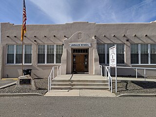
Jarales is a census-designated place (CDP) in Valencia County, New Mexico, United States. The population was 2,475 at the 2010 census. It is part of the Albuquerque Metropolitan Statistical Area.
Rocky Mountain is a census-designated place (CDP) in Adair County, Oklahoma, United States. The population was 420 at the 2010 census.
Black Lick is a census-designated place (CDP) in Burrell Township, Indiana County, Pennsylvania, United States. The population was 1,462 at the 2010 census.
Jacksonville is a census-designated place (CDP) in Indiana County, Pennsylvania, United States. The population was 637 at the 2010 census. It was formerly an independent borough, until January 1, 1993 when it was returned to Black Lick Township, Pennsylvania.
Donaldson is a census-designated place (CDP) in Frailey Township, Schuylkill County, Pennsylvania, United States. The population was 325 at the 2000 census.
Marlin, or MarLin is a census-designated place (CDP) in Schuylkill County, Pennsylvania, United States. The population was 640 at the 2000 census. It is a village of Norwegian Township. The village is the seat of government for the township.
Gastonville is a census-designated place (CDP) in Washington County, Pennsylvania, United States. The population was 2,818 at the 2010 census.
Gantt is a census-designated place (CDP) in Greenville County, South Carolina, United States. The population was 14,229 at the 2010 census. It is part of the Greenville–Mauldin–Easley Metropolitan Statistical Area and a suburb of the city of Greenville.
Santa Cruz is a former census-designated place (CDP) in Starr County, Texas, United States. The population was 630 at the 2000 census. Prior to the 2010 census, this CDP was deleted and parts were taken to form El Chaparral and Santa Rosa CDPs. A new CDP of the same name was created that does not contain any part of the old CDP.
Buffalo is a census-designated place (CDP) in Liberty Township, White County, in the U.S. state of Indiana. The population was 692 at the 2010 census.
Fort Fairfield is a census-designated place (CDP) comprising the main village within the town of Fort Fairfield in Aroostook County, Maine, United States. The population of the CDP was 1,825 at the 2010 census, out of a population of 3,496 for the entire town.
This page is based on this Wikipedia article Text is available under the CC BY-SA 4.0 license; additional terms may apply. Images, videos and audio are available under their respective licenses.