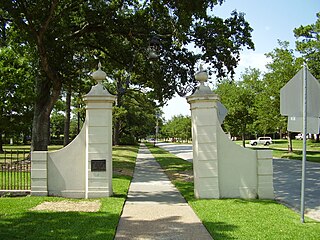
River Oaks is a residential community located in the center of Houston, Texas, United States. Located within the 610 Loop and between Downtown and Uptown, the community spans 1,100 acres (450 ha). Established in the 1920s by brothers Will Hogg and Michael Hogg, the community became a well-publicized national model for community planning. Real estate values in the community range from $1 million to over $20 million. River Oaks was also named the most expensive neighborhood in Houston in 2013. The community is home to River Oaks Country Club, which includes a golf course designed by architect Donald Ross and redesigned in 2015 by Tom Fazio.

Spring Branch is a district in west-northwest Harris County, Texas, United States, roughly bordered by Tanner Road and Hempstead Road to the north, Beltway 8 to the west, Interstate 10 to the south, and the 610 Loop to the east; it is almost entirely within the city of Houston. Established by the Texas Legislature, the Spring Branch Management District exercises jurisdiction over the area.

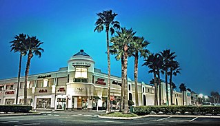
Sharpstown is a master-planned community in the Southwest Management District, Southwest Houston, Texas. It was one of the first communities to be built as a master-planned, automobile centered community and the first in Houston. Frank Sharp (1906–1993), the developer of the subdivision, made provisions not only for homes but also for schools, shopping and recreation areas. While this model has been duplicated countless times in the past fifty years, at the time it was quite revolutionary, attracting national media attention. The development was dedicated on March 13, 1955.

Westbury is a neighborhood in the Brays Oaks district of Southwest Houston, Texas, United States. It is located east of Bob White Road, north of U.S. Highway 90 Alternate, and west of South Post Oak Road, adjacent to the Fondren Southwest and Meyerland neighborhoods, just west of the southwest corner of the 610 Loop.
The Memorial area of Houston, Texas is located west of Downtown, northwest of Uptown, and south of Spring Branch. The Memorial Super Neighborhood, as defined by the City of Houston, is bounded by Buffalo Bayou to the south, Barker Reservoir to the west, Westview to the north, and the Memorial Villages, a contiguous group of independent municipalities, to the east.
Meyerland is a community in southwest Houston, Texas, outside of the 610 Loop and inside Beltway 8. The neighborhood is named after the Meyer family, who bought and owned 6,000 acres (24 km2) of land in southwest Houston.

Acres Homes is a neighborhood located in northwest Houston, Texas. The 9-square-mile (23 km2) mile area is loosely bounded by the city limits and West Gulf Bank Road to the north; Pinemont Drive to the south; North Shepherd Drive to the east; and Alabonson Drive to the west. Historically, it has been predominantly African American. Unincorporated for decades, it was annexed to Houston in 1967.

Southampton Place, also known as Southampton, is a neighborhood located in Houston, Texas. The Southampton Civic Club Inc. is the homeowners' association.
Southgate is a neighborhood in Houston, Texas, United States.

Oak Forest is a large residential community in northwest Houston, Texas, United States. Oak Forest is the third largest group of subdivisions in Harris County.
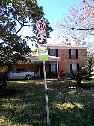
University Oaks is a subdivision in southeast Houston with approximately 240 homes located adjacent to the University of Houston. It is bounded by Wheeler Avenue to the north, South MacGregor Way to the south, Calhoun Road to the east, and Cullen Boulevard to the west.

Hockley is an unincorporated community located in Harris County, Texas, United States, on Texas State Highway 6 and U.S. Highway 290, approximately five miles southeast of the city hall of Waller, and 36 mi (57.9 km) northwest of downtown Houston.
Northgate Forest is a golf course community in unincorporated Harris County, Texas, United States, in Greater Houston. It is located directly off Farm to Market Road 1960, 13 miles (21 km) west of George Bush Intercontinental Airport and 18 miles (29 km) north of Downtown Houston.
Kleinbrook is an unincorporated community in northwestern Harris County, Texas, United States.
Riverside Terrace is a neighborhood in Houston, Texas, United States. It is along Texas State Highway 288 and north of the Texas Medical Center and located near Texas Southern University and University of Houston. There about 20 sections of Riverside Terrace that span across North and South MacGregor. The community, formerly an affluent Jewish neighborhood, became an affluent community for African Americans in the 1950s and '60s. It is still predominantly African American neighborhood with different income levels. It has been undergoing a gradual change in demographics and aesthetics due to gentrification efforts since the early 2000s.
Traces is a subdivision in unincorporated northwestern Harris County, Texas, United States. Mint Homes built houses in Traces.
Quail Valley is a neighborhood dating from 1969 of Missouri City, in Fort Bend County, Texas, United States.

Lakes of Parkway is a gated community in western Houston, Texas, also the most southern community in the Energy Corridor. It has 888 lots. Peggy O'Hare of the Houston Chronicle stated in 2002 that the houses were "upscale".
Sunset Heights is a neighborhood in northern Houston.
Greenwood Forest is an unincorporated area in Harris County, Texas, United States. It is within the Champions region of area 649 acres (263 ha). According to Louis B. Parks of the Houston Chronicle, the commuting distance to Downtown Houston in 2004 was 20 minutes.

