
Missouri City is a city in the U.S. state of Texas, within the Houston–The Woodlands–Sugar Land metropolitan area. The city is mostly in Fort Bend County, with a small portion in Harris County. As of the 2020 census, the city had a population of 74,259, up from 67,358 in 2010. The population was estimated at 75,457 in 2019.

Texas's 7th congressional district of the United States House of Representatives comprises a small area of southwestern Houston and Harris County, along with a northern portion of suburban Fort Bend County. As of the 2000 census, the 7th district comprises 651,620 people. Since 2019, it has been represented by Democrat Lizzie Fletcher.

State Highway 6 (SH 6) runs from the Red River, the Texas–Oklahoma state line, to northwest of Galveston, where it is known as the Old Galveston Highway. In Sugar Land and Missouri City, it is known as Alvin-Sugarland Road and runs perpendicular to Interstate 69/U.S. Highway 59 (I-69/US 59). In the Houston area, it runs north to Farm to Market Road 1960 (FM 1960), then northwest along US 290 to Hempstead, and south to Westheimer Road and Addicks, and is known as Addicks Satsuma Road. In the Bryan–College Station area, it is known as the Earl Rudder Freeway. In Hearne, it is known as Market Street. In Calvert, it is known as Main Street. For most of its length, SH 6 is not a limited-access road. In 1997, the Texas Legislature designated SH 6 as the Texas Korean War Veterans Memorial Highway.
State Highway 99, also known as the Grand Parkway, is a ring road in the U.S. state of Texas. Its first section opened on August 31, 1994. When the route is completed, it will be the longest beltway in the U.S., the world's seventh-longest ring road, and the third (outer) loop of the Houston–The Woodlands–Sugar Land metropolitan area, with Interstate 610 being the first (inner) loop and Beltway 8 being the second (middle) loop. The proposed 170-mile (270 km) loop has been divided into 11 separate segments for construction and funding purposes. In May 2019, the Texas Department of Transportation gave the Grand Parkway a secondary designation as the Mayor Bob Lanier Memorial Parkway, honoring Bob Lanier, who served as the mayor of Houston from 1992 to 1998 and who had spearheaded the creation of the Grand Parkway.

Alief Independent School District is a school district that is based in southwest Houston, Texas, United States.

Beltway 8 (BW8), the Sam Houston Parkway, along with the Sam Houston Tollway, is an 88-mile (142 km) beltway around the city of Houston, Texas, United States, lying entirely within Harris County.
Alief is a working-class suburb in Southwest Harris County, Texas, United States. Most of Alief is within the city limits of Houston, while a portion of the community is in unincorporated Harris County.
Westchase is a business district and neighborhood in western Houston, Texas, bounded by Westheimer Road on the north, Gessner Road on the east, Houston Center Boulevard on the west, and Westpark Tollway on the south. The area is bisected by Beltway 8. Westchase is adjacent to Greater Sharpstown, the International District, and the Royal Oaks Country Club subdivision. The area is immediately northeast of Alief.

The Westpark Tollway, also Fort Bend Westpark Tollway, is a limited-access toll road in Texas, serving western Houston and Harris County, and northeastern Fort Bend County. Construction on the facility began in 2001 and portions of the road were opened to traffic in May 2004. Construction of the roadway was completed in August 2005. The Westpark Tollway begins on Westpark Drive just past the South Rice Avenue intersection in the Uptown District of Houston and runs approximately 22 miles (35 km) west to Farm to Market Road 1093 just past Farm to Market Road 723 in Fulshear, Texas. It runs roughly parallel and to the south of Westheimer Road in Harris County and concurrently with FM 1093 in Fort Bend County.
The Harris County Toll Road Authority maintains and operates a 103-mile (165.8 km) toll road system in the Greater Houston area of Texas, United States. Its headquarters are located in Houston's Fairbanks/Northwest Crossing neighborhood.

Addicks is an area of Houston that was formerly its own community.

Royal Oaks Country Club is a country club and subdivision in Houston, Texas, United States, in the Alief community. The country club is located at 2910 Royal Oaks Club Drive, 8 miles (13 km) west of The Galleria. Sunrise Colony Company developed Royal Oaks out of the former Andrau Airpark property.

Clodine is an unincorporated community in Fort Bend County, Texas, United States. According to the Handbook of Texas, the community had a population of 31 in 1990. It is located in the Greater Houston metro area.

Westheimer Road is an arterial east–west road in Houston, Texas, United States. It runs from Bagby Street in Downtown and terminates at the Westpark Tollway on the southern edge of George Bush Park, stretching about 19 miles (31 km) long. The street was named after Michael Louis Westheimer, a German immigrant and flour salesman.
Trammels was an unincorporated area near State Highway 6 in eastern Fort Bend County.

Southwest Houston is a region in Houston, Texas, United States. The area is considered to be from Texas State Highway 6, south of Westpark Tollway to north of U.S. Route 90.

Southwest Management District, formerly Greater Sharpstown Management District, is a district in Houston, Texas, United States. The district is split into 6 neighborhoods: Sharpstown, Chinatown, Mahatma Gandhi District/Little India, Westwood, Harwin, and University.
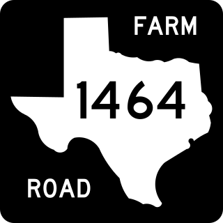
Farm to Market Road 1464 (FM 1464) is a state highway in the U.S. state of Texas that stays within Fort Bend County. The highway starts from State Highway 99 in Sugar Land and goes north to FM 1093 at Clodine. The four-lane divided highway passes through both rural and suburban areas.
Duke is a ghost town in Fort Bend County, in the U.S. state of Texas. The former settlement's location was west of Arcola along the BNSF Railway near Houston Southwest Airport. In 2014 the town site was no longer accessible by public roads.


