Chester, Utah

Last updated
Chester, Utah
USA Utah location map.svg
Red pog.svg
Chester
Location of Chester within the State of Utah
USA Utah location map.svg
Red pog.svg
Chester
Chester (Utah)
Coordinates: 39°28′34″N111°33′47″W / 39.47611°N 111.56306°W / 39.47611; -111.56306 Coordinates: 39°28′34″N111°33′47″W / 39.47611°N 111.56306°W / 39.47611; -111.56306
Country United States
State Utah
County Sanpete
Founded byDavid Candland
Named for Chesterfield
Elevation
[1]
5,515 ft (1,681 m)
Population
 (2000)
  Total178
Time zone UTC-7 (Mountain (MST))
  Summer (DST) UTC-6 (MDT)
ZIP codes
84623
Area code(s) 435
GNIS feature ID1439662 [1]

Chester is an unincorporated community in central Sanpete County, Utah, United States. [1]

Contents

Description

The community is located in the Sanpete Valley, 4 miles (6.4 km) west of Spring City at the junction of Utah State Route 132 (formerly SR-11 and U.S. Route 189) and Utah State Route 117. [2] The population was 178 at the 2000 census. [3]

Chester Ponds (a series of six small reservoirs) [4] are located along the Canal [5] and Oak [6] creeks in the northeastern part of the community. [7]

Historical population
CensusPop.
1880 188
1890 25937.8%
1900 2704.2%
1910 2793.3%
1920 256−8.2%
1930 171−33.2%
1940 19212.3%
1950 153−20.3%
2000 178
Source: U.S. Census Bureau [3]

History

Chester was founded by David Candland. In the beginning the town was named Canal Creek after the waterway [5] from which the community received its water. Candland then changed the name to Chesterfield after his hometown in England; it was later reduced to Chester. [8] Chester had its own post office until 1967. [9]

In August 1885, the San Pete Valley Railway completed its tracks as far south as Chester and began regular service to Nephi (via Moroni and Fountain Green); however, passenger service was not offered until after the "Station House" was completed. [10] The railway ran north–south through the western part of the community, at about 3300 East. The railway was acquired by Union Pacific Railroad in 1890 and extended farther south to Manti by 1984. The railway was taken over by the Denver & Rio Grande Railroad (D&RG) in 1908 and became known as the D&RG San Pete Valley Branch. The branch was later abandoned by the D&RG (by then known as the Denver and Rio Grande Western Railroad) in 1947, [10] leaving the Marysvale Branch, through Spring City, as the nearest rail service.

See also

Flag of Utah.svg  Utahportal

Related Research Articles

Roan Cliffs

The Roan Cliffs are a series of desert mountains and cliffs in eastern Utah and western Colorado, in the western United States that are distinct from the Book Cliffs.

Hamiltons Fort is an unincorporated community in south-central Iron County, Utah, United States.

Black Rock is an unincorporated community and near-ghost town in the Beaver Bottoms in southern Millard County, Utah, United States, approximately 20 miles (32 km) north of Milford.

Birdseye is an unincorporated community in southeastern Utah County, Utah, United States.

Vivian Park, Utah Unincorporated community in the State of Utah, United States

Vivian Park is an unincorporated community in northeastern Utah County, Utah, United States.

The Kern Mountains are a mountain range primarily on the eastern edge of White Pine County, Nevada, United States, but extending slightly east into western Juab County, Utah.

Peterson, Utah Unincorporated community in the State of Utah, United States

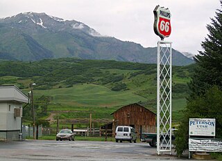
Peterson is an unincorporated community in northwestern Morgan County, Utah, United States.

Burmester is an unincorporated community in northeastern Tooele County, Utah, United States.

Moore, Utah Unincorporated community in the State of Utah, United States

Moore is an unincorporated community in west central Emery County, Utah, United States, at the edge of the San Rafael Swell.

Rosette is an unincorporated ranching community in northwestern Box Elder County, Utah, United States.

Trout Creek is an unincorporated community, in far western Juab County, Utah, United States.

Shivwits is an unincorporated community in west-central Washington County, Utah, United States. It is occupied by the Shivwits Band of Paiutes.

Juab Valley Valley in Juab County, Utah, United States

The Juab Valley is a 40-mile (64 km) long valley located on the eastern edge of Juab County, Utah, United States.

Maple Canyon is a canyon in the northeastern San Pitch Mountains in northern Sanpete County, Utah, United States Nearly all of the canyon, except the western end, is located within the Uinta National Forest. The mouth of the canyon is in the northwestern Sanpete Valley, south of Fountain Green and just northwest of the unincorporated community of Freedom, at an elevation of 6,017 feet (1,834 m).

Beaver Dam is an unincorporated community on the northeastern edge of Box Elder County, Utah, United States.

Salduro, Utah Ghost town in Utah, United States

Salduro is a ghost town located in Tooele County, Utah, United States.

Crouse Creek is a stream in the Uinta Mountains near the eastern edge of Daggett County, Utah, United States.

Spanish Valley (Utah)

Spanish Valley is a flat in Grand and San Juan counties in Utah, United States, south of Moab.

Diamond Gulch is a gulch in eastern Juab County, Utah, United States.

Currant Creek is a stream in eastern Juab County and southern Utah County in northern Utah, United States.

References

  1. 1 2 3 "Chester". Geographic Names Information System . United States Geological Survey.
  2. "MyTopo Maps - Chester, UT, USA" (Map). mytopo.com. Trimble Navigation, Ltd. Retrieved 18 Mar 2018.
  3. 1 2 "Census of Population and Housing". census.gov. United States Census Bureau. Archived from the original on 8 Feb 2006. Retrieved 4 Nov 2011.
  4. "Chester Ponds". Geographic Names Information System . United States Geological Survey.
  5. 1 2 "Canal Creek". Geographic Names Information System . United States Geological Survey.
  6. "Oak Creek". Geographic Names Information System . United States Geological Survey.
  7. "MyTopo Maps - Chester Ponds, Utah, USA" (Map). mytopo.com. Trimble Navigation, Ltd. Retrieved 18 Mar 2018.
  8. Van Cott, John W. (1990). Utah Place Names: A Comprehensive Guide to the Origins of Geographic Names: A Compilation. Salt Lake City: University of Utah Press. p. 77. ISBN   978-0-87480-345-7. OCLC   797284427 . Retrieved 18 Mar 2018.
  9. "Post Offices: Utah: Sanpete County". postalhistory.com. Las Vegas, Nevada: Jim Forte. Retrieved 18 Mar 2018.
  10. 1 2 "San Pete Valley Railway (1874-1908)". utahrails.net. Don Strack. 24 Mar 2015. Retrieved 18 Mar 2018.

Commons-logo.svg Media related to Chester, Utah at Wikimedia Commons