Fountain Green, Utah

Last updated

Fountain Green, Utah
Sanpete County Utah incorporated and unincorporated areas Fountain Green highlighted.svg
Location in Sanpete County and the state of Utah.
Coordinates: 39°37′40″N111°38′22″W / 39.62778°N 111.63944°W / 39.62778; -111.63944
Country United States
State Utah
County Sanpete
SettledMarch 1859
Named for Springs and meadows
Area
[1]
  Total1.25 sq mi (3.24 km2)
  Land1.25 sq mi (3.24 km2)
  Water0.00 sq mi (0.00 km2)
Elevation
[2]
5,899 ft (1,798 m)
Population
 (2010)
  Total1,071
  Estimate 
(2019) [3]
1,166
  Density932.05/sq mi (359.87/km2)
Time zone UTC-7 (Mountain (MST))
  Summer (DST) UTC-6 (MDT)
ZIP code
84632
Area code 435
FIPS code 49-26720 [4]
GNIS feature ID1441187 [2]
Website fountaingreencity.com

Fountain Green is a city in Sanpete County, Utah, United States. The population was 1,071 at the 2010 census.

Contents

History

Fountain Green was originally called "Uintah Springs", and under the latter name settlement was made in 1859. [5] A post office called Fountain Green has been in operation since 1860. [6] The present name is for springs and green pastures near the original town site. [5]

Geography

According to the United States Census Bureau, the city has a total area of 1.4 square miles (3.6 km2), all land.

Historical population
CensusPop.Note
1870 562
1880 88156.8%
1890 677−23.2%
1900 75511.5%
1910 87515.9%
1920 1,16933.6%
1930 982−16.0%
1940 9880.6%
1950 767−22.4%
1960 544−29.1%
1970 467−14.2%
1980 57823.8%
1990 5780.0%
2000 94563.5%
2010 1,07113.3%
2019 (est.)1,166 [3] 8.9%
U.S. Decennial Census [7]

Demographics

As of the census [4] of 2010, there were 1071 people and 370 households, 88.4% of which were occupied housing units. The population density was 705 people per square mile. The racial makeup of the city was 89.07% White, 0.10% African American, 0.60% Native American, and 1.73% from other races. Hispanic or Latino of any race were 8.50% of the population.

Education

Fountain Green is located in the North Sanpete School District and contains an elementary school. Students attend North Sanpete Middle School in Moroni and North Sanpete High School in Mount Pleasant.

Events

The annual city celebration is Lamb Day. Held in July of each year, it is famous for its pit cooking of over 30 lambs made into delicious lamb sandwiches. The event includes a play, mutton busting, carnival, softball games, a fun run, and a great parade down State Street.

See also

Related Research Articles

<span class="mw-page-title-main">Daggett County, Utah</span> County in Utah, United States

Daggett County is a county in the northeastern corner of the U.S. state of Utah. As of the 2020 United States Census, the population was 935, making it the least populous county in Utah. Its county seat is Manila. The county was named for Ellsworth Daggett, the first surveyor-general of Utah. The small community of Dutch John, located near the state line with Colorado and Wyoming, became an incorporated town in January 2016.

<span class="mw-page-title-main">Carbon County, Utah</span> County in the United States

Carbon County is a county in the U.S. state of Utah. As of the 2020 United States Census, the population was 20,412. Its county seat and largest city is Price.

<span class="mw-page-title-main">Beaver County, Utah</span> County in Utah, United States

Beaver County is a county in west central Utah, United States. As of the 2020 United States Census, the population was 7,072, up from the 2010 figure of 6,629. Its county seat and largest city is Beaver. The county was named for the abundance of beaver in the area.

<span class="mw-page-title-main">Juab County, Utah</span> County in Utah, United States

Juab County is a county in western Utah, United States. As of the 2020 United States Census, the population was 11,786. Its county seat and largest city is Nephi.

<span class="mw-page-title-main">Sanpete County, Utah</span> County in Utah, United States

Sanpete County is a county in the U.S. state of Utah. As of the 2020 United States Census, the population was 28,437. Its county seat is Manti, and its largest city is Ephraim. The county was created in 1850.

<span class="mw-page-title-main">Sevier County, Utah</span> County in Utah, United States

Sevier County is a county in Utah, United States. As of the 2020 United States Census, the population was 21,522. Its county seat and largest city is Richfield.

<span class="mw-page-title-main">Fountain, Colorado</span> City in Colorado, United States

The City of Fountain is a home rule municipality located in El Paso County, Colorado, United States. The population was 29,802 at the 2020 census. Fountain is a part of the Colorado Springs, CO Metropolitan Statistical Area and the Front Range Urban Corridor.

<span class="mw-page-title-main">Woods Cross, Utah</span> City in Utah, United States

Woods Cross is a city in Davis County, Utah, United States. It is part of the Ogden–Clearfield, Utah Metropolitan Statistical Area. The population was 9,761 as of the 2010 census, with an estimated population in 2019 of 11,431.

<span class="mw-page-title-main">Centerfield, Utah</span> City in Utah, United States

Centerfield is a city in southwestern Sanpete County, Utah, United States. The population was 1,367 at the 2010 census. Although Centerfield was a town in 2000, it has since been classified as a fifth-class city by state law. The community was so named because of its location in the center of a wide valley.

<span class="mw-page-title-main">Ephraim, Utah</span> City in Utah, United States

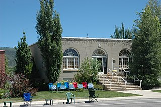
Ephraim is a city in Sanpete County, Utah, United States. The population was 5,611 at the 2020 census, making it the largest city in Sanpete County. It is the location of Snow College and is located along U.S. Route 89.

<span class="mw-page-title-main">Fairview, Utah</span> City in Utah, United States

Fairview is a city in northern Sanpete County, Utah, United States. The population was 1,203 at the 2020 census.

<span class="mw-page-title-main">Fayette, Utah</span> Town in Utah, United States

Fayette is a town in Sanpete County, Utah, United States. The population was 204 at the 2000 census.

<span class="mw-page-title-main">Gunnison, Utah</span> City in Utah, United States

Gunnison is a city in the Sevier Valley in southwestern Sanpete County, Utah, United States. The population was 3,509 at the 2020 census. The city was named in honor of John W. Gunnison, a United States Army officer who surveyed for the transcontinental railroad in 1853.

<span class="mw-page-title-main">Mayfield, Utah</span> Town in the state of Utah, United States

Mayfield is a town in southwestern Sanpete County, Utah, United States. The population was 496 at the 2010 census.

<span class="mw-page-title-main">Moroni, Utah</span> City in Utah, United States

Moroni is a city in Sanpete County, Utah, United States. The population was 1,423 at the 2010 census.

<span class="mw-page-title-main">Mount Pleasant, Utah</span> City in Utah, United States

Mount Pleasant is a city in the U.S. state of Utah. Located in Sanpete County, Mt. Pleasant is known for being home to Wasatch Academy. As of the 2010 census, the city's population was 3,260.

<span class="mw-page-title-main">Spring City, Utah</span> City in Utah, United States

Spring City is a city in Sanpete County, Utah, United States. The population was 988 at the 2010 census.

<span class="mw-page-title-main">Wales, Utah</span> Town in Sanpete County, Utah, United States

Wales is a town in Sanpete County, Utah, United States. The population was 219 at the 2000 census. The town is governed by a mayor and several council members. As of December 2008, Wales had no stores, gas stations, or stoplights. It does have a park, fire station, library and cemetery.

<span class="mw-page-title-main">Monroe, Utah</span> City in Utah, United States

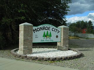
Monroe is a city in Sevier County, Utah, United States. The population was 2,256 at the 2010 United States Census.

Chester is an unincorporated community in central Sanpete County, Utah, United States.

References

  1. "2019 U.S. Gazetteer Files". United States Census Bureau. Retrieved August 7, 2020.
  2. 1 2 U.S. Geological Survey Geographic Names Information System: Fountain Green, Utah
  3. 1 2 "Population and Housing Unit Estimates". United States Census Bureau. May 24, 2020. Retrieved May 27, 2020.
  4. 1 2 "U.S. Census website". United States Census Bureau . Retrieved January 31, 2008.
  5. 1 2 The Utah Genealogical and Historical Magazine, Volumes 9-10. 1918. p. 127.
  6. "Post Offices" . Retrieved January 22, 2018.
  7. "Census of Population and Housing". Census.gov. Retrieved June 4, 2015.

Further reading