Emery County is a county in east-central Utah, United States. As of the 2010 United States Census, the population was 10,976. Its county seat is Castle Dale, and the largest city is Huntington.

Juab County is a county in western Utah, United States. As of the 2010 United States Census, the population was 10,246. Its county seat and largest city is Nephi.

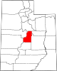
Millard County is a county in the U.S. state of Utah. As of the 2010 United States Census, the population was 12,503. Its county seat is Fillmore, and the largest city is Delta.

Sanpete County is a county in the U.S. state of Utah. As of the 2010 United States Census, the population was 27,822. Its county seat is Manti, and its largest city is Ephraim. The county was created in 1850.

Sevier County is a county in Utah, United States. As of the 2010 United States Census, the population was 20,802. Its county seat and largest city is Richfield.

The Sevier River is a 400-mile (640 km)-long river in the Great Basin of southwestern Utah in the United States. Originating west of Bryce Canyon National Park, the river flows north through a chain of high farming valleys and steep canyons along the west side of the Sevier Plateau before turning southwest and terminating in the endorheic basin of Sevier Lake in the Sevier Desert. It is used extensively for irrigation along its course, with the consequence that Sevier Lake is usually dry.

Iosepa is a ghost town in the Skull Valley, located approximately 75 miles (120 km) southwest of Salt Lake City in Tooele County, Utah, United States. Once home to over 200 Polynesian members of the Church of Jesus Christ of Latter-day Saints, Iosepa was inhabited during the period 1889–1917. Today, it is the site of an annual Memorial Day gathering that draws islanders and others from all over the Western United States.

Thistle is a ghost town in Spanish Fork Canyon in southeastern Utah County, Utah, United States. During the era of steam locomotives, the town's primary industry was servicing trains for the Denver and Rio Grande Western Railroad. The fortunes of the town were closely linked with those of the railroad until the changeover to diesel locomotives, when the town started to decline.

Clarion is a ghost town in Sanpete County, Utah, United States, 5 miles (8.0 km) southwest of Gunnison. Clarion was the site of an early-twentieth century experiment in Jewish rural living. The Clarion site totaled 6,085 acres, and was five miles from north to south along the Sevier River and 3 miles (4.8 km) wide. The area today is in the Centerfield, Utah postal district.

The Black Hawk War, or Black Hawk's War, is the name of the estimated 150 battles, skirmishes, raids, and military engagements taking place from 1865 to 1872, primarily between Mormon settlers in Sanpete County, Sevier County and other parts of central and southern Utah, and members of 16 Ute, Southern Paiute, Apache and Navajo tribes, led by a local Ute war chief, Antonga Black Hawk. The conflict resulted in the abandonment of some settlements and hindered Mormon expansion in the region.

Grafton is a ghost town, just south of Zion National Park in Washington County, Utah, United States. Said to be the most photographed ghost town in the West, it has been featured as a location in several films, including 1929's In Old Arizona—the first talkie filmed outdoors—and the classic Butch Cassidy and the Sundance Kid. The nearest inhabited town is Rockville.

Axtell is an unincorporated community in the Sevier Valley on the southwestern edge of Sanpete County, Utah, United States.
Kiz is a ghost town located in arid Clark Valley, in the sparsely populated eastern part of Carbon County, Utah, United States. This agricultural settlement existed between approximately 1906 and 1940. The nearest currently inhabited town is East Carbon.
Rockport is a ghost town in a narrow part of Weber Valley at the mouth of Three Mile Canyon in Summit County, Utah, United States. Located 4 miles (6.4 km) south of Wanship, it was inhabited for nearly a century before the creation of Rockport Reservoir, which covered almost the whole townsite.
Connellsville is a ghost town located high in the mountains of Coal Canyon, near the head of Huntington Canyon in the northwestern corner of Emery County, Utah, United States. A coal mining and coke manufacturing center, Connellsville was the first settlement in what is now Emery County, inhabited from 1874 to 1878. The town now lies beneath the waters of Electric Lake.

Widtsoe is an unincorporated community and a near-ghost town in Garfield County, Utah, United States. Located in John's Valley northeast of Bryce Canyon and along the Sevier River at the mouth of Sweetwater Creek, the town existed from about 1908 to 1936.
Hebron is a ghost town on Shoal Creek in Washington County in southwestern Utah, United States. Hebron was inhabited from 1862 until 1902, when the already-declining town was mostly destroyed by an earthquake. The present-day city of Enterprise, 6 miles (9.7 km) to the east, was settled largely by people leaving Hebron.
McCornick is an unincorporated community and near-ghost town located in Millard County, Utah, United States. Lying in Whiskey Creek Flat 11 miles (18 km) northwest of Holden, McCornick was a failed land development project that lasted from 1919 until circa 1930. Today, McCornick is made up of a few scattered homes and farms.
Winter Quarters is a ghost town in Carbon County, Utah, United States. Coal was discovered in the area in 1875, and later that year, the Pleasant Valley Coal Company began coal mining operations. A group of coal miners were delayed during an early winter storm in 1877, which led to the town's name of Winter Quarters. On May 1, 1900, an explosion in the Winter Quarters Number Four mine killed 200 miners. Despite the mine explosion, the coal mining operations remained active until 1922, when the opening of a new mine in Castle Gate caused many people to relocate there. By 1930, Winter Quarters was abandoned.