Chesterhill, Ohio

Last updated

Chesterhill, Ohio
Chesterhill, Marion at Mill.jpg
Marion Street downtown
OHMap-doton-Chesterhill.png
Location of Chesterhill, Ohio
Map of Morgan County Ohio Highlighting Chesterhill Village.png
Location of Chesterhill in Morgan County
Coordinates: 39°29′27″N81°52′00″W / 39.49083°N 81.86667°W / 39.49083; -81.86667
Country United States
State Ohio
County Morgan
Area
[1]
  Total0.54 sq mi (1.41 km2)
  Land0.54 sq mi (1.40 km2)
  Water0.00 sq mi (0.01 km2)
Elevation
[2]
971 ft (296 m)
Population
 (2020)
  Total276
  Density512.06/sq mi (197.53/km2)
Time zone UTC-5 (Eastern (EST))
  Summer (DST) UTC-4 (EDT)
ZIP code
43728
Area code 740
FIPS code 39-14086 [3]
GNIS feature ID2397618 [2]

Chesterhill is a village in Morgan County, Ohio, United States. The population was 276 at the 2020 census. Chesterhill was laid out in 1834, and named after Chester County, Pennsylvania, the native home of a large share of the first settlers. [4]

Contents

Geography

According to the United States Census Bureau, the village has a total area of 0.54 square miles (1.40 km2), all land. [5]

Demographics

Historical population
CensusPop.Note
1900 480
1910 410−14.6%
1920 4274.1%
1930 4310.9%
1940 4422.6%
1950 426−3.6%
1960 876105.6%
1970 361−58.8%
1980 3959.4%
1990 309−21.8%
2000 305−1.3%
2010 289−5.2%
2020 276−4.5%
U.S. Decennial Census [6]

2010 census

As of the census [7] of 2010, there were 289 people, 121 households, and 84 families living in the village. The population density was 535.2 inhabitants per square mile (206.6/km2). There were 143 housing units at an average density of 264.8 per square mile (102.2/km2). The racial makeup of the village was 73.7% White, 9.7% African American, 0.3% Native American, 0.3% Asian, 0.3% from other races, and 15.6% from two or more races. Hispanic or Latino of any race were 0.3% of the population.

There were 121 households, of which 33.9% had children under the age of 18 living with them, 54.5% were married couples living together, 11.6% had a female householder with no husband present, 3.3% had a male householder with no wife present, and 30.6% were non-families. 28.1% of all households were made up of individuals, and 14.9% had someone living alone who was 65 years of age or older. The average household size was 2.39 and the average family size was 2.89.

The median age in the village was 41.4 years. 25.3% of residents were under the age of 18; 4.4% were between the ages of 18 and 24; 26.4% were from 25 to 44; 25.3% were from 45 to 64; and 18.7% were 65 years of age or older. The gender makeup of the village was 47.4% male and 52.6% female.

2000 census

As of the census [3] of 2000, there were 305 people, 131 households, and 91 families living in the village. The population density was 560.8 inhabitants per square mile (216.5/km2). There were 146 housing units at an average density of 268.4 per square mile (103.6/km2). The racial makeup of the village was 79.02% White, 15.41% African American, and 5.57% from two or more races. Hispanic or Latino of any race were 0.33% of the population.

There were 131 households, out of which 31.3% had children under the age of 18 living with them, 51.9% were married couples living together, 11.5% had a female householder with no husband present, and 29.8% were non-families. 28.2% of all households were made up of individuals, and 14.5% had someone living alone who was 65 years of age or older. The average household size was 2.33 and the average family size was 2.78.

In the village, the population was spread out, with 23.0% under the age of 18, 9.5% from 18 to 24, 29.8% from 25 to 44, 21.3% from 45 to 64, and 16.4% who were 65 years of age or older. The median age was 38 years. For every 100 females there were 96.8 males. For every 100 females age 18 and over, there were 89.5 males.

The median income for a household in the village was $33,750, and the median income for a family was $45,833. Males had a median income of $33,636 versus $20,536 for females. The per capita income for the village was $17,329. About 14.0% of families and 19.8% of the population were below the poverty line, including 34.5% of those under the age of eighteen and 18.2% of those 65 or over.

Education

Chesterhill has a public library, a branch of the Kate Love Simpson Morgan County Library. [8]

Related Research Articles

<span class="mw-page-title-main">Hillsdale, Missouri</span> Village in Missouri, United States

Hillsdale is a village in St. Louis County, Missouri, United States. Greenwood Cemetery is located in Hillsdale. The population was 1,478 at the 2010 census.

<span class="mw-page-title-main">Hanley Hills, Missouri</span> Village in Missouri, United States

Hanley Hills is a village in St. Louis County, Missouri, United States. The population was 2,101 at the 2010 census.

<span class="mw-page-title-main">Uplands Park, Missouri</span> Village in Missouri, United States

Uplands Park is a village in St. Louis County, Missouri, United States. The population was 445 at the 2010 census. The village is one of many small majority black communities located in the Natural Bridge corridor of mid-St. Louis County, characterized by small homes on small lots.

<span class="mw-page-title-main">Fort Shawnee, Ohio</span> CDP in Ohio, United States

Fort Shawnee is census-designated place (CDP) in Allen County, Ohio, United States. The population was 6,263 at the 2020 census. It is included in the Lima, Ohio Metropolitan Statistical Area. Fort Shawnee is adjacent to the city of Lima and the village of Cridersville in Auglaize County. In 2012, village residents voted to disincorporate the village. According to the United States Census Bureau, the village had a total area of 7.25 square miles (18.78 km2), of which 7.21 square miles (18.67 km2) is land and 0.04 square miles (0.10 km2) is water.

<span class="mw-page-title-main">Nellie, Ohio</span> Village in Ohio, United States

Nellie is a village in Coshocton County, Ohio, United States, along the Walhonding River. The population was 122 at the 2020 census.

<span class="mw-page-title-main">Cuyahoga Heights, Ohio</span> Village in Ohio, United States

Cuyahoga Heights is a village in Cuyahoga County, Ohio, United States. The population was 573 at the 2020 census. A suburb of Cleveland, it is a part of the Cleveland metropolitan area.

<span class="mw-page-title-main">Addyston, Ohio</span> Village in Ohio, United States

Addyston is a village in Miami Township, Hamilton County, Ohio, United States. Located along the Ohio River, it is a western suburb of the neighboring city of Cincinnati. The population was 927 at the 2020 census.

<span class="mw-page-title-main">Waite Hill, Ohio</span> Village in Ohio, United States

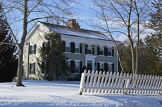
Waite Hill is a village in Lake County, Ohio, United States and a rural suburb of Cleveland. The population was 543 at the 2020 census.

<span class="mw-page-title-main">Hartford, Ohio</span> Village in Ohio, United States

Hartford is a village in the township of the same name in Licking County, Ohio, United States. The population was 404 at the 2020 census.

<span class="mw-page-title-main">Haviland, Ohio</span> Village in Ohio, United States

Haviland is a village in Paulding County, Ohio, United States. The population was 160 at the 2020 census.

<span class="mw-page-title-main">Port Jefferson, Ohio</span> Village in Ohio, United States

Port Jefferson is a village in Salem Township, Shelby County, Ohio, United States. The population was 308 at the 2020 census.

<span class="mw-page-title-main">Hartville, Ohio</span> Village in Ohio, United States

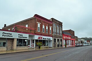
Hartville is a village in northern Stark County, Ohio, United States. The population was 3,329 at the 2020 census. It is part of the Canton–Massillon metropolitan area. Hartville lies halfway between Akron and Canton at the intersection of State Routes 43 and 619.

<span class="mw-page-title-main">Boston Heights, Ohio</span> Village in Ohio, United States

Boston Heights is a village in northern Summit County, Ohio, United States. The population was 1,402 at the 2020 census. It is part of the Akron metropolitan area. Boston Heights is home to the headquarters of Arhaus, a major home furnishings retailer.

<span class="mw-page-title-main">Congress, Ohio</span> Village in Ohio, United States

Congress is a village in Wayne County, Ohio, United States. The population was 132 at the 2020 census.

<span class="mw-page-title-main">Bellevue, Wisconsin</span> Village in Wisconsin, United States

Bellevue is a village in Brown County, Wisconsin. It was a town until incorporating as a village on February 14, 2003. The population was 15,935 at the time of the 2020 census. Bellevue is part of the Green Bay metropolitan area. Bellevue sits around 4.34 miles (6.99 km) east from central Green Bay.

<span class="mw-page-title-main">Kekoskee, Wisconsin</span> Village in Wisconsin, United States

Kekoskee is a village in Dodge County, Wisconsin, United States. The population was 161 at the 2010 census.

<span class="mw-page-title-main">Avoca, Wisconsin</span> Village in Wisconsin, United States

Avoca is a village in Iowa County, Wisconsin, United States. The population was 637 at the 2010 census. It is part of the Madison Metropolitan Statistical Area. It is named after Avoca in Ireland.

<span class="mw-page-title-main">Wilson, Ohio</span> Village in Ohio, United States

Wilson is a village in Belmont and Monroe counties in the U.S. state of Ohio. The population was 129 at the 2020 census. It is part of the Wheeling metropolitan area.

<span class="mw-page-title-main">Verona, Ohio</span> Village in Ohio, United States

Verona is a village in Montgomery and Preble counties in the U.S. state of Ohio. The population was 403 at the 2020 census. It is part of the Dayton Metropolitan Statistical Area.

<span class="mw-page-title-main">Bloomington, Wisconsin</span> Village in Wisconsin, United States

Bloomington is a village in Grant County, Wisconsin, United States. The population was 735 as of the 2010 census. The village is located within the Town of Bloomington.

References

  1. "ArcGIS REST Services Directory". United States Census Bureau. Retrieved September 20, 2022.
  2. 1 2 U.S. Geological Survey Geographic Names Information System: Chesterhill, Ohio
  3. 1 2 "U.S. Census website". United States Census Bureau . Retrieved January 31, 2008.
  4. Overman, William Daniel (1958). Ohio Town Names. Akron, OH: Atlantic Press. p. 27.
  5. "US Gazetteer files 2010". United States Census Bureau. Archived from the original on January 25, 2012. Retrieved January 6, 2013.
  6. "Census of Population and Housing". Census.gov. Retrieved June 4, 2015.
  7. "U.S. Census website". United States Census Bureau . Retrieved January 6, 2013.
  8. "Hours & Locations". Kate Love Simpson Morgan County Library. Retrieved March 1, 2018.