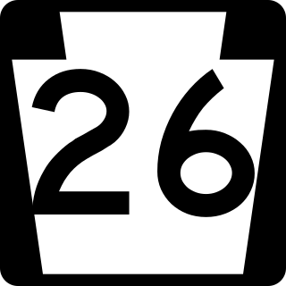
Pennsylvania Route 26 is a 125.5-mile (202.0 km) highway in the south-central area of Pennsylvania. Its northern terminus is at PA 150 northwest of Howard; its southern terminus is at the Maryland state line near Barnes Gap in Union Township. Two major destinations along this route are Raystown Lake near Huntingdon and the Pennsylvania State University at State College.
Iberia is a census-designated place in western Washington Township, Morrow County, Ohio, United States. The community is served by the Northmor Local School District which formerly operated Iberia Elementary School in the community. Iberia is near to Galion, and Martel. The ZIP code assigned to Iberia by the United States Postal Service is 43325. The population of Iberia was 431 at the 2020 census. Iberia is northwest of Mount Gilead, the county seat.

Pennsylvania Route 34 is a 62-mile-long (100 km) state route located in southern Pennsylvania. The southern terminus of the route is at U.S. Route 15 Business in Gettysburg. The northern terminus is at US 11/US 15 south of Liverpool. PA 34 heads north from Gettysburg through farmland in northern Adams County, passing through Biglerville. The route crosses South Mountain into Cumberland County and reaches Mount Holly Springs, where it intersects PA 94. PA 34 heads north into the agricultural Cumberland Valley and heads north to Carlisle, where it has an interchange with Interstate 81 (I-81) in the southern part of town and intersects US 11/PA 74/PA 641 in the downtown area. The route continues north through more rural land and crosses Blue Mountain into Perry County, where it continues through the Ridge-and-Valley Appalachians, winding north to New Bloomfield. From here, PA 34 continues northeast to Newport, where it crosses the Juniata River and reaches an interchange with US 22/US 322, before heading to its terminus at US 11/US 15 near the Susquehanna River.

Pennsylvania Route 44 is a 149.24 mi (240.18 km)-long state highway in the U.S. state of Pennsylvania. The route, which is signed north-south, is designated from Interstate 80 (I-80) and PA 42 in Buckhorn northwest to the New York state line near New York State Route 417 in Ceres Township.

Pennsylvania Route 35 is a 70.8-mile-long (113.9 km) state highway located in central Pennsylvania. The southern terminus of the route is at U.S. Route 522 (US 522) near Shade Gap. The northern terminus is at US 11/US 15 in Selinsgrove.

Pennsylvania Route 926 is a 26.2-mile-long (42.2 km) state route located west of Philadelphia in Chester County, Pennsylvania. The western terminus of the route is at PA 10 in Upper Oxford Township. The eastern terminus is at PA 3 in the Philadelphia suburb of Willistown Township. The route is known as Street Road for its entire length. For 0.9 miles (1.4 km), PA 926 runs along the county line between Delaware and Chester counties. The route passes through a mix of suburban and rural areas along its extent. PA 926 is two lanes and undivided its entire length.
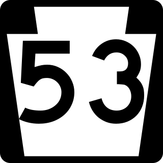
Pennsylvania Route 53 is an 83-mile-long (134 km) state highway located in central Pennsylvania. The southern terminus of the route is at U.S. Route 219 (US 219) near the borough of Summerhill. The northern terminus is at PA 144 in the Snow Shoe Township community of Moshannon.

Pennsylvania Route 68 is a 90.036-mile-long (144.899 km) east–west state highway located in western Pennsylvania in the United States. The western terminus of the route is at the Ohio state line west of Glasgow, where PA 68 continues into Ohio as State Route 39. The eastern terminus is at U.S. Route 322 in Clarion. The route runs southwest-northeast across Beaver, Butler, Armstrong, and Clarion counties. PA 68 follows the Ohio River between the Ohio border and Beaver, where it crosses the Beaver River into Rochester and heads northeast away from the Ohio River. The route runs through rural areas to Butler County, where it intersects Interstate 79 (I-79) in Zelienople before serving Evans City and Butler. PA 68 passes through a section of Armstrong County before crossing the Allegheny River into Clarion County. Here, the route passes through Rimersburg and Sligo before it has an interchange with I-80 and continues to its terminus in Clarion.

York Township is one of the fourteen townships of Morgan County, Ohio, United States. The 2020 census found 753 people in the township.

Brandt is an unincorporated community and census-designated place in southern Bethel Township, Miami County, Ohio, United States. Brandt is part of the Dayton Metropolitan Statistical Area. The population was 282 at the 2020 census. The Bethel Township Administration Facility is located in Brandt.

Brownsville is an unincorporated community and census-designated place (CDP) in northeastern Bowling Green Township, Licking County, Ohio, United States. As of the 2020 census, it had a population of 214. It lies at the intersection of U.S. Route 40 with State Route 668.
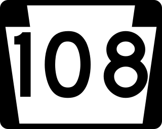
Pennsylvania Route 108 is a highway in Western Pennsylvania that runs for 32 miles (51 km) from the Ohio state line near SNPJ to PA 8 in Adams Corner. PA 108 intersects Interstate 376 (I-376) near New Castle and U.S. Route 19 (US 19) near Harlansburg. PA 108 also has an interchange with Interstate 79 (I-79) at exit 105.
Pennsylvania Route 235 (PA 235) is a 43-mile (69 km) state highway in Pennsylvania. PA 235's southern terminus is at U.S. Route 11 (US 11)/US 15 in Liverpool, and the northern terminus is at PA 45 near Laurelton.

Pennsylvania Route 104 is a 22-mile-long (35 km) state highway located in Perry, Juniata, Snyder, and Union counties in Pennsylvania. The southern terminus is at US 11/US 15 between McKees Half Falls and Liverpool. The northern terminus is at PA 45 in Mifflinburg.
Pennsylvania Route 850 is a 44-mile-long (71 km) state highway located in Juniata and Perry counties in Pennsylvania. The western terminus is at PA 35 in Tuscarora Township. The eastern terminus is at U.S. Route 11 /US 15 in Marysville. PA 850 is a two-lane undivided road that runs through rural areas in the Ridge-and-Valley Appalachians. The route heads southeast from PA 35 and crosses PA 75 in Honey Grove before it traverses Tuscarora Mountain and leaves Juniata County for Perry County. PA 850 continues southeast and crosses PA 17 in Kistler before running east concurrent with PA 274 between Fort Robinson and Loysville. The route turns back to the southeast and heads south concurrent with PA 233 into Landisburg. PA 850 heads east, crossing PA 74 in Alinda before following PA 34 southeast between Dromgold and Shermans Dale. From here, the route continues east to its terminus in Marysville. PA 850 was designated in 1928 to run from PA 274 in Fort Robinson northwest to Kistler, with the road between Landisburg and Dromgold designated as part of PA 233. In 1937, the route was extended to its current length between PA 35 in Tuscarora Township and PA 14 in Marysville, replacing the portion of PA 233 between Landisburg and Dromgold.
Clarktown is an unincorporated community and census-designated place in southeastern Jefferson Township, Scioto County, Ohio, United States. As of the 2020 census it had a population of 911.
State Route 555 is a 62.36-mile-long (100.36 km), north–south running state highway that passes through four counties in southeastern Ohio. State Route 555's southern terminus is at the concurrency of US 50, SR 7 and SR 32 in the unincorporated community of Little Hocking in extreme southwestern Washington County. Its northern terminus is at SR 60 in Wayne Township, just outside Zanesville. The route passes through primarily rural portions of Washington, Morgan, Perry, and Muskingum counties, connecting unincorporated villages along the way. Its emergence into southern Zanesville at the route's northern end takes the route into a more suburban setting before it terminates.

Lafayette is a census-designated place in the center of Deer Creek Township, Madison County, Ohio, United States. It is located along U.S. Route 40, just west of its intersection with U.S. Route 42. The population of Lafayette was 206 at the 2020 census.

Mack is a census-designated place (CDP) in Green and Miami townships, Hamilton County, Ohio, United States. The population was 11,088 at the 2020 census. At prior censuses, the community was listed as two separate CDPs, Mack North and Mack South.

Salem Heights is an unincorporated community and census-designated place (CDP) in Columbiana County, Ohio, United States. It was first listed as a CDP prior to the 2020 census, in which its population was 336. Salem Heights sits on the 1,275-foot (389 m) Blackburn Hill, separated from the city of Salem by the valley of the Middle Fork of the Little Beaver Creek. It is part of the Salem micropolitan area.


