
Monroe Township is one of the fourteen townships of Perry County, Ohio, United States. The 2000 census found 1,565 people in the township, 926 of whom lived in the unincorporated portions of the township.
Moxahala is an unincorporated community in northern Pleasant Township, Perry County, Ohio, United States. Although it is unincorporated, it has a post office, with the ZIP code of 43761. State Route 13 runs through Moxahala, connecting it with New Lexington to the northwest and Rendville to the southeast.

Sulphur Springs is a census-designated place (CDP) in eastern Liberty Township, Crawford County, Ohio, United States. As of the 2010 census it had a population of 194. Although it is unincorporated, it has a post office, with the ZIP code of 44881. It is located along State Route 98 northeast of the city of Bucyrus, the county seat of Crawford County.

Pyrmont is an unincorporated community in northwestern Perry Township, Montgomery County, Ohio, United States. It lies at the intersection of Sulphur Springs and Providence Roads with the Brookville-Pyrmont Pike. Located in the far west of the county, it lies several miles from the city of Dayton; the nearest city is Brookville, 3 miles to the northeast. Pyrmont is a part of the Brookville Local School District. Pyrmont was a busy town before interstate 70 was established near Brookville. Pyrmont was on the Stage Coach Wagon route. Then Interstate 70 was formed.

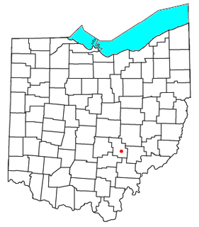
Bristol is an unincorporated community in southern Pike Township, Perry County, Ohio, United States. It lies along State Route 93 at its intersection with Marietta Road and Township Road 223. It is located 4 miles south of New Lexington, the county seat of Perry County.
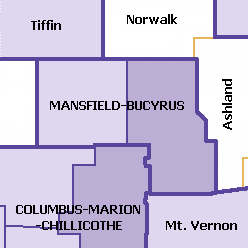
The Mansfield–Bucyrus, OH Combined Statistical Area is a CSA in the U.S. state of Ohio, as defined by the United States Census Bureau. It consists of the Mansfield Metropolitan Statistical Area ; and the Bucyrus Micropolitan Statistical Area. As of the 2000 Census, the Combined Statistical Area had a population of 175,818, but according to a US Census 2009 estimate, the CSA has a population of 167,893 residents.
McLuney is an unincorporated community in Perry County, in the U.S. state of Ohio.
Portersville is an unincorporated community in Perry County, in the U.S. state of Ohio. The town borders neighboring Morgan County and is in Bearfield Township.
Thornport is a census-designated place in Perry County, in the U.S. state of Ohio. It is 2 miles north of Thornville and 22 miles north of the county seat of New Lexington.
Millertown is an unincorporated community in Perry County, in the U.S. state of Ohio.
Chapel Hill is an unincorporated community in Perry County, in the U.S. state of Ohio.
Buckingham is an unincorporated community in Perry County, in the U.S. state of Ohio.
Dicksonton is an extinct town in Perry County, in the U.S. state of Ohio.
Oakfield is an unincorporated community in Perry County, in the U.S. state of Ohio.
Chalfants is an unincorporated community in Perry County, in the U.S. state of Ohio.
Clarksville is an unincorporated community in Perry County, in the U.S. state of Ohio.
Crossenville is an unincorporated community in Perry County, in the U.S. state of Ohio.
McCuneville is an unincorporated community in Perry County, in the U.S. state of Ohio.
Saltillo is an unincorporated community in Perry County, in the U.S. state of Ohio.
Sego is an unincorporated community in Perry County, in the U.S. state of Ohio.


