Corning, Ohio

Last updated

Corning, Ohio
Corning from State Route 13.jpg
View from State Route 13
OHMap-doton-Corning.png
Location of Corning, Ohio
Map of Perry County Ohio Highlighting Corning Village.png
Location of Corning in Perry County
Coordinates: 39°36′06″N82°05′15″W / 39.60167°N 82.08750°W / 39.60167; -82.08750
Country United States
State Ohio
County Perry
Area
[1]
  Total0.43 sq mi (1.11 km2)
  Land0.43 sq mi (1.11 km2)
  Water0.00 sq mi (0.00 km2)
Elevation
[2]
764 ft (233 m)
Population
 (2020)
  Total488
  Density1,134.88/sq mi (438.11/km2)
Time zone UTC-5 (Eastern (EST))
  Summer (DST) UTC-4 (EDT)
ZIP code
43730
Area code 740
FIPS code 39-18770 [3]
GNIS feature ID2398629 [2]

Corning is a village in Perry County, Ohio, United States. The population was 488 at the 2020 census. [4]

Contents

History

Originally named Ferrara, the town was focused on farming along the Sunday Creek Valley. That would change when the Atlantic and Lake Erie Railway completed the Moxahala tunnel in 1879. By 1880, Joseph Rodgers sold over 8,000 acres along Sunday Creek to the Ohio Central Coal Company. With New York capitalists investing heavily in the coal camp, the town was soon renamed Corning. [5] A post office has been in operation at Corning since 1880. [6]

Battle of Corning, September 19, 1880 Battle of Corning Map.jpg
Battle of Corning, September 19, 1880

Known as one of the most lawless towns in the state, Corning can only be compared to violent mining towns such as Tombstone, Arizona, or Deadwood, South Dakota. In addition to shootouts and murders, Corning saw several violent events that made it famous. [7] [8] On September 19, 1880, the Ohio National Guard battled white coal miners trying to force out newly arrived African American miners. The Battle of Corning, or the Corning War, was the first time the Ohio National Guard shed blood in defense of the state. [9]

In 1884, the town witnessed an Irish Catholic Feud between local parish Priest Father Bernard O’Boylan and saloon owner Andy McDevitt. Known as the Corning Church War, the feud gained national attention and grew Corning’s reputation. [10] After several mine strikes during the early 1890s, Corning served as the unofficial site of “insurgency” against the leadership of the newly formed United Mine Workers of America. [7]

At a meeting between Ohio and West Virginia miners at the Mercer Hotel, Richard L. Davis, an African American miner and labor organizer from Rendville, was denied service at the restaurant. In 1895, the Mercer Hotel became the first Ohio business punished under the state’s anti-discrimination laws. [11] The incident at the Mercer Hotel represented the “High Water Mark of the Color Line in Ohio,” establishing a boundary between acceptable and unacceptable segregation of African Americans across the state. [7]

Geography

Corning is located along Sunday Creek. [12]

According to the United States Census Bureau, the village has a total area of 0.43 square miles (1.11 km2), all land. [13]

Demographics

Historical population
CensusPop.Note
1880 270
1890 1,551474.4%
1900 1,401−9.7%
1910 1,56411.6%
1920 1,6284.1%
1930 1,411−13.3%
1940 1,4331.6%
1950 1,215−15.2%
1960 1,065−12.3%
1970 838−21.3%
1980 789−5.8%
1990 703−10.9%
2000 593−15.6%
2010 583−1.7%
2020 488−16.3%
U.S. Decennial Census [14]

2010 census

As of the census [15] of 2010, there were 583 people, 226 households, and 152 families living in the village. The population density was 1,355.8 inhabitants per square mile (523.5/km2). There were 264 housing units at an average density of 614.0 per square mile (237.1/km2). The racial makeup of the village was 97.3% White, 0.5% African American, 0.3% Native American, and 1.9% from two or more races. Hispanic or Latino of any race were 0.3% of the population.

There were 226 households, of which 39.4% had children under the age of 18 living with them, 37.2% were married couples living together, 21.7% had a female householder with no husband present, 8.4% had a male householder with no wife present, and 32.7% were non-families. 25.7% of all households were made up of individuals, and 14.2% had someone living alone who was 65 years of age or older. The average household size was 2.58 and the average family size was 3.07.

The median age in the village was 30.9 years. 30% of residents were under the age of 18; 9.7% were between the ages of 18 and 24; 27.8% were from 25 to 44; 18.8% were from 45 to 64; and 13.7% were 65 years of age or older. The gender makeup of the village was 48.9% male and 51.1% female.

2000 census

As of the census [3] of 2000, there were 593 people, 239 households, and 159 families living in the village. The population density was 1,360.1 inhabitants per square mile (525.1/km2). There were 269 housing units at an average density of 617.0 per square mile (238.2/km2). The racial makeup of the village was 97.13% White, 0.34% African American, 0.34% Native American, 0.17% Asian, and 2.02% from two or more races. Hispanic or Latino of any race were 0.17% of the population.

There were 239 households, out of which 29.7% had children under the age of 18 living with them, 49.8% were married couples living together, 13.8% had a female householder with no husband present, and 33.1% were non-families. 28.5% of all households were made up of individuals, and 18.0% had someone living alone who was 65 years of age or older. The average household size was 2.48 and the average family size was 3.03.

In the village, the population was spread out, with 25.8% under the age of 18, 8.6% from 18 to 24, 28.0% from 25 to 44, 20.4% from 45 to 64, and 17.2% who were 65 years of age or older. The median age was 38 years. For every 100 females there were 88.3 males. For every 100 females age 18 and over, there were 84.1 males.

The median income for a household in the village was $27,868, and the median income for a family was $31,875. Males had a median income of $31,875 versus $20,481 for females. The per capita income for the village was $13,615. About 12.5% of families and 15.3% of the population were below the poverty line, including 24.0% of those under age 18 and 8.4% of those age 65 or over.

Education

Southern Local School District operates one elementary school and Miller High School. [16]

Corning has a public library, a branch of the Perry County District Library. [17]

Related Research Articles

<span class="mw-page-title-main">Rushville, Missouri</span> Village in Missouri, United States

Rushville is a village in western Buchanan County, Missouri, United States. The population was 225 at the 2020 census. It is part of the St. Joseph, MO–KS Metropolitan Statistical Area.

<span class="mw-page-title-main">Evergreen, Missouri</span> Village in Missouri, United States

Evergreen is a village in Laclede County, Missouri, United States. The population was 28 at the 2010 census. It was named Twin Bridges at the 2000 census.

<span class="mw-page-title-main">Carrollton, Ohio</span> Village in Ohio, United States

Carrollton is a village in and the county seat of Carroll County, Ohio, located 22 miles (35 km) southeast of Canton. The population was 3,087 at the time of the 2020 census. It is part of the Canton–Massillon metropolitan area.

<span class="mw-page-title-main">Dellroy, Ohio</span> Village in Ohio, United States

Dellroy is a village in western Carroll County, Ohio, United States. The population was 268 at the 2020 census. It is part of the Canton–Massillon metropolitan area.

<span class="mw-page-title-main">Bethel, Ohio</span> Village in Ohio, United States

Bethel is a village in Tate Township, Clermont County, Ohio, United States. The population was 2,620 at the 2020 census. Bethel was founded in 1798 by Obed Denham as Denham Town, in what was then the Northwest Territory. Bethel is the home of the first movie theater in Ohio which was founded in 1908 by Aaron Little.

<span class="mw-page-title-main">Milledgeville, Ohio</span> Village in Ohio, United States

Milledgeville is a village in Jasper Township, Fayette County, Ohio, United States. The population was 98 at the 2020 census.

<span class="mw-page-title-main">Malinta, Ohio</span> Village in Ohio, United States

Malinta is a village in Henry County, Ohio, United States. The population was 226 at the 2020 census.

<span class="mw-page-title-main">Berkey, Ohio</span> Village in the United States

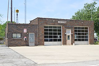
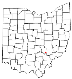
Berkey is a village in Lucas County, Ohio, United States. The population was 275 at the 2020 census.

<span class="mw-page-title-main">Mendon, Ohio</span> Village in Ohio, United States

Mendon is a village in Mercer County, Ohio, United States. The population was 628 at the 2020 census.

<span class="mw-page-title-main">Montezuma, Ohio</span> Village in Ohio, United States

Montezuma is a village in Mercer County, Ohio, United States. The population was 152 at the 2020 census.

<span class="mw-page-title-main">Junction City, Ohio</span> Village in Ohio, United States

Junction City is a village in Perry County, Ohio, United States. The population was 721 at the 2020 census.

<span class="mw-page-title-main">New Straitsville, Ohio</span> Village in Ohio, United States

New Straitsville is a village in Perry County, Ohio, United States. The population was 652 at the 2020 census.

<span class="mw-page-title-main">Shawnee, Perry County, Ohio</span> Village in Ohio, United States

Shawnee is a village in Perry County, Ohio, United States. The population was 505 at the 2020 census. It is 9 miles (14 km) south of the county seat of New Lexington.

<span class="mw-page-title-main">Somerset, Ohio</span> Village in Ohio, United States

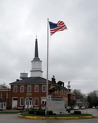
Somerset is a village in Perry County, Ohio, United States. The 2024 population estimate was 1,743 with 619 households. It is located 9.5 miles north of the county seat New Lexington and has a dedicated historical district. Saint Joseph Church, the oldest Catholic church in Ohio, is located just outside Somerset on State Route 383.

<span class="mw-page-title-main">Thornville, Ohio</span> Village in Ohio, United States

Thornville is a village in Perry County, Ohio, United States. It is 20 miles (32 km) north of the county seat of New Lexington. The village had a population of 1,087 as of the 2020 census.

<span class="mw-page-title-main">Mineral City, Ohio</span> Village in Ohio, United States

Mineral City is a village in Tuscarawas County, Ohio, United States. The population was 652 at the 2020 census.

<span class="mw-page-title-main">Blakeslee, Ohio</span> Village in Ohio, United States

Blakeslee is a village in Williams County, Ohio, United States. The population was 104 at the 2020 census.

<span class="mw-page-title-main">Custar, Ohio</span> Village in Ohio, United States

Custar is a village in Wood County, Ohio, United States. The population was 178 at the 2020 census.

<span class="mw-page-title-main">South Shenango Township, Pennsylvania</span> Township in Pennsylvania, United States

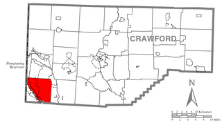
South Shenango Township is a township in Crawford County, Pennsylvania, United States. The population was 1,831 at the 2020 census, down from 2,037 at the 2010 census.

<span class="mw-page-title-main">Burkettsville, Ohio</span> Village in Ohio, United States

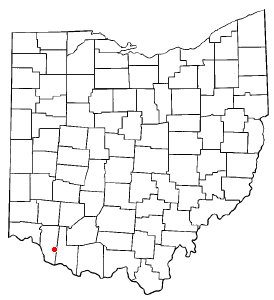
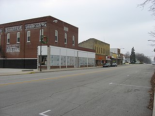
Burkettsville is a village in Darke and Mercer counties in the U.S. state of Ohio. The population was 272 at the 2020 census.

References

  1. "ArcGIS REST Services Directory". United States Census Bureau. Retrieved September 20, 2022.
  2. 1 2 U.S. Geological Survey Geographic Names Information System: Corning, Ohio
  3. 1 2 "U.S. Census website". United States Census Bureau . Retrieved January 31, 2008.
  4. "Corning, OH Profile: Facts, Map & Data". ohio.hometownlocator.com. Retrieved May 2, 2018.
  5. Colborn, Ephraim S. (1883). History of Fairfield and Perry Counties, Ohio: Their Past and Present. Brookhaven Press. p. 222.
  6. "Perry County". Jim Forte Postal History. Retrieved December 16, 2015.
  7. 1 2 3 4 Siemer, Jobie (2023). Rum, Romanism, and Rebellion Along Sunday Creek. Unpublished Manuscript.
  8. "Corning". Marion Daily Star. January 6, 1885.
  9. Smith, Samuel. Annual Report of the Adjutant General, Ohio 1880. (Columbus: G. J. Brand & CO, 1881), 13.
  10. New Lexington Tribune, March 6, 1884.
  11. "Richard L. Davis". Ohio History Connrction. Retrieved July 8, 2023.
  12. DeLorme (1991), Ohio Atlas & Gazetteer, Yarmouth, Maine ISBN   0-89933-233-1
  13. "US Gazetteer files 2010". United States Census Bureau. Archived from the original on July 2, 2012. Retrieved January 6, 2013.
  14. "Census of Population and Housing". Census.gov. Retrieved June 4, 2015.
  15. "U.S. Census website". United States Census Bureau . Retrieved January 6, 2013.
  16. "Homepage". Southern Local Schools. Retrieved March 3, 2018.
  17. "Hours and locations". Perry County District Library. Retrieved March 3, 2018.