City Hall station (BMT Broadway Line)

Last updated

 City Hall
  NYCS-bull-trans-R-Std.svg NYCS-bull-trans-W-Std.svg
MTA NYC logo.svg New York City Subway station (rapid transit)
City Hall north platform NB.jpg
View from the northbound side of the platform towards the south end.
Station statistics
AddressMurray Street & Broadway
New York, NY
Borough Manhattan
Locale Civic Center, Tribeca
Coordinates 40°42′48″N74°00′25″W / 40.71324°N 74.007082°W / 40.71324; -74.007082
Division B (BMT) [1]
Line     BMT Broadway Line
Services    N   NYCS-SSI-nightsonly.svg (late nights)
   R   NYCS-SSI-allexceptnights.svg (all except late nights)
   W   NYCS-SSI-weekdaysonly.svg (weekdays only)
TransitAiga bus trans.svg NYCT Bus: M9, M22, M55, M103, X27, X28
StructureUnderground
Levels2 (lower level not for passenger service)
Platforms2 island platforms (1 on upper level, 1 on lower level)
Tracks5 (2 on upper level, 3 on lower level)
Other information
OpenedJanuary 5, 1918;106 years ago (1918-01-05) [2]
Opposite-
direction
transfer
Yes
Traffic
20231,138,401 [3] Increase2.svg 20.5%
Rank261 out of 423 [3]
Services
Preceding station MTA NYC logo.svg New York City Subway Following station
Canal Street
N   NYCS-SSI-nightsonly.svg R   NYCS-SSI-allexceptnights.svg W   NYCS-SSI-weekdaysonly.svg
NYCS-bull-trans-R-Std.svg NYCS-bull-trans-W-Std.svg Cortlandt Street
N   NYCS-SSI-nightsonly.svg R   NYCS-SSI-allexceptnights.svg W   NYCS-SSI-weekdaysonly.svg
Location
NYCS map blank.svg
Map pointer.svg
USA New York City location map.svg
Map pointer.svg
USA New York location map.svg
Map pointer.svg
Track layout

Contents

BSicon MFADEg.svg
BSicon uvSTR.svg
BSicon numN330.svg
BSicon MFADEg.svg
BSicon utvSTR.svg
BSicon uvSTRfg.svg
BSicon utvUST.svg
BSicon uSHI1+l.svg
BSicon uSHI1+r.svg
BSicon utSHI1+l.svg
BSicon utSHI1+r.svg
BSicon uPSTR(L).svg
BSicon uPSTR(R).svg
BSicon utSTR.svg
BSicon uetKRWgl.svg
BSicon uextKRW+r.svg
BSicon uPSTR(L).svg
BSicon uPSTR(R).svg
BSicon utPSTR(L).svg
BSicon utPSTR.svg
BSicon PLTr.svg
BSicon uextSTR.svg
Superimposed tracks
BSicon uPSTR(L).svg
BSicon uPSTR(R).svg
BSicon utPSTR(L).svg
BSicon utPSTR.svg
BSicon PLTr.svg
BSicon uextSTR.svg
(Left tracks over right)
BSicon uPSTR(L).svg
BSicon uPSTR(R).svg
BSicon utPSTR(L).svg
BSicon utPSTR.svg
BSicon PLTr.svg
BSicon uextSTR.svg
BSicon uSHI1l.svg
BSicon uSHI1r.svg
BSicon utENDEe.svg
BSicon utENDEe.svg
BSicon uextENDEe.svg
BSicon uvSTRfg.svg
BSicon MFADEf.svg
BSicon uvSTR.svg
BSicon utSTRq.svg
Lower level tracks
BSicon uextSTRq.svg
Lower unpowered tracks
BSicon uSTRq.svg
Upper level tracks
Street map

City Hall station (BMT Broadway Line)

Station service legend
SymbolDescription
NYCS-SSI-allexceptnights.svg Stops all times except late nights
NYCS-SSI-weekdaysonly.svg Stops weekdays during the day
NYCS-SSI-nightsonly.svg Stops late nights only

The City Hall station is a local station on the BMT Broadway Line of the New York City Subway in Tribeca and Civic Center, Manhattan. It is served by the R train all times except late nights, when the N train takes over service. The W train serves this station on weekdays only.

History

The Brooklyn Rapid Transit Company's, later Brooklyn–Manhattan Transit Corporation (BMT)'s, Broadway Line was built as four tracks south to City Hall, where the local tracks were to terminate on the upper level, and the express tracks were to use the lower level, curving through Vesey Street into Church Street. However, the final plan had the express tracks splitting at Canal Street and passing under the northbound local track to the Manhattan Bridge. The tracks via Canal Street and the Manhattan Bridge were supposed to be a crosstown line continuing further west, but the Broadway Line connection allowed through operation from the BMT Fourth Avenue Line in Brooklyn to go into operation more than a year earlier than would otherwise have been possible. [4] As such, the express tracks north of Canal Street were connected to the Manhattan Bridge instead. [5] The tunnel south of City Hall was rebuilt to bring the upper local tracks down to the lower level north of Vesey Street, and the lower level at City Hall was never used for passenger service, instead being used for train storage. [5] [6] [7]

The Broadway Line, initially comprising a short section north of Canal Street, was extended south to Rector Street on January 5, 1918, including the City Hall station. Local service henceforth ran between Times Square and Rector Street. [8] The station's platforms originally could only fit six 67-foot-long (20 m) cars. In 1926, the New York City Board of Transportation received bids for the lengthening of platforms at nine stations on the Broadway Line, including the City Hall station, to accommodate eight-car trains. Edwards & Flood submitted a low bid of $101,775 for the project. [9] The platform-lengthening project was completed in 1927, bringing the length of the platforms to 535 feet (163 m). [10] [11] The city government took over the BMT's operations on June 1, 1940. [12] [13]

Station layout

GStreet levelExit/entrance
B1
Upper platforms
Northbound NYCS-bull-trans-R-Std.svg toward Forest Hills–71st Avenue (Canal Street)
NYCS-bull-trans-W-Std.svg toward Astoria–Ditmars Boulevard weekdays (Canal Street)
NYCS-bull-trans-N-Std.svg toward Astoria–Ditmars Boulevard late nights (Canal Street)
Island platform
Fare control, station agent, stairways to lower level
Island platform
Southbound NYCS-bull-trans-R-Std.svg toward Bay Ridge–95th Street (Cortlandt Street)
NYCS-bull-trans-W-Std.svg toward Whitehall Street–South Ferry weekdays (Cortlandt Street)
NYCS-bull-trans-N-Std.svg toward Coney Island–Stillwell Avenue late nights (Cortlandt Street)
B2MezzanineStorage area
B3
Lower platforms
Track B4 No passenger service
Uncompleted island platform, not in service
Track BM No passenger service
Island platform, not in service
Track B3 No passenger service

Upper level

The south end of the platform City Hall south platform.jpg
The south end of the platform

There are two tracks and a very wide island platform. The northbound track is located under City Hall Park, while the southbound track is under the east side of Broadway.

There is an active tower at the north end, with a window that lets any waiting passengers observe Transit Authority goings-on. The platform tapers off toward the southern end, where the northbound and southbound portions join. The station's configuration, and the wide-open staircases to the sky above, is responsible for another distinguishing feature: the number of birds that fly into and around the station.

This station was overhauled in the late 1970s, changing the station's structure and overall appearance. It replaced the original wall tiles, old signs, and incandescent lighting with more modern wall tiles, signs and fluorescent lights, as well as fixing staircases and platform edges.

Before the new City Hall master tower was built, there was a provision at the north end of the upper level for a diamond crossover (which has existed since the construction of this station, when the upper level platform was to be a terminal) which is now occupied by a relay room. At the south end of the station, the uptown track curves away from the wall; this dates from the original construction when the upper level was converted from a terminal, with presumably a straight line, to a through station with a single two-track tunnel. [14]

Immediately south of this station, the line utilizes a sharp reverse curve, first turning west under Vesey Street, then turning south under Church Street toward Cortlandt Street. [15]

Exits

The entrance at Murray Street City Hall - Murray Street Entrance.jpg
The entrance at Murray Street

The fare control area is located in the center of the platform and fenced off from the rest of the platform area, has exits on either end. At the north end, two exits lead to the east side of Broadway at Warren Street, and at the south end, one exit leads to the east side of Broadway at Murray Street. Passengers enter from the sidewalk adjacent to City Hall Park directly onto the wide island platform on the upper level. [16]

An exit at the south end of the platform led to the Woolworth Building, but this was closed in 1982 due to concerns over crime. [17]

Lower level

Staircase leading to the lower level platform City Hall closed level vc.jpg
Staircase leading to the lower level platform

The City Hall station is a bi-level station, with an unused two-island platform, three-track lower level reachable from a single staircase from about the center of the in-use upper platform. The staircase leads to the western platform; the eastern platform was never finished and does not have a usable stairway. The middle track in the lower level station was to be used for short turns from either direction depending on the service pattern, with a layout much like that at Whitehall Street–South Ferry station further south. [18]

It was initially intended that the local trains were to terminate on the upper level, while the express trains using the lower level would continue on through lower Manhattan and then through the Montague Street Tunnel. However, plans were changed before construction ended. As a result, the lower level of the station is unused (except for non-rush hour storage of trains), as are the stub-end center express tracks at Canal Street on its upper level (the connections to which were instead "temporarily" rerouted to the Manhattan Bridge for service across that bridge). Another effect of this change is that the southern end of the upper level station slopes downward. This is a result of platform lengthening and rerouting the upper level downward toward the south, rather than letting the lower level stay at the same elevation and continue south through lower Manhattan. The lower level floor continues south of the station until it disappears under the increasingly low ceiling under the ramps carrying the upper level downgrade. [19] The lower level was never used for passenger service or even finished with tiles and signage. Only the western platform was fully completed; the shorter eastern platform was never finished. [18]

The lower level is only long enough to store 480-foot-long (150 m) 8-car trains, with cars of 60 feet (18 m) lengths, like the platforms in the BMT Eastern Division. Only two of the three tracks are usable: the westernmost and the center tracks, which are used to store trains. The easternmost track on the lower level is unusable as it has no third rail; it was removed at an unknown date. [20]

Lower Manhattan transit
BSicon MFADEg.svg
BSicon STR red.svg
BSicon MFADEg.svg
BSicon uSTR.svg
BSicon MFADEg.svg
BSicon STR yellow.svg
BSicon MFADEg.svg
BSicon fSTR.svg
BSicon MFADEg.svg
BSicon STR brown.svg
BSicon HST red.svg
BSicon uSTR.svg
BSicon STR yellow.svg
BSicon HUB2.svg
BSicon fACC.svg
BSicon HUBc3.svg
BSicon STR brown.svg
NYCS-bull-trans-1-Std.svg NYCS-bull-trans-2-Std.svg NYCS-bull-trans-3-Std.svg Chambers Street
BSicon ACC red.svg
BSicon uKRWgl.svg
BSicon uKRW+r.svg
BSicon STR yellow.svg
BSicon HUBc1.svg
BSicon fSTR.svg
BSicon HUB4.svg
BSicon ACC brown.svg
BSicon STR red.svg
BSicon HUBaq.svg
BSicon uBHF.svg
BSicon lACC.svg
BSicon HUBlg.svg
BSicon uKBHFe.svg
BSicon HST yellow.svg
BSicon fSTR.svg
BSicon STR brown.svg
City Hall NYCS-bull-trans-R-Std.svg NYCS-bull-trans-W-Std.svg
BSicon ABZgl red.svg
BSicon uSTR.svg
BSicon STRq red.svg
BSicon HUB.svg
BSicon BHFq red.svg
BSicon STR yellow.svg
BSicon STRq red.svg
BSicon fSTR.svg
BSicon STRq red.svg
BSicon STR brown.svg
BSicon STRq red.svg
BSicon STR+r red.svg
BSicon ACC red.svg
BSicon BLaq.svg
BSicon ukSTR2.svg
BSicon BLq.svg
BSicon KRW+l yellow.svg
BSicon lACC~L.svg
BSicon HUBl.svg
BSicon BLq.svg
BSicon KRWr yellow.svg
BSicon BL2+r.svg
BSicon lACC~R.svg
BSicon dHUBeq.svg
BSicon d.svg
BSicon BLc3.svg
BSicon c.svg
BSicon fSTR.svg
BSicon STR brown.svg
BSicon STR red.svg
(Pfeil links.svg  HOB    NWK  ) World Trade Center
BSicon MFADEgq.svg
BSicon STRq.svg
BSicon STR red.svg
BSicon cdSTRq.svg
BSicon KACCeq.svg
BSicon ukSTRc1.svg
BSicon STR yellow.svg
BSicon ukSTRl+4.svg
BSicon BLc1.svg
BSicon uSTRq.svg
BSicon XACC-L.svg
BSicon fSTR.svg
BSicon KBL4.svg
BSicon lACC.svg
BSicon HUBaq.svg
BSicon uSTRq.svg
BSicon ACC brown.svg
BSicon HUBq.svg
BSicon XACC-M.svg
BSicon XACC-R.svg
BSicon ACC red.svg
BSicon HUBeq.svg
BSicon uSTRq.svg
BSicon MFADEfq.svg
BSicon uSTRq.svg
Fulton Street NYCS-bull-trans-2-Std.svg NYCS-bull-trans-3-Std.svg NYCS-bull-trans-4-Std.svg NYCS-bull-trans-5-Std.svg NYCS-bull-trans-A-Std.svg NYCS-bull-trans-C-Std.svg NYCS-bull-trans-J-Std.svg NYCS-bull-trans-Z-Std.svg
BSicon HST red.svg
BSicon HST yellow.svg
BSicon fSTR.svg
BSicon STR brown.svg
BSicon STR red.svg
BSicon STR red.svg
BSicon STR yellow.svg
BSicon fHST.svg
BSicon KBL2.svg
BSicon STR brown.svg
BSicon BL3+l.svg
BSicon HST red.svg
BSicon BLeq.svg
BSicon eABZgl red.svg
BSicon exSTRq red.svg
BSicon STR yellow.svg
BSicon exSTR+r red.svg
BSicon fACC.svg
BSicon BLc1.svg
BSicon KHSTxe brown.svg
BSicon KBL4.svg
BSicon STRl red.svg
BSicon MFADEfq.svg
BSicon STRq red.svg
Broad Street (Pfeil oben.svg NYCS-bull-trans-J-Std.svg NYCS-bull-trans-Z-Std.svg )
BSicon STRl red.svg
BSicon HUBaq.svg
BSicon KACCeq red.svg
BSicon HUBeq.svg
BSicon BHF yellow.svg
BSicon exSTR red.svg
BSicon fexKRW+l.svg
BSicon fSTR.svg
BSicon fexKRWr.svg
BSicon exSTR brown.svg
BSicon FERRY.svg
BSicon STRl yellow.svg
BSicon exSTR red.svg
BSicon STRq yellow.svg
BSicon fkSTR2.svg
BSicon STRq yellow.svg
BSicon exSTRl brown.svg
BSicon STRq yellow.svg
BSicon MFADEfq.svg
BSicon STRq yellow.svg
BSicon exKBHFe red.svg
BSicon fkSTRc1.svg
BSicon fkSTRl+4.svg
BSicon fSTRq.svg
BSicon MFADEfq.svg
BSicon fSTRq.svg

In Chuck Hogan and Guillermo del Toro's novel The Strain , it is by trekking through the disused City Hall station's lower levels that Dr. Goodweather, Setrakian and Fet find their way towards the Master's lair. [21] Though not mentioned by name, the station also appears in episode 11 of the TV series' first season.

In Fantastic Beasts and Where to Find Them (film) one of the final scenes is located in the 1920‘s subway station.

Related Research Articles

<span class="mw-page-title-main">Nevins Street station</span> New York City Subway station in Brooklyn

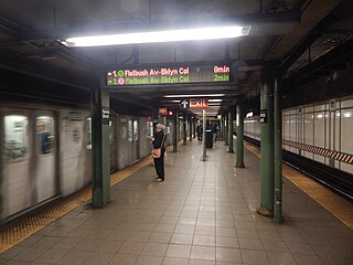
The Nevins Street station is an express station on the IRT Eastern Parkway Line of the New York City Subway. Located at the intersection of Nevins Street, Flatbush Avenue, and Fulton Street in Downtown Brooklyn, it is served by the 2 and 4 trains at all times, the 3 train all times except late nights, and the 5 train on weekdays only.

<span class="mw-page-title-main">Queensboro Plaza station</span> New York City Subway station in Queens

The Queensboro Plaza station is an elevated New York City Subway station at Queens Plaza in the Long Island City neighborhood of Queens. It is near the east end of the Queensboro Bridge, with Queens Boulevard running east from the plaza. The station is served by the 7 and N trains at all times, the W train on weekdays, and the <7> train rush hours in the peak direction.

The IND Eighth Avenue Line is a rapid transit line in New York City, United States, and is part of the B Division of the New York City Subway. Opened in 1932, it was the first line of the Independent Subway System (IND); as such, New Yorkers originally applied the Eighth Avenue Subway name to the entire IND system.

The IRT Lexington Avenue Line is one of the lines of the A Division of the New York City Subway, stretching from Lower Manhattan north to 125th Street in East Harlem. The line is served by the 4, ​5, ​6, and <6> trains.

<span class="mw-page-title-main">Borough Hall/Court Street station</span> New York City Subway station in Brooklyn

The Borough Hall/Court Street station is an underground New York City Subway station complex in Brooklyn shared by the BMT Fourth Avenue Line, the IRT Broadway–Seventh Avenue Line and the IRT Eastern Parkway Line. The complex comprises three stations: Borough Hall on the IRT lines and Court Street on the BMT line. The stations are located under Court, Joralemon, and Montague Streets, next to Brooklyn Borough Hall, in the Downtown Brooklyn and Brooklyn Heights neighborhoods of Brooklyn. It is served by the 2, 4, and R trains at all times; the 3 train all times except late nights; the 5 train on weekdays; the N train during late nights; and limited rush-hour W trains.

The BMT Broadway Line is a rapid transit line of the B Division of the New York City Subway in Manhattan. As of November 2016, it is served by four services, all colored yellow: the N and ​Q trains on the express tracks and the R and ​W trains on the local tracks during weekdays. The line is often referred to as the "N and R", since those were the only services on the line from 1988 to 2001, when the Manhattan Bridge's southern tracks were closed for rebuilding. The Broadway Line was built to give the Brooklyn Rapid Transit Company access to Midtown Manhattan.

The BMT Nassau Street Line is a rapid transit line of the B Division of the New York City Subway system in Manhattan. At its northern end, the line is a westward continuation of the BMT Jamaica Line in Brooklyn after the Jamaica Line crosses the Williamsburg Bridge into Manhattan. The Nassau Street Line continues south to a junction with the BMT Broadway Line just before the Montague Street Tunnel, after which the line reenters Brooklyn. Although the tracks merge into the Broadway Line south of Broad Street, there has been no regular service south of the Broad Street station since June 25, 2010. While the line is officially recognized as the Nassau Street Line, it only serves one station on Nassau Street: Fulton Street.

<span class="mw-page-title-main">DeKalb Avenue station (BMT lines)</span> New York City Subway station in Brooklyn

The DeKalb Avenue station is an interchange station on the BMT Brighton Line and BMT Fourth Avenue Line of the New York City Subway, located at the intersection of DeKalb and Flatbush Avenues in Downtown Brooklyn. It is served by the Q and R trains at all times, the B train on weekdays, and the D and N trains during late nights. During rush hours only, a few W train trips also serve this station.

<span class="mw-page-title-main">Eighth Street–New York University station</span> New York City Subway station in Manhattan

The Eighth Street–New York University station is a local station on the New York City Subway's BMT Broadway Line. Located at the intersection of Eighth Street and Broadway in Greenwich Village, Manhattan, it is served by the R train at all times except late nights, the W train on weekdays, the N train during late nights and weekends, and the Q train during late nights. It serves the main campus of New York University.

<span class="mw-page-title-main">23rd Street station (BMT Broadway Line)</span> New York City Subway station in Manhattan

The 23rd Street station is a local station on the BMT Broadway Line of the New York City Subway. Located at the intersection of 23rd Street, Broadway, and Fifth Avenue in the Flatiron District of Manhattan, it is served by the R train at all times except late nights, the W train on weekdays, the N train during late nights and weekends, and the Q train during late nights.

<span class="mw-page-title-main">Prince Street station</span> New York City Subway station in Manhattan

The Prince Street station is a local station on the BMT Broadway Line of the New York City Subway. Located in SoHo, Manhattan, it is served by the R train at all times except late nights, the W train on weekdays, the N train during late nights and weekends, and the Q train during late nights.

<span class="mw-page-title-main">Rector Street station (BMT Broadway Line)</span> New York City Subway station in Manhattan

The Rector Street station is a local station on the BMT Broadway Line of the New York City Subway. Located at the corner of Rector Street and Trinity Place in Financial District, Lower Manhattan, the station is served by the R train at all times except late nights, when the N train takes over service. The W train also serves this station on weekdays.

<span class="mw-page-title-main">28th Street station (BMT Broadway Line)</span> New York City Subway station in Manhattan

The 28th Street station is a local station on the BMT Broadway Line of the New York City Subway, located at 28th Street and Broadway in Manhattan. It is served by the R train at all times except late nights, the W train on weekdays, the N train during late nights and weekends and the Q train during late nights.

<span class="mw-page-title-main">South Ferry/Whitehall Street station</span> New York City Subway station in Manhattan

The South Ferry/Whitehall Street station is a New York City Subway station complex in the Financial District neighborhood of Manhattan, under Battery Park. The complex is shared by the IRT Broadway–Seventh Avenue Line and the BMT Broadway Line. It is served by the 1 and R trains at all times, the W train only on weekdays during the day, and the N train at night.

<span class="mw-page-title-main">Lexington Avenue/59th Street station</span> New York City Subway station in Manhattan

The Lexington Avenue/59th Street station is a New York City Subway station complex shared by the IRT Lexington Avenue Line and the BMT Broadway Line. It is located at Lexington Avenue between 59th and 60th Streets, on the border of Midtown and the Upper East Side of Manhattan. The station complex is the fourteenth-busiest in the system, with over 21 million passengers in 2016.

<span class="mw-page-title-main">Canal Street station (New York City Subway)</span> New York City Subway station in Manhattan

The Canal Street station is a New York City Subway station complex. It is located in the neighborhoods of Chinatown and SoHo in Manhattan and is shared by the BMT Broadway Line, the IRT Lexington Avenue Line, and the BMT Nassau Street Line. It is served by the 6, J, N, and Q trains at all times; the R train at all times except late nights; the W train during weekdays; the <6> train during weekdays in the peak direction; the Z train during rush hours in the peak direction; and the 4 train during late nights.

<span class="mw-page-title-main">Fourth Avenue/Ninth Street station</span> New York City Subway station in Brooklyn

The Fourth Avenue/Ninth Street station is a New York City Subway station complex shared by the elevated IND Culver Line and the underground BMT Fourth Avenue Line. It is located at the intersection of Ninth Street and Fourth Avenue in Park Slope, Brooklyn and served by the:

<span class="mw-page-title-main">Fulton Street station (New York City Subway)</span> New York City Subway station in Manhattan

The Fulton Street station is a major New York City Subway station complex in Lower Manhattan. It consists of four linked stations on the IND Eighth Avenue Line, the IRT Lexington Avenue Line, the BMT Nassau Street Line and the IRT Broadway–Seventh Avenue Line. The complex is served by the 2, 4, A, and J trains at all times. The 3, 5, and C trains stop here at all times except late nights, and the Z stops during rush hours in the peak direction.

<span class="mw-page-title-main">Brooklyn Bridge–City Hall/Chambers Street station</span> New York City Subway station in Manhattan

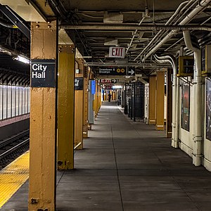
The Brooklyn Bridge–City Hall/Chambers Street station is a New York City Subway station complex in Lower Manhattan. The complex is served by trains of the IRT Lexington Avenue Line and the BMT Nassau Street Line. The station is served by the 4, 6, and J trains at all times; the 5 train at all times except late nights; the <6> train during weekdays in the peak direction; and the Z train during rush hours in the peak direction.

<span class="mw-page-title-main">Chambers Street–World Trade Center/Park Place/Cortlandt Street station</span> New York City Subway station in Manhattan

The Chambers Street–World Trade Center/Park Place/Cortlandt Street station is a New York City Subway station complex on the IND Eighth Avenue Line, IRT Broadway–Seventh Avenue Line, and BMT Broadway Line. Located on Church Street between Chambers and Cortlandt Streets in Lower Manhattan, it is served by the 2, A and E trains at all times; W train on weekdays; 3, C and R trains at all times except late nights; and N train during late nights.

References

  1. "Glossary". Second Avenue Subway Supplemental Draft Environmental Impact Statement (SDEIS) (PDF). Vol. 1. Metropolitan Transportation Authority. March 4, 2003. pp. 1–2. Archived from the original (PDF) on February 26, 2021. Retrieved January 1, 2021.
  2. The New York Times , Open New Subway to Times Square, January 6, 1918
  3. 1 2 "Annual Subway Ridership (2018–2023)". Metropolitan Transportation Authority. 2023. Retrieved April 20, 2024.
  4. Report of the Public Service Commission for the First District of the State of New York. The Public Service Commission for the First District of the State of New York. 1918. p. 74.
  5. 1 2 "B.R.T. Plan Cuts Into Express Runs; Trains To and From Brooklyn Interrupt Service at 59th and Canal Streets". The New York Times. December 10, 1913. ISSN   0362-4331 . Retrieved April 30, 2023.
  6. Report of the Public Service Commission of The First District of the State Of New York For The Year Ending December 31, 1915. New York State Public Service Commission. January 1, 1916.
  7. Cudahy, Brian J. (January 1, 1995). Under the Sidewalks of New York: The Story of the Greatest Subway System in the World . Fordham University Press. p.  132. ISBN   978-0-8232-1618-5.
  8. "Open New Subway To Times Square; Brooklyn Directly Connected with Wholesale and Shopping Districts of New York. Nickel Zone Is Extended. First Train in Broadway Tube Makes Run from Rector Street in 17 Minutes. Cost About $20,000,000 Rapid Transit from Downtown to Hotel and Theatre Sections Expected to Affect Surface Lines. Increases Five-Cent Zone. First Trip to Times Square. Benefits to Brooklyn" (PDF). The New York Times. January 6, 1918. ISSN   0362-4331 . Retrieved November 5, 2016.
  9. "Bids for B.M.T. Stations; Platforms South of Fourteenth Street to Be Lengthened". The New York Times. July 8, 1926. ISSN   0362-4331 . Retrieved April 28, 2023.
  10. "B.M.T. to Operate Eight-car Trains; Platforms in Forty Stations Are Lengthened, Increasing Capacity 33 1-3%". The New York Times. August 2, 1927. ISSN   0362-4331 . Retrieved May 12, 2023.
  11. "B. M, T. Station Lengthening Is Nearly Finished: 76 Platforms Are Extended 3,186 Feet to Make Room for 126.000 Additional Passengers in Rush Hours City Carried Out Work I.R.T. Changes Planned, but That Company Refuses to Pay Its Share of Costs". New-York Tribune. August 2, 1927. p. 32. ISSN   1941-0646. ProQuest   1113704092.
  12. "B.M.T. Lines Pass to City Ownership; $175,000,000 Deal Completed at City Hall Ceremony-- Mayor 'Motorman No. 1'". The New York Times. June 2, 1940. ISSN   0362-4331. Archived from the original on July 19, 2021. Retrieved May 14, 2022.
  13. "City Takes Over B. M. T. System; Mayor Skippers Midnight Train". New York Herald Tribune. June 2, 1940. p. 1. ProQuest   1243059209.
  14. http://images.nycsubway.org/i1000/img_1228.jpg [ bare URL image file ]
  15. Dougherty, Peter (2020). Tracks of the New York City Subway 2020 (16th ed.). Dougherty. OCLC   1056711733.
  16. "MTA Neighborhood Maps: Lower Manhattan" (PDF). mta.info . Metropolitan Transportation Authority. 2015. Retrieved August 21, 2015.
  17. Buder, Leonard (June 26, 1983). "Coping with Crime in Office Buildings". The New York Times. ISSN   0362-4331 . Retrieved January 23, 2019.
  18. 1 2 Joseph Brennan, Abandoned Stations: City Hall (BMT) lower level, accessed March 21, 2007
  19. "Tomb of the Unnamed + Repent Tunnel". June 16, 2014.
  20. "Showing Image 31845".
  21. Chuck Hogan & Guillermo del Toro, The Strain . ISBN   006-1-5582-3-0. 2009, pp. 360—385

Further reading