
LebanonCounty is a county in the Commonwealth of Pennsylvania. As of the 2020 census, the population was 143,257. Its county seat is the city of Lebanon.

Colebrook is a town in Litchfield County, Connecticut, United States. The population was 1,361 at the 2020 census. The town is part of the Northwest Hills Planning Region. Colebrook was named after Colebrooke in the English county of Devon; the reason is now unknown.
Mount Gretna Heights is an unincorporated community and census-designated place (CDP) in Lebanon County, Pennsylvania, United States, adjacent to the borough of Mount Gretna. The population was 323 at the 2010 census.

South Londonderry Township is a township in Lebanon County, Pennsylvania, United States. It is part of the Lebanon, PA Metropolitan Statistical Area. The population was 8,763 at the 2020 census.
Timber Hills is an unincorporated community and census-designated place (CDP) in Lebanon County, Pennsylvania, United States. The population was 360 at the 2010 census.

U.S. Route 322 is a 494 mi (795.0 km) long, east–west United States Highway, traversing Ohio, Pennsylvania, and New Jersey. The road is a spur of US 22 and one of the original highways from 1926. A portion of it at one time was concurrent with the Lakes-to-Sea Highway.

U.S. Route 422 (US 422) is a 271-mile (436 km) long spur route of US 22 split into two segments in the U.S. states of Ohio and Pennsylvania. The western segment of US 422 runs from downtown Cleveland, Ohio, east to Ebensburg, Pennsylvania. The eastern segment, located entirely within Pennsylvania, runs from Hershey east to King of Prussia, near Philadelphia. US 422 Business serves as a business route into each of four towns along the way.

Swatara State Park is a 3,515-acre (1,422 ha) Pennsylvania state park in Bethel, Swatara and Union Townships, Lebanon and Pine Grove Township, Schuylkill Counties in Pennsylvania in the United States. 8 miles (13 km) of Swatara Creek lie within the park's boundaries, which are roughly formed by Pennsylvania Route 443 to the north and Interstate 81 to the south. The park is in a valley in the ridge and valley region of Pennsylvania between Second Mountain (north) and Blue Mountain (south).

Bucktail State Park Natural Area is a 16,433-acre (6,650 ha) Pennsylvania state park in Cameron and Clinton Counties in Pennsylvania in the United States. The park follows Pennsylvania Route 120 for 75 miles (121 km) between Emporium and Lock Haven. Bucktail State Park Natural Area park runs along Sinnemahoning Creek and the West Branch Susquehanna River and also passes through Renovo. The park is named for the Civil War Pennsylvania Bucktails Regiment and is primarily dedicated to wildlife viewing, especially elk.

The Harrisburg–Carlisle metropolitan statistical area, officially the Harrisburg–Carlisle, PA Metropolitan Statistical Area, and also referred to as the Susquehanna Valley, is defined by the Office of Management and Budget as an area consisting of three counties in South Central Pennsylvania, anchored by the cities of Harrisburg and Carlisle.

Pennsylvania Route 897 is a 41.7-mile-long (67.1 km) north–south route in eastern Pennsylvania, United States. The southern terminus is at an intersection with U.S. Route 30 in Gap. The northern terminus is at US 422 on the eastern edge of Lebanon. The route is a two-lane undivided road its entire length. PA 897 is located in Lancaster and Lebanon counties. The route heads north from Gap through agricultural areas in the Pennsylvania Dutch Country in Lancaster County, passing through White Horse, Blue Ball, and Terre Hill before continuing northwest through the northern portion of the county. PA 897 continues into Lebanon County and heads west to Schaefferstown before turning northwest to Lebanon. PA 897 was first designated in 1928 to the road between Reinholds and Kleinfeltersville while the road between Gap and White Horse was designated as the easternmost portion of PA 340. PA 897 was extended to its current length in the 1930s, replacing the portion of PA 340 between Gap and White Horse that was rerouted.

Pennsylvania Route 117 is a 12.6-mile-long (20.3 km) state route in Lebanon County, Pennsylvania. Its southern terminus is at an interchange with U.S. Route 322 /PA 72 in Cornwall. Its northern terminus is at US 422 in Palmyra. PA 117 heads west from US 322/PA 72 through forested areas, passing through Mount Gretna before forming a short concurrency with PA 241 in Colebrook. From here, the route heads northwest and intersects US 322 near Campbelltown.

Pennsylvania Route 241 is a 23.6-mile-long (38.0 km) state highway in the U.S. state of Pennsylvania. The route runs from PA 441 in Conoy Township, Lancaster County, northeast to PA 72 in the city of Lebanon in Lebanon County. The route heads east from PA 441 to Elizabethtown, where it runs concurrent with both PA 230 and PA 743. PA 241 continues into Lebanon County and intersects PA 341 and PA 117 in Colebrook. The route heads northeast and forms a concurrency with U.S. Route 322 before continuing to Lebanon.
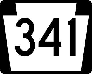
Pennsylvania Route 341 is a state highway in the U.S. state of Pennsylvania. The route runs 10.7 miles (17.2 km) from PA 230 in Londonderry Township in Dauphin County east to PA 241 in South Londonderry Township in Lebanon County. The route is a two-lane undivided road known as Colebrook Road for its entire length, passing through rural areas. Along the way, PA 341 crosses PA 743 near Deodate and passes through Upper Lawn. An eastbound truck route, PA 341 Truck, bypasses the route between PA 230 and PA 743. PA 341 was first designated onto its current alignment by 1930, running between U.S. Route 230 and PA 241. The route was fully paved in the 1930s. Between the 1930s and 1940s, PA 341 headed southeast along Lawn Road to end at PA 241 in Lawn.

The Lebanon Valley Rail Trail (LVRT) is a National Recreation Trail. The rail trail goes from the southwestern border of Lebanon County and goes through Colebrook, Mt. Gretna, Cornwall, and the city of Lebanon. At the southern border of Lebanon County, Pennsylvania the LVRT connects with the Conewago Recreation Trail and continues for another 5.0 miles (8.0 km). The trail is partly built on the old Cornwall–Lebanon Railroad created by industrialist Robert H. Coleman in the 1880s. The trail runs 15.0 miles (24.1 km), and there are many phases in development that would extend the trail to northern Lebanon County and Jonestown. The trail features a packed stone path and paved path at many parts that traverses "Pennsylvania Dutch Country" and other scenic routes. Trail users see untouched woodlands of state gamelands, forests, and views of area fields and farms. The trail is maintained by dedicated group of volunteers, and allows for running, walking, biking, horseback riding, and cross-country skiing.
Upper Lawn is an unincorporated community in South Londonderry Township in Lebanon County, Pennsylvania, United States. Upper Lawn is located at the intersection of Pennsylvania Route 341, Lawn Road, and Gingrich Road.
Mount Wilson is an unincorporated community on the border of South Annville Township and South Londonderry Township in Lebanon County, Pennsylvania, United States. Mount Wilson is located along Pennsylvania Route 241.

Lawn, previously known as Roseland, is an unincorporated community in South Londonderry Township in Lebanon County, Pennsylvania, United States. Lawn is located at the intersection of Pennsylvania Route 241 and Lawn Road.
Rileyville is a village in the Lebanon Township, Wayne County, Pennsylvania, United States. It is located at the intersection of Route 191 and Route 371. The mailing city address for the area is Honesdale, a borough and the county seat directly south of Rileyville.
The Pennsylvania State Game Lands Number 80 are Pennsylvania State Game Lands in Berks, Lebanon and Schuylkill Counties in Pennsylvania, providing hunting, bird watching, and other activities.


