
Interstate 95 (I-95) is the main north–south Interstate Highway on the East Coast of the United States, running from U.S. Route 1 (US 1) in Miami, Florida, north to the Houlton–Woodstock Border Crossing between Maine and the Canadian province of New Brunswick. The highway largely parallels the Atlantic coast and US 1, except for the portion between Savannah, Georgia, and Washington, D.C., and the portion between Portland and Houlton in Maine, both of which follow a more direct inland route.
Mifflin County is a county in the Commonwealth of Pennsylvania. As of the 2020 census, the population was 46,143. Its county seat is Lewistown. The county was created on September 19, 1789, from parts of Cumberland County and Northumberland County. It was named for Thomas Mifflin, the first Governor of Pennsylvania. Mifflin County comprises the Lewistown, PA Micropolitan Statistical Area.

Mt. Lebanon is a township with home rule status in Allegheny County, Pennsylvania, United States. The population was 34,075 at the 2020 census. It is a suburb of Pittsburgh. Established in 1912 as Mount Lebanon, the township was a farming community. With the arrival of the first streetcar lines and the development of the first real estate subdivision, both in 1901, it became a streetcar suburb, offering residents the ability to commute to Downtown Pittsburgh. Furthermore, the opening of the Liberty Tunnel in 1924 allowed easy automobile access to Pittsburgh. In 1975, the renamed Mt. Lebanon adopted one of the first home rule charters in Pennsylvania.

Spring Township is a township in Berks County, Pennsylvania, United States. The population was 27,119 at the 2010 census, making it the second most populous municipality in Berks County after Reading.

Pottstown is a borough in Montgomery County, Pennsylvania, United States. Pottstown was laid out in 1752–53 and named Pottsgrove in honor of its founder, John Potts. The old name was abandoned at the time of the incorporation as a borough in 1815. In 1888, the limits of the borough were considerably extended. Pottstown is the center of a productive farming and dairying region.

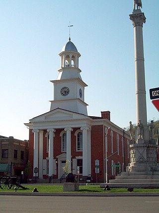
Mount Carmel is a borough in Northumberland County, located in the Coal Heritage Region of Central Pennsylvania's Susquehanna River Valley, United States. The population was 5,725 at the 2020 census. It is located 88 miles (141 km) northwest of Philadelphia and 71 miles (114 km) northeast of Harrisburg, in the Coal Region. It is completely encircled by Mount Carmel Township.

U.S. Route 322 is a 494 mi (795.0 km) long, east–west United States Highway, traversing Ohio, Pennsylvania, and New Jersey. The road is a spur of US 22 and one of the original highways from 1926. A portion of it at one time was concurrent with the Lakes-to-Sea Highway.
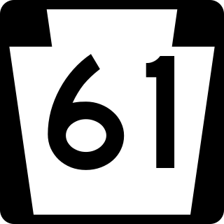
Pennsylvania Route 61 is an 81.8-mile-long (131.6 km) state highway that is located in the Commonwealth of Pennsylvania in the United States. The route is signed on a north–south direction, running from U.S. Route 222 Business in Reading northwest to US 11/US 15/PA 147 in Shamokin Dam.

Orson is a village in Preston Township, Pennsylvania, United States, situated in the Lake Region of the Poconos. It was once an important depot of the Scranton Division of the New York, Ontario & Western (O&W) Railway, but today, when it is known outside of its immediate vicinity, it is largely for being the site of the intersection of two state roads, Belmont Turnpike and Crosstown Highway, or as the location of Independent Lake Camp (ILC), since ILC's reputation and commercial reach, like those of most rural American summer camps, extend beyond the community in which the camp is physically located.

Pennsylvania Route 16 is a 43-mile-long (69 km) east–west state route located in southern Pennsylvania, United States. The western terminus of the route is at U.S. Route 522 in McConnellsburg. The eastern terminus is at the Mason–Dixon line in Liberty Township, where the road continues into Maryland as Maryland Route 140. PA 16 is a two-lane road that runs through rural areas in Fulton, Franklin, and Adams counties. The route heads east from McConnellsburg and crosses Tuscarora Mountain into Franklin County, where it continues east into the agricultural Cumberland Valley. Here, the passes through Mercersburg, Greencastle, and Waynesboro. PA 16 heads east through the South Mountain range, where it heads into Adams County and passes through Carroll Valley before coming to the Maryland border. PA 16 intersects several roads including PA 456 in Cove Gap, PA 75 and PA 416 in Mercersburg, PA 995 in Upton, US 11 and Interstate 81 (I-81) in Greencastle, PA 316 and PA 997 in Waynesboro, and PA 116 in Carroll Valley. The road's main name is Buchanan Trail in honor of 15th President James Buchanan, who was born near the road in Cove Gap.

Pennsylvania Route 31 is a 74-mile-long (119 km) state highway located in Western Pennsylvania, paralleling U.S. Route 30 and the Pennsylvania Turnpike for most of its length. The designation begins at PA 136 near West Newton and ends at US 30 near Bedford.
The 58th Pennsylvania House of Representatives District is located in southwest Pennsylvania and has been represented by Eric Davanzo since 2020.

Little Fishing Creek is a tributary of Fishing Creek in Sullivan County, Lycoming County, and Columbia County, in Pennsylvania, in the United States. It is approximately 23.5 miles (37.8 km) long and flows through eight townships. The watershed of the creek has an area of 68.1 square miles (176 km2). The creek has six named tributaries, of which the largest are Spruce Run and West Branch Run.
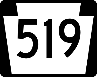
Pennsylvania Route 519 runs in a north–south route through central Washington County connecting the Glyde area of North Bethlehem Township at the southern terminus with the Hickory area of Mt. Pleasant Township at the north end.

Pennsylvania Route 117 is a 12.6-mile-long (20.3 km) state route in Lebanon County, Pennsylvania. Its southern terminus is at an interchange with U.S. Route 322 /PA 72 in Cornwall. Its northern terminus is at US 422 in Palmyra. PA 117 heads west from US 322/PA 72 through forested areas, passing through Mount Gretna before forming a short concurrency with PA 241 in Colebrook. From here, the route heads northwest and intersects US 322 near Campbelltown.

Pennsylvania Route 331 is a 14.5-mile-long (23.3 km), east–west state highway located in Washington County, Pennsylvania. The western terminus is at the West Virginia state line in Independence Township where the road continues as West Virginia Route 67. The eastern terminus is at PA 844 in Canton Township. PA 331 was initially established on May 27, 1935. The route was rerouted in the 2000s following the closure of a bridge over Buffalo Creek.

Pennsylvania Route 653 (PA 653) is a 26-mile-long (42 km) state highway that is located in Fayette and Somerset counties in the Commonwealth of Pennsylvania in the United States.

Pennsylvania Route 819 is a 46.6-mile-long (75.0 km) state highway located in Fayette and Westmoreland counties in Pennsylvania, United States. The southern terminus is at PA 201 in Vanderbilt. The northern terminus is at PA 66 in Oklahoma.
Unionville is an unincorporated community in Union Township in Berks County, Pennsylvania, United States. Unionville is located at the intersection of Pennsylvania Route 724 and Unionville Road, south of the Schuylkill River.
Colebrook is an unincorporated community in South Londonderry Township in Lebanon County, Pennsylvania, United States. Colebrook is located at the intersection of Pennsylvania Route 117 and Mount Wilson Road just to the south of Pennsylvania Route 241.


