Newmanstown, Pennsylvania

Last updated

Newmanstown, Pennsylvania
Ancient and historic landmarks in the Lebanon Valley (1895) (14596670937).jpg
Newmanstown in 1895
USA Pennsylvania location map.svg
Red pog.svg
Newmanstown
Location in Pennsylvania
Usa edcp location map.svg
Red pog.svg
Newmanstown
Location in the United States
Coordinates: 40°21′3″N76°12′49″W / 40.35083°N 76.21361°W / 40.35083; -76.21361
Country United States
State Pennsylvania
County Lebanon
Township Millcreek
Area
[1]
  Total2.18 sq mi (5.64 km2)
  Land2.18 sq mi (5.64 km2)
  Water0.00 sq mi (0.00 km2)
Elevation
490 ft (150 m)
Population
 (2020) [2]
  Total2,834
  Density1,300.60/sq mi (502.09/km2)
Time zone UTC-5 (Eastern (EST))
  Summer (DST) UTC-4 (EDT)
ZIP code
17073
Area code(s) 610
FIPS code 42-53856
GNIS feature ID1182402

Newmanstown is an unincorporated community and census-designated place (CDP) in Millcreek Township, Lebanon County, Pennsylvania. The population was 2,478 at the 2010 census, [3] an increase over the figure of 1,536 tabulated in 2000.

Contents

Geography

Newmanstown is in southeastern Lebanon County along the northeastern edge of Millcreek Township. It is bordered to the northeast by Marion Township and Heidelberg Township in Berks County. Route 419 runs through the center of town as Main Street, leading northeast 2 miles (3 km) to Womelsdorf and southwest 6 miles (10 km) to Schaefferstown. Lebanon, the county seat, is 12 miles (19 km) to the west of Newmanstown, and Reading is 16 miles (26 km) to the east.

According to the United States Census Bureau, the Newmanstown CDP has a total area of 2.2 square miles (5.7 km2), all land. [4] Mill Creek, which drains northward into Tulpehocken Creek, a tributary of the Schuylkill River, runs along the west side of the town.

Newsmanstown view of 1911 Aug 26 1911 Newmanstown PA.jpg
Newsmanstown view of 1911

Demographics

Historical population
CensusPop.Note
2020 2,834
U.S. Decennial Census [5]

As of the 2000 census, [6] there were 1,536 people, 603 households, and 417 families residing in the CDP. The population density was 702.3 inhabitants per square mile (271.2/km2). There were 635 housing units at an average density of 290.3 per square mile (112.1/km2). The racial makeup of the CDP was 98.05% White, 0.52% African American, 0.26% Asian, 0.52% from other races, and 0.65% from two or more races. Hispanic or Latino of any race were 1.56% of the population.

There were 603 households, out of which 33.0% had children under the age of 18 living with them, 55.7% were married couples living together, 8.0% had a female householder with no husband present, and 30.7% were non-families. 25.2% of all households were made up of individuals, and 12.6% had someone living alone who was 65 years of age or older. The average household size was 2.53 and the average family size was 3.05.

In the CDP, the population was spread out, with 25.5% under the age of 18, 7.1% from 18 to 24, 30.5% from 25 to 44, 23.2% from 45 to 64, and 13.6% who were 65 years of age or older. The median age was 37 years. For every 100 females, there were 98.7 males. For every 100 females age 18 and over, there were 96.6 males.

The median income for a household in the CDP was $43,098, and the median income for a family was $47,308. Males had a median income of $29,280 versus $21,759 for females. The per capita income for the CDP was $18,284. About 1.8% of families and 3.3% of the population were below the poverty line, including 4.7% of those under age 18 and 4.7% of those age 65 or over.

Related Research Articles

<span class="mw-page-title-main">Heidelberg Township, Berks County, Pennsylvania</span> Township in Pennsylvania, United States

Heidelberg Township is a township in Berks County, Pennsylvania. The population was 1,726 at the 2020 census.

<span class="mw-page-title-main">Marion Township, Berks County, Pennsylvania</span> Township in Pennsylvania, United States

Marion Township is a township in Berks County, Pennsylvania. The population was 1,688 at the 2010 census.

<span class="mw-page-title-main">Meadowood, Pennsylvania</span> Census-designated place in Pennsylvania, United States

Meadowood is a census-designated place (CDP) in Butler County, Pennsylvania, United States. The population was 2,693 at the 2010 census.

<span class="mw-page-title-main">Millcreek Township, Clarion County, Pennsylvania</span> Township in Pennsylvania, United States

Millcreek Township is a township in Clarion County, Pennsylvania, United States. The population was 362 at the 2020 census, a decrease from the figure of 396 tabulated in 2010.

<span class="mw-page-title-main">Canadohta Lake, Pennsylvania</span> Census-designated place in Pennsylvania, United States

Canadohta Lake is a census-designated place (CDP) in Crawford County, Pennsylvania, United States. The population was 516 at the 2010 census.

<span class="mw-page-title-main">Pymatuning Central, Pennsylvania</span> Census-designated place in Pennsylvania, United States

Pymatuning Central is a census-designated place (CDP) in Crawford County, Pennsylvania, United States. The population was 2,269 at the 2010 census.

<span class="mw-page-title-main">Millcreek Township, Erie County, Pennsylvania</span> Township in Pennsylvania

Millcreek Township is a township in Erie County, Pennsylvania. The population was 54,065 at the 2020 census. It is the 12th largest municipality in the state. and the largest township in Western Pennsylvania.

Avon is an unincorporated community and census-designated place (CDP) in Lebanon County, Pennsylvania, United States. The population was 1,667 at the 2010 census, a decline from the figure of 2,856 tabulated in 2000.

Campbelltown is an unincorporated community and census-designated place (CDP) in Lebanon County, Pennsylvania, United States. The population was 3,616 at the 2010 census. It is located east of Hershey at the intersection of U.S. Route 322 and Pennsylvania Route 117 and is located in the Harrisburg metropolitan area.

Lebanon South is an unincorporated area and census-designated place (CDP) in Lebanon County, Pennsylvania, United States. The population was 2,270 at the 2010 census.

<span class="mw-page-title-main">Millcreek Township, Lebanon County, Pennsylvania</span> Township in Pennsylvania, United States

Millcreek Township is a township in Lebanon County, Pennsylvania, United States. The population was 4,350 at the 2020 census. It is part of the Lebanon, PA Metropolitan Statistical Area.

Mount Gretna Heights is an unincorporated community and census-designated place (CDP) in Lebanon County, Pennsylvania, United States, adjacent to the borough of Mount Gretna. The population was 323 at the 2010 census.

<span class="mw-page-title-main">Quentin, Pennsylvania</span> Census-designated place in Pennsylvania, United States

Quentin is an unincorporated community and census-designated place (CDP) in Lebanon County, Pennsylvania, United States. It was named after Quentin Roosevelt, youngest son of President Theodore Roosevelt. The population was 594 at the 2010 census, up from 529 at the 2000 census.

Sand Hill is an unincorporated community and census-designated place (CDP) in Lebanon County, Pennsylvania, United States. The population was 2,496 at the 2010 census.

<span class="mw-page-title-main">Schaefferstown, Pennsylvania</span> Census-designated place in Pennsylvania, United States

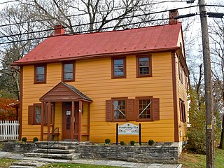
Schaefferstown is an unincorporated community and census-designated place (CDP) in Heidelberg Township, Lebanon County, Pennsylvania, United States. The population was 941 at the 2010 census.

Timber Hills is an unincorporated community and census-designated place (CDP) in Lebanon County, Pennsylvania, United States. The population was 360 at the 2010 census.

<span class="mw-page-title-main">Evansburg, Pennsylvania</span> Census-designated place in Pennsylvania, United States

Evansburg is a census-designated place (CDP) in Montgomery County, Pennsylvania, United States. The population was 2,129 at the 2010 census. It is a section of Lower Providence Township and is the namesake of Evansburg State Park.

<span class="mw-page-title-main">Hometown, Pennsylvania</span> CDP in Pennsylvania, United States

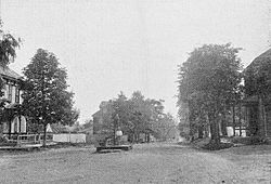
Hometown is a village in Rush Township, Schuylkill County, Pennsylvania, United States that sits astride a crossing point between important transportation corridors. The population was 1,399 at the 2000 census, and excepting for the area near the east–west PA 54 running mostly parallel to the tracks of the Reading, Blue Mountain, and Northern Railroad — once the important east-west shortline Nesquehoning & Mahanoy Railroad — and the PA 54 junction with PA 309.

Newtown is a census-designated place (CDP) in Reilly Township, Schuylkill County in the U.S. state of Pennsylvania. The population was 244 at the 2000 census.

<span class="mw-page-title-main">Loveland Park, Ohio</span> Census-designated place in Ohio, United States

Loveland Park is a census-designated place (CDP) located in Symmes Township, Hamilton County and Deerfield Township, Warren County, in the southwestern part of the U.S. state of Ohio. The CDP is named after the city of Loveland. The population was 1,737 at the 2020 census.

References

  1. "ArcGIS REST Services Directory". United States Census Bureau. Retrieved October 12, 2022.
  2. "Census Population API". United States Census Bureau. Retrieved October 12, 2022.
  3. "Total Population: 2010 Census DEC Summary File 1 (P1), Newmanstown CDP, Pennsylvania". data.census.gov. U.S. Census Bureau. Retrieved October 16, 2020.
  4. "2019 U.S. Gazetteer Files: Places: Pennsylvania". United States Census Bureau. Retrieved October 16, 2020.
  5. "Census of Population and Housing". Census.gov. Retrieved June 4, 2016.
  6. "U.S. Census website". United States Census Bureau . Retrieved January 31, 2008.