Coulter, Iowa

Last updated

Coulter, Iowa
Coulter, Iowa (1799340180).jpg
Coulter Public Library in 2007
Franklin County Iowa Incorporated and Unincorporated areas Coulter Highlighted.svg
Location of Coulter, Iowa
Coordinates: 42°44′4″N93°22′9″W / 42.73444°N 93.36917°W / 42.73444; -93.36917
Country Flag of the United States.svg  United States
State Flag of Iowa.svg  Iowa
County Franklin
Area
[1]
  Total2.47 sq mi (6.40 km2)
  Land2.47 sq mi (6.40 km2)
  Water0.00 sq mi (0.00 km2)
Elevation
1,240 ft (378 m)
Population
 (2020)
  Total219
  Density88.66/sq mi (34.24/km2)
Time zone UTC-6 (Central (CST))
  Summer (DST) UTC-5 (CDT)
ZIP code
50431
Area code 641
FIPS code 19-16815
GNIS feature ID0455671

Coulter is a city in Franklin County, Iowa, United States. The population was 219 at the 2020 census. [2]

Contents

History

Coulter got its start in the 1880s, following construction of the Chicago & Great Western Railway through that territory. [3]

Geography

Coulter is located at 42°44′4″N93°22′9″W / 42.73444°N 93.36917°W / 42.73444; -93.36917 (42.734311, -93.369173). [4]

According to the United States Census Bureau, the city has a total area of 2.45 square miles (6.35 km2), all land. [5]

Demographics

Historical populations
YearPop.±%
1910 198    
1920 277+39.9%
1930 266−4.0%
1940 236−11.3%
1950 271+14.8%
1960 315+16.2%
1970 262−16.8%
1980 264+0.8%
1990 252−4.5%
2000 262+4.0%
2010 281+7.3%
2020 219−22.1%
Source: "U.S. Census website". United States Census Bureau . Retrieved March 29, 2020. and Iowa Data Center
Source:
U.S. Decennial Census [6] [2]
The population of Coulter, Iowa from US census data CoulterIowaPopPlot.png
The population of Coulter, Iowa from US census data

2010 census

At the 2010 census there were 281 people, 107 households, and 76 families living in the city. The population density was 114.7 inhabitants per square mile (44.3/km2). There were 117 housing units at an average density of 47.8 per square mile (18.5/km2). The racial makeup of the city was 87.2% White, 0.4% African American, 12.1% from other races, and 0.4% from two or more races. Hispanic or Latino people of any race were 14.9%. [7]

Of the 107 households 37.4% had children under the age of 18 living with them, 55.1% were married couples living together, 6.5% had a female householder with no husband present, 9.3% had a male householder with no wife present, and 29.0% were non-families. 26.2% of households were one person and 11.2% were one person aged 65 or older. The average household size was 2.63 and the average family size was 3.12.

The median age was 34.5 years. 29.5% of residents were under the age of 18; 8% were between the ages of 18 and 24; 24.6% were from 25 to 44; 27.3% were from 45 to 64; and 10.7% were 65 or older. The gender makeup of the city was 55.2% male and 44.8% female.

2000 census

At the 2000 census there were 262 people, 105 households, and 66 families living in the city. The population density was 106.8 inhabitants per square mile (41.2/km2). There were 118 housing units at an average density of 48.1 per square mile (18.6/km2). The racial makeup of the city was 96.18% White, 3.82% from other races. Hispanic or Latino people of any race were 4.20%. [8]

Of the 105 households 29.5% had children under the age of 18 living with them, 51.4% were married couples living together, 8.6% had a female householder with no husband present, and 37.1% were non-families. 27.6% of households were one person and 9.5% were one person aged 65 or older. The average household size was 2.50 and the average family size was 3.14.

The age distribution was 27.9% under the age of 18, 7.6% from 18 to 24, 26.3% from 25 to 44, 20.6% from 45 to 64, and 17.6% 65 or older. The median age was 37 years. For every 100 females, there were 114.8 males. For every 100 females age 18 and over, there were 110.0 males.

The median household income was $35,208 and the median family income was $38,958. Males had a median income of $26,538 versus $20,625 for females. The per capita income for the city was $14,056. About 13.4% of families and 18.4% of the population were below the poverty line, including 36.3% of those under the age of eighteen and none of those sixty five or over.

Education

The CAL Community School District operates public schools serving Coulter. [9]

Related Research Articles

<span class="mw-page-title-main">Pocahontas County, Iowa</span> County in Iowa, United States

Pocahontas County is a county located in Iowa, United States. As of the 2020 census the population was 7,078, making it the state's ninth-least populous county. The county seat is Pocahontas. The county was formed in 1851.

<span class="mw-page-title-main">Spring Valley, San Diego County, California</span> Census-designated place in California, United States

Spring Valley is a census-designated place (CDP) in the East County region of San Diego County, California. The population was 28,205 at the time of the 2010 census.

<span class="mw-page-title-main">Buck Grove, Iowa</span> City in Iowa, United States

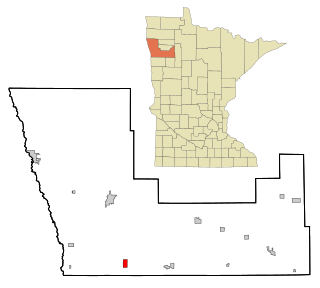
Buck Grove is a city in Crawford County, Iowa, United States. The population was 34 at the 2020 census.

<span class="mw-page-title-main">Mondamin, Iowa</span> City in Iowa, United States

Mondamin is a city in Harrison County, Iowa, United States. The population was 339 at the time of the 2020 census.

<span class="mw-page-title-main">Dixon, Iowa</span> City in Iowa, United States

Dixon is a city in Scott County, Iowa, United States. The population was 202 at the time of the 2020 census.

<span class="mw-page-title-main">Lilydale, Minnesota</span> City in Minnesota, United States

Lilydale is a city in Dakota County, Minnesota, United States. The population was 623 at the 2010 census.

<span class="mw-page-title-main">Wanamingo, Minnesota</span> City in Minnesota, United States

Wanamingo is a community in Goodhue County, Minnesota, United States, incorporated as a city. It lies along the North Fork of the Zumbro River. The population was 1,086 at the 2010 census.

<span class="mw-page-title-main">Foreston, Minnesota</span> City in Minnesota, United States

Foreston is a city in Mille Lacs County, Minnesota, United States. The population was 533 at the 2010 census.

<span class="mw-page-title-main">Harding, Minnesota</span> City in Minnesota, United States

Harding is a city in Morrison County, Minnesota, United States, along the Platte River. The population was 123 at the 2020 census.

<span class="mw-page-title-main">Deer Creek, Minnesota</span> City in Minnesota, United States

Deer Creek is a city in Otter Tail County, Minnesota, United States. The population was 330 at the 2020 census.

<span class="mw-page-title-main">Beltrami, Minnesota</span> City in Minnesota, United States

Beltrami is a city in Polk County, Minnesota, United States and was named in honor of Giacomo Costantino Beltrami, an Italian exile, who traveled to the Red river and the upper Mississippi in 1823. Officially incorporated in 1902, there had been settlers in the area since 1870. It is part of the Grand Forks, ND-MN Metropolitan Statistical Area. The population was 88 at the 2020 census.

<span class="mw-page-title-main">Leonidas, Minnesota</span> City in Minnesota, United States

Leonidas is a city in Saint Louis County, Minnesota, United States. The population was 52 at the 2010 census.

<span class="mw-page-title-main">St. Rosa, Minnesota</span> City in Minnesota, United States

Saint Rosa is a city in Stearns County, Minnesota, United States. The population was 68 at the 2010 census. It is part of the St. Cloud Metropolitan Statistical Area.

<span class="mw-page-title-main">Winchester, Missouri</span> City in Missouri, United States

Winchester is a city in St. Louis County, Missouri, United States. The population was 1,447 at the 2020 census.

<span class="mw-page-title-main">Uehling, Nebraska</span> Village in Nebraska, United States

Uehling is a village in Dodge County, Nebraska, United States. The population was 230 at the 2010 census.

<span class="mw-page-title-main">Gardena, North Dakota</span> City in North Dakota, United States

Gardena is a city in Bottineau County, North Dakota, United States. The population was 24 at the 2020 census. Gardena was founded in 1905.

<span class="mw-page-title-main">South Versailles Township, Allegheny County, Pennsylvania</span> Township in Pennsylvania, United States

South Versailles Township is a township in Allegheny County, Pennsylvania, United States. The population was 351 at the 2010 census. It contains the village of Coulter, also called Coulterville or Coulters. The U.S. Post Office in the village is called Coulters.

<span class="mw-page-title-main">Haskell, Texas</span> City in Texas, United States

Haskell is a city in central Haskell County, Texas, in the United States. As of the 2010 census, the city population was 3,322. It is the Haskell county seat.

<span class="mw-page-title-main">Minnesota Lake, Minnesota</span> City in Minnesota, United States

Minnesota Lake is a city in Blue Earth and Faribault counties in the State of Minnesota. The population was 661 at the 2020 census. The bulk of the city is in Faribault County; a small part extends into Blue Earth County.

<span class="mw-page-title-main">Minneiska, Minnesota</span> City in Minnesota, United States

Minneiska is a city in Wabasha and Winona counties in the U.S. state of Minnesota. The population was 111 at the 2010 census.

References

  1. "2020 U.S. Gazetteer Files". United States Census Bureau. Retrieved March 16, 2022.
  2. 1 2 "2020 Census State Redistricting Data". census.gov. United states Census Bureau. Retrieved August 12, 2021.
  3. Stuart, I. L. (1914). History of Franklin County, Iowa: A Record of Settlement, Organization, Progress and Achievement, Volume 1. S. J. Clarke Publishing Company. p. 337.
  4. "US Gazetteer files: 2010, 2000, and 1990". United States Census Bureau. February 12, 2011. Retrieved April 23, 2011.
  5. "US Gazetteer files 2010". United States Census Bureau. Archived from the original on July 2, 2012. Retrieved May 11, 2012.
  6. "Census of Population and Housing". Census.gov. Retrieved June 4, 2015.
  7. "U.S. Census website". United States Census Bureau . Retrieved May 11, 2012.
  8. "U.S. Census website". United States Census Bureau . Retrieved January 31, 2008.
  9. "CAL." Iowa Department of Education. Retrieved on September 15, 2018.