Geneva, Iowa

Last updated
Geneva, Iowa
Franklin County Iowa Incorporated and Unincorporated areas Geneva Highlighted.svg
Location of Geneva, Iowa
Coordinates: 42°40′33″N93°7′53″W / 42.67583°N 93.13139°W / 42.67583; -93.13139 Coordinates: 42°40′33″N93°7′53″W / 42.67583°N 93.13139°W / 42.67583; -93.13139
Country Flag of the United States.svg  United States
State Flag of Iowa.svg  Iowa
County Franklin
Area
[1]
  Total0.41 sq mi (1.06 km2)
  Land0.41 sq mi (1.06 km2)
  Water0.00 sq mi (0.00 km2)
Elevation
1,102 ft (336 m)
Population
 (2020)
  Total136
  Density332.52/sq mi (128.47/km2)
Time zone UTC-6 (Central (CST))
  Summer (DST) UTC-5 (CDT)
ZIP code
50633
Area code(s) 641
FIPS code 19-30135
GNIS feature ID0456868

Geneva is a city in Franklin County, Iowa, United States. The population was 136 at the time of the 2020 census. [2]

Contents

History

Geneva was platted in 1871, and it was incorporated as a town in 1903. [3]

Geography

Geneva is located at 42°40′33″N93°07′53″W / 42.675905°N 93.131396°W / 42.675905; -93.131396 (42.675905, -93.131396). [4]

According to the United States Census Bureau, the city has a total area of 0.42 square miles (1.09 km2), all land. [5]

Demographics

Historical populations
YearPop.±%
1910 199    
1920 244+22.6%
1930 249+2.0%
1940 268+7.6%
1950 242−9.7%
1960 219−9.5%
1970 201−8.2%
1980 218+8.5%
1990 169−22.5%
2000 171+1.2%
2010 165−3.5%
2020 136−17.6%
Source: "U.S. Census website". United States Census Bureau . Retrieved 2020-03-28. and Iowa Data Center
Source:
U.S. Decennial Census [6] [2]
The population of Geneva, Iowa from US census data GenevaIowaPopPlot.png
The population of Geneva, Iowa from US census data

2010 census

As of the census [7] of 2010, there were 165 people, 68 households, and 42 families residing in the city. The population density was 392.9 inhabitants per square mile (151.7/km2). There were 74 housing units at an average density of 176.2 per square mile (68.0/km2). The racial makeup of the city was 98.2% White and 1.8% from two or more races. Hispanic or Latino of any race were 0.6% of the population.

There were 68 households, of which 30.9% had children under the age of 18 living with them, 51.5% were married couples living together, 7.4% had a female householder with no husband present, 2.9% had a male householder with no wife present, and 38.2% were non-families. 32.4% of all households were made up of individuals, and 16.1% had someone living alone who was 65 years of age or older. The average household size was 2.43 and the average family size was 3.12.

The median age in the city was 40.2 years. 24.2% of residents were under the age of 18; 8.6% were between the ages of 18 and 24; 21.8% were from 25 to 44; 27.9% were from 45 to 64; and 17.6% were 65 years of age or older. The gender makeup of the city was 46.7% male and 53.3% female.

2000 census

As of the census [8] of 2000, there were 171 people, 69 households, and 42 families residing in the city. The population density was 400.4 inhabitants per square mile (154.6/km2). There were 77 housing units at an average density of 180.3 per square mile (69.6/km2). The racial makeup of the city was 100.00% White. Hispanic or Latino of any race were 0.58% of the population.

There were 69 households, out of which 29.0% had children under the age of 18 living with them, 55.1% were married couples living together, 4.3% had a female householder with no husband present, and 37.7% were non-families. 34.8% of all households were made up of individuals, and 23.2% had someone living alone who was 65 years of age or older. The average household size was 2.48 and the average family size was 3.28.

The population was 29.8% under the age of 18, 5.8% from 18 to 24, 22.2% from 25 to 44, 24.0% from 45 to 64, and 18.1% who were 65 years of age or older. The median age was 40 years. For every 100 females, there were 78.1 males. For every 100 females age 18 and over, there were 81.8 males.

The median income for a household in the city was $33,542, and the median income for a family was $40,625. Males had a median income of $33,750 versus $20,000 for females. The per capita income for the city was $15,112. None of the families and 5.9% of the population were living below the poverty line, including no under eighteens and 8.5% of those over 64.

Education

AGWSR Community School District operates area public schools. [9] The district formed on July 1, 2001, with the merger of the Wellsburg-Steamboat Rock Community School District and the Ackley–Geneva Community School District. [10]

Related Research Articles

Keystone, Iowa City in Iowa, United States

Keystone is a city in Benton County, Iowa, United States. The population was 599 at the time of the 2020 census. It is part of the Cedar Rapids Metropolitan Statistical Area.

<span class="mw-page-title-main">Beaver, Iowa</span> City in Iowa, United States

Beaver is a city in Amaqua Township, Boone County, Iowa, United States. The population was 46 at the 2020 census. It is part of the 'Boone, Iowa Micropolitan Statistical Area', which is a part of the larger Ames-Boone, Iowa Combined Statistical Area.

Stanley, Iowa City in Iowa, United States

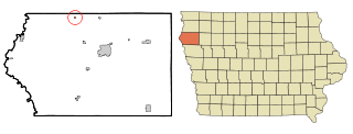
Stanley is a city in Buchanan and Fayette counties in the U.S. state of Iowa. The population was 81 at the time of the 2020 census.

Rembrandt, Iowa City in Iowa, United States

Rembrandt is a city in Buena Vista County, Iowa, United States. The population was 209 at the time of the 2020 census.

<span class="mw-page-title-main">Garber, Iowa</span> City in Iowa, United States

Garber is a city in Clayton County, Iowa, United States. The population was 76 at the time of the 2020 census, down from 103 in 2000.

St. Olaf, Iowa City in Iowa, United States

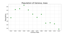
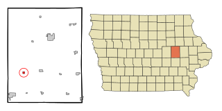
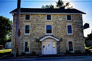
St. Olaf is a city in Clayton County, Iowa, United States. The population was 106 at the time of the 2020 census, down from 136 in 2000. Swiss Valley has a large cheese packaging plant in St. Olaf.

<span class="mw-page-title-main">Charter Oak, Iowa</span> City in Iowa, United States

Charter Oak is a city in Crawford County, Iowa, United States, along the East Soldier River. The population was 535 at the 2020 census.

<span class="mw-page-title-main">Durango, Iowa</span> City in Iowa, United States

Durango is a city in Dubuque County, Iowa, United States. It is part of the Dubuque, Iowa Metropolitan Statistical Area. The population was 20 at the time of the 2020 census, down from 24 in 2000.

Maynard, Iowa City in Iowa, United States

Maynard is a city in Fayette County, Iowa, United States. The population was 476 at the time of the 2020 census.

Wellsburg, Iowa City in Iowa, United States

Wellsburg is a city in Grundy County, Iowa, United States. The population was 720 at the 2020 census, a slight increase from 716 in 2000. It is part of the Waterloo–Cedar Falls Metropolitan Statistical Area. The city is named for George Wells, an early settler in the region.

Steamboat Rock, Iowa City in Iowa, United States

Steamboat Rock is a city in Hardin County, Iowa, United States. The population was 264 at the time of the 2020 census.

La Motte, Iowa City in Iowa, United States

La Motte is a small city in northern Jackson County, Iowa, United States. The population was 237 at the time of the 2020 census.

Morley, Iowa City in Iowa, United States

Morley is a city in Jones County, Iowa, United States. The population was 96 at the time of the 2020 census. It is part of the Cedar Rapids Metropolitan Statistical Area.

<span class="mw-page-title-main">Prairieburg, Iowa</span> City in Iowa, United States

Prairieburg is a city in Linn County, Iowa, United States. The population was 160 at the time of the 2020 census. It is part of the Cedar Rapids Metropolitan Statistical Area.

<span class="mw-page-title-main">Clemons, Iowa</span> City in Iowa, United States

Clemons is a city in Marshall County, Iowa, United States. The population was 140 at the 2020 census.

<span class="mw-page-title-main">Craig, Iowa</span> City in Iowa, United States

Craig is a city in Plymouth County, Iowa, United States. The population was 79 at the 2020 census.

Redding, Iowa City in Iowa, United States

Redding is a city in southwest Ringgold County, Iowa, United States. The population was 63 at the time of the 2020 census.

<span class="mw-page-title-main">Chatsworth, Iowa</span> City in Iowa, United States

Chatsworth is a city in Sioux County, Iowa, United States. The population was 75 at the 2020 census.

Vincent, Iowa City in Iowa, United States

Vincent is a city in Webster County, Iowa, United States. The population was 130 at the time of the 2020 census.

Zwingle, Iowa City in Iowa, United States

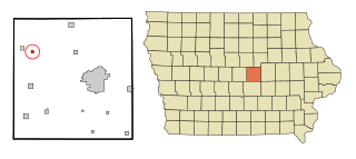
Zwingle is a city in Dubuque and Jackson counties in the U.S. state of Iowa. The population was 84 at the time of the 2020 census, down from 100 in 2000.

References

  1. "2020 U.S. Gazetteer Files". United States Census Bureau. Retrieved March 16, 2022.
  2. 1 2 "2020 Census State Redistricting Data". census.gov. United states Census Bureau. Retrieved 12 August 2021.
  3. Stuart, I. L. (1914). History of Franklin County, Iowa: A Record of Settlement, Organization, Progress and Achievement, Volume 1. S. J. Clarke Publishing Company. p. 291.
  4. "US Gazetteer files: 2010, 2000, and 1990". United States Census Bureau. 2011-02-12. Retrieved 2011-04-23.
  5. "US Gazetteer files 2010". United States Census Bureau. Archived from the original on 2012-01-25. Retrieved 2012-05-11.
  6. "Census of Population and Housing". Census.gov. Retrieved June 4, 2015.
  7. "U.S. Census website". United States Census Bureau . Retrieved 2012-05-11.
  8. "U.S. Census website". United States Census Bureau . Retrieved 2008-01-31.
  9. "AGWSR" (PDF). Iowa Department of Education . Retrieved 2019-08-03.
  10. "REORGANIZATION & DISSOLUTION ACTIONS SINCE 1965-66." Iowa Department of Education. Retrieved on July 20, 2018.