Dows, Iowa

Last updated

Dows, Iowa
Motto: 
A good town in a friendly community!
Wright County Iowa Incorporated and Unincorporated areas Dows Highlighted.svg
Location of Dows, Iowa
Coordinates: 42°39′25″N93°30′8″W / 42.65694°N 93.50222°W / 42.65694; -93.50222
Country Flag of the United States.svg  United States
State Flag of Iowa.svg  Iowa
Counties Wright, Franklin
Area
[1]
  Total0.79 sq mi (2.06 km2)
  Land0.77 sq mi (1.99 km2)
  Water0.03 sq mi (0.06 km2)
Elevation
1,152 ft (351 m)
Population
 (2020)
  Total521
  Density677.50/sq mi (261.55/km2)
Time zone UTC-6 (Central (CST))
  Summer (DST) UTC-5 (CDT)
ZIP code
50071
Area code 515
FIPS code 19-22305
GNIS feature ID0455978

Dows is a city in Franklin and Wright counties of the U.S. state of Iowa. The population was 521 at the time of the 2020 census. [2] The town was incorporated on May 3, 1892. [3]

Contents

History

Dows got its start in the year 1880, following construction of the railroad through that territory. [4] Dows is named for a railroad contractor, [5] Col. William Greene Dows. [6]

Dows, Iowa - 1917 Dows IA - 1917.jpg
Dows, Iowa - 1917

Historical sites

The Dows Historical Society and community volunteers have restored several historical buildings, three of which are listed on the National Register of Historic Places. The Rock Island Depot in Dows was built in 1896. The historical society purchased and restored the depot in 1988 that houses an Iowa Welcome Center and historical railroad and community memorabilia. The Quasdorf Blacksmith and Wagon Museum was built in 1899 and was restored in 1990. This is one of the best equipped blacksmith shops in the Midwest. The Fillmore Building, a large cornerstone building on the south side of Main Street, was built in 1894 and has housed many businesses over the years. In 1987 the building was purchased by the historical society and restored. In 1989, the Dows Mercantile and Crème de la Crème were opened in the building. The Dows Mercantile is an antique mall covering three floors. The Crème de la Crème is a sandwich shop/ice cream parlor.

The Vernon Township Schoolhouse was built in 1887 and is a typical of what one-room, country schoolhouses were like in the 19th and early 20th centuries. The building was moved to town and was restored both inside and out. The schoolhouse is furnished with original desks, blackboards, and books. Another historical building located in the downtown area is the Evans Prairie Home, located across from the Welcome Center.

Geography

Dows is located two miles (3.2 km) west of Interstate 35.

Dows is located at 42°39′25″N93°30′8″W / 42.65694°N 93.50222°W / 42.65694; -93.50222 (42.656882, -93.502175). [7]

According to the United States Census Bureau, the city has a total area of 0.80 square miles (2.07 km2), of which 0.77 square miles (1.99 km2) is land and 0.03 square miles (0.08 km2) is water. [8]

Demographics

Historical populations
YearPop.±%
1900 818    
1910 892+9.0%
1920 1,145+28.4%
1930 926−19.1%
1940 945+2.1%
1950 948+0.3%
1960 882−7.0%
1970 777−11.9%
1980 771−0.8%
1990 660−14.4%
2000 675+2.3%
2010 538−20.3%
2020 521−3.2%
Source: "U.S. Census website". United States Census Bureau . Retrieved March 29, 2020. and Iowa Data Center
Source:
U.S. Decennial Census [9] [2]
The population of Dows, Iowa from US census data DowsIowaPopPlot.png
The population of Dows, Iowa from US census data
DowsIowa002.jpg

2010 census

As of the census [10] of 2010, there were 538 people, 250 households, and 142 families residing in the city. The population density was 698.7 inhabitants per square mile (269.8/km2). There were 305 housing units at an average density of 396.1 per square mile (152.9/km2). The racial makeup of the city was 93.3% White, 1.3% African American, 0.2% Asian, 3.9% from other races, and 1.3% from two or more races. Hispanic or Latino of any race were 18.4% of the population.

There were 250 households, of which 21.2% had children under the age of 18 living with them, 44.8% were married couples living together, 7.6% had a female householder with no husband present, 4.4% had a male householder with no wife present, and 43.2% were non-families. 38.4% of all households were made up of individuals, and 19.2% had someone living alone who was 65 years of age or older. The average household size was 2.15 and the average family size was 2.77.

The median age in the city was 47.8 years. 19.5% of residents were under the age of 18; 5.5% were between the ages of 18 and 24; 20.2% were from 25 to 44; 29.3% were from 45 to 64; and 25.5% were 65 years of age or older. The gender makeup of the city was 48.9% male and 51.1% female.

2000 census

As of the census [11] of 2000, there were 675 people, 290 households, and 164 families residing in the city. The population density was 867.3 inhabitants per square mile (334.9/km2). There were 320 housing units at an average density of 411.2 per square mile (158.8/km2). The racial makeup of the city was 92.30% White, 0.89% Asian, 6.37% from other races, and 0.44% from two or more races. Hispanic or Latino of any race were 9.19% of the population.

There were 290 households, out of which 21.7% had children under the age of 18 living with them, 47.2% were married couples living together, 7.6% had a female householder with no husband present, and 43.4% were non-families. 40.0% of all households were made up of individuals, and 23.1% had someone living alone who was 65 years of age or older. The average household size was 2.21 and the average family size was 2.97.

20.0% were under the age of 18, 7.4% from 18 to 24, 25.5% from 25 to 44, 20.9% from 45 to 64, and 26.2% were 65 years of age or older. The median age was 42 years. For every 100 females, there were 89.6 males. For every 100 females age 18 and over, there were 85.6 males.

The median income for a household in the city was $26,141, and the median income for a family was $35,156. Males had a median income of $22,386 versus $25,500 for females. The per capita income for the city was $15,109. About 8.1% of families and 7.7% of the population were below the poverty line, including 9.1% of those under age 18 and 7.4% of those age 65 or over.

Convention Center

In 2003, the Dows Community Convention Center was built on Ellsworth Street. The building was modeled similarly to the Exchange Block that once stood as the cornerstone building to the north side of Ellsworth Street. The building includes a 4,800-square-foot (450 m2) convention room and a 360-square-foot (33 m2) meeting room. Also included is a large kitchen as well as many tables, internet hook ups, and nice restrooms. The building also houses the city offices.

Education

Previously before the year 2014, the school located in Dows was in use. Due to fewer students in 2014, the school had to close down. The current community is within the Clarion–Goldfield–Dows Community School District, which was formed by the merger of the Dows Community School District and the Clarion–Goldfield Community School District on July 1, 2014. [12] The school property in Dows was later on purchased.

Churches

The Dows area is home to several churches. Located in town are the Abundant Life Chapel, Sovereign Grace Church, United Methodist Church, First Presbyterian Church, and First Lutheran Church. The United Methodist Church and the First Presbyterian Church share a pastor with the Alexander United Methodist Church. The Sovereign Grace Church meets in the First Presbyterian Church and is an independent reformed church. Located six miles east of town is the Morgan Methodist Church. Also, southwest of town is the Vernon Lutheran Church, which no longer has services.

Dows Corn Days

The first weekend in August always marks a large celebration, the Dows Corn Days. The festivities include an impressive parade, entertainment in the park, food vendors, inflatable rides, several activities, and a community church service.

Rest area/travel center

A new rest area was built near the interstate with a Civil War theme in 2003. The "Dows Junction" travel center includes a gas station/truck stop, convenience store, and fast food restaurant. It will also promote the historical sites in Dows, just two miles (3.2 km) away. It is hoped the two projects along with the convention center and historical sites will encourage tourism and economic development. [13]

Related Research Articles

<span class="mw-page-title-main">Wright County, Iowa</span> County in Iowa, United States

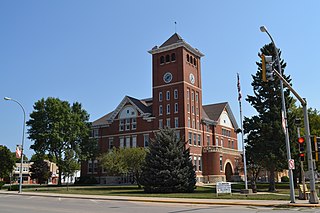
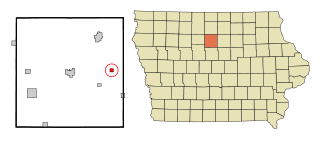
Wright County is a county in the U.S. state of Iowa. As of the 2020 census, the population was 12,943. The county seat is Clarion. The county organization became effective in January 1851, and is believed to be named either after Silas Wright, a governor of New York, or Joseph Albert Wright, a governor of Indiana.

<span class="mw-page-title-main">Fontanelle, Iowa</span> City in Iowa, United States

Fontanelle is a city in Summerset Township, Adair County, Iowa, United States. The population was 676 at the time of the 2020 census.

<span class="mw-page-title-main">Aredale, Iowa</span> City in Iowa, United States

Aredale is a city in Butler County, Iowa, United States. The population was 62 at the 2020 census.

<span class="mw-page-title-main">Massena, Iowa</span> City in Iowa, United States

Massena is a city in Cass County, Iowa, United States. The population was 359 at the time of the 2020 census. Massena's motto is: "The Home of Friendly People". Massena's sister community is Cumberland, Iowa. Massena is named after Massena, New York.

<span class="mw-page-title-main">Wilton, Iowa</span> City in Iowa, United States

Wilton is a city in Cedar and Muscatine counties in the U.S. state of Iowa. The population was 2,924 at the time of the 2020 census. The Muscatine County portion of Wilton is part of the Muscatine Micropolitan Statistical Area.

<span class="mw-page-title-main">Dow City, Iowa</span> City in Iowa, United States

Dow City is a city in Crawford County, Iowa, United States, along the Boyer River. The population was 485 at the time of the 2020 census.

<span class="mw-page-title-main">Scranton, Iowa</span> City in Iowa, United States

Scranton is a city in Greene County, Iowa, United States. The population was 511 at the time of the 2020 census. It was named after Scranton, Pennsylvania.

<span class="mw-page-title-main">La Motte, Iowa</span> City in Iowa, United States

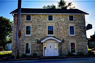
La Motte is a small city in northern Jackson County, Iowa, United States. The population was 237 at the time of the 2020 census.

<span class="mw-page-title-main">Sabula, Iowa</span> City in Iowa, United States

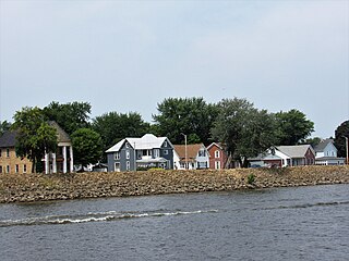
Sabula is a city in Jackson County, Iowa, United States. The population was 506 at the 2020 census. Sabula is the site of Iowa's only island city. The island has a beach and a campground, as well as a harbor with boat docks and storage sheds to store boats during the winter. Because of its proximity to Chicago, Sabula has become a popular vacation destination during the summer months. Sabula is the northern terminus of U.S. Route 67, a 1,560 mile (2,511 km) long north–south highway in the Central United States. The southern terminus of the route is at the United States–Mexico border in Presidio, Texas.

<span class="mw-page-title-main">Burt, Iowa</span> City in Iowa, United States

Burt is a city in Kossuth County, Iowa, United States. The population was 418 at the 2020 census.

<span class="mw-page-title-main">Ely, Iowa</span> City in Iowa, United States

Ely is a city in Linn County, Iowa. The population was 2,328 at the time of the 2020 census. It is part of the Cedar Rapids metropolitan area

<span class="mw-page-title-main">Henderson, Iowa</span> City in Iowa, United States

Henderson is a city in Mills County, Iowa, United States. The population was 144 at the time of the 2020 census.

<span class="mw-page-title-main">Nichols, Iowa</span> City in Iowa, United States

Nichols is a city in Muscatine County, Iowa, United States. The population was 340 at the time of the 2020 census. It is part of the Muscatine Micropolitan Statistical Area.

<span class="mw-page-title-main">Shambaugh, Iowa</span> City in Iowa, United States

Shambaugh is a city in Page County, Iowa, United States. The population was 159 at the time of the 2020 census.

<span class="mw-page-title-main">Varina, Iowa</span> City in Iowa, United States

Varina is an incorporated small, rural village in Pocahontas County, Iowa, United States. The population was 68 at the time of the 2020 census.

<span class="mw-page-title-main">Montezuma, Iowa</span> City in Iowa, United States

Montezuma is a city in Poweshiek County, Iowa, United States. The population was 1,442 at the time of the 2020 census. It is the county seat of Poweshiek County.

<span class="mw-page-title-main">Princeton, Iowa</span> City in Iowa, United States

Princeton is a city in Scott County, Iowa, United States. The population was 923 at the time of the 2020 census.

<span class="mw-page-title-main">Clarion, Iowa</span> City in Iowa, United States

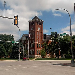
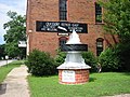
Clarion is a city in and the county seat of Wright County, Iowa, United States. The population was 2,810 at the time of the 2020 census.

<span class="mw-page-title-main">Goldfield, Iowa</span> City in Iowa, United States

Goldfield is a city in Wright County, Iowa, United States. The population was 634 at the time of the 2020 census.

<span class="mw-page-title-main">Rowan, Iowa</span> City in Iowa, United States

Rowan is a city in Wright County, Iowa, United States. The population was 123 at the time of the 2020 census.

References

  1. "2020 U.S. Gazetteer Files". United States Census Bureau. Retrieved March 16, 2022.
  2. 1 2 "2020 Census State Redistricting Data". census.gov. United states Census Bureau. Retrieved August 12, 2021.
  3. Savage, Tom (August 2007). A Dictionary of Iowa Place-Names. University of Iowa Press. p. 74. ISBN   978-1-58729-759-5 . Retrieved August 22, 2022.
  4. Stuart, I. L. (1914). History of Franklin County, Iowa: A Record of Settlement, Organization, Progress and Achievement, Volume 1. S. J. Clarke Publishing Company. pp. 261–262.
  5. Gannett, Henry (1905). The Origin of Certain Place Names in the United States. Govt. Print. Off. pp.  109.
  6. Petersen, William John (1952). The Story of Iowa: The Progress of an American State. Lewis Historical Publishing Company. Retrieved August 22, 2022.
  7. "US Gazetteer files: 2010, 2000, and 1990". United States Census Bureau. February 12, 2011. Retrieved April 23, 2011.
  8. "US Gazetteer files 2010". United States Census Bureau. Archived from the original on July 2, 2012. Retrieved May 11, 2012.
  9. "Census of Population and Housing". Census.gov. Retrieved June 4, 2015.
  10. "U.S. Census website". United States Census Bureau . Retrieved May 11, 2012.
  11. "U.S. Census website". United States Census Bureau . Retrieved January 31, 2008.
  12. "REORGANIZATION & DISSOLUTION ACTIONS SINCE 1965-66 Archived 2019-02-09 at the Wayback Machine ." Iowa Department of Education. Retrieved on August 14, 2018.
  13. "Globe Gazette" . Retrieved October 24, 2012.