
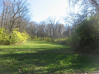
Fort Ancient is a Native American earthworks complex located in Washington Township, Warren County, Ohio, along the eastern shore of the Little Miami River about seven miles (11 km) southeast of Lebanon on State Route 350. The site is the largest prehistoric hilltop enclosure in the United States with three and one-half miles (18,000 ft) of walls in a 100-acre (0.40 km2) complex. Built by the Hopewell culture, who lived in the area from the 200 BC to AD 400, the site is situated on a wooded bluff 270 feet (82 m) above the Little Miami. It is the namesake of a culture known as Fort Ancient who lived near the complex long after it was constructed.
The Benham Mound is a Native American mound in the southwestern part of the U.S. state of Ohio. Located in modern Amberley Village in Hamilton County, the mound is an archaeological site.

The Conrad Mound Archeological Site is an archaeological site in the southwestern part of the U.S. state of Ohio. Located east of Cleves in Hamilton County, the site is centered on an isolated Native American mound. Its location atop a ridgeline has been interpreted as evidence that the mound was constructed by the Adena culture. No artifacts have been found at the site, for no archaeological excavation has ever been carried out; however, experience with other sites has led archaeologists to surmise that the mound is surrounded by a larger zone of archaeological interest. Because of its potential archaeological value, the mound was listed on the National Register of Historic Places in 1975.

The Short Woods Park Mound is a Native American mound in the southwestern part of the U.S. state of Ohio. Located in the Sayler Park neighborhood of the city of Cincinnati, it is believed to have been built by people of the Adena culture. Measuring 38 feet (12 m) high, the mound is an ellipse, approximately 175 feet (53 m) long and 140 feet (43 m) wide.

The Mann Mound is a Native American mound in the southwestern part of the U.S. state of Ohio. Located near the unincorporated community of Jacksonburg in Butler County, it is tree-covered and sits on the edge of a field in Section 12 of Wayne Township. Its height is approximately 20 feet (6.1 m), and its circumference is approximately 540 feet (160 m).

The Williamson Mound Archeological District is an archaeological site in the southwestern part of the U.S. state of Ohio. Located north of Maud in Butler County, the mound appears to have been the work of peoples of the Hopewell tradition.
The Portsmouth Earthworks are a large prehistoric mound complex constructed by the Ohio Hopewell culture mound builder indigenous peoples of eastern North America. The site was one of the largest earthwork ceremonial centers constructed by the Hopewell and is located at the confluence of the Scioto and Ohio Rivers, in present-day Ohio.

The Dunns Pond Mound is a historic Native American mound in northeastern Logan County, Ohio, United States. Located near Huntsville, it lies along the southeastern corner of Indian Lake in Washington Township. In 1974, the mound was listed on the National Register of Historic Places as a potential archeological site, with much of its significance deriving from its use as a burial site for as much as nine centuries.

The Lake Ridge Island Mounds are a group of small hills in Logan County, Ohio, United States that have been thought to be Native American mounds. Located in an area of about 5 acres (2.0 ha) at the northern end on Lake Ridge Island in Indian Lake, the mounds are near the village of Russells Point in the southeastern corner of Stokes Township. State Route 368 passes a short distance to the east of the mounds, even weaving at one point to avoid them. The four mounds on the island are small, not reaching a height greater than 3 feet (0.91 m) or a diameter greater than 40 feet (12 m); they are small enough that they appear to be natural knolls. A report produced in the 1970s observed that the mounds were in "excellent" condition at the time, never having been disturbed by artifact seekers.

The Carl Potter Mound is a historic Native American mound in southern Champaign County, Ohio, United States. Located near Mechanicsburg, it lies on a small ridge in a pasture field in southeastern Union Township. In 1974, the mound was listed on the National Register of Historic Places as a potential archaeological site, primarily because of its use as a burial mound.

The Bone Mound II is a Native American mound in the southwestern part of the U.S. state of Ohio. Located northwest of the unincorporated community of Oregonia, the mound sits in an area of light woodland.

The Bone Stone Graves are a prehistoric cemetery in the southwestern part of the U.S. state of Ohio. Located northwest of the unincorporated community of Oregonia in northwestern Washington Township, Warren County, the cemetery is composed of an uncertain number of graves of individuals from the Fort Ancient culture of Native Americans.

The W.C. Clemmons Mound is a Native American mound in the south central portion of the U.S. state of Ohio. Located near the unincorporated community of Fox, it lies in the middle of a farm field near a creek. A cone measuring approximately 22 feet (6.7 m) high and 144 feet (44 m) in diameter, its shape is almost exactly circular.
The Snead Mound is a Native American mound in the southwestern portion of the U.S. state of Ohio. Located off U.S. Route 52 near the community of Neville, it lies in woodland atop a bluff. The mound is a conical structure measures approximately 5 feet (1.5 m) high and 55 feet (17 m) in diameter at the base; except for a small hole that may have been dug by a hunter, the mound appears never to have been disturbed since white settlement of the region.

The Keiter Mound is a Native American mound in the southwestern part of the U.S. state of Ohio. Located north of the city of Wilmington, it sits on a wooded hill above the stream bottom of a small secondary creek, the Anderson Fork. About 5.5 feet (1.7 m) tall at its highest point, the mound measures 58 feet (18 m) from north to south and 65 feet (20 m) from east to west.

The Hillside Haven Mound is a Native American mound in the southwestern part of the U.S. state of Ohio. Located southwest of Oakland in Clinton County, it sits in dense woodland on the side of a hill. It is believed to have been conical in shape at the time of construction, but today it is rounded in shape, measuring 2.5 feet (0.76 m) high and 33 feet (10 m) in diameter.
The Beam Farm Woodland Archaeological District is a group of archaeological sites in the southwestern part of the U.S. state of Ohio. Located at 3983 Stone Road near the village of Sabina in Clinton County, the district is composed of one Native American mound and two other archaeological sites spread out over an area of 2 acres (0.81 ha). Known as the Beam Farm Mound and the Beam Sites 9 and 12, the sites that compose the district have yielded artifacts from the Adena culture and the Hopewell tradition, both of which inhabited southwestern Ohio during the Woodland period. Because both the Adena and the Hopewell lived around the mound, and because both cultures built mounds, the identity of the people who constructed the Beam Farm Mound cannot be established; all that can be known with reasonable certainty is that it was raised during the early or middle portion of the Woodland period, or between 800 BC and AD 500.
Indian Mound Reserve is a public country park near the village of Cedarville, Ohio, United States. Named for two different earthworks within its bounds — the Williamson Mound and the Pollock Works — the park straddles Massies Creek as it flows through a small canyon.

The Rocky Fork Park Site is an archaeological site in the southeastern part of the U.S. state of Ohio. Located in Rocky Fork State Park in eastern Highland County, the site's earthworks have been designated a historic site because of their archaeological importance.

The Stubbs Earthworks was a massive Ohio Hopewell culture archaeological site located in Morrow in Warren County, Ohio.


