The Cascade Range or Cascades is a major mountain range of western North America, extending from southern British Columbia through Washington and Oregon to Northern California. It includes both non-volcanic mountains, such as many of those in the North Cascades, and the notable volcanoes known as the High Cascades. The small part of the range in British Columbia is referred to as the Canadian Cascades or, locally, as the Cascade Mountains. The highest peak in the range is Mount Rainier in Washington at 14,411 feet (4,392 m).

Gnaw Bone is an unincorporated community in Washington Township, Brown County, in the U.S. state of Indiana. Gnaw Bone is situated on State Highway 46, between Nashville and Columbus. The small community contains three flea markets.

Adams Township is one of thirteen townships in Parke County, Indiana, United States. As of the 2010 census, its population was 5,825 and it contained 2,062 housing units.

Quincy is a small unincorporated community in northwestern Hickory County, Missouri, United States. It is located on Route 83, north of U.S. Route 54. A post office and a few homes are located there.

Benge is an unincorporated community in Adams County, Washington. Benge School District serves the community, and downtown Benge contains Benge Elementary School.
Adams Crossroads is an settlement 2.7 miles (4.3 km) southeast of Hickman in Sussex County, Delaware, United States. Adams Crossroads is located at the intersection of Delaware Route 404 and Adamsville Road, northwest of Bridgeville in the Northwest Fork Hundred.

Adamsville was a populated place in Pinal County, Arizona. Once a thriving farm town, it became a ghost town by the 1920s. Adamsville is located at an elevation is 1,450 feet, on the south bank of the Gila River, west of Florence, Arizona.
Cunningham is an unincorporated community in Chariton County, in the U.S. state of Missouri. The community is approximately one mile south of Sumner. Swan Lake and the Swan Lake National Wildlife Refuge are one-half mile to the south.
The Blue Hills just west of Bremerton, Washington, also called the Bremerton Hills, Bald Hills, and Wildcat Hills, consist of Gold Mountain, Green Mountain, and several informally named hills. Reaching an elevation of 1761 feet, a thousand feet above the glacial till that fills the Puget Lowland, they form a prominent landmark visible around the region. They are formed of uplifted blocks of marine basalts, the steep-walled canyons between the various summits being the fissures between the blocks. In addition to Gold Mountain and Green Mountain are several other prominent peaks unofficially named according to their elevation :

Lucerne is an unincorporated community in Knox County, in the U.S. state of Ohio.
Cunningham Hill is a former town in Beaver County, Utah. The GNIS classifies it as a populated place.
Linton Mills is a former town in Coshocton County, in the U.S. state of Ohio. The GNIS classifies it as a populated place.
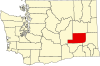
Ankeny was a town in Adams County, Washington. The GNIS classifies it as a populated place.
Rockwell was a town in Adams County, Washington. The GNIS classifies it as a populated place.
Servia was a town in Adams County, Washington. The GNIS classifies it as a populated place.
Cunningham Township is a township in Chariton County, in the U.S. state of Missouri.
Cunningham is an unincorporated community in Pemiscot County, in the U.S. state of Missouri.
Arbela is an unincorporated community in Washington Township, Union County, Ohio, United States. It is located at 40°28′54″N83°24′25″W, at the intersection of Ohio State Route 739 and Cunningham-Arbela Road.