Interstate 5 (I-5) is the main north–south Interstate Highway on the West Coast of the United States, running largely parallel to the Pacific Coast of the contiguous U.S. from Mexico to Canada. It travels through the states of California, Oregon, and Washington, serving several large cities on the West Coast, including San Diego, Los Angeles, Sacramento, Portland, and Seattle. It is the only continuous Interstate highway to touch both the Mexican and Canadian borders. Upon crossing the Mexican border at its southern terminus, I-5 continues to Tijuana, Baja California, as Mexican Federal Highway 1 (Fed. 1). Upon crossing the Canadian border at its northern terminus, it continues to Vancouver as British Columbia Highway 99 (BC 99).
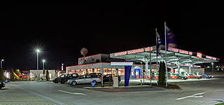
A rest area is a public facility located next to a large thoroughfare such as a motorway, expressway, or highway, at which drivers and passengers can rest, eat, or refuel without exiting onto secondary roads. Other names include motorway service area (UK), services (UK), travel plaza, rest stop, oasis (US), service area, rest and service area (RSA), resto, service plaza, lay-by, and service centre (Canada). Facilities may include park-like areas, fuel stations, public toilets, water fountains, restaurants, and dump and fill stations for caravans / motorhomes.

Tailem Bend is a rural town in South Australia, 85 kilometres south-east of the state capital of Adelaide. It is located on the lower reaches of the River Murray, near where the river flows into Lake Alexandrina. It is linear in layout since it is constrained by river cliffs on its western side and the Adelaide–Melbourne railway line is dominant on its eastern side. The town grew and consolidated through being a large railway centre between the 1890s and 1990s; now it continues to service regional rural communities. In the 2021 census, Tailem Bend and the surrounding area had a population of 1,705.

Hemp, or industrial hemp, is a botanical class of Cannabis sativa cultivars grown specifically for industrial or medicinal use. It can be used to make a wide range of products. Along with bamboo, hemp is among the fastest growing plants on Earth. It was also one of the first plants to be spun into usable fiber 50,000 years ago. It can be refined into a variety of commercial items, including paper, rope, textiles, clothing, biodegradable plastics, paint, insulation, biofuel, food, and animal feed.

Grapevine is an unincorporated community in Kern County, California, United States, at the southern end of the San Joaquin Valley. The small village is directly adjacent to Interstate 5 and consists mainly of travelers' and roadside services. At an elevation of 1,499 feet (457 m), the community is located at the foot of a grade known as the Grapevine that lies in Grapevine Canyon through the Tejon Pass.

The history of agriculture in the United States covers the period from the first English settlers to the present day. In Colonial America, agriculture was the primary livelihood for 90% of the population, and most towns were shipping points for the export of agricultural products. Most farms were geared toward subsistence production for family use. The rapid growth of population and the expansion of the frontier opened up large numbers of new farms, and clearing the land was a major preoccupation of farmers. After 1800, cotton became the chief crop in southern plantations, and the chief American export. After 1840, industrialization and urbanization opened up lucrative domestic markets. The number of farms grew from 1.4 million in 1850, to 4.0 million in 1880, and 6.4 million in 1910; then started to fall, dropping to 5.6 million in 1950 and 2.2 million in 2008.

Breezewood is an unincorporated town in East Providence Township, Bedford County in south-central Pennsylvania, United States.

New Bohemia is an unincorporated community in Prince George County, Virginia, United States, along U.S. Route 460. It was also once known as Wells or Wells Station.

A weigh station is a checkpoint along a highway to inspect vehicular weights and safety compliance criteria. Usually, trucks and commercial vehicles are subject to the inspection.

U.S. Route 50 (US 50) is a transcontinental United States Numbered Highway, stretching from West Sacramento, California, in the west to Ocean City, Maryland, in the east. The California portion of US 50 runs east from Interstate 80 (I-80) in West Sacramento to the Nevada state line in South Lake Tahoe. A portion in Sacramento also has the unsigned designation of Interstate 305. The western half of the highway in California is a four-or-more-lane divided highway, mostly built to freeway standards, and known as the El Dorado Freeway outside of downtown Sacramento. US 50 continues as an undivided highway with one eastbound lane and two westbound lanes until the route reaches the canyon of the South Fork American River at Riverton. The remainder of the highway, which climbs along and out of the canyon, then over the Sierra Nevada at Echo Summit and into the Lake Tahoe Basin, is primarily a two-lane road.

Interstate 95 (I-95) is a part of the Interstate Highway System that runs along the East Coast of the United States from Miami, Florida, to the Canada–United States border at Houlton, Maine. In the state of North Carolina, the route runs for 181.36 miles (291.87 km) from the South Carolina border near Rowland to the Virginia border near Pleasant Hill. The highway serves the cities of Lumberton, Fayetteville, Wilson, Rocky Mount, and Roanoke Rapids. The route goes through a mostly rural area of the state, avoiding most of the major metro areas of North Carolina. It forms the informal border between the Piedmont and Atlantic Plain regions of the state.

Route 15, consisting of the contiguous segments of State Route 15 (SR 15) and Interstate 15 (I-15), is a major north–south state highway and Interstate Highway in the U.S. state of California, connecting San Bernardino, Riverside, and San Diego Counties. The route consists of the southernmost 289.24 miles (465.49 km) of I-15, which extends north through Nevada, Arizona, Utah, Idaho, and Montana to the Canada–US border. It is a major thoroughfare for traffic between San Diego and the Inland Empire, as well as between Southern California, Las Vegas, Nevada, and the Intermountain West.

Interstate 70 (I-70) is a transcontinental Interstate Highway in the United States, stretching from Cove Fort, Utah, to Baltimore, Maryland. In Colorado, the highway traverses an east–west route across the center of the state. In western Colorado, the highway connects the metropolitan areas of Grand Junction and Denver via a route through the Rocky Mountains. In eastern Colorado, the highway crosses the Great Plains, connecting Denver with metropolitan areas in Kansas and Missouri. Bicycles and other non-motorized vehicles, normally prohibited on Interstate Highways, are allowed on those stretches of I-70 in the Rockies where no other through route exists.
Interstate 15 (I-15) is an Interstate Highway, running from San Diego, California, United States, to the Canada–US border, through Mohave County in northwest Arizona. Despite being isolated from the rest of Arizona, in the remote Arizona Strip, and short in length at 29.43 miles (47.36 km), it remains notable for its scenic passage through the Virgin River Gorge. The highway heads in a northeasterly direction from the Nevada border northeast of Mesquite, Nevada, to the Utah border southwest of St. George, Utah.

Interstate 90 (I-90), designated as the American Veterans Memorial Highway, is a transcontinental Interstate Highway that runs from Seattle, Washington, to Boston, Massachusetts. It crosses Washington state from west to east, traveling 298 miles (480 km) from Seattle across the Cascade Mountains and into Eastern Washington, reaching the Idaho state line east of Spokane. I-90 intersects several of the state's other major highways, including I-5 in Seattle, I-82 and U.S. Route 97 (US 97) near Ellensburg, and US 395 and US 2 in Spokane.

Interstate 84 (I-84) in the U.S. state of Idaho is a major Interstate Highway that traverses the state from the Oregon state line in the northwest to Utah state line in the southeast. It primarily follows the Snake River across a plain that includes the cities of Boise, Mountain Home, and Twin Falls. The highway is one of the busiest in Idaho and is designated as the Vietnam Veterans Memorial Highway.

U.S. Route 395 (US 395) is a United States Numbered Highway that runs from California to the inland regions of Oregon and Washington. It travels north–south through Washington, including long concurrencies with Interstate 82 (I-82) and I-90, and connects the Tri-Cities region to Spokane and the Canadian border at Laurier.

Cannabis in Washington relates to a number of legislative, legal, and cultural events surrounding the use of cannabis. On December 6, 2012, Washington became the first U.S. state to legalize recreational use of marijuana and the first to allow recreational marijuana sales, alongside Colorado. The state had previously legalized medical marijuana in 1998. Under state law, cannabis is legal for medical purposes and for any purpose by adults over 21.

Milburn Lincoln Wilson was an American Undersecretary of the U.S. Department of Agriculture (USDA) under Presidents Franklin D. Roosevelt and Harry S. Truman under the New Deal and Fair Deal. His main interest was social justice for farmers. He made major contributions to federal agricultural policies, including creating the first domestic allotment plan for the Agricultural Adjustment Act and helping to create the first agricultural commodity programs and for the United States. He also convinced the Millers' National Federation and others to begin enriching bread and cereals.