Related Research Articles

Great Bend is a city in Richland County, North Dakota, United States, on the banks of the Wild Rice River. Its population was 60 at the 2010 census. It was founded in 1888, and incorporated as a village in 1908. It is part of the Wahpeton, ND–MN Micropolitan Statistical Area.

Pulga is an unincorporated community in Butte County, California. It is located along the west slope of the Feather River canyon, at an elevation of 1398 feet. A variant name for the community is Big Bar. Other nearby communities include Mayaro, Poe and Parkhill. The town hosts a Caltrans highway maintenance station along State Route 70 (SR70). The place is at the mouth of the Flea Valley Creek, which gives rise to the toponym.

Corpse Pond is a small lake in Ontonagon County, Michigan, located at 46°20′44″N89°0′9″W.

Logansville is an unincorporated community in central Pleasant Township, Logan County, Ohio, United States. It lies along State Route 47 at its intersection with County Road 24. The Great Miami River flows southward along the western edge of Logansville. The community lies 2½ miles (4 km) north of the village of De Graff and 9 miles west of the city of Bellefontaine, the county seat of Logan County. It is located at 40°20′44″N83°55′50″W, and its altitude is 1,010 feet (308 m).
Mount Nebo is an unincorporated community in Accomack County, Virginia.
Wild Horse Creek is a stream in the U.S. state of Colorado.
Lower Forni is an unincorporated community in El Dorado County, California. It is located 3.25 miles (5 km) west-southwest of Upper Forni, at an elevation of 6929 feet.
Meloland is an unincorporated community in Imperial County, California. It is located on the Holton Interurban Railroad 4 miles (6.4 km) west of Holtville, at an elevation of 52 feet below sea level.
Highland Landing is an unincorporated community in Northumberland County, in the U.S. state of Virginia.
New Point is an unincorporated community in Mathews County, in the U. S. state of Virginia.
York View is an unincorporated community in Gloucester County, Virginia, United States.
Corfu is an unincorporated community in Grant County, in the U.S. state of Washington.
Bryman, is a populated place in the central Mojave Desert, within San Bernardino County, California. It lies along the Mojave River in the northern Victor Valley, at an elevation of 2,526 feet . It is on the historic U.S. Route 66, 5 miles north of Oro Grande, and south of Helendale.
Dixon is an unincorporated community in Allen County, Indiana and Van Wert County, Ohio.
Haven is an extinct town in Grant County, in the U.S. state of Washington.
Jericho is an extinct town in Grant County, in the U.S. state of Washington. The GNIS classifies it as a populated place.
Low Gap is an unincorporated community in Grant County, in the U.S. state of Washington.
Smyrna is an unincorporated community in Grant County, in the U.S. state of Washington.

Riggs is an unincorporated community in Boone County, in the U.S. state of Missouri. Today the community is centered around Riggs Union Church. A small store and several homes formerly stood at the intersection of Old Number 7 and Williams Road. The Mount Carmel (Sims) Cemetery is nearby.
References
- ↑ U.S. Geological Survey Geographic Names Information System: Taunton, Washington
- ↑ "Post Offices". Jim Forte Postal History. Retrieved 25 August 2016.
- ↑ Meany, Edmond S. (1923). Origin of Washington geographic names. Seattle: University of Washington Press. p. 302.
Municipalities and communities of Adams County, Washington, United States | ||
|---|---|---|
| Cities | 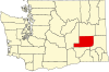 | |
| Towns | ||
| Unincorporated community | ||
| Ghost towns | ||
Coordinates: 46°48′11″N119°20′44″W / 46.80306°N 119.34556°W
| This Adams County, Washington state location article is a stub. You can help Wikipedia by expanding it. |