Delta, British Columbia

Last updated

Delta
City of Delta [1]
Bridge Street & Delta Street - 37542593804.jpg
Bridge Street & Delta Street
Flag of Delta, British Columbia.svg
Corpdelta.png
City of Delta logo.png
Motto(s): 
Ours to preserve by hand and heart
Delta in Metro Vancouver.svg
Location of Delta in Metro Vancouver
Coordinates: 49°05′05″N123°03′31″W / 49.08472°N 123.05861°W / 49.08472; -123.05861 [2]
CountryCanada
Province British Columbia
Regional district Metro Vancouver
Incorporated as a district municipality November 10, 1879 [4]
Incorporated as a citySeptember 22, 2017
Seats of governmentDelta City Hall
North Delta Centre for the Arts
Government
  Type Mayor-council government
  BodyDelta City Council
  Mayor George Harvie (Achieving for Delta)
  City Council
List of councillors
   MP Carla Qualtrough (Liberal)
   MLAs Ravi Kahlon (BC NDP), Ian Paton (BC United)
Area
  Total364 km2 (141 sq mi)
  Land179.66 km2 (69.37 sq mi)
Elevation
10 m (30 ft)
Population
 (2021) [7]
  Total108,455
  Estimate 
(2022) [8]
113,347
  Rank 52nd in Canada
  Density603.7/km2 (1,564/sq mi)
Demonym Deltan
Time zone UTC−08:00 (PST)
  Summer (DST) UTC−07:00 (PDT)
Forward sortation area
Area codes 604, 778, 236, 672
Website www.delta.ca OOjs UI icon edit-ltr-progressive.svg

Delta is a city in the Lower Mainland region of British Columbia, Canada, as part of Greater Vancouver. Located on the Fraser Lowland south of Fraser River's south arm, it is bordered by the city of Richmond on the Lulu Island to the north, New Westminster to the northeast, Surrey to the east, the Boundary Bay and the American pene-exclave Point Roberts to the south, and the Strait of Georgia to the west.

Contents

Encompassing the nearby Annacis Island, Deas Island and Westham Island, Delta is mostly rural and officially composed of three distinct communities: North Delta, Ladner and Tsawwassen.

History

Prior to European settlement, Delta's flatlands and coastal shores were inhabited by the Tsawwassen First Nation of the Coast Salish. The land was first sighted by Europeans in 1791, when Spanish explorer Lieutenant Francisco de Eliza mistook the area for an island and named it "Isla de Cepeda". The first European settler in Delta was James Kennedy who pre-empted 135 acres in what later became Annieville in February 1860. Thomas and William Ladner, began farming the area named after them in 1868. Farming and fishing helped the community grow quickly over the next few decades. In 1879, the area was incorporated as a municipality, named "the Corporation of Delta", and the village of Ladner was made as its administrative centre.

Due to its geography, Delta was a relatively isolated community. The completion of the George Massey Tunnel in 1959 linking Ladner to Richmond and Vancouver along with the opening, in 1960, of the Tsawwassen Ferry Terminal and the Highway 99 being rerouted from the King George Highway in Surrey in 1962 to a new route through Delta, ended Delta's isolation and resulted in a massive 400% population growth over the next 20 years. The 1986 completion of the Alex Fraser Bridge connecting North Delta to New Westminster and Vancouver also helped Delta's growth.

On 22 September 2017, at the request of Delta's council, the Government of British Columbia changed the name and classification of the Corporation of Delta to the City of Delta. [1]

Neighbourhoods

Delta comprises three distinct, geographically separate communities:

Demographics

Historical populations
YearPop.±%
19212,839    
19313,709+30.6%
19414,287+15.6%
19516,701+56.3%
19568,752+30.6%
196114,597+66.8%
196620,664+41.6%
197145,860+121.9%
197664,492+40.6%
198174,692+15.8%
198679,610+6.6%
199188,978+11.8%
1996 95,411+7.2%
2001 96,950+1.6%
2006 96,723−0.2%
2011 99,863+3.2%
2016 102,238+2.4%
2021 108,455+6.1%
Statistics Canada [9]

In the 2021 Census of Population conducted by Statistics Canada, Delta had a population of 108,455 living in 38,058 of its 39,736 total private dwellings, a change of

In 2011, the median age was 42.8 years old, which is slightly higher than the national median age at 40.6 years old. There were 35,781 private dwellings with an occupancy rate of 97.1%. According to the 2011 National Household Survey, the median value of a dwelling in Delta is $562,181 which is significantly higher than the national average at $280,552. The median household income (after-taxes) in Delta is $71,590, quite higher than the national average at $54,089.

Ethnicity

As of 2021, Delta's population is 108,455. About 45% of Delta's population are visible minorities, of which there are approximately 28,000 South Asian Canadians, 9,700 Chinese Canadians, and 3,700 Filipino Canadians. [10] There are also about 3,180 Indigenous peoples or 3% of the total population, [10] some from Tsawwassen First Nation, who still hold a fraction of their former traditional territories; the Tsawwassen Lands at the mouth of the Fraser River, which are shared with the Hwlitsum First Nation from the Gulf Islands.[ citation needed ] Forming over one-quarter (26.1%) of the population, Delta has the fourth largest municipal South Asian population in British Columbia after neighbouring Vancouver, Surrey and Abbotsford.

Panethnic groups in Delta (2001–2021)
Panethnic group2021 [10] 2016 [11] 2011 [12] 2006 [13] 2001 [14]
Pop. %Pop.%Pop.%Pop.%Pop.%
European [lower-alpha 1] 55,46561,83566,63068,40072,375
South Asian 27,99020,48517,03014,22012,035
East Asian [lower-alpha 2] 11,0409,3207,0657,2806,675
Southeast Asian [lower-alpha 3] 4,4203,2403,1652,2802,060
Indigenous 3,1802,7102,2901,7001,495
African 1,095795595495610
Latin American 1,035815710710490
Middle Eastern [lower-alpha 4] 890515240280220
Other [lower-alpha 5] 2,1401,1201,010715420
Total responses [lower-alpha 6] 107,270100,84598,74096,07596,370
Total population108,455102,23899,86396,72396,950

Religion

According to the 2021 census, religious groups in Delta included: [10]

Geography

A trail on Deas Island in late September Deas Island in fall.JPG
A trail on Deas Island in late September

Delta is located 27 km (17 mi) south of Vancouver and 22 km (14 mi) north of the Canada–US border at Peace Arch, Surrey. It is bordered by water on three sides: The Fraser River to the north, the Georgia Strait to the west and Boundary Bay to the south. At 364 km2 (141 sq mi), Delta is the largest municipality in the GVRD; the second largest is its neighbour to the east, Surrey, at 317.4 km2 (122.5 sq mi).

Trachycarpus fortunei windmill palms line some streets in Tsawwassen Trachycarpus fortunei 56 st tsawwassen bc.jpg
Trachycarpus fortunei windmill palms line some streets in Tsawwassen

Delta's flat, fertile land has made it one of the most important agricultural areas in Greater Vancouver. The Agricultural Land Reserve regulations preserve most of this land for agricultural use, preventing its conversion to suburban housing. North Delta is also home to the Burns Bog, 40 km2 (15 sq mi) of natural wetlands that are important for wildlife.

Delta includes Annacis Island, an industrial island reached via the Alex Fraser Bridge, which connects Delta with Richmond and New Westminster. Delta also includes a peninsula on the east side of the Fraser River at Delta's northern city limits, which is only accessible via Surrey.

Climate

Delta is known for its relatively dry and sunny climate compared with other locations in Metro Vancouver. For example, it receives nearly 40% less precipitation than downtown Vancouver [15] and less than half of that of North Vancouver. [16] It has a warm-summer Mediterranean climate (Köppen Csb) with cooler summers and milder winters than other areas on the Canada–U.S. border, and features some of the mildest winters and lowest diurnal temperature variation in Canada.

Climate data for Delta Tsawwassen Beach
Climate ID: 1102425; coordinates 49°00′39″N125°05′36″W / 49.01083°N 125.09333°W / 49.01083; -125.09333 (Delta Tsawwassen Beach) ; elevation: 2.4 m (7 ft 10 in); 1981-2010 normals
MonthJanFebMarAprMayJunJulAugSepOctNovDecYear
Record high °C (°F)14.5
(58.1)
15.5
(59.9)
19.0
(66.2)
23.0
(73.4)
27.0
(80.6)
29.0
(84.2)
31.0
(87.8)
28.5
(83.3)
28.5
(83.3)
23.0
(73.4)
15.5
(59.9)
14.5
(58.1)
31.0
(87.8)
Mean daily maximum °C (°F)7.2
(45.0)
8.2
(46.8)
10.5
(50.9)
13.5
(56.3)
16.8
(62.2)
19.6
(67.3)
21.7
(71.1)
21.5
(70.7)
18.4
(65.1)
13.4
(56.1)
9.5
(49.1)
7.1
(44.8)
13.9
(57.0)
Daily mean °C (°F)5.1
(41.2)
5.8
(42.4)
7.7
(45.9)
10.4
(50.7)
13.4
(56.1)
16.0
(60.8)
17.9
(64.2)
17.9
(64.2)
15.3
(59.5)
11.2
(52.2)
7.5
(45.5)
5.1
(41.2)
11.1
(52.0)
Mean daily minimum °C (°F)2.9
(37.2)
3.3
(37.9)
4.9
(40.8)
7.2
(45.0)
9.8
(49.6)
12.3
(54.1)
14.0
(57.2)
14.3
(57.7)
12.0
(53.6)
8.9
(48.0)
5.5
(41.9)
3.0
(37.4)
8.2
(46.8)
Record low °C (°F)−9.5
(14.9)
−12.0
(10.4)
−4.5
(23.9)
0.0
(32.0)
3.5
(38.3)
7.0
(44.6)
9.5
(49.1)
10.0
(50.0)
6.5
(43.7)
−1.5
(29.3)
−9.0
(15.8)
−11.5
(11.3)
−12.0
(10.4)
Average precipitation mm (inches)134.6
(5.30)
80.4
(3.17)
78.5
(3.09)
67.9
(2.67)
52.2
(2.06)
42.6
(1.68)
30.5
(1.20)
28.7
(1.13)
39.8
(1.57)
101.3
(3.99)
145.1
(5.71)
125.9
(4.96)
927.5
(36.52)
Average rainfall mm (inches)124.3
(4.89)
77.1
(3.04)
77.0
(3.03)
67.9
(2.67)
52.2
(2.06)
42.6
(1.68)
30.5
(1.20)
28.7
(1.13)
39.8
(1.57)
101.0
(3.98)
142.7
(5.62)
116.3
(4.58)
900.1
(35.45)
Average snowfall cm (inches)10.4
(4.1)
3.3
(1.3)
1.6
(0.6)
0.0
(0.0)
0.0
(0.0)
0.0
(0.0)
0.0
(0.0)
0.0
(0.0)
0.0
(0.0)
0.3
(0.1)
2.4
(0.9)
9.6
(3.8)
27.6
(10.8)
Average precipitation days (≥ 0.2 mm)18.514.315.514.211.79.76.25.66.715.218.818.6155
Average rainy days (≥ 0.2 mm)17.713.915.514.211.79.76.25.66.715.218.517.5152.4
Average snowy days (≥ 0.2 cm)1.61.00.50.00.00.00.00.00.00.10.61.65.4
Source: Environment and Climate Change Canada [17]

Government and politics

Delta is governed by the Delta City Council, led by a Mayor and six Councillors, elected for four-year terms, and there is also an elected school board. The current mayor is George Harvie. Unlike most communities in Canada, but like Vancouver and Richmond, Delta has a system of locally based election slates such as TriDelta, IDEA, One Delta, Delta Residents Association, Delta Connect, DIVA, Independents Working For You, and Achieving For Delta.

In the House of Commons of Canada, Delta is part of the Delta electoral district. As of the 2015 Federal general election, Delta's seat is held by Carla Qualtrough of the Liberal Party. In the 2017 provincial general election, the North Delta seat went to Ravi Kahlon of the British Columbia New Democratic Party while the South Delta seat went to Ian Paton of BC United.

Delta, unlike most Lower Mainland municipalities, has its own police department.

Former Delta mayor Lois Jackson served from 1999 to 2018 and since 1973 has had a seat on Delta Council. Jackson was elected to council again in 2018.

Power

In Delta is the Arnott Substation (ARN), the mainland terminal of the HVDC Vancouver Island circuit.

Transportation

The Alex Fraser Bridge links Delta to New Westminster and Richmond. Alex Fraser Bridge 02.jpg
The Alex Fraser Bridge links Delta to New Westminster and Richmond.

Major highways

Health

Delta is the westernmost community served by Fraser Health Authority which operates Delta Hospital in Ladner and also funds home and community care. The Delta Hospice Society operates a facility near to the hospital.

Education

Delta Public Schools operates Anglophone public schools in the city.

The Conseil scolaire francophone de la Colombie-Britannique operates one Francophone primary school in that city: école du Bois-joli. [18]

Sports and recreation

Delta has many minor sports teams in ice hockey, soccer, football, field hockey, baseball, softball, field lacrosse and box lacrosse. Over 160 young people play ringette in Delta. The Delta Ringette Association has 13 teams in 2005. Notable professional sports players from Delta are Jeff Francis (MLB), James Paxton (MLB), Justin Morneau (MLB), Brent Seabrook (NHL), Troy Brouwer (NHL) and Mitch Berger (NFL).

Tour de Delta wall cover on electrical box outside of Delta, British Columbia municipal hall TourdeDeltaAD.jpg
Tour de Delta wall cover on electrical box outside of Delta, British Columbia municipal hall

Delta's unique and varying terrain provides a challenging test for many of the world's best cyclists in the Tour de Delta (one day races, for men since 2001, and for women since 2011). Since its first event in 2001, the Tour de Delta has grown to be Canada's largest cycling event, held annually in July as part of BC Superweek.

The Delta Triathlon is also a very popular event, selling out each year in April. The event takes place in Ladner from the Ladner Leisure Centre. Over 500 participants take part, including many from the local South Delta Triathlon Club.

ClubSportLeagueVenue
Delta Ice Hawks Ice hockey PIJHL Ladner Leisure Centre
Delta Islanders Box Lacrosse BCJALL Ladner Leisure Centre
Ladner Pioneers Box Lacrosse WCSLA Ladner Leisure Centre

Notable people

Appearances in film and media

The town is used as the principal filming location for the TV series Resident Alien . [20] The Heritage Hangar at the Boundary Bay Airport in Delta has been used as a film location in many TV series and movies. [21]

Sister city

Notes

  1. Statistic includes all persons that did not make up part of a visible minority or an indigenous identity.
  2. Statistic includes total responses of "Chinese", "Korean", and "Japanese" under visible minority section on census.
  3. Statistic includes total responses of "Filipino" and "Southeast Asian" under visible minority section on census.
  4. Statistic includes total responses of "West Asian" and "Arab" under visible minority section on census.
  5. Statistic includes total responses of "Visible minority, n.i.e." and "Multiple visible minorities" under visible minority section on census.
  6. Note: Totals greater than 100% due to multiple origin responses.

Related Research Articles

<span class="mw-page-title-main">Lower Mainland</span> Region in British Columbia, Canada

The Lower Mainland is a geographic and cultural region of the mainland coast of British Columbia that generally comprises the regional districts of Metro Vancouver and the Fraser Valley. Home to approximately 3.05 million people as of the 2021 Canadian census, the Lower Mainland contains sixteen of the province's 30 most populous municipalities and approximately 60% of the province's total population.

<span class="mw-page-title-main">Richmond, British Columbia</span> City in British Columbia, Canada

Richmond is a city in the coastal Lower Mainland region of British Columbia, Canada. Mainly a suburban city, it occupies almost the entirety of Lulu Island, between the two estuarine distributaries of the Fraser River. Encompassing the adjacent Sea Island and several other smaller islands and uninhabited islets to its north and south, the suburb neighbours Vancouver and Burnaby on the Burrard Peninsula to the north, New Westminster and Annacis Island to the east, Delta to the south, and the Strait of Georgia to the west.

<span class="mw-page-title-main">Surrey, British Columbia</span> City in British Columbia, Canada

Surrey is a city in British Columbia, Canada. It is located south of the Fraser River on the Canada–United States border. It is a member municipality of the Metro Vancouver regional district and metropolitan area. Mainly a suburban city, Surrey is the province's second-largest by population after Vancouver and the third-largest by area after Abbotsford and Prince George. Seven neighbourhoods in Surrey are designated town centres: Cloverdale, Fleetwood, Guildford, Newton, South Surrey, and City Centre encompassed by Whalley.

<span class="mw-page-title-main">Burnaby</span> City in British Columbia, Canada

Burnaby is a city in the Lower Mainland region of British Columbia, Canada. Located in the centre of the Burrard Peninsula, it neighbours the City of Vancouver to the west, the District of North Vancouver across the confluence of the Burrard Inlet with its Indian Arm to the north, Port Moody and Coquitlam to the east, New Westminster and Surrey across the Fraser River to the southeast, and Richmond on the Lulu Island to the southwest.

<span class="mw-page-title-main">Fraser Valley</span> Geographical region in British Columbia

The Fraser Valley is a geographical region in southwestern British Columbia, Canada and northwestern Washington State. It starts just west of Hope in a narrow valley encompassing the Fraser River and ends at the Pacific Ocean stretching from the North Shore Mountains, opposite the city of Vancouver BC, to just south of Bellingham, Washington.

<span class="mw-page-title-main">Nanaimo</span> City in British Columbia, Canada

Nanaimo is a city of about 100,000 on the east coast of Vancouver Island, in British Columbia, Canada. "The Harbour City" was previously known as the "Hub City", which was attributed to its original layout design with streets radiating from the shoreline like the spokes of a wagon wheel, and to its relatively central location on Vancouver Island. Nanaimo is the headquarters of the Regional District of Nanaimo.

<span class="mw-page-title-main">Langley, British Columbia (district municipality)</span> Municipality in British Columbia, Canada

The Township of Langley is a district municipality immediately east of the City of Surrey in southwestern British Columbia, Canada. It extends south from the Fraser River to the Canada–United States border, and west of the City of Abbotsford. Langley Township is not to be confused with the City of Langley, which is adjacent to the township but politically is a separate entity. Langley is located in the eastern part of Metro Vancouver.

<span class="mw-page-title-main">Chilliwack</span> City in British Columbia, Canada

Chilliwack is a city of about 100,000 people and 261 km2 (100 sq mi) in the Canadian province of British Columbia. It is located about 100 km (62 mi) east of the City of Vancouver in the Fraser Valley. The enumerated population is 93,203 in the city and 113,767 in the greater metropolitan area. It is the second-fastest growing metropolitan area in Canada.

Highway 17 is a provincial highway in British Columbia, Canada. It comprises two separate sections connected by a ferry link. The Vancouver Island section is known as the Patricia Bay Highway and connects Victoria to the Swartz Bay ferry terminal in North Saanich. The Lower Mainland section is known as the South Fraser Perimeter Road and connects the Tsawwassen ferry terminal to Delta and Surrey, terminating at an interchange with Highway 1 in the Fraser Valley.

Highway 10 is a minor east-west route through the southern portion of Greater Vancouver. Highway 10 is used mainly as a local access route in North Delta, Surrey and Langley, its former connector role between South Delta and Highway 1 having been taken over by the Highway 17.

<span class="mw-page-title-main">Tsawwassen</span> Neighbourhood in Metro Vancouver, British Columbia, Canada

Tsawwassen is a suburban, mostly residential community on a peninsula in the southwestern corner of the City of Delta in British Columbia, Canada. It provides the only road access to the American territory on the southern tip of the peninsula, the community of Point Roberts, Washington, via 56th Street. It is also the location of Tsawwassen Ferry Terminal, part of the BC Ferries, built in 1959 to provide foot-passenger and motor vehicle access from the Lower Mainland to the southern part of Vancouver Island and the southern Gulf Islands. Because Tsawwassen touches a shallow bank, the ferry terminal is built at the southwestern end of a 3 km (1.9 mi) causeway that juts into the Strait of Georgia. Boundary Bay Airport, a major training hub for local and international pilots which also provides local airplane and helicopter service, is ten minutes away. The Roberts Bank Superport is also nearby.

<span class="mw-page-title-main">White Rock, British Columbia</span> City in British Columbia, Canada

White Rock is a city in British Columbia, Canada, and a member municipality of the Metro Vancouver Regional District. It is bordered by Semiahmoo Bay to the south and is surrounded on three sides by Surrey. To the southeast across a footbridge lies the Semiahmoo First Nation, which is within the borders of Surrey. Semiahmoo Bay and the Southern Gulf Islands in the Strait of Georgia are also to the south.

<span class="mw-page-title-main">Greater Vancouver</span> Metropolitan area in British Columbia, Canada

Greater Vancouver, also known as Metro Vancouver, is the metropolitan area with its major urban centre being the city of Vancouver, British Columbia, Canada. The term "Greater Vancouver" describes an area that is roughly coterminous with the region governed by the Metro Vancouver Regional District (MVRD), though it predates the 1966 creation of the regional district. It is often used to include areas beyond the boundaries of the regional district but does not generally include wilderness and agricultural areas that are included within the MVRD.

<span class="mw-page-title-main">Langley, British Columbia (city)</span> City in British Columbia, Canada

The City of Langley, commonly referred to as Langley City, or just Langley, is a municipality in the Metro Vancouver Regional District in British Columbia, Canada. It lies directly east of Surrey, adjacent to the Cloverdale area, and is surrounded elsewhere by the Township of Langley, bordered by its neighbourhoods of Willowbrook to the north, Murrayville to the east, and Brookswood and Fern Ridge to the south.

<span class="mw-page-title-main">Ladner, British Columbia</span> Neighbourhood in Canada

Ladner is a part of the City of Delta, British Columbia, Canada, and a suburb of Vancouver, British Columbia. It was created as a fishing village on the banks of the Fraser River.

<span class="mw-page-title-main">North Delta</span> Neighbourhood of Delta in Lower Mainland, British Columbia, Canada

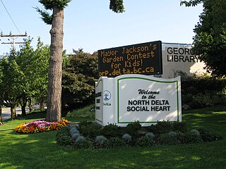
North Delta is a largely middle-class commuter town situated in the Lower Mainland, of British Columbia, Canada. The community is the most populous of the three communities that make up the City of Delta. North Delta is home to numerous parks and recreational opportunities. Alongside North Delta is Burns Bog, the largest raised urban peat bog in North America. As well, Watershed Park provides walking and biking trails, home to many artesian aquifers. Besides this, North Delta is home to a large amount of green-space. As of the 2016 census, North Delta has a population of 56,017.

<span class="mw-page-title-main">South Delta Secondary School</span> High school in Delta, British Columbia, Canada

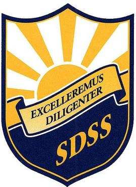
South Delta Secondary (SDSS) is a public high school in Tsawwassen, British Columbia, Canada. There are approximately 1,500 students enrolled in each grade 8 through 12. Graduation rates in the years 2005 to 2010 vary between 95% and 99%.

<span class="mw-page-title-main">Tsawwassen ferry terminal</span> Ferry terminal in British Columbia, Canada

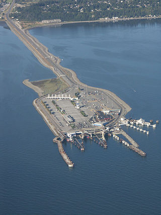
Tsawwassen is a ferry terminal and a major transportation facility in Delta, British Columbia, part of the BC Ferries system and Highway 17. Positioned less than 500 metres (1,600 ft) from the 49th parallel along the Canada–United States border, it is located at the southwestern end of a 2-kilometre (1.2 mi) causeway that juts out into the Strait of Georgia off the mainland at the community of Tsawwassen. With an approximate size of 23 hectares, it is the largest ferry terminal in North America.

The 400-series highways were a pair of controlled-access highways located in the southwestern portion of the Canadian province of British Columbia, forming a special subset of the provincial highway system. Modelled after the 400-Series Highways in Ontario, 400-series designations were introduced in 1964 in conjunction with the completion of the Trans-Canada Highway freeway between Vancouver and Clearbrook ; however, unlike their Ontario counterparts, both routes had signalized sections. The 400-series system never expanded beyond two freeways, and in 1973 Highways 401 and 499 were renumbered 1 and 99 respectively, while the former routes were assigned the 'A' suffix.

<span class="mw-page-title-main">Punjabi Canadians</span> Canadian people of Punjabi descent

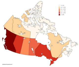
Punjabi Canadians number approximately 950,000 and account for roughly 2.6% of Canada's population, as per the 2021 Canadian census. Their heritage originates wholly or partly from the Punjab region of India and Pakistan.

References

  1. 1 2 "Order of the Lieutenant Governor in Council". Province of British Columbia. 22 September 2017. Retrieved 12 April 2019.
  2. "Delta". Geographical Names Data Base . Natural Resources Canada.
  3. "Delta". Geographical Names Data Base . Natural Resources Canada.
  4. "CivicInfo BC | Municipality: Delta (City)". www.civicinfo.bc.ca. Retrieved 17 August 2022.
  5. "2022 Council Meeting Schedule" (PDF). City of Delta. Retrieved 9 August 2022.
  6. "Council Members | City of Delta". www.delta.ca. Retrieved 9 August 2022.
  7. 1 2 "Population and dwelling counts: Canada, provinces and territories, and census subdivisions (municipalities), British Columbia". Statistics Canada. 9 February 2022. Retrieved 20 February 2022.
  8. Services, Ministry of Citizens'. "Population Estimates – Province of British Columbia". www2.gov.bc.ca. Retrieved 19 March 2023.
  9. "British Columbia Municipal Population Estimates 1996–2005". Archived from the original on 19 July 2012.
  10. 1 2 3 4 "Census Profile, 2021 Census of Population". Statistics Canada. 26 October 2022. Retrieved 9 November 2022.
  11. "Census Profile, 2016 Census". Statistics Canada. 27 October 2021. Retrieved 9 November 2022.
  12. "NHS Profile". Statistics Canada. 27 November 2015. Retrieved 9 November 2022.
  13. "2006 Community Profiles". Statistics Canada. 20 August 2019. Retrieved 9 November 2022.
  14. "2001 Community Profiles". Statistics Canada. 2 July 2019. Retrieved 9 November 2022.
  15. "Canadian Climate Normals 1971–2000 Station Data". Environment Canada. 19 January 2011. Retrieved 30 March 2020.
  16. "Station Results | Canada's National Climate Archive". Environment and Climate Change Canada. 4 February 2013. Archived from the original on 12 May 2013. Retrieved 30 March 2020.
  17. "Canadian Climate Normals 1981–2010". Environment and Climate Change Canada . Retrieved 2 September 2017.
  18. "Carte des écoles Archived 17 August 2015 at the Wayback Machine ." Conseil scolaire francophone de la Colombie-Britannique . Retrieved on 22 January 2015.
  19. Johns, Fred (21 November 2010). "Kyle O'Reilly's long journey ends with ROH deal". Slam! Sports. Canadian Online Explorer. Archived from the original on 15 July 2012. Retrieved 7 December 2010.{{cite web}}: CS1 maint: unfit URL (link)
  20. "DGC BC Production List" (PDF). Directors Guild of Canada . 9 October 2020. Archived from the original (PDF) on 9 October 2020. Retrieved 11 February 2022.
  21. Filming; Boundary Bay Airport; Delta BC.
  22. "Mangalore, Delta in sisterly embrace". DNA. 13 October 2010. Retrieved 13 October 2010.
  23. "Corporations of Delta, Mangalore sign pact". The Hindu . 13 October 2010. Retrieved 1 September 2018.
  24. "Delta looks to India for twin city". DeltaOptimist. 7 April 2010. Retrieved 17 May 2010.[ permanent dead link ]
  25. "Twinning". British Columbia Trade and Investment Representative Office. Retrieved 17 May 2010.[ permanent dead link ]