Road transport or road transportation is a type of transport using roads. Transport on roads can be roughly grouped into the transportation of goods and transportation of people. In many countries licensing requirements and safety regulations ensure a separation of the two industries. Movement along roads may be by bike, automobile, bus, truck, or by animal such as horse or oxen. Standard networks of roads were adopted by Romans, Persians, Aztec, and other early empires, and may be regarded as a feature of empires. Cargo may be transported by trucking companies, while passengers may be transported via mass transit. Commonly defined features of modern roads include defined lanes and signage. Various classes of road exist, from two-lane local roads with at-grade intersections to controlled-access highways with all cross traffic grade-separated.

The Garden State Parkway (GSP) is a controlled-access toll road that stretches the north–south length of eastern New Jersey from the state's southernmost tip near Cape May north to the New York state line at Montvale. Its name refers to New Jersey's nickname, the "Garden State". The parkway has an unsigned reference number of Route 444 by the New Jersey Department of Transportation (NJDOT). At its north end, the road becomes the Garden State Parkway Connector, a component of the New York State Thruway system that connects to the Thruway mainline in Ramapo.

The Pulaski Skyway is a four-lane bridge-causeway in the northeastern part of the U.S. state of New Jersey, carrying an expressway designated U.S. Route 1/9 (US 1/9) for most of its length. The structure has a total length of 3.502 miles (5.636 km). Its longest bridge spans 550 feet (168 m). Traveling between Newark and Jersey City, the roadway crosses the Passaic and Hackensack rivers, Kearny Point, the peninsula between them, and the New Jersey Meadowlands.

A variable-message sign or message board, often abbreviated VMS, VMB, CMS, or DMS, and in the UK known as a matrix sign, is an electronic traffic sign often used on roadways to give travelers information about special events. Such signs warn of traffic congestion, accidents, incidents such as terrorist attacks, AMBER/Silver/Blue Alerts, roadwork zones, or speed limits on a specific highway segment. In urban areas, VMS are used within parking guidance and information systems to guide drivers to available car parking spaces. They may also ask vehicles to take alternative routes, limit travel speed, warn of duration and location of the incidents, inform of the traffic conditions, or display general public safety messages.
A frontage road is a local road running parallel to a higher-speed, limited-access road. A frontage road is often used to provide access to private driveways, shops, houses, industries or farms. Where parallel high-speed roads are provided as part of a major highway, these are also known as local lanes. Sometimes a similar arrangement is used for city roads; for example, the collector portion of Commonwealth Avenue in Boston, Massachusetts, is known as a carriage road.

A warning sign is a type of sign which indicates a potential hazard, obstacle, or condition requiring special attention. Some are traffic signs that indicate hazards on roads that may not be readily apparent to a driver.

Road signs in the United Kingdom and in its associated Crown dependencies and overseas territories conform broadly to European design norms, though a number of signs are unique: direction signs omit European route numbers, and road signs generally use the imperial system of units, unlike the rest of Europe. Signs in Wales and parts of Scotland are bilingual.

A bypass is a road or highway that avoids or "bypasses" a built-up area, town, or village, to let through traffic flow without interference from local traffic, to reduce congestion in the built-up area, and to improve road safety. A bypass specifically designated for trucks may be called a truck route.

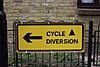
Cycling is the second-most common mode of transport in the Netherlands, with 36% of Dutch people listing the bicycle as their most frequent way of getting around on a typical day, as opposed to the car (45%) and public transport (11%). Cycling has a modal share of 27% of all trips nationwide. In cities this is even higher, such as Amsterdam which has 38%, and Zwolle 46%. This high frequency of bicycle travel is enabled by excellent cycling infrastructure such as cycle paths, cycle tracks, protected intersections, ample bicycle parking and by making cycling routes shorter and more direct than car routes.

Road traffic control involves directing vehicular and pedestrian traffic around a construction zone, accident or other road disruption, thus ensuring the safety of emergency response teams, construction workers and the general public.

Interstate 95 (I-95) is a major north–south Interstate Highway that runs along the East Coast of the United States from Miami, Florida, north to the Canada–United States border at Houlton, Maine. In the state of Pennsylvania, it runs 51.00 miles (82.08 km) from the Delaware state line near Marcus Hook in Delaware County in the southeastern part of the state northeast to the Delaware River–Turnpike Toll Bridge at the New Jersey state line near Bristol in Bucks County, closely paralleling the New Jersey state line for its entire length through Pennsylvania.
The city of Markham in Ontario, Canada, offers a complex transportation infrastructure. These include airports, highways, public transit, regional roads, municipality-funded roads, and train services.

Road signs in Thailand are standardized road signs similar to those used in other nations but much of it resembles road signage systems used in South American countries with certain differences, such as using a blue circle instead of a red-bordered white circle to indicate mandatory actions. Until the early 1980s, Thailand closely followed American, European, Australian, and Japanese practices in road sign design, with diamond-shaped warning signs and circular restrictive signs to regulate traffic. The Department of Railway maintains a standard on the typeface used in the sign, with custom made type for Thai text, unofficially named “Thang Luang”(อักษรทางหลวง) and a small derivation of FHWA Series fonts typeface, which is used on American road signage, for Latin text. In most Bangkok Metropolitan Area's routes, TS Lopburi is still used.

Transportation in New Jersey utilizes a combination of road, rail, air, and water modes. New Jersey is situated between Philadelphia and New York City, two major metropolitan centers of the Boston-Washington megalopolis, making it a regional corridor for transportation. As a result, New Jersey's freeways carry high volumes of interstate traffic and products. The main thoroughfare for long distance travel is the New Jersey Turnpike, the nation's fifth-busiest toll road. The Garden State Parkway connects the state's densely populated north to its southern shore region. New Jersey has the 4th smallest area of U.S. states, but its population density of 1,196 persons per sq. mi causes congestion to be a major issue for motorists.

The North–South Motorway is a partially complete motorway traversing the inner western suburbs of Adelaide, from Waterloo Corner in the north to Bedford Park in the south. Progressively constructed in stages since 2010, once complete it will replace the adjacent South Road as Adelaide's main north–south roadway. It will form the central section of the North–South Corridor, being flanked north and south by the Northern Expressway and Southern Expressway, respectively. It is designated part of route M2.

Traffic signs, installations, and symbols used in Germany are prescribed by the Road Traffic Regulation (StVO) and the Traffic Signs Catalog (VzKat).

Cycling infrastructure is all infrastructure cyclists are allowed to use. Bikeways include bike paths, bike lanes, cycle tracks, rail trails and, where permitted, sidewalks. Roads used by motorists are also cycling infrastructure, except where cyclists are barred such as many freeways/motorways. It includes amenities such as bike racks for parking, shelters, service centers and specialized traffic signs and signals. The more cycling infrastructure, the more people get about by bicycle.
A permanently signed detour route is a type of route which is used temporarily during special circumstances. Various areas have developed these systems as part of incident management. The purpose of these routes is to provide a detour in the event that the parent route is impassable, due to either a traffic jams, traffic collision, or road closure. Sometimes these routes are signed as a prefixed or suffixed numbered road, making them a type of special route.
Road signs in Indonesia are standardized road signs similar to those used in other nations but with certain distinctions. As a former Dutch colony, until the 1970s road signs in Indonesia closely followed The Netherlands rules on road signs. Nowadays, Indonesian road sign design are a mix of European, US MUTCD, Australia, New Zealand and Japanese road sign features. According to the 2014 Minister of Transport's Regulation No. 13 concerning Traffic Signs, the official typeface for road signs in Indonesia is Clearview. Indonesia formerly used FHWA Series fonts as the designated typeface though the rules are not being implemented properly.

Terminology related to road transport—the transport of passengers or goods on paved routes between places—is diverse, with variation between dialects of English. There may also be regional differences within a single country, and some terms differ based on the side of the road traffic drives on. This glossary is an alphabetical listing of road transport terms.