Doon, Iowa | |
---|---|
Coordinates: 43°16′46″N96°13′58″W / 43.27944°N 96.23278°W [1] | |
Country | United States |
State | Iowa |
County | Lyon |
Incorporated | 1892 |
Government | |
• Type | Mayor-council |
• Mayor | Tim Mantel |
Area | |
• Total | 0.70 sq mi (1.82 km2) |
• Land | 0.70 sq mi (1.82 km2) |
• Water | 0.00 sq mi (0.00 km2) |
Elevation | 1,296 ft (395 m) |
Population (2020) | |
• Total | 619 |
• Density | 881.77/sq mi (340.59/km2) |
Time zone | UTC-6 (Central (CST)) |
• Summer (DST) | UTC-5 (CDT) |
ZIP code | 51235 |
Area code | 712 |
FIPS code | 19-21900 |
Website | City of Doon |
Doon is a city in Lyon County, Iowa, United States, along the Rock River. The population was 619 at the time of the 2020 census. [3] The BNSF Railway passes through Doon.
Located on a plateau on the eastern bank of the Rock River, the city was named after the River Doon in Scotland, [4] made famous as the subject of Robert Burns' poem, "The Banks O' Doon". Founded by G. W. Bowers and A. H. Davison on September 6, 1889, the railway town was connected first by the Rock Valley Railway, followed by the Iowa & Dakota Railroad. The city was incorporated on March 8, 1892.
According to the United States Census Bureau, the city has a total area of 0.57 square miles (1.48 km2), all land. [5]
The Rock River, a tributary of the Big Sioux River, flows past the north and west sides of the town and the Little Rock River flows past to the south to join The Rock just southwest of the community. [6]
The city is served by U.S. Route 75, three miles east of Doon, connected by Iowa Highway 167. The Burlington Northern passes the west side of the community. [6]
Year | Pop. | ±% |
---|---|---|
1900 | 545 | — |
1910 | 581 | +6.6% |
1920 | 576 | −0.9% |
1930 | 576 | +0.0% |
1940 | 576 | +0.0% |
1950 | 517 | −10.2% |
1960 | 436 | −15.7% |
1970 | 437 | +0.2% |
1980 | 537 | +22.9% |
1990 | 476 | −11.4% |
2000 | 533 | +12.0% |
2010 | 577 | +8.3% |
2020 | 619 | +7.3% |
Source: "U.S. Census website". United States Census Bureau . Retrieved March 29, 2020. and Iowa Data Center Source: |
As of the census [8] of 2010, there were 577 people, 214 households, and 150 families living in the city. The population density was 1,012.3 inhabitants per square mile (390.9/km2). There were 224 housing units at an average density of 393.0 per square mile (151.7/km2). The racial makeup of the city was 98.6% White, 1.2% from other races, and 0.2% from two or more races. Hispanic or Latino of any race were 2.4% of the population.
There were 214 households, of which 36.0% had children under the age of 18 living with them, 66.8% were married couples living together, 1.9% had a female householder with no husband present, 1.4% had a male householder with no wife present, and 29.9% were non-families. 26.6% of all households were made up of individuals, and 14.4% had someone living alone who was 65 years of age or older. The average household size was 2.70 and the average family size was 3.33.
The median age in the city was 32.5 years. 30.8% of residents were under the age of 18; 9.2% were between the ages of 18 and 24; 24.3% were from 25 to 44; 20.2% were from 45 to 64; and 15.4% were 65 years of age or older. The gender makeup of the city was 54.6% male and 45.4% female.
As of the census [9] of 2000, there were 533 people, 202 households, and 151 families living in the city. The population density was 924.1 inhabitants per square mile (356.8/km2). There were 217 housing units at an average density of 376.2 per square mile (145.3/km2). The racial makeup of the city was 99.81% White and 0.19% Native American. Hispanic or Latino of any race were 0.38% of the population.
There were 202 households, out of which 38.1% had children under the age of 18 living with them, 69.8% were married couples living together, 4.5% had a female householder with no husband present, and 24.8% were non-families. 22.8% of all households were made up of individuals, and 9.9% had someone living alone who was 65 years of age or older. The average household size was 2.64 and the average family size was 3.13.
In the city, the population was spread out, with 30.0% under the age of 18, 9.0% from 18 to 24, 27.0% from 25 to 44, 18.6% from 45 to 64, and 15.4% who were 65 years of age or older. The median age was 32 years. For every 100 females, there were 116.7 males. For every 100 females age 18 and over, there were 100.5 males.
The median income for a household in the city was $33,281, and the median income for a family was $39,773. Males had a median income of $26,607 versus $19,286 for females. The per capita income for the city was $14,698. About 6.4% of families and 7.0% of the population were below the poverty line, including 5.9% of those under age 18 and 12.1% of those age 65 or over.
Doon is served by the Central Lyon Community School District. [10]
Lyon County is the most northwesterly county of the U.S. state of Iowa. As of the 2020 census, the population was 11,934. The county seat is Rock Rapids.
Greene is a city in Butler County, Iowa, United States, along the Shell Rock River, and along Butler County's northern border, where Butler and Floyd counties meet. The population was 990 at the time of the 2020 census.
Shell Rock is a city in Butler County, Iowa, United States, along the Shell Rock River. The population was 1,268 at the time of the 2020 census. The city is located along the county's eastern border, between Butler and Bremer counties.
Plymouth is a city in Cerro Gordo County, Iowa, United States, along the Shell Rock River. The population was 375 at the time of the 2020 census. It is part of the Mason City Micropolitan Statistical Area.
Rock Falls is a city in Cerro Gordo County, Iowa, United States, along the Shell Rock River. The population was 150 at the time of the 2020 census. It is part of the Mason City Micropolitan Statistical Area.
Marble Rock is a city in Floyd County, Iowa, United States, along the Shell Rock River. The population was 271 at the time of the 2020 census. Marble Rock has a city park, historical museums, a powerhouse on the river, and a veterans' memorial. The Marble Rock Historical Society has a website with information about the museums.
Rockford is a city in Floyd County, Iowa, United States, at the confluence of the Shell Rock and Winnebago rivers. The population was 758 at the time of the 2020 census.
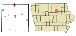
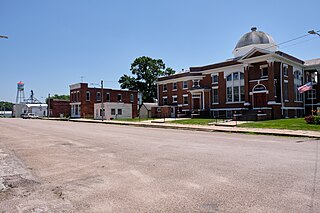
Steamboat Rock is a city in Hardin County, Iowa, United States. The population was 264 at the time of the 2020 census.
Lone Rock is a city in Kossuth County, Iowa, United States. The population was 146 at the time of the 2020 census. The city is named after a large boulder.
Wapello is a city in and the county seat of Louisa County, Iowa, United States. The population was 2,084 at the time of the 2020 census.
George is a city in Lyon County, Iowa, United States, along the Little Rock River. The population was 1,077 at the time of the 2020 census. The ZIP Code for George is 51237.
Inwood is a city in Lyon County, Iowa, United States. The population was 928 at the time of the 2020 census.
Little Rock is an incorporated city in Lyon County, Iowa, United States, along the Little Rock River. The population was 439 at the time of the 2020 census. The zip code for Little Rock is 51243.
Rock Rapids is a city in and the county seat of Lyon County, Iowa, United States. The population was 2,611 in the 2020 census, an increase from 2,573 in the 2000 census.
Elliott is a city in Montgomery County, Iowa, United States, along the East Nishnabotna River. The population was 338 at the time of the 2020 census.
Carson is a city in Pottawattamie County, Iowa, United States. The population was 766 at the 2020 census. Carson has a number of interesting and historic places.
Hancock is a city in Pottawattamie County, Iowa, United States, along the West Nishnabotna River. The population was 200 at the time of the 2020 census.
Oakland is a city located along the West Nishnabotna River in Pottawattamie County, Iowa, United States. The population was 1,524 at the time of the 2020 census. Formerly named Big Grove, Oakland is home to Nishna Heritage Museum and a number of historical buildings.
Rock Valley is a city in Sioux County, Iowa, the North Western corner of Iowa, United States, along the Rock River. The population was 4,059 at the time of the 2020 census.
Northwood is a city in Worth County, Iowa, United States, along the Shell Rock River. The population was 2,072 at the time of the 2020 census. It is the county seat of Worth County.